Order Total (1 Item Items):
Shipping Destination:

Muirhead, Findlay Edited (17 results)
Skip to main search results
Product Type
- All Product Types
- Books (16)
- Magazines & Periodicals
- Comics
- Sheet Music
- Art, Prints & Posters
- Photographs
- Maps (1)
-
Manuscripts &
Paper Collectibles
Condition
- All Conditions
- New
- Used
Binding
Collectible Attributes
- First Edition (3)
- Signed
- Dust Jacket (3)
- Seller-Supplied Images (7)
- Not Printed On Demand
Free Shipping
Seller Location
Seller Rating
-

The Blue Guides: England
Published by Macmillan, 1930
Book
Hardcover. Condition: Fair. Third Edition. Hardcover. No dust jacket. Shelfwear. Front hinge cracked, rear starting. Lacking prelims. Frontis foldout map almost torn in half, hanging by final fold. A reading copy.
-
Hardcover. Condition: Good. The Blue Guides series Ex library.
-
Hardcover. Condition: Very good. 5 x 7 in. Semi-rigid cloth boards. Fold-out maps. Condition is VERY GOOD ; very clean, front has a small crease, mild edge wear. Binding tight. Fold-out maps all excellent. Trav. Stax.
-
Cloth. Condition: Good. No Jacket. 1926 Edition. xxxviii. Maps and fold-out maps. Index, 488pp. 24 pages of additional maps Map on lining papers. Two silk ribbon markers. Blue cloth overs with gilt title on spine and front cover. Pencil notes on half title page. Covers rubbed and a couple nicks. Hardcover.
-
Hardcover. Condition: Good. with a complete Atlas of Ireland and 13 other map's and plans (illustrator). Firmly bound, blue cloth boards without a jacket, a little light rubbing on the edges and corners of the cover, some small page corner creases inside.
-
Hardcover. Condition: Good. the blue guides, cr 8vo, 598pp, table of fares, orig blue cloth, little edge rubbed, mark on back , will probably come off with a clean, binding good ,frontis map has been torn out, maps and contents in good condition, good copy. Book.
-
THE BLUE GUIDES. THE FRENCH ALPS.
Publication Date: 1923
Seller: Graham York Rare Books ABA ILAB, Honiton, United Kingdom
Association Member: ABA ILAB PBFA
Seller Rating:

Condition: Very good. 1923, London, Macmillan and Co., Ltd., 12mo, ppxxxiv + 255, colour folding maps, blue cloth.
-
Switzerland with Chamonix and the Italian lakes. 78 maps and plans. Second edition.
Published by MacMillan/Hachette, London/Paris, 1930
Hardcover. Condition: Gut. 2. Auflage. The Blue Guides. LXII-508 S. Mit mehreren Faltkarten. Kleinoktav. Oln. alle Karten vorhanden. Innen gut. Einband minimal berieben, aber gut erhalten. Insgesamt ein recht gutes Exemplar (in fair condition). Buch.
-
Full-Leather. Condition: Good. Blue Guide, maps present. Light edge wear.
-
Hardcover. Condition: Fine. 1st Edition. Original blue cloth with gilt lettering on front cover and spine. 4 1/4 X 6 1/4 inches. 683 pages. Part of the Blue Guides Series. Copy has 90 color maps and plans, some folded. Table of contents include, practical information, England, South England, South-Western England, Central England, Northern England, Eastern England, Wales, Scotland, Edinburgh, Glasgow and Southern Scotland, Central and Eastern Scotland and North-Western and Northern Scotland, plus road routes. Slight worn spots on corners. Pages and maps are clean and complete. Binding is tight.
-
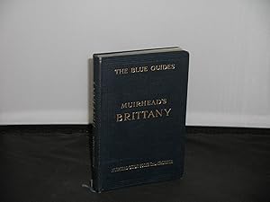
Muirhead's Guide to Brittany The Blue Guide 2nd Impression 1925
Published by Macmillan and Co Ltd & Libraire Hachette, London & Paris, 1925
Book
Hardcover. Condition: Very Good. 2nd impression, 1925, 152 pages, illustrated with 3 maps and 12 town plans, large folded map of Brittany (one of the panels torn), very good condition in original blue cloth binding, slight staining to the rear cover.
-
Hardcover. Condition: Good. Dust Jacket Condition: Good. 2nd Edition. Good condition copy 2nd edition See photos.
-
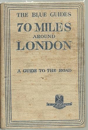
The Blue Guides. 70 Miles Around London. A Guide to the Road With an Atlas of 48 Pages and 10 Town Plans
Published by Macmillan & Co/Librairie Hachette, London/Paris, 1930
Book First Edition
Cloth. Condition: Very Good. No Jacket. First Edition. Hardback. First Edition. The Blue Guides. 70 Miles Around London. Browning to spine. Reading marks to cloth. Beige cloth with blue lettering. This book is a descriptive guide for motorist, cyclist, and pedestrian, of the roads within a radius of seventy miles from the metropolis. Without competing with the formal road-books of the great motoring organisations, the object is to conduct the road-traveller through a charming country by convenient routes and at the same time to encourage him to exploration off the beaten track; to arouse and to satisfy his curiosity about the reagion he is traversing; to describe the places he passes and to recall their historical and literary associations; and to indicate attractive features and interesting monuments that might be missed for lack of a pointer to show the way. With an Atlas of 48 pages and 10 Town Plans. 306+ pp. (We carry a wide selection of titles in The Arts, Theology, History, Politics, Social and Physical Sciences. academic and scholarly books and Modern First Editions, Reference books ,and all types of Academic Literature.).
-
Soft cover. Condition: Poor to Fair. Binding is somewhat loose but all pages are intact. Some discoloration to pages and covers. Some wear to covers and edges. Text and images are clear without any markings.
-
HardBack. Condition: Good. No jacket. First edition. With a complete atlas of Ireland. Thirteen maps and plans.Dw worn but still bright. Throughout the book in light pencil , notes have been made in margins. All maps andplans present. Firm clean binding.
-
Hardback with Dustwrapper , dustwrapper is slightly worn small piece missing at top of spine ,Boards and contents good cond includes red and blue ribboned bookmarks.A complete atlas of Holland and The Rhine and 48 other maps and plans.
-
Hard Cover. Condition: Fair. Dust Jacket Condition: Poor. Second Edition. Blue/gilt cloth hardback - wearing/chipped - in very worn/torn/repaired DJ. (front fly-leaf present but detached; rear fly-leaf pencil annotated). Two attached fabric book markers. lvi + 260pp., including b/w textual plans as well as additional colour illustrations (some fold-out). A few edge-tears to fold-out maps, particularly in the first half of the text block. Occasional page blemishes. Good content. Fair.