Cook Captain James John Hawkesworth (9 results)
Product Type
- All Product Types
- Books (9)
- Magazines & Periodicals
- Comics
- Sheet Music
- Art, Prints & Posters
- Photographs
- Maps
-
Manuscripts &
Paper Collectibles
Condition
- All Conditions
- New
- Used
Binding
Collectible Attributes
- First Edition (5)
- Signed
- Dust Jacket
- Seller-Supplied Images (7)
- Not Printed On Demand
Free Shipping
Seller Location
Seller Rating
-
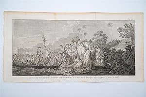
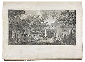
Condition: Very Good. This fascinating engraving is from Captain James Cook & John Hawkesworth's Relation des Voyages entrepris par ordre de Sa Majesté Britannique. Or A Voyage towards the South Pole, and Round the World. Performed in His Majesty's Ships the Resolution and Adventure, In the years 1772, 1773, 1774, and 1775. In which is included Captain Furneaux's Narrative of his Proceedings in the Adventure during the Separation of the Ships. The work was published in Paris by Hotel de Thou from 1778 to 1785. It is an account of Cook's second voyage on which he was directed to circumnavigate the globe as far south as possible to search for any southern continent. "The famous accounts of Captain Cook's three voyages form the basis for any collection of Pacific books. In three great voyages Cook did more to clarify the geographical knowledge of the southern hemisphere than all his predecessors had done together. He was really the first scientific navigator and his voyages made great contributions to many fields of knowledge." (Hill) "Cook earned his place in history by opening up the Pacific to western civilization and by the foundation of British Australia. The world was given for the first time an essentially complete knowledge of the Pacific Ocean and Australia, and Cook proved once and for all that there was no great southern continent, as had always been believed. He also suggested the existence of antarctic land in the southern ice ring, a fact which was not proved until the explorations of the nineteenth century." (Printing and the Mind of Man p.135) "The success of Cook's first voyage led the Admiralty to send him on a second expedition, which was to circumnavigate the globe as far south as possible in search of any southern continents . The men of this expedition became the first to cross the Antarctic Circle. Further visits were made to New Zealand, and on two great sweeps Cook made an astonishing series of discoveries and rediscoveries including Easter Island, the Marquesas, Tahiti and the Society Islands, Niue, the Tonga Islands, the New Hebrides, New Caledonia, Norfolk Island, and a number of smaller islands. Rounding Cape Horn, on the last part of the voyage, Cook discovered and charted South Georgia, after which he called at Cape Town, St. Helena and Ascension, and the Azores . This voyage produced a vast amount of information concerning the Pacific peoples and islands, proved the value of the chronometer as an aid to finding longitude, and improved techniques for preventing scurvy." (Hill p.123) 20 1/2" by 10 1/4.
-
An Account of the Voyages Undertaken by the Order of His Present Majesty for Making Discoveries in the Southern Hemisphere . in the Dolphin, Swallow and Endeavour (with) folding plates ?View of Endeavour River? and ?The Kanguroo?. Volumes III & IV
Published by W. Strahan and T. Cadell, London, 1785
Seller: Muir Books -Robert Muir Old & Rare Books - ANZAAB/ILAB, PERTH, WA, Australia
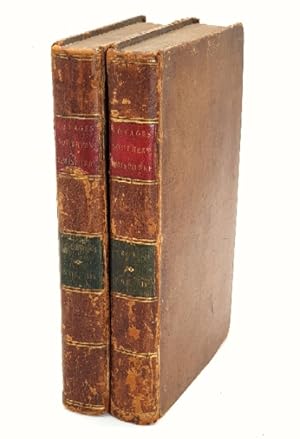
Full Calf. William Bryne and George Stubbs (after) (illustrator). 3rd edition. 3rd ed. (first octavo edition), two volumes (of four). Vol.III: pp.(viii), 416, five fold engraved plates, closed tear along upper fold and tape remains to rear of 'Endeavour' plate, some darkening to folds, light off-setting opp. plates, lacking r.f.e.p. Vol.IV: pp.(vi), 429, (ii, publisher's adverts), two engraved folding plates, lacking r.f.e.p. and creased f.f.e.p., water-staining to edges of prelims, t.p. and contents, not affecting text. Prev owner's ink signature and date to f.f.e.p. of both volumes, "George Mundy, Sept. 19th, 1790" (1792 in other volume) with his contemporary book-plates (G.M.) to front paste-down in each volume. Both volumes full calf, cnrs and edges rubbed, spine worn, green and red titled leather labels to each volume. Engraved folding plates in volume four, "A View of Endeavour River on the Coast of New Holland" and "The Kanguroo, an animal found on the Coast of New Holland". Very good and generally clean condn, the two volumes complete with all plates. First English octavo edition, volumes 3 and 4 only, with the two folding plates, "A View of Endeavour River"on the Coast of New Holland" and "The Kanguroo". Beddie 665.
-
Relation des voyages entrepris par ordre de sa Majeste Britannique, actuellement regnante: Pour faire des decouvertes dans l'Hemisphere Meridional, et successivement executes par le Commodore Byron, le Capitaine Carteret, le Capitaine Wallis & le Capitaine Cook, dans les vaisseaux le Dauphin, le Swallow & l'Endeavour . Four volumes. Paris, 1774.
Published by 1774, 1774
Seller: Charlotte Du Rietz Rare Books (ILAB), Stockholm, Sweden
First Edition
4to. Pp. (iv), iv, (ii), v-xvi, xxxii, 388 with 16 folding engraved maps and plates; pp. (vi), 536 and 16 engraved maps and plates, of which many folding; pp. (vi), 394, (1) and 17 engraved maps and plates, mostly folding; pp. viii, (ii), 367, (1) and 3 folding engraved maps and plates. A few plates with small tears at fold and one leaf in volume four (pp. 359/60) reinforced at outer margin without loss of text. Contemporary full calf, spines with five raised bands, decorated in gilt and with title labels, worn. Extremities rubbed, hinges weak and cracked (volume four upper board detached), and first volume's title label vanished. Occasionally some browning but overall a good copy. First French edition of this early important compilation of British maritime expeditions, edited by Hawkesworth, translated from the original English published in the previous year. Includes the first official account of Cook's first voyage during which he visited Tahiti to observe the transit of Venus across the disk of the sun, discovered the Society Islands, explored and surveyed New Zealand, and the eastern coast of Australia, naming it New South Wales. Other voyages included are: Byron's voyage to the Gilbert Islands, Wallace's discovery of Tahiti and Moorea, and Carteret's discovery of Pitcairn Island. The beautiful plates depict sea views, landscapes and natives. The maps show the new discoveries in the Pacific and the different routes of the ships. Many new areas were charted and several islands and coastlines were recorded for the first time. Borba de Moraes 395. Cf Hill 783. Sabin 30940.
-
An Account of the Voyages Undertaken by the Order of His Present Majesty for Making Discoveries in the Southern Hemisphere, and successively performed by Commodore Byron, Captain Wallis, Captain Carteret, and Captain Cook, in the Dolphin, the Swallow, and the Endeavour
Published by W. Strahan and T. Cadell, London, 1785
Seller: James Cummins Bookseller, ABAA, New York, NY, U.S.A.
Third edition. Third edition. Large folding general chart of the expedition, folding chart of the Island of Otaheite, and 9 folding plates. [lvi], 362; [10], 447; [8], 416; [6], 429, [3] pp. 4 vols. 8vo. Cook's first voyage. Third edition of this chronicle of important English south-seas expeditions, including Cook's monumental first voyage, which is covered in volumes 2-4. The aim of Cook's first voyage was to sail to Tahiti to observe the transit of Venus; having done so Cook left Tahiti and discovered the Society Islands, explored New Zealand at great length, as well as the eastern coast of Australia, which he charted for 2,000 miles and named New South Wales. The expedition lasted from 1768-1771 and resulted in the annexation of both Australia and New Zealand by Britain, won Cook fame, and led to his two subsequent voyages. Beddie 665; ESTC T165111 Modern calf over marbled paper boards. Occasional foxing and minor offset, a very clean copy Large folding general chart of the expedition, folding chart of the Island of Otaheite, and 9 folding plates. [lvi], 362; [10], 447; [8], 416; [6], 429, [3] pp. 4 vols. 8vo.
-
An Account of the Voyages Undertaken by the Order of His Present Majesty for Making Discoveries in the Southern Hemisphere, and Successively Performed by Commodore Byron, Captain Carteret, Captain Wallis and Captain Cook &c., &c.
Published by W. Strahan and T. Cadell, London, 1773
Seller: Arapiles Mountain Books - Mount of Alex, Castlemaine, VIC, Australia
First Edition
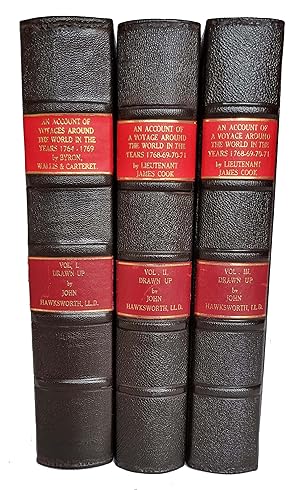
Hard Cover. Condition: VG-. First Edition. Cook's First Voyage. 3 vols. 4to. modern full black leather gilt, blindstamped raised bands (new endpapers, some toning and marking, bound without half-titles, leaf edges a little thumbed, occ. misfolding to plans and charts, marginal tear to final leaf with only slight loss, occ. pencil marginalia, else generally clean and neat); pp. [xii (last blank)], xxxvi, [iv ('Directions for Placing the Cuts and Charts', last blank), 1-39, 360-676, with folding frontispiece + 19 other views, charts and plates (many folding, lacks 'Chart of the Streight of Magellan', as is usual in the first edition); xvi (last errata), 1-410 (last blank), with 21 views, charts and plates (lacks 'Chart of Cook's Streight in New Zealand'); vi (last errata), 411-800 (last blank), with 9 views, charts and plates; Very heavy set (7 kg), additional postage may be required for international and domestic delivery. A very good copy in a new binding. (Holmes, 3). Ex-libris Charles Scobie (ANARE, Macquarie Island, 1948), with his ownership signature dated 19-9-41 to first volume and his occasional pencil marginalia.
-
Relation des voyages entrepris par ordre de Sa Majeste Britanique . Pour faire des Decouvertes dans L Hemisphere Meridional
Published by Saillant et Nyon & Panckoucke,, 1774
Seller: Libreria Antiquaria Pontremoli SRL, Milano, MI, Italy
Book First Edition
Paris, Saillant et Nyon & Panckoucke, [1774] MDCCLXXIV, Prima edizione francese. Ex libris nobiliare. Professionale restauro alle cerniere ma esemplari in ottimo stato di conservazione, grandi margini. James Cook (Marton, 27 ottobre 1728 Kealakekua, 14 febbraio 1779) è stato uno dei più importanti esploratori britannici. Tra il 1768 e il 1779 compì tre viaggi nell'Oceano Pacifico nel corso dei quali realizzò il primo contatto europeo con le coste dell'Australia e le Hawaii, oltre alla prima circumnavigazione ufficiale della Nuova Zelanda. Il primo volume inizia con la spedizione in navigazione verso Rio de Janeiro, e copre il passaggio attraverso lo Stretto di Magellano, rappresentato in una dettagliata carta pieghevole, che spesso manca, qui presente. L'opera è riccamente illustrata con mappe, vedute di città, fauna e costumi locali. Il viaggio era destinato principalmente alle Indie Orientali, ma il vero scopo era fare scoperte nei mari del sud. Sbarcato in Patagonia, riferì degli indiani alti otto piedi e infine avvistò le Falkland che rivendicò come territorio inglese. Il viaggio toccò in fine Filippine, Sumatra, Capo di Buona Speranza prima di rientrare in Inghilterra. Cfr. Graesse, II, 258; Brunet, II, 254; Sabin 30940; Borba de Moraes 395. 4 voll., in 4°, bella legatura in piena pelle con stemma in oro al piatto anteriore; titoli in tassello in oro al dorso, pp. [4] xxxii 388; [6], 536 [2]; [6] 394 [4]; [2] viii, 367 [1]; carta bianca all inizio e fine di ogni volume e 52 mappe e tavole incise, per lo più volte ripiegate o a doppia pagina. Prima edizione francese. Ex libris nobiliare. Professionale restauro alle cerniere ma esemplari in ottimo stato di conservazione, grandi margini. bella legatura in piena pelle con stemma in oro al piatto anteriore; titoli in tassello in oro al dorso,
-
An Account of the Voyages undertaken by Order of His Present Majesty for Making Discoveries in the Southern Hemisphere
Published by W. Strahan and T. Cadell, London, 1773
First Edition
Hardcover. charts and engravings (illustrator). 1st edition. 4to. This is the first printing, first state, of the famous account of what is now described as 'Cook's First Voyage', although primary credit for the creation of this account is given to John Hawkesworth (who had been commissioned by the Admiralty to edit Capt. Cook's papers). Note: there was a second edition published in the same year, containing a Preface by Hawkesworth (Beddie 650). Volume I of our offering ends at page 676, and shows page 139 as numbered 139-360 (as called for in Beddie 648). It contains 18 of the 21 charts and plates called for in this volume, lacking two charts and one plate (or 'cut' as it is called). Volume II has a large tide mark across the top of the first third, or so, of the contents. Page 189 is misnumbered 191. Old worm hole to margins of pages 119-161. Contains 16 of 22 charts and plates (five folding charts, seven folding plates, and four single page plates). The text is complete in 410 numbered pages. Volume III text commences at page 411 and concludes at page 795. All nine plates and charts are present, including the very large folding chart of New Zealand (Cook was the first to confirm that New Zealand was, in fact, an island). Lack of nine plates/ charts. The text shows foxing, severe on a few pages but, on the whole, the text is perfectly readable and, if professionally restored, the plates and charts would be magnificent.
-
A New Voyage, Round the World, In the Years 1768, 1769, 1770, and 1771; undertaken by order of his present Majesty, performed by, Captain James Cook, in the ship Endeavour, drawn up from his own journal, and from the papers of Joseph Banks
Published by printed by James Rivington, New York, 1774
Seller: Donald A. Heald Rare Books (ABAA), New York, NY, U.S.A.
First Edition
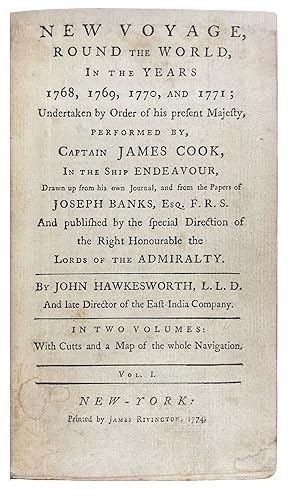
2 volumes, octavo. (7 11/16 x 4 1/2 inches). 18pp. list of subscribers in vol.I, 6pp. publisher's advertisement for an edition of "Chesterfield's letters". 2 folding engraved frontispieces (one engraved by Paul Revere), 1 folding world map engraved by Bernard Romans. Bound to style in half 18th century calf with 18th century marble paper boards, spine simply gilt in six compartments with morocco labels. The very rare first American edition of Cook's First Voyage, with a plate engraved by Paul Revere and the first world map to be published in America The first volume with 17 pages of subscribers' names, one of the longest lists of subscribers in any American book published before the Revolution. Complete copies of this American piracy are rarely seen on the market: only four copies are listed as having sold at auction in the past thirty years. It is a condensed version of the official London edition which had been published in England in 1773 in three quarto volumes. The London first edition also included a survey of earlier British voyagers in the Pacific, but the present work concentrates almost entirely on the narrative of Cook's voyage. The folding frontispiece to the first volume is by the Revolutionary hero, silversmith and engraver, Paul Revere. It is a version of plate 7 by F. Bartolozzi that is usually found facing p.265 in vol.II of the first English edition. According to Clarence Brigham, Revere worked from a reduced reversed version of this pIate published in The Town and Country Magazine (June, 1773, vol.V, p.313), a copy of which was sent to him by the publisher Rivington (via Henry Knox of Boston) in April 1774. Rivington asked that Revere engrave the image "with all the ability in his power and let it be done as soon as possible" (letter to Knox, dated 8 April 1774). The final result (about fifty per cent smaller than Bartolozzi's original) amply demonstrates the charming naïveté that is such a hallmark of Paul Revere's work. Revere's day book shows that he charged £4-0-0 for the plate (see 3 May 1774 entry) The folding map, as the Wheat & Brun number confirms, is the first World map to be published in America and is the work of another notable figure from the Revolutionary war: the military engineer, cartographer and engraver Bernard Romans. Romans intention was to show the track of Cook, Captain Wallis and Bougainville: most of the map is once again a reduced version of the original map, but in this case it also extends the area covered so that an image of the entire world is included, rather than just the "South Seas". It is bound in vol.I facing the first page of text, and is also the first American map to depict Australia "accurately". The folding frontispiece to the second volume is unsigned, but is a composite of two images that both originate with drawings by Sydney Parkinson, the official draughtsman/artist on the voyage. The image is divided in two vertically: the left side of the plate is of a New Zealander. The original of this image was eventually engraved by T. Charles and published in Parkinson's A Journal of a Voyage (London: 1784) facing p.88. The right side is of two Australian aboriginals. The original of this image was also engraved by T. Charles and in Parkinson's work opposite p.134. Unusually, we know where the paper used in this work came from: Rivington advertised the work on 20 October 1774. "These books are printed upon a paper fabricated by Mr. Christopher Leffingwell, of Norwich in Connecticut, with ink made in Boston, and every part of the labour effected by inhabitants of the city of New-York". The set was priced at 12 shillings half bound and 16 shillings full bound and lettered. Beddie 656; Brigham Paul Revere's Engravings pp 102-105; L. Diamant Bernard Romans pp.29-30; Evans 13324; Holmes 9; Sabin 30936; Streeter Sale 2407; Wheat & Brun Maps and Charts Published in America before 1800 1.
-
The Three Voyages of Captain James Cook
Published by Printed for W. Strahan; and T. Cadell in the Strand. H. Hughs for G. Nicol, Bookseller to His Majesty, in the Strand, London, 1785
Seller: Donald A. Heald Rare Books (ABAA), New York, NY, U.S.A.
8 Volumes, 4to; Atlas, folio. Vols: (11 1/4 x 9 inches). Atlas: (22 x 16 inches). Contemporary tan calf paneled with gold floral tooling, spines elaborately decorated with gilt foliate in six compartments with raised bands, red morocco lettering-piece in second compartment with brown letter-piece in third compartment giving the years covered in each volume in gilt. Atlas bound to matching style in half-calf with contemporary marbled paper boards, spine in seven compartments with red morocco lettering-piece in second compartment and brown morocco lettering-piece in third compartment Provenance: Bookplates of Rev. William Goodall, Samuel Alexander Cooke, and G. N. R. A magnificent complete set of Cook's three voyages in eight volumes with very fine uniform original full calf bindings, paired with an unusually fine atlas. "Captain Cook's three great voyages form the basis for any collection of Pacific books. In three voyages Cook did more to clarify the geographical knowledge of the southern hemisphere than all his predecessors had done together. He was the first really scientific navigator and his voyages made great contributions to many fields of knowledge." (Hill) The set comprises: An Account of the Voyages Undertaken by the Order of His Present Majesty for Making Discoveries in the Southern Hemisphere, and Successively Performed by Commodore Byron, Captain Wallis, Captain Carteret, and Captain Cook, in the Dolphin, the Swallow, and the Endeavour. Vols. I-III. London: Printed for W. Strahan; and T. Cadell, 1773. Three volumes. Second edition. Vol. I: [12] [i]-xxxvi [12] [1]-456. 21 cuts. 516 pp. Title, Dedication, Contents, Introduction, Nautical Terms, Cuts Description, Cuts Placement, Preface, Byron, Wallis, Carteret, Compass Table. Vol. II: [i]-xiv [1]-410. 22 cuts. 424 pp. Title, Contents, Introduction, Cook's Voyage. Vol. III: [1]-395. 8 cuts. 395 pp. Title, Contents, Cook's Voyage. 51 engravings, folded maps, and charts. A classic work of exploration, this is the official account of Cook's first voyage commanding the Endeavour, edited from his journal by Hawkesworth. It also contains the official accounts of the voyages of Commodore John Byron (1723-1786), Captain Samuel Wallis (1728-1795), and Captain Philip Carteret (1733-1796). Cook herein travels to Tahiti where he observed the Transit of Venus, then mapped New Zealand and the east coast of Australia. [With] A Voyage Towards the South Pole, and Round the World. Performed in His Majesty's Ships the Resolution and Adventure, in the Years 1772, 1773, 1774, and 1775. Vols.I-II. London: Printed for W. Strahan; and T. Cadell in the Strand. 1784. Two volumes. Fourth edition. Vol. I: [i]-xl [1]-378. 37 engraved plates. 418 pp. Frontispiece portrait by J. Basire after William Hodges, Title, Contents, Introduction, Plate List, Voyage Towards the South Pole. Vol. II: [8] [1]-396. 27 engraved plates. 404 pp. Title, Contents, Advertisement, A Voyage Towards the South Pole and Around the World. 64 engraved plates of maps, portraits, and views, many of which folding. "The voyage where Cook proved there was no 'Terra Australis' which supposedly lay between New Zealand and South America and was the first to cross the Antarctic Circle. This voyage produced a vast amount of information concerning the Pacific peoples and islands, proved the value of the chronometer as an aid in finding longitude, and improved techniques for preserving scurvy, in addition to the aforementioned discoveries." (Hill). [With:] A Voyage to the Pacific Ocean. Undertaken, by the Command of His Majesty, for Making Discoveries in the Northern Hemisphere. Performed under the Direction of Captains Cook, Clerke, and Gore, in His Majesty's Ships the Resolution and Discovery; in the Years 1776, 1777, 1778, 1779, and 1780. Vols. I-III and Atlas. London: Printed by H. Hughs; for G. Nicol and T. Cadell, 1785. In three volumes 4to with an atlas folio. Second Edition. Vol. I: [10] [i]-xcvi [1]-421. 7 engraved plates with the rest in the Atlas. 528 pp. Title, Contents, Introduction, To the Memory of Captain James Cook, List of the Plates with Directions for Placing Them, A Voyage to the Pacific Ocean. Vol. II: [14] [1]-548. 11 engraved plates with rest in Atlas. 562 pp. Title, Contents, A Voyage to the Pacific Ocean. Vol. III: [14] [1]-556. 6 engraved plates with the rest in the Atlas. 570 pp. Title, Contents, Appendix, A Voyage to the Pacific Ocean, Appendices I-VII. Atlas: 63 engraved plates including 2 fold-out maps. Cook's third and final voyage was a search for the Northwest Passage, during which he anchored in Hawaii, explored the Alaskan coast, the Bering Strait, and the Arctic Circle. On his southerly return, Cook was killed in Hawaii. The expedition was then taken over by Charles Clerke, and following Clerke's death, John Gore. While en transit back to the UK, the voyagers sighted Japan, anchored in China, and circled the Cape of Good Hope. Provenance: William Goodall (1757-1844), Lord of the manor, Dinton Hall, Buckinghamshire, and an English artist known for his detailed watercolor illustrations of birds and animals. Beddie 648-50, 1216-7, 1543, 1552. Forbes, Hawaiian National Bibliography, 62, 85. Hill 358, 361, 782-3. Holmes 5, 24, 47A. Howes C729a. Howgego I C174. Jenks, The Great Events, Vol XVII, p.238. Kroepelien, 535. Lada-Mocarski 37. Mitchell Library, Cook, 648. O'Reilly, Tahiti, 433. Printing and the Mind of Man 223 (Second voyage). Rosove 77 (Second voyage). Sabin 16245, 16250, 30934. Spence 314.


