Order Total (1 Item Items):
Shipping Destination:

Matthew Flinders (Over 2,000 results)
Skip to main search results
Product Type
- All Product Types
- Books (2,018)
- Magazines & Periodicals (1)
- Comics
- Sheet Music
- Art, Prints & Posters
- Photographs
- Maps
-
Manuscripts &
Paper Collectibles (1)
Condition
Binding
Collectible Attributes
- First Edition (69)
- Signed (3)
- Dust Jacket (40)
- Seller-Supplied Images (704)
- Not Printed On Demand (1,136)
Free Shipping
Seller Location
Seller Rating
-
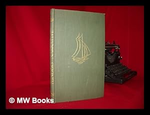
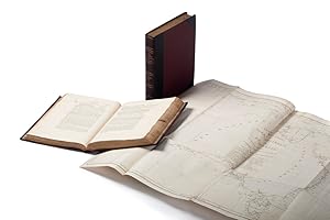
A Voyage to Terra Australis; undertaken for the purpose of completing the discovery of that vast country, and prosecuted in the years 1801, 1802, and 1803, in His Majesty's Ship the Investigator.
Published by G. and W. Nicol, London, 1830
Seller: Hordern House Rare Books, Surry Hills, NSW, Australia
Association Member: ANZAAB ILAB
Seller Rating:

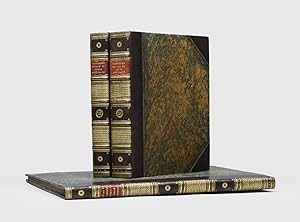
Two volumes quarto, and atlas folio; the text volumes on large paper and the atlas in the preferred elephant folio size with the botanical plates unfolded; nine plates in the text; the atlas with 16 charts (nine folding), two plates (on four double-page sheets) of coastal views, and ten large botanical plates; text in handsome contemporary half crimson morocco bindings with brown moir� cloth sides, atlas in contemporary quarter red morocco and marbled sides, spine lettered in gilt. A superb set, evidently acquired by George Wyndham (later Lord Egremont) in 1836, with the splendid and large atlas volume containing updated maps appropriate to that date. Showing details of coastal exploration carried out by P.P. King and others in the two decades since original publication, this represents the detailed knowledge of the Australian coastline current at about the time that Wyndham acquired the set. Its binding is very similar to other books from Wyndham's library that we have handled in recent years. It is typical of books from his library that the text volumes should be examples of the scarce issue on Large Paper, while the atlas, which shows the latest available information, is in the preferred largest format with the fine botanical plates therefore unfolded. The three-volume official account of Flinders's great circumnavigation of Australia in the Investigator offers a complete record of the expedition with an authoritative introductory history of maritime exploration in Australian waters from the earliest times. The text contains a day by day account of the Investigator voyage and Flinders's later voyages on the Porpoise and the Cumberland. Robert Brown's 'General Remarks, geographical and systematical, on the Botany of Terra Australis', which is illustrated by Ferdinand Bauer's botanical plates in the atlas, is printed in an appendix in the second volume. The text is illustrated by William Westall's nine engraved plates in the text and two double-page plates of coastal views in the atlas. These are in many cases the very earliest views of the places visited and discovered on the voyage. Flinders's charts in the atlas were of such accuracy that they continued to be issued by the Admiralty for decades and form the basis of all modern charts of Australia. The atlas here contains late issues of some of the maps, and thus represents the detailed knowledge of the Australian coastline current around 1836 when Wyndham acquired this fine set. A number of revised issues of the Flinders atlas were to appear in the twenty years after publication. In this copy, the general map of Australia contains revisions to 1829, while chart X has revisions "to 1826 by Phillip P. King", and charts XI and XII have been completely replaced by sheets 1 and 3 of Phillip Parker King's "Chart of part of the N.E. Coast of Australia", published in 1824. Charts VI, XIV and XV are of the Admiralty issue with rhumb-lines added and the Hydrographical Office stamp. The remaining nine charts are of the first issue. The charts continued to be issued by the Admiralty for decades. . Provenance: From the library of George Wyndham at Petworth House, with his signature on the title-page dated 1836 and his bookplate as Lord Egremont. In very attractive condition, the text volumes with much less offsetting from the plates than usual; atlas in fine state.
-
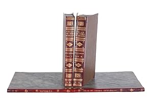
A voyage to Terra Australis; undertaken for the purpose of completing the discovery of that vast country, and proscuted in the years 1801, 1802, and 1803, in his majesty's ship the Investigator, and subsequently in the armed vessel Porpoise and Cumberland schooner with an account of the shipwreck of the Porpoise, arrival of the Cumberland at Mauritius, and imprisonment of the commander during six years and half in that island.
Seller: Gert Jan Bestebreurtje Rare Books (ILAB), Vianen, Netherlands
Seller Rating:
First Edition
London, printed by W. Bulmer and Co. and published by G. and W. Nicol, 1814.2 text volumes in 4to, large paper copy, and elephant folio atlas. Later uniformly blue morocco, spines gilt. With 9 steelengravings by William Westall in the text volumes and in the atlas 16 doublepage charts, 4 plates of coastal views by William Westall and 10 plates of botanical specimens by Ferdinand Bauer to illustrate Robert Brown's botanical appendix to the voyage. IX,(10),CCIV,269; 613 pp.First edition, issue on 'Imperial' large paper, of which only 150 copies were prepared and atlas in larger format as usual. - Flinders was the first commander to circumnavigate the Australian continent, and the first to give it its present name. By the time he was given command of the Investigator, Flinders had already demonstrated his unusual talent for navigation and surveying, notably on Captain Bligh's second breadfruit voyage. He surveyed the entire south coast from Cape Leeuwin to Bass Strait, the east coast, and the Gulf of Carpentaria. In the course of its survey, the Investigator encountered the French exploratory vessel G�ographe, commanded by Nicolas Baudin. On his return to England, Flinders was compelled to put in to Mauritius for repairs and was made a prisoner for several years by the French government. Upon returning to England, he devoted the remainder of his life to preparing this work for the press, and died shortly before its publication. His account is one of the great works of Australian exploration from the earliest times (Hill p.216). 'The most outstanding book on the coastal navigation of Australia' and 'the centrepiece of any collection of books dealing with Australian coastal discovery' (Wantrup ). - Age-browned otherwise a superb set of this classic voyage account, in the largest possible format for both text and atlas.Ferguson 567; Hill 614; Wantrup 67a; Du Rietz 438 (text volumes only); Huntress 176C; Howgego F11.
-
A Voyage to Terra Australis. undertaken for the purpose of completing the discovery of that vast country, and prosecuted in the years 1801, 1802, and 1803, in His Majesty's ship The Investigator.
Published by London: G. and W. Nicol, 1814, 1814
Seller: Peter Harrington. ABA/ ILAB., London, United Kingdom
Association Member: ABA ILAB PBFA
Seller Rating:
First Edition
First edition, one of 1,000 copies and with the text in the standard issue, of "the most outstanding book on the coastal exploration of Australia. Such is the historical importance of this monumental work that no general collection of Australian books can be considered complete without it" (Wantrup). Flinders made the first known circumnavigation of the Australian continent and was the first to give it its present name. "By the time he was given command on the Investigator, Flinders had already demonstrated his unusual talent for navigation and surveying, notably on Captain Bligh's second breadfruit voyage. Upon returning to England, he devoted the remainder of his life to preparing this work for the press, and died shortly before its publication. His account is one of the great works of Australian discovery" (Hill). Flinders had suggested the name of Australia for the continent as early as 1804 and used it for several years, but it did not receive official sanction and he reverted to the name Terra Australis for the continent, reluctantly employing it in the title of A Voyage. In addition to Flinders's historical essay on previous Australian explorations and his painstaking journal of the expedition, A Voyage contains the founding texts of Australian botany. Through the influence of Joseph Banks, the naturalist Robert Brown was commissioned to join the expedition and returned with over 3,600 plant specimens. "The botanical collections were to occupy Brown throughout his career and provided the touchstone for major advances in cytology and palynology as well as in systematics and biogeography" (ODNB). Brown supplies the third appendix, "General remarks systematical and geographical on the botany of Terra Australis". The ten botanical plates in the atlas are from the work of Ferdinand Bauer, who had prepared well over 2,000 plant and animal field drawings during the expedition. The first proposals to establish a colony on the south coast and a new penal settlement on the east coast were based on Flinders's descriptions of the country. The charts Flinders produced on this circumnavigation were so accurate that they were re-issued by the Admiralty for many decades, with altered imprints - all the plates here have the first edition G. and W. Nicol imprint. The charts still form the basis for many modern ones of the Australian coastline. The text was published in two issues: the "Imperial" issue on large fine wove paper, measuring approximately 355 x 266 mm, with the Westall plates on Whatman hand-made paper watermarked 1808; and the standard issue, measuring approximately 375 x 255 mm. Wantrup notes that "1000 copies of the smaller standard issue and only 150 copies of the large paper edition were printed". Provenance: bookplate of Lieutenant-Commander Andrew David (1924-2021) on the front free endpaper in each text volume and on the front pastedown in the atlas. David joined the Royal Navy in 1943 and, during a four-decade career, served in Western Australia and throughout the world. He took command of HMS Medusa in 1961. From 1961 to 1985, David worked in the Hydrographic Office of the Ministry of Defence, with a particular interest in its collection of manuscripts relating to voyages of discovery. He wrote many papers on cartography and voyages of discovery and served on the council of the Hakluyt Society, acting as the chief editor of its The Charts and Coastal Views of Captain Cook's Voyages (three volumes, 1988-97). His bookplate reproduces James Wilson's 1855 lithograph of HMS Herald arriving in Fiji. Ferguson 576; Hill 614; Howgego II, F11; Kroepelien 438; Nissen BBI 367; Sabin 24758; Stafleu & Cowan TL2 180; Tooley, Mapping of Australia, pp. 77-9; Wantrup 67a. 3 volumes, 2 quarto text volumes (310 x 239 mm) together with folio atlas (469 x 376 mm). Late 20th-century half sheep to style, spines with raised bands, richly gilt in compartments, red morocco labels, volume numbers on green morocco roundels, marbled sides, edges uncut. Text volumes: 9 steel-engraved plates after William Westall (without watermarks). Atlas: 16 engraved charts (double-page or folding), 2 engraved coastal profiles bound as 4 folding plates, and 10 engraved botanical plates after Ferdinand Bauer. Bound without half-titles. Bindings bright, some offsetting, occasional soiling and dust soiling at edges (occasional short tears), small marginal holes to T4 and quire 3F in vol. II, contents with sporadic light foxing (a little more pronounced to plates), free endpapers in atlas volume creased, minor splits along centrefold creases of a few charts (X and XIII with old paper repairs on verso); a very good copy.
-
A Voyage to Terra Australis; undertaken for the purpose of completing the discovery of that Vast Country, and prosecuted in the years 1801, 1802, and 1803, in His Majesty's Ship the Investigator, and subsequently in the armed vessel Porpoise and Cumberland schooner. With an account of the shipwreck of the Porpoise, arrival of the Cumberland at Mauritius, and imprisonment of the commander during six years and a half in that island.
Published by Printed by W. Bulmer. and published by G. and W. Nicol, London, 1814
Seller: Hordern House Rare Books, Surry Hills, NSW, Australia
Association Member: ANZAAB ILAB
Seller Rating:
Two text volumes, quarto, with nine engraved plates, in large paper format with generous margins and a few edges uncut; and folio atlas with sixteen large charts either folding or double-page, two double-page folding plates of coastal views and ten folded botanical plates; the text volumes in old half maroon grained calf, the atlas in old half calf. One of the most famous Australian rare books, the full account of the first circumnavigation of Australia. The two extensive text volumes and the accompanying volume of charts of the coastline represent the magnificent achievement that was Flinders's voyage in the Investigator, the full-scale expedition to discover and explore the entire coastline of Australia (the name that Flinders himself preferred and championed). Flinders was the first to circumnavigate the continent, finally establishing that Australia was one large island and not, as previously had been speculated, divided by a navigable central strait. The three volumes form the complete record of the expedition with an authoritative introductory history of maritime exploration in Australian waters from the earliest times. The text contains a day by day account of the Investigator voyage and Flinders' later voyages on the Porpoise and the Cumberland. Robert Brown's 'General Remarks, geographical and systematical, on the Botany of Terra Australis', which is illustrated by Ferdinand Bauer's botanical plates in the atlas, is printed in an appendix in the second volume. The nine engraved plates in the text volumes and two double-page plates of coastal views in the atlas are by the landscape painter William Westall, who travelled as official artist on the voyage. These are in many cases the very earliest views of the places visited and discovered on the voyage. The important charts in the folio atlas are all in their earliest issue - a significant point since they remained standard charts for many parts of the Australian coast for a long time, and were revised and updated as new information came to hand. Flinders's charts were generally of such accuracy that they form the basis of all modern charts of Australia. "Flinders's Voyage to Terra Australis is the most outstanding book on the coastal exploration of Australia. It is the centrepiece in any collection of books dealing with Australian coastal discovery. Such is the historical importance of this monumental work that no general collection of Australian books could be considered complete without it" (Wantrup). The text volumes in this set are examples of the issue on 'Imperial' large paper, of which only 150 copies were prepared, while the atlas volume is in the smaller of the two formats issued. . Provenance: Joseph Husband (bookplate); Scot Clifford (bookplate). Text volumes: the two frontispieces and other plates with edge-staining from oxidisation of paper. Atlas volume: a few folds repaired, a couple of the maps with some spotting.
-
Ontdekkings-reis naar het groote Zuidland anders Nieuw Holland; bezigtiging van het zelve in 1801, 1802, en 1803; noodlottige schipbreuk, en gevangenschap van 6� jaar bij de Franschen op Mauritius.Haarlem, Loosjes, 1815-1816. 4 volumes. 8vo. Each volume with an engraved title-page with a different oval view (King George Sound, Port Jackson, Wreck Reefs and Rempart River), and a large folding engraved map of New Holland loosely inserted. Contemporary mottled half calf, with gold fillets on spine.
Seller: ASHER Rare Books, T Goy Houten, Netherlands
Seller Rating:
[4], XVI, 362; [4], 346; [4], 415, [1 blank]; [4], 416 pp.Rare first and only edition of the Dutch translation of an account of the first circumnavigation of Australia, by Captain Matthew Flinders, who was the first to give the continent its present name. "The greatest of all the early coastal voyages His journal is a highlight of Australiana and in one form or another, should be in every collection" (Davidson). This anonymous Dutch translation contains a new preface and footnotes.Flinders was appointed commander of the HMS Investigator in 1801 with instructions to explore the coast of South Australia. Almost a year later, in June 1803, he completed the first circumnavigation of the elusive continent. His ship was in such bad condition, however, that he was unable to complete his surveys. He sailed in the HMS Porpoise to obtain a suitable ship to finish his task, but was wrecked on a reef off the coast of Port Jackson. He managed to get back to Port Jackson, where he set sail for England in the Cumberland, which, again, proved to be in rather poor condition. Unaware that a war had recently broken out between England and France, Flinders called at Mauritius to seek repairs. Here he was immediately arrested by the French governor and kept imprisoned for nearly seven years. In June 1810, Flinders was finally allowed to set sail for England. There he struggled to get his journal published, finally succeeding in 1814.With the labels of the Doctrina & Amicitia library, Amsterdam. Some occasional browning and foxing, especially to the opening leaves of each volume, bindings slightly rubbed, but generally in good condition.l Davidson, pp. 120-125; Ferguson 602; Kroepelien 439; NCC (6 copies); WorldCat (9 copies, incl. 6 the same); cf. Howgego, 1800-1850, F11; not in Tiele, Bibl.
-
A Voyage to Terra Australis, undertaken for the purpose of completing the discovery of that vast country, and prosecuted in the years 1801, 1802, and 1803, in His Majesty's Ship The Investigator and subsequently in the armed vessel Porpoise and Cumberland schooner
Published by W. Bulmer and Co. for G. and W. Nicol, London, 1814
Seller: Donald A. Heald Rare Books (ABAA), New York, NY, U.S.A.
Seller Rating:
First Edition
(11 1/2 x 9 inches). Half-titles, 9 engraved plates by J. Byrne, John Pye, W. Woolnoth, I. Scott, Edward Finden and S. Middiman after William Westall. (Plates and pages on either side toned). Contemporary half russia over marbled paper-covered boards, the flat spines divided into six compartments by double gilt fillets, lettered in the second compartment, numbered in the fourth A fine set of the first edition text of the first circumnavigation of Australia an enlightening and fascinating story of brilliant navigation and discovery. Wantrup rightly calls this work "the most outstanding book on the coastal navigation of Australia," and "the centrepiece of any collection of books dealing with Australian coastal discovery." Flinders sailed from England on 18 July 1801, and during the next two years he surveyed the entire south coast of Australia from Cape Leeuwin to Bass Strait, the east coast, and the Gulf of Carpentaria. He returned to Port Jackson in 1803 having completed the first circumnavigation of Australia. On the return journey, Flinders was detained by the French in Mauritius for six and a half years and was not released until June 1810. He devoted the remainder of his life to the publication of this work, which was formally published one day before his death on 19 July 1814. It is a day-by-day record of the expedition and includes a lengthy introduction detailing earlier South Seas voyages and an appendix by Robert Brown, the botanist who accompanied the expedition. Flinders took great pains to insure the accuracy of the work and the charts contained in the atlas were used for navigation for over a century. The two volumes of text were originally published in both large-paper and normal issues: the present set is from the regular-sized issue. Ferguson 576; Hill (2004) 614; Ingelton 6487; Nissen BBI 637; Stafleu & Cowan I,1806; Wantrup Australian Rare Books, pp.138-144. 2 volumes only (lacking atlas volume of plates), quarto.
-
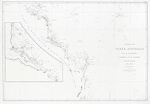
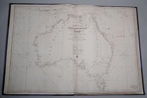
Chart of Terra Australis. East Coast Sheet III
Publication Date: 1814
Seller: Antique Print & Map Room, Ultimo, NSW, Australia
Association Member: ANZAAB ILAB
Seller Rating:

Book
No Binding. Condition: Very Good. Very rare and historically important chart by Matthew Flinders from the elephant folio deluxe issue of Flinders's famous atlas of the Queensland coast from Northumberland Islands to Flat Isles. In the deluxe issue elephant folio format issue of the atlas the large charts such as this one, were bound with only a centre fold, rather than with multiple folds as found in the smaller sized standard issue of the atlas. The tracks of the Norfolk in 1799, Investigator in 1802 and Porpoise, Cato, Bridgewater, Cumberland, Rolla and Francis in 1803 are shown. With an inset of coast from Keppel Bay to Bustard Bay. From: Flinders's, A Voyage to Terra Australis. References: Ferguson 756, Perry/Prescott 1814.10, Tooley 579 Collections: National Library of Australia: Bib ID 589314 Image Size: 910mm x 630mm (35.8" x 24.8"). Condition: Minor splits to upper and lower fold close to sheet edge, otherwise in good condition, with only the one fold as issued. Technique: Copper engraving.
-
Half-Leather. Condition: Good. First Ediition. ix, [11], cciv, 269 pages [4 plates]; 613 pages [5 plates]. This set includes the 10 botanical plates by Ferdinand Bauer which are in a custom made Solander box. Original binding, front hinge of volume I is split but front cover is firmly attached. Size of text volumes: 30 cm x 23.5 cm, Solander box: 62cm x 45cm.
-
A Voyage to Terra Australis, undertaken for the purpose of completing the discovery of that vast country, and prosecuted in the years 1801, 1802, and 1803, in His Majesty's Ship The Investigator ,
Published by W. Bulmer and Co. for G. and W. Nicol,, 1814
Seller: HALEWOOD : ABA:ILAB : Booksellers :1867, PRESTON, United Kingdom
Association Member: ABA ILAB PBFA
Seller Rating:
First Edition
Hardcover. Condition: Very Good. 1st Edition. and subsequently in the armed vessel Porpoise and Cumberland schooner. With an account of the shipwreck of the Porpoise, arrival of the Cumberland at Mauritius, and imprisonment of the commander during six years and a half in that island. Two Volumes Text Volumes. with engraved plates. Large Quarto. Pagination: v. 1: [4], ix, [11], cciv, 269, [1] p., [4 plates] v. 2: [4], 613, [1] p., [5 plates] On his return voyage from Australia in 1803, the unseaworthiness of his vessel, the Cumberland, forced Flinders to seek assistance in Mauritius. The French Governor detained him for the next six and a half years. During his captivity Flinders worked on his monumental 'A voyage to Terra Australis'. (1814) and chapters IV to IX of volume II contain an account of his confinement. Engravings "painted by W[illiam] Westall" and engraved by John Pye, William Finden, John Scott, J. Byrne, and W. Woodnoth. Contemporary green linen' with original paper title labels [little wear]. Excellent Set of the First Edition text of the first circumnavigation of Australia. Ferguson 576. Sold with the complete facsimile Bound Quarto size Chart Volume (1966) All Excellent.
-
Observations upon the Marine Barometer, made during the Examination of the Coasts of New Holland and New South Wales, in the years 1801, 1802, and 1803. Read March 27, 1806 (+) Concerning the Differences in the Magnetic Needle, on Board the Investigat. - [THE NAMING OF AUSTRALIA]
First Edition
London, W. Bulmer and Co., 1805 - 1806. 4to. In recent marbled paper wrappers. Extracted from "Philosophical Transactions". Leaves reinforced in margin. (4), (239)-266, (2), 185-198 pp. First edition of these two important papers by Captain Matthew Flinders, the first circumnavigator of Australia.OBSERVATIONS UPON THE MARINE BAROMETER:First printing of this important paper relating Flinder's observations on the ship "Investigator" when exploring the coast of Australia. IN THE PAPER THE NAME "AUSTRALIA" APPEARS PROBABLY FOR THE FIRST TIME IN A SCIENTIFIC MEMOIR (p. 247).The name Australia was popularised by Matthew Flinders, who pushed for the name to be formally adopted as early as 1804. When preparing his manuscript and charts for his 1814 A Voyage to Terra Australis, he was persuaded by his patron, Sir Joseph Banks, to use the term Terra Australis as this was the name most familiar to the public. Flinders did so, but allowed himself the footnote:"Had I permitted myself any innovation on the original term, it would have been to convert it to Australia" as being more agreeable to the ear, and an assimilation to the names of the other great portions of the earth." In the paper offered he used the name "Australia" as early as 1806.CONCERNING THE DIFFERENCES IN THE MAGNETIC NEEDLE:First printing of, probably the first work, to discover, and correct for the errors of the compass caused by the iron in ships, by the first circumnavigator of Australia."Captain Matthew Flinders RN (16 March 1774 - 19 July 1814) was one of the most successful navigators and cartographers of his age. In a career that spanned just over twenty years, he sailed with Captain William Bligh, circumnavigated Australia and encouraged the use of that name for the continent, which had previously been known as New Holland. He survived shipwreck and disaster only to be imprisoned for violating the terms of his scientific passport by changing ships and carrying prohibited papers. He identified and corrected the effect upon compass readings of iron components and equipment on board wooden ships and he wrote what may be the first work on early Australian exploration A Voyage to Terra Australis."(Wikepedia).
-

A Voyage to Terra Australia; Undertaken for the Purpose of Completing the Discovery of That Vast Country, and Prosecuted in the Years 1801, 1802, and 1803, in His Majesty's Ship the Investigator, &c, &c.
Published by G. and W. Nicol, London, 1814
Seller: Arapiles Mountain Books - Mount of Alex, Castlemaine, VIC, Australia
Association Member: ANZAAB ILAB
Seller Rating:
First Edition
Hard Cover. Condition: VG. First Edition. 2 vols. Folio. modern burgundy half-leather gilt, marbled boards, blindstamped raised bands, (new endpapers, some toning and marking, contents pages in vol. 1 are brittle with some edge fraying and chipping (no loss to text), else generally clean and neat; lacks atlas volume); pp. [iv (last blank)], x (last blank), x, cciv, 270 (last blank), with frontispiece + 3 plates; [4 (last blank)], 614 (last blank), with frontispiece + 4 plates. Very heavy set (5 kg), additional postage may be required for international and domestic delivery. A very good copy in a new binding, collated and complete with all plates.Ex-libris Charles Scobie (ANARE, Macquarie Island, 1948), with his occasional pencil marginalia.
-
Observations upon the Marine Barometer, made during the Examination of the Coasts of New Holland and New South Wales, in the years 1801, 1802, and 1803. Read March 27, 1806. - [THE NAMING OF AUSTRALIA.]
First Edition
London, W. Bulmer and Co., 1806. 4to. No wrappers as extracted from "Philosophical Transactions" 1806 - Part II. Pp. 239-268. Having also the titlepage to the volume (Part II, 1806). A faint bit of soiling to outer right margin of the first 2 leaves, otherwise clean and wide-margined. First printing of this important paper relating Flinder's observations on the ship "Investigator" when exploring the coast of Australia. IN THE PAPER THE NAME "AUSTRALIA" APPEARS PROBABLY FOR THE FIRST TIME IN A SCIENTIFIC MEMOIR (p. 247).The name Australia was popularised by Matthew Flinders, who pushed for the name to be formally adopted as early as 1804. When preparing his manuscript and charts for his 1814 A Voyage to Terra Australis, he was persuaded by his patron, Sir Joseph Banks, to use the term Terra Australis as this was the name most familiar to the public. Flinders did so, but allowed himself the footnote:"Had I permitted myself any innovation on the original term, it would have been to convert it to Australia" as being more agreeable to the ear, and an assimilation to the names of the other great portions of the earth." In the paper offered he used the name "Australia" as early as 1806."Captain Matthew Flinders RN (16 March 1774 - 19 July 1814) was one of the most successful navigators and cartographers of his age. In a career that spanned just over twenty years, he sailed with Captain William Bligh, circumnavigated Australia and encouraged the use of that name for the continent, which had previously been known as New Holland. He survived shipwreck and disaster only to be imprisoned for violating the terms of his scientific passport by changing ships and carrying prohibited papers. He identified and corrected the effect upon compass readings of iron components and equipment on board wooden ships and he wrote what may be the first work on early Australian exploration A Voyage to Terra Australis."(Wikepedia).
-
A Voyage to Terra Australis; Undertaken for the Purpose of Completing the Discovery of That Vast Country, and Prosecuted in the Years 1801, 1802, and 1803, in His Majesty's Ship the Investigator.(2 volumes)
Published by G. And W. Nicol., London., 1814
Seller: Anah Dunsheath RareBooks ABA ANZAAB ILAB, Auckland, NZ, New Zealand
Association Member: ABA ANZAAB ILAB
Seller Rating:
Book
Quarter buckram and Boards. Condition: Very Good. volumes 1 and 2 text only. Complete with 9 plates. Fine uncut copy in early boards, and buckram spines circa 1930s. Page size 12 1/2" x 9 3/4". Handsome leather spine label. Rare original first edition.
-
Concerning the Differences in the Magnetic Needle, on Board the Investigator, arising from an Alteration in the Direction of the Ship's Head. Read March 28, 1805.
First Edition
London, W. Bulmer and Co., 1805. 4to. No wrappers as extracted from "Philosophical Transactions" 1805. With titlepage to Phil. Transactions Part I. Pp. 186-197. Having also the titlepage to the volume (Part II, 1805). A few scattered brownspots and very faint browning to outer margins, otherwise fine and wide-margined. A small stamp to verso of titlepage. First printing of, probably the first work, to discover, and correct for the errors of the compass caused by the iron in ships, by the first circumnavigator of Australia."Captain Matthew Flinders RN (16 March 1774 - 19 July 1814) was one of the most successful navigators and cartographers of his age. In a career that spanned just over twenty years, he sailed with Captain William Bligh, circumnavigated Australia and encouraged the use of that name for the continent, which had previously been known as New Holland. He survived shipwreck and disaster only to be imprisoned for violating the terms of his scientific passport by changing ships and carrying prohibited papers. He identified and corrected the effect upon compass readings of iron components and equipment on board wooden ships and he wrote what may be the first work on early Australian exploration A Voyage to Terra Australis."(Wikepedia).
-
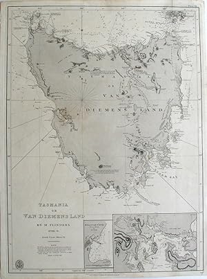
Tasmania or Van Diemens Land by M. Flinders 1798-9. South Coast, Sheet VI
Published by British Admiralty Hydrographical Office, London, 1860
Seller: Antipodean Books, Maps & Prints, ABAA, Garrison, NY, U.S.A.
Association Member: ABAA ANZAAB ESA ILAB
Seller Rating:

Maps. Map of Tasmania based on Matthew Flinder's chart. In 1798, Flinders and George Bass set out in the 'Norfolk' to explore the extent of the strait between the mainland and Van Diemen's Land [Tasmania]. By circumnavigating Van Diemen's Land, Flinders proved that it was a separate island. This Admiralty chart of Tasmania includes Hunter, Three Hummock Island and most of Barren Island, with insets of Sullivan Cove (Hobart Town) by Mr. I Welsh and an untitled inset of the approaches to Hobart, including depth soundings. Plate VII outside of top right rule line, no. 1079 below bottom right rule. Tooley p. 319, #226 & also Tooley 597. Libraries Australia ID 21991504. This edition updated to 1859. Map washed in gray, lighthouses noted in yellow with red dots. Platemark 18 3/4 x 26". Small but adequate margins, with one small closed repaired tear. Very good condition. The "Note" reads "The following authorities have been consulted and used for the East Coast. The Surveys of Adm. D.'Entrecasteaux, Capts Cook, Furneaux, J. H. Cox and Baudin; the inland parts from Messrs Grimes, Harris & Mehan with additional information from Capt. King to the year 1815. The North coast has been corrected from Commander J. L. Stokes' Survey in 1843. Variation 9 degrees 30' E. in 1859." Below the bottom rule line; "Published as the Act directs by Capt. Hurd, R.N. Hydrographer to the Admiralty : Sold by J.D. Potter, Agent for the Admiralty Charts, 31 Poultry and 11 King Street Tower Hill, 1814 Feb. 4.".
-
Narrative of his Voyage in the Schooner Francis: 1798 Preceded and Followed by Notes on Flinders, Bass, the Wreck of the Sydney Cove, &c, by Geoffrey Rawson.
Published by London The Golden Cockerel Press, 1946
Book First Edition
First edition, number 9 of 100 specially bound copies, from an overall limitation of 750; folio (310 x 190 mm.); printed in dark green throughout, wood-engraved frontispiece, title vignette, 6 chapter headings and device, all by John Buckland-Wright, one full-page map of the east coast of Australia; full green morocco, gilt, by Sangorski & Sutcliffe, top edge gilt, others uncut, spine very slightly lightened, but otherwise a very good copy; housed in original cloth slip-case, lightly marked. A handsome first edition of this recounting of Matthew Flinders' famous voyage, that led to the discovery of the Illawarra coal seams and the Bass Strait; the first time the original manuscript had been published. One of one hundred copies only to be bound thus in full morocco. Cockalorum 170.
-

Observations upon the marine barometer, made during the examination of the coasts of New Holland and New South Wales, in the years 1801, 1802, and 1803.
Seller: Douglas Stewart Fine Books, Armadale, VIC, Australia
Association Member: ANZAAB ILAB
Seller Rating:
Contained within: Philosophical transactions of the Royal Society of London for the year MDCCVI. Part II. London : printed by W. Bulmer, 1806. Quarto, original plain blue wrappers, pp. iv; 239 - 473; [8]; 12 engraved plates (some folding), the plates foxed but the text clean, all edges uncut and a little dusty, a fine example. An important scientific paper which relates to Flinders' observations on the relationship between atmospheric pressure with regard tovariation and deviation of navigation by magnetic compass. In this article, Flinders uses the termAustralia for the first time in a scientific context in reference to the island continent. In 1814 his atlas would include the first map of the continent entitledAustralia. The term Australia had been used previously to reference an undefined southern landmass however it was Flinders who would advocate this term as the agreed name for the continent.The matter of naming the continent was one contested with Sir Joseph Banks, who favoured Terra Australis.Flinders' Australia would, however, eventually prevail. Ferguson 474a.
-
Matthew Flinders' Narrative of his Voyage in the Schooner Francis: 1798, preceded and followed by notes on Flinders, Bass, the wreck of the Sidney Cove, &c. by Geoffrey Rawson.
Published by Golden Cockerel Press, London, 1946
Seller: Hordern House Rare Books, Surry Hills, NSW, Australia
Association Member: ANZAAB ILAB
Seller Rating:
Condition: A fine copy. Folio, with a map and wood-engravings by John Buckland Wright; uncut in the original full green morocco gilt by Sangorski. The scarce de luxe issue, one of only one hundred numbered copies in full morocco binding. This important first publication of the manuscript in the State Library of Victoria gives Flinders' account of his 1798 voyage in the Francis that led to his exploration of Bass Strait, and to the discovery of the Illawarra coal seams by Bass. .
-
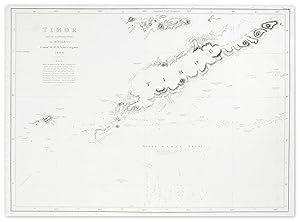
Timor and Some Neighbouring Islands: by M.Flinders Commr. of H.M.S. Investigator 1893.
Publication Date: 1814
Seller: Antique Print & Map Room, Ultimo, NSW, Australia
Association Member: ANZAAB ILAB
Seller Rating:
Book
No Binding. Condition: Very Good. Very rare first edition of Flinders's chart of Timor from Flinders's seminal atlas, in it's rarest issue - ELEPHANT FOLIO format. In the deluxe elephant folio issue of the Flinders's atlas, this chart has no folds, rather the usual quarto issue of the atlas which has multiple folds. Additionally in this example it is untrimmed with full wide margins as issued. An exceptional example from the most important and accurate charting of the Australian coastline. From: Flinders 'A Voyage to Terra Australis.' Collections: National Library of Australia: Bib ID 273684 Image Size: 630mm x 480mm. (24.8" x 18.9"). Paper Size: 720mm x 490mm (28.3" x 19.3"). Condition: Faint stain at top left, otherwise in good condition. Technique: Copper engraving.
-
MATTHEW FLINDERS - NAVIGATOR AND CHARTMAKER
Published by Genesis Press, Guildford, Surrey, 1986
Seller: Kay Craddock - Antiquarian Bookseller, Melbourne, VIC, Australia
Association Member: ANZAAB ILAB
Seller Rating:
Signed
Pp. xxiv+468(last blank), coloured frontispiece and 16 plates (including reproductions of 6 natural history subjects by Ferdinand Bauer and 8 views by William Westall), plus 16 black & white plates of Flinders' manuscript charts and of views, portraits and instruments, over 250 black & white text illustrations (many reconstructions by the author), the title page decorative border and text decorations printed in brown, notes & chapter references, appendices, indices; [together with]: Flinders (Matthew) PRIVATE JOURNAL 1803-14. Pp. vi+366, frontispiece map, title page decorated in brown, index. [A facsimile of Flinders' manuscript journal, covering his imprisonment on the Isle de France (Mauritius)]. Both volumes med. 4to; hand bound in qr. brown morocco, spines lettered and decorated in gilt between raised bands, blue cloth boards with gilt silhouette of Flinders on upper board, and gilt facsimile of his signature on lower board; a.e.g.; within blue cloth slipcase with printed title label; Genesis/Hedley, Guildford, Surrey, 1986. De Luxe Edition, limited to 550 numbered sets signed by the author of Volume I.
-
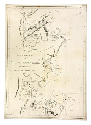
North West Side of the Gulf of Carpentaria by M. Flinders Commr. of H.M. Investigator 1803
Published by G and W. Nicol, London, 1814
Seller: Hordern House Rare Books, Surry Hills, NSW, Australia
Association Member: ANZAAB ILAB
Seller Rating:
Engraved map measuring 668 x 469 mm., neatly backed upon linen. Original engraved chart of the Gulf of Carpentaria published for the atlas volume of Flinders' masterpiece A Voyage to Terra Australis. Charting this region was particularly difficult for Flinders and his officers; beset by scurvy in the tropical heat they soon discovered the timbers of the Investigator to be rotten and the vessel barely seaworthy. This map is one of sixteen published for the atlas, and is clearly identified as its first state by the publisher's details 'G. & W. Nicol, Jany. 1st 1814' engraved to the lower margin. Noted for their accuracy and utility, Flinders' charts were republished and updated by the Admiralty and remained in use for well over a century. Accordingly, examples of the first issue are increasingly uncommon, and it is probable that this unfolded copy backed on linen was used at sea. . A few spots and a little flecking at the periphery, otherwise very good condition.
-

The Oxford Handbook of British Politics (Hardback)
Published by Oxford University Press, 2009
ISBN 10: 0199230951ISBN 13: 9780199230952
Book
Hardback. Condition: Muy Bueno / Very Good.
-

Multi-level Governance: Essential Readings
Published by Edward Elgar Publishing Ltd, 2015
ISBN 10: 1783479787ISBN 13: 9781783479788
Book
Condition: New. 2015. Hardback. . . . . . Books ship from the US and Ireland.
-
The arts and crafts of ancient Egypt / by W.M. Flinders Petrie
Published by London ; Edinburgh : T.N. Foulis, 1910
Book
Hardcover. Condition: Very Good. Dust Jacket Condition: NA. 2nd Edition. Very Good condition! Pages crisp, clean, and bright. May show light signs of wear; e.g bumping, rubbing, creasing. Binding strong & spine intact!.
-

Multi-level Governance (Hardback)
Published by Oxford University Press, 2004
ISBN 10: 0199259259ISBN 13: 9780199259250
Book
Hardback. Condition: Muy Bueno / Very Good.
-
Multi-level Governance: Essential Readings
Published by Edward Elgar Pub, 2015
ISBN 10: 1783479787ISBN 13: 9781783479788
Book
Hardcover. Condition: Brand New. 1520 pages. 9.75x6.75x3.50 inches. In Stock.
-
Multi-level Governance: Essential Readings
Published by Edward Elgar Publishing Ltd, 2015
ISBN 10: 1783479787ISBN 13: 9781783479788
Book
Condition: New. 2015. Hardback. . . . . .
-
Multi-Level Governance: Essential Readings
Published by Edward Elgar Pub, 2015
ISBN 10: 1783479787ISBN 13: 9781783479788
Book
Condition: new.
-
Matthew Flinders' narrative of his voyage in the schooner Francis: 1798 : preceded and followed by notes on Flinders, Bass, the wreck of the Sidney Cove, &c.
Published by London : Golden Cockerel Press, 1946
First Edition
First Edition. Very good copy in the original gilt-blocked cloth. Spine bands and panel edges somewhat rubbed and dust-toned as with age. Remains quite well-preserved overall; tight, bright, clean and strong. Physical description; 100, [2] p. : ill. (wood engravings), map ; 32 cm. Notes; ". designed, produced, and published by Christopher Sandford at the Golden Cockerel Press, London, on Arnold's mould-made paper . The edition is limited to 750 copies. Nos 1-100 are bound in full green morocco. Number 209." --Colophon. "Bass's journal of the whaleboat voyage": p. 29-43. Printing: printed on grey paper with initials and illustrations printed in green. Wood-engraved frontispiece and title page vignette [by John Buckland-Wright and map drawn by Mrs. C. G. Storry (Joan Rutter)]. Printer's device beneath the colophon on final leaf. Imprint from colophon. Subjects; Bass, George (1771?-d. 1812?). Flinders, Matthew (1774-1814) - Travel. Sydney Cove (Ship). Francis (Schooner). Golden Cockerel Press. Voyages and travels. Australia - Discovery and exploration. New South Wales - Discovery and exploration. Furneaux Islands - Description and travel. 1 Kg.
-
MultiLevel Governance Essential Readings Elgar Mini Series Volume 1 2
Published by Edward Elgar, 2015
ISBN 10: 1783479787ISBN 13: 9781783479788
Book
HRD. Condition: New. New Book. Shipped from UK. Established seller since 2000.

![Seller image for A Voyage to Terra Australis; Undertaken for the purpose of completing the discovery of that vast country, and prosecuted in the years 1801, 1802, and 1803, in His Majesty's Ship the Investigator, and subsequently in the armed vessel Porpoise and Cumberland schooner. With an account of the shipwreck of the Porpoise, arrival of the Cumberland at Mauritius, and imprisonment of the commander during six years and a half in that island. [Volumes I and II, plus ten plates of plants] for sale by Tinakori Books](https://pictures.abebooks.com/inventory/md/md30445909404.jpg)
![Seller image for Observations upon the Marine Barometer, made during the Examination of the Coasts of New Holland and New South Wales, in the years 1801, 1802, and 1803. Read March 27, 1806 (+) Concerning the Differences in the Magnetic Needle, on Board the Investigat. - [THE NAMING OF AUSTRALIA] for sale by Lynge & S�n ILAB-ABF](https://pictures.abebooks.com/inventory/md/md30308481840.jpg)

![Seller image for Observations upon the Marine Barometer, made during the Examination of the Coasts of New Holland and New South Wales, in the years 1801, 1802, and 1803. Read March 27, 1806. - [THE NAMING OF AUSTRALIA.] for sale by Lynge & S�n ILAB-ABF](https://pictures.abebooks.com/inventory/md/md5781456763.jpg)