
Order Total (1 Item Items):
Shipping Destination:

New Hampshire Vermont Atlas (60 results)
Skip to main search results
Product Type
- All Product Types
- Books (54)
- Magazines & Periodicals
- Comics
- Sheet Music
- Art, Prints & Posters (2)
- Photographs
- Maps (4)
-
Manuscripts &
Paper Collectibles
Condition
Binding
Collectible Attributes
- First Edition (4)
- Signed
- Dust Jacket (2)
- Seller-Supplied Images (14)
- Not Printed On Demand
Free Shipping
Seller Location
Seller Rating
-
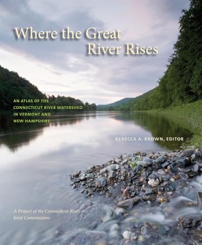
Where the Great River Rises: An Atlas of the Upper Connecticut River Watershed in Vermont and New Hampshire
Published by Dartmouth College Press, 2009
ISBN 10: 1584657650ISBN 13: 9781584657651
Book
Condition: Good. SHIPS FROM USA. Used books have different signs of use and do not include supplemental materials such as CDs, Dvds, Access Codes, charts or any other extra material. All used books might have various degrees of writing, highliting and wear and tear and possibly be an ex-library with the usual stickers and stamps. Dust Jackets are not guaranteed and when still present, they will have various degrees of tear and damage. All images are Stock Photos, not of the actual item. book.
More buying choices from other sellers on AbeBooks
New offers from US$ 32.64
Used offers from US$ 15.97
Also find Softcover
-
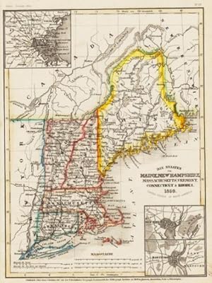
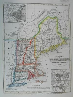
MAP: 'Vermont/New Hampshire'.from Rand McNally's Dollar Atlas of the World
Published by Rand McNally & Co, Chicago IL, 1916
Art / Print / Poster
Unbound. Condition: Very Good. Colored Map (illustrator). 5.5" x 7'' map, suitable for framing Size: 5.5" x 7''.
-

No Binding. Condition: Near Fine. Population ststed as 346,991 which is also the 1880 cencus data for NH. Very nice condition colored map ready for framing. Measures 14" wide x 22.5" tall with a horizontal seam/fold line as it was excised fron an atlas and is a double-page map pp36/37. Book.
-
Johnson's Family Atlas New Hampshire, Vermont Map
Published by 1861, 1861
Seller: Manning's Books & Prints, ABAA, Pacifica, CA, U.S.A.
Seller Rating:

Book
No Binding. Condition: Fine. 14� X 36. Johnson's Family Atlas Hand colored maps from 1861. Published in NYC.
-
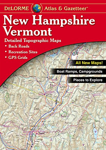
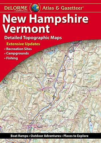
New Hampshire, Vermont Atlas & Gazetteer (Delorme Atlas & Gazetteer)
Published by Delorme, 2015
ISBN 10: 0899334415ISBN 13: 9780899334417
Book
Condition: Good. SHIPS FROM USA. Used books have different signs of use and do not include supplemental materials such as CDs, Dvds, Access Codes, charts or any other extra material. All used books might have various degrees of writing, highliting and wear and tear and possibly be an ex-library with the usual stickers and stamps. Dust Jackets are not guaranteed and when still present, they will have various degrees of tear and damage. All images are Stock Photos, not of the actual item. book.
More buying choices from other sellers on AbeBooks
New offers from US$ 76.40
Used offers from US$ 47.98
Also find Softcover
-
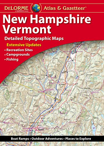
Delorme Atlas & Gazetteer: New Hampshire, Vermont
Published by Delorme Mapping Company, 2022
ISBN 10: 194649447XISBN 13: 9781946494474
Book
Condition: New. Buy with confidence! Book is in new, never-used condition.
More buying choices from other sellers on AbeBooks
New offers from US$ 53.76
Used offers from US$ 111.81
Also find Softcover
-
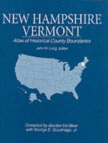
New Hampshire, Vermont: Atlas of Historical County Boundaries
Published by Simon & Schuster, 1993
ISBN 10: 0130519545ISBN 13: 9780130519542
Book First Edition
Hardcover. Condition: New. Dust Jacket Condition: New. 1st Edition. New, no markings. Hardcover with dust jacket. 100% Satisfaction Guarantee. We are in business to sell books, not maintain inventory. If you find a comparable book at a lower price, we will usually beat their price. We often can discount shipping or price on multiple book orders.
More buying choices from other sellers on AbeBooks
New offers from US$ 55.00
Used offers from US$ 100.00
Also find Hardcover Softcover First Edition
-
Delorme New Hampshire/Vermont Atlas & Gazetteer (Delorme Atlas & Gazetteer)
Published by DeLorme Publishing, 2018
ISBN 10: 194649416XISBN 13: 9781946494160
Book
Condition: New. Buy with confidence! Book is in new, never-used condition.
More buying choices from other sellers on AbeBooks
New offers from US$ 63.89
-
-
New Hampshire vermont Atlas of Historical County Boundaries
Published by Simon and Schuster, 1993
Book First Edition
Hardcover. Condition: Like New. Dust Jacket Condition: like new. First Edition. book and dust jacket never used in rarer Simon and Shuster as publisher.
-
Mit 3 Nebenkarten: Umgebung von Boston, Umgebung von New Haven, Umgebung Hartford.# Steel engraving with original outline color.- With inset maps of Boston, New Haven and Hartford.
-
24 1/2 x 16 3/4 inches. Condition: Very good. This is a brilliant use of color to designate the individual railroads in both states at 1899. Cram's presentation of American railroads was unsurpassed for its time. Various state level commissions produced maps but it was Cram that offered blanket coverage of the entire United States. Important for this map is the extensive coverage of railroads around cities. Shown are numerous railroads and express companies. Railroads have the same color on the separate maps through which they pass. Included are: Boston & Maine, Grand Trunk, Maine Central, Delaware & Hudson and Central Vermont.
-
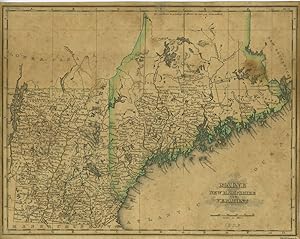
A Map of Maine, New Hampshire and Vermont from "An Atlas of the United States, on an Improved Plan;." with a complete index
Published by N. & S.S. Jocelyn, New Haven, 1823
Seller: Antipodean Books, Maps & Prints, ABAA, Garrison, NY, U.S.A.
Association Member: ABAA ANZAAB ESA ILAB
Seller Rating:

Maps. Condition: Good + overall. This map is one of the 11 published in Sidney E. Morse's atlas. Morse [1794 -- 1871] was an American inventor, geographer, journalist and brother of the telegraph pioneer Samuel F. B. Morse. 10 x 8", original outline color, trimmed close, evenly toned with index tipped onto card, sunned due to being previously framed, ruffled at top edge.
-

MAP: "Johnson's Map of New Hampshire & Vermont (1861)'.from Johnson's New Illustrated (Steel Plate) Family Atlas, 1861
Published by Johnson & Browning, Richmond, VA, 1861
Art / Print / Poster First Edition
Unbound. Condition: Very Good. Handcolored Map (illustrator). 1st. Plate #23, 24: lovely double page hand-colored map; mid-19th century, decorative strapwGreen Mountains indicated, , railroads and canals as well. Lower right quadrant goes beyond the bordering as shown. Size: 17 x 24.5 Inches.
-
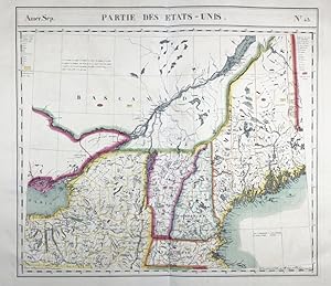
Amer. Sep. / Partie des Etats-Unis. / N� 43" - New England New Hampshire New York Maine Vermont Massachusetts United States USA America Amerique Amerika / from: "Atlas Universel De Geographie, Physique, Politique Et Mineralogique"
Published by Bruxelles, 1825
Seller: Antiquariat Steffen V�lkel GmbH, Seubersdorf, Germany
Seller Rating:

Map First Edition
Sheet size: ca.54 x72 cm. -- Original handcolored lithographic map from Vandermaelen's folio-size world atlas. It is the first atlas produced by the then new printing process of lithography and the first to show the whole world in maps using a large scale resulting in the most detailed maps at the time. -- Map of the region on the east of Lake Ontario. Very detailed map showing the St. Lawrence river, and the states of Vermont, Massachusetts, Maine, New Hampshire and a part of the state of New York. -- in very good condition. | | Original lithographierte, handkolorierte Karte aus Vandermaelen's Weltatlas aus dem Jahre 1827. Es ist der erste Atlas, welcher im damals neuartigen Verfahren der Lithographie hergestellt wurde. -- gut erhalten. || Dies ist ein Original! - Kein Nachdruck! - Keine Kopie! -- This is an original! - No copy! - No reprint! Sprache: Franz�sisch Gewicht in Gramm: 35.
-
![Seller image for AMERICA, U.S. A. New Hampshire and Vermont MAP 1880 County and township map of the states of New Hampshire and Vermont. [By S. Augustus Mitchell] [from: Mitchell's new general atlas, containing maps of the various countries of the World] for sale by ANTIQUARIAT.WIEN Fine Books & Prints](https://pictures.abebooks.com/inventory/md/md30869433650.jpg)
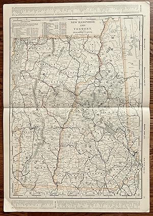
AMERICA, U.S. A. New Hampshire and Vermont MAP 1880 County and township map of the states of New Hampshire and Vermont. [By S. Augustus Mitchell] [from: Mitchell's new general atlas, containing maps of the various countries of the World]
Published by S.A. Mitchell, Philadelphia, 1880
Seller: ANTIQUARIAT.WIEN Fine Books & Prints, Wien, Austria
Seller Rating:
Map
map, original engraving, hand-coloured, image size approximately 53 x 35 cm old Antique Print / originale Druckgrafik; Cobb, D.A. New Hampshire maps to 1900, 363 en 500 Landkarte.
-
Condition: very good. Slightly Used Copy.
More buying choices from other sellers on AbeBooks
New offers from US$ 271.53
Used offers from US$ 265.10
Also find Softcover
