Items related to Folded Map: Atlanta Regional Map
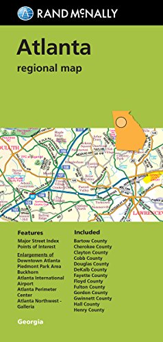

Rand McNally's folded map for Atlanta is a must-have for anyone traveling in and around the Atlanta area, offering unbeatable accuracy and reliability at a great price. Our trusted cartography shows all Interstate, U.S., state, and county highways, along with clearly indicated parks, points of interest, airports, county boundaries, and streets. The easy-to-use legend and detailed index make for quick and easy location of destinations. You'll see why Rand McNally folded maps have been the trusted standard for years.
Folded map features:
Regularly updated
Full-color maps
Clearly labeled Interstate, U.S., state, and county highways
Indications of parks, points of interest, airports, county boundaries, downtown & vicinity maps
Easy-to-use legend
Convenient folded size
Additional Features:
Major Street Index
Points of Interest
Enlargements of Downtown Atlanta
Piedmont Park Area
Buckhorn
Atlanta International Airport
Atlanta Perimeter Center
Atlanta Northwest Galleria
Coverage Area
Communities Included: Bartow County, Chereokee County, Clayton County, Cobb County, Douglas County, DeKalb County, Fayette County, Floyd County, Fulton County, Gordon County, Gwinett County, Hall County, Henry County
Product Details
Measures 9.5' x 4' and folds out to 40' x 28'.
"synopsis" may belong to another edition of this title.
- PublisherRand McNally
- Publication date2017
- ISBN 10 0528007947
- ISBN 13 9780528007941
- BindingPaperback
- Number of pages2
Buy New
Learn more about this copy
US$ 43.70
Shipping:
FREE
Within U.S.A.
Top Search Results from the AbeBooks Marketplace
Stock Image
Folded Map: Atlanta Regional Map
Published by
Rand McNally
(2017)
ISBN 10: 0528007947
ISBN 13: 9780528007941
New
Softcover
Quantity: 1
Seller:
Rating
Book Description Condition: New. Buy with confidence! Book is in new, never-used condition. Seller Inventory # bk0528007947xvz189zvxnew
Buy New
US$ 43.70
Convert currency
Stock Image
Folded Map: Atlanta Regional Map
Published by
Rand McNally
(2017)
ISBN 10: 0528007947
ISBN 13: 9780528007941
New
Paperback
Quantity: 1
Seller:
Rating
Book Description Paperback. Condition: New. Brand New!. Seller Inventory # VIB0528007947
Buy New
US$ 43.73
Convert currency