Items related to Everglades National Park Map (National Geographic Trails...

� Waterproof � Tear-Resistant � Topographic Map
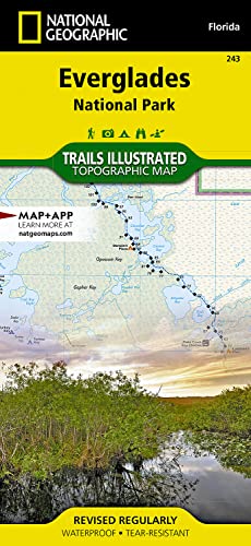
Visited by more than 1 million people a year, Everglades National Park has one of the world's most diverse ecosystems and is an international treasure. Outdoor enthusiasts exploring this unique and fragile environment will marvel at National Geographic's Trails Illustrated map of the park. Created in cooperation with the National Park Service and others, this expertly researched map covers not only the park, but also parts of neighboring John Pennekamp Coral Reef State Park, Big Cypress National Preserve and Cape Romano Ten Thousand Islands Aquatic Preserve, as well as Everglades City and Key Largo. Inset maps provide extensive detail of Flamingo, Whitewater Bay, Pineland Trails of the Long Pine Key area and Nine Mile Pond.
Mapped canoes trails will guide you through the area's bays, lakes and other waterways. The 99-mile Wilderness Waterway is mapped in its entirety along with its NPS markers, backcountry campsites and chickees. The Whitewater Bay area additionally shows Coast Guard markers, sounding depths and sub-surface conditions. Those exploring on foot can enjoy mapped hiking trails, many displaying mileage markers. To aid in your navigation, the map displays areas of mangroves, hardwood hammocks and wooded cover, marshes, sawgrass prairies, wildlife protection areas, selected waypoints and clear color-coded national park, national preserve and state park boundaries. Additional recreation features and facilities pinpointed include marinas, boat launch areas, bike trails, interpretive trails, showers and restrooms.
Every Trails Illustrated map is printed on "Backcountry Tough" waterproof, tear-resistant paper. A full UTM grid is printed on the map to aid with GPS navigation.
Other features found on this map include: Barnes Sound, Big Cypress, Cape Sable, Everglades, Florida Bay, Ponce de Le�n Bay, Ten Thousand Islands, Whitewater Bay.
- Map Scale = 1:100,000
- Sheet Size = 25.5" x 37.75"
- Folded Size = 4.25" x 9.25"
"synopsis" may belong to another edition of this title.
About the Author:
Founded in 1915 as the Cartographic Group, the first division of National Geographic, National Geographic Maps has been responsible for illustrating the world around us through the art and science of mapmaking.Today, National Geographic Maps continues this mission by creating the world's best wall maps, recreation maps, atlases, and globes which inspire people to care about and explore their world.
"About this title" may belong to another edition of this title.
- PublisherNatl Geographic Society Maps
- Publication date2022
- ISBN 10 1566954096
- ISBN 13 9781566954099
- BindingMap
- Number of pages2
Buy New
Learn more about this copy
US$ 19.41
Shipping:
FREE
Within U.S.A.
Top Search Results from the AbeBooks Marketplace
Stock Image
Everglades National Park (National Geographic Trails Illustrated Map, 243)
Published by
Natl Geographic Society Maps
(2019)
ISBN 10: 1566954096
ISBN 13: 9781566954099
New
Quantity: 1
Seller:
Rating
Book Description Map. Condition: New. Seller Inventory # DADAX1566954096
Buy New
US$ 19.41
Convert currency
Stock Image
Everglades National Park
Published by
National Geographic Maps Division 2012-08-02, Washington, D.C.
(2012)
ISBN 10: 1566954096
ISBN 13: 9781566954099
New
Quantity: 1
Seller:
Rating
Book Description sheet map (folded). Condition: New. Language: ENG. Seller Inventory # 9781566954099
Buy New
US$ 16.64
Convert currency
Stock Image
Everglades National Park Trails Illustrated National Parks National Geographic Trails Illustrated Map
Published by
National Geographic Maps Division
(2012)
ISBN 10: 1566954096
ISBN 13: 9781566954099
New
Quantity: 3
Seller:
Rating
Book Description UNK. Condition: New. New Book. Shipped from UK. Established seller since 2000. Seller Inventory # EA-9781566954099
Buy New
US$ 23.90
Convert currency
Stock Image
National Geographic Trails Illustrated Map Everglades National Park, Florida, USA
Seller:
Rating
Book Description Map. Condition: Brand New. map edition. 2 pages. 9.25x4.25x0.50 inches. In Stock. Seller Inventory # x-1566954096
Buy New
US$ 16.54
Convert currency
Stock Image
National Geographic Trails Illustrated Map Everglades National Park, Florida, USA
Seller:
Rating
Book Description Map. Condition: Brand New. map edition. 2 pages. 9.25x4.25x0.50 inches. In Stock. Seller Inventory # __1566954096
Buy New
US$ 18.69
Convert currency
Stock Image
Everglades National Park Map (National Geographic Trails Illustrated Map, 243)
Published by
Natl Geographic Society Maps
(2022)
ISBN 10: 1566954096
ISBN 13: 9781566954099
New
Quantity: 1
Seller:
Rating
Book Description Condition: New. Book is in NEW condition. Seller Inventory # 1566954096-2-1
Buy New
US$ 33.75
Convert currency
Stock Image
Everglades National Park Map (National Geographic Trails Illustrated Map, 243)
Published by
Natl Geographic Society Maps
(2022)
ISBN 10: 1566954096
ISBN 13: 9781566954099
New
Paperback
Quantity: 1
Seller:
Rating
Book Description Paperback. Condition: new. New. Seller Inventory # Wizard1566954096
Buy New
US$ 30.29
Convert currency
Seller Image
Everglades National Park Map
Published by
National Geographic Maps Jan 2022
(2022)
ISBN 10: 1566954096
ISBN 13: 9781566954099
New
Quantity: 1
Seller:
Rating
Book Description Karte. Condition: Neu. Neuware -This Trails Illustrated topographic map for Everglades National Park and surrounding area is the perfect map for hiking, boating, paddling, biking, fishing, exploring, camping, and sightseeing in this unique national treasure. This two-sided map includes the Key Largo, Everglades City, Chokoloskee, Everglades National Park, portions of Big Cypress National Preserve, Fakahatchee Strand State Preserve, Cape Romano Ten Thousand Islands Aquatic Preserve, Shark Valley Tram Road, Old Ingraham highway and campsite, North Nest Key, West Lake Canoe Trail, Snake Bight Trail, backcountry campsites, beach sites, ground sites, and chickees, and detailed insets of Flamingo, Whitewater Bay, Pineland Trails of the Long Pine Key area, and Nine Mile Pond. The map also shows the entire Wilderness Waterway, from the Gulf Coast Visitor Center near Everglades City to its terminus beyond the Flamingo Visitor Center. Includes UTM grids for use with your GPS unit. 2 pp. Englisch. Seller Inventory # 9781566954099
Buy New
US$ 17.54
Convert currency
Stock Image
Everglades National Park Map (National Geographic Trails Illustrated Map, 243)
Published by
Natl Geographic Society Maps
(2022)
ISBN 10: 1566954096
ISBN 13: 9781566954099
New
Paperback
Quantity: 1
Seller:
Rating
Book Description Paperback. Condition: new. New Copy. Customer Service Guaranteed. Seller Inventory # think1566954096
Buy New
US$ 38.01
Convert currency
Seller Image
Everglades National Park Map
Published by
National Geographic Maps Jan 2022
(2022)
ISBN 10: 1566954096
ISBN 13: 9781566954099
New
Quantity: 1
Seller:
Rating
Book Description Karte. Condition: Neu. Neuware -This Trails Illustrated topographic map for Everglades National Park and surrounding area is the perfect map for hiking, boating, paddling, biking, fishing, exploring, camping, and sightseeing in this unique national treasure. This two-sided map includes the Key Largo, Everglades City, Chokoloskee, Everglades National Park, portions of Big Cypress National Preserve, Fakahatchee Strand State Preserve, Cape Romano Ten Thousand Islands Aquatic Preserve, Shark Valley Tram Road, Old Ingraham highway and campsite, North Nest Key, West Lake Canoe Trail, Snake Bight Trail, backcountry campsites, beach sites, ground sites, and chickees, and detailed insets of Flamingo, Whitewater Bay, Pineland Trails of the Long Pine Key area, and Nine Mile Pond. The map also shows the entire Wilderness Waterway, from the Gulf Coast Visitor Center near Everglades City to its terminus beyond the Flamingo Visitor Center. Includes UTM grids for use with your GPS unit. Seller Inventory # 9781566954099
Buy New
US$ 17.54
Convert currency