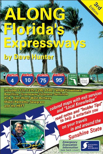
Items related to Along Florida's Expressways, 3rd edition

"Filled with insider tips, Along Floridas Expressways is an excellent resource for Sunshine State visitors and residents alike. As the states official source for travel planning, VISIT FLORIDAs staff knows Florida well - and even we use Daves driving guide." -- Visit Florida
"synopsis" may belong to another edition of this title.
From the Author:
About the Author:
Florida Hurricane Evacuation, by road
Floridians evacuating by road need answers to the following questions and "Along Florida's Expressways" provides answers.
Do you know . . . ?
... each of the county names for 250 miles along your evacuation route? Weather information is always provided by county name - all our colored 25 mile strip maps include county names and their borders.
... the various emergency radio frequencies you need to tune into as you evacuate? The appropriate local emergency evacuation, FM radio frequency is shown on our maps . . . at least every 50 miles.
... the locations of any parallel routes and which exits access them? Parallel routes are often underutilized in emergency situations as everyone tries to reach an expressway. Our maps show you how to reach these parallel routes, and which expressway exits interconnect.
... whether congested traffic is the result of a lane merge, ahead? All lane merges/expansions are shown on our maps so you will know which is your best (or worst) driving lane. We even show exits leaving the expressway on your left, so you don’t get trapped in these lanes!
... as traffic congestion eases, where is the next rest area? Where is the next service exit with gas, food, lodging, pharmacy, supermarket, police, hospital or vet? All these details (and more) are featured on our maps. We even indicate which side of the expressway the services are on so you can avoid becoming mired in local traffic patterns.
Dave Hunter - Bio
Dave loves maps, history, driving and discovering unusual stories along the way. Combined with his fondness for writing, this led to Along Interstate-75―a travel book which has quickly become the “must-have” guide for "snowbirds" heading out for the long-distance drive to Florida, each winter.
His passion for history paid dividends while writing the I-75 guide. During research, he rediscovered two little known Civil War battle sites in North Georgia and noted that the interstate ran right across the middle of the Union and Confederate battle lines. Modern posters of his battlemaps were displayed in Georgia's Welcome Center, during the 1996 Atlanta Olympics. He also found a forgotten trail blazed in 1775 by Daniel Boone, which crosses the path of the modern interstate in Kentucky.
Both of these finds were made possible by Dave's ability to read topographical maps–a skill he developed as a youngster roaming the hills and valleys of England’s South Downs, looking for prehistoric encampments and lost Roman roads.
With more than twenty-five years of writing about I-75 road travel, Dave has become the media "go-to" person when producing annual drive-to-Florida content, and has appeared in hundreds of newspaper articles and radio & TV guest appearances.
For the past sixteen years, Dave has hosted an all-day entertainment stage at the two-day Snowbird Extravaganza, held in Lakeland, Florida. This annual consumer show attracts over 15,000 U.S. & Canadian snowbirds each day. He is also a regular contributor of I-75 and Florida articles for the CSA News, Canada's official Canadian Snowbird Association.
Dave is a credentialed member of the prestigious Society of American Travel Writers (SATW). He is also a member of North American Travel Journalist Association (NATJA) and International Travel Writers Alliance-UK (ITWA). His full biography may be found in Canada's Who's Who.
(Dave Hunter)"About this title" may belong to another edition of this title.
- PublisherMile Oak Publishing
- Publication date2011
- ISBN 10 1896819443
- ISBN 13 9781896819440
- BindingSpiral-bound
- Edition number3
- Number of pages202
- Rating
Buy New
Learn more about this copy
US$ 101.80
Shipping:
US$ 3.50
Within U.S.A.
Top Search Results from the AbeBooks Marketplace
Stock Image
Along Florida's Expressways, 3rd edition
Published by
Mile Oak Publishing
(2011)
ISBN 10: 1896819443
ISBN 13: 9781896819440
New
Paperback
Quantity: 1
Seller:
Rating
Book Description Paperback. Condition: new. New. Seller Inventory # Wizard1896819443
Buy New
US$ 101.80
Convert currency
Stock Image
Along Florida's Expressways, 3rd edition
Published by
Mile Oak Publishing
(2011)
ISBN 10: 1896819443
ISBN 13: 9781896819440
New
Paperback
Quantity: 1
Seller:
Rating
Book Description Paperback. Condition: new. New. Fast Shipping and good customer service. Seller Inventory # Holz_New_1896819443
Buy New
US$ 102.10
Convert currency
Stock Image
Along Florida's Expressways, 3rd edition
Published by
Mile Oak Publishing
(2011)
ISBN 10: 1896819443
ISBN 13: 9781896819440
New
Paperback
Quantity: 1
Seller:
Rating
Book Description Paperback. Condition: new. New Copy. Customer Service Guaranteed. Seller Inventory # think1896819443
Buy New
US$ 104.73
Convert currency