
Order Total (1 Item Items):
Shipping Destination:

Davies, John,kent, Alexander J (19 results)
Skip to main search results
Search filters
Product Type
- All Product Types
- Books (19)
- Magazines & Periodicals (No further results match this refinement)
- Comics (No further results match this refinement)
- Sheet Music (No further results match this refinement)
- Art, Prints & Posters (No further results match this refinement)
- Photographs (No further results match this refinement)
- Maps (No further results match this refinement)
- Manuscripts & Paper Collectibles (No further results match this refinement)
Condition Learn more
- New (10)
- As New, Fine or Near Fine (3)
- Very Good or Good (6)
- Fair or Poor (No further results match this refinement)
- As Described (No further results match this refinement)
Binding
- All Bindings
- Hardcover (19)
- Softcover (No further results match this refinement)
Collectible Attributes
- First Edition (1)
- Signed (No further results match this refinement)
- Dust Jacket (2)
- Seller-Supplied Images (10)
- Not Print on Demand (19)
Language (1)
Free Shipping
Seller Location
Seller Rating
-

The Red Atlas: How the Soviet Union Secretly Mapped the World
Published by University of Chicago Press, 2017
ISBN 10: 022638957X ISBN 13: 9780226389578
Language: English
Condition: good. A copy that has been read, remains in good condition. All pages are intact, and the cover is intact. The spine and cover show signs of wear. Pages can include notes and highlighting and show signs of wear, and the copy can include "From the library of" labels or previous owner inscriptions. 100% GUARANTEE! Shipped with delivery confirmation, if you're not satisfied with purchase please return item for full refund. Ships via media mail.
-
The Red Atlas: How the Soviet Union Secretly Mapped the World
Published by University of Chicago Press, 2017
ISBN 10: 022638957X ISBN 13: 9780226389578
Language: English
Hardcover. Condition: Very Good. Connecting readers with great books since 1972! Used books may not include companion materials, and may have some shelf wear or limited writing. We ship orders daily and Customer Service is our top priority!
-
The Red Atlas: How the Soviet Union Secretly Mapped the World
Published by University of Chicago Press, 2017
ISBN 10: 022638957X ISBN 13: 9780226389578
Language: English
Hardcover. Condition: Very Good. Dust Jacket Condition: Very Good. Light shelfwear to edges. Text is clean and the binding is firm.
-
The Red Atlas: How the Soviet Union Secretly Mapped the World
Published by University of Chicago Press, 2017
ISBN 10: 022638957X ISBN 13: 9780226389578
Language: English
Hardcover. Condition: Very Good. Connecting readers with great books since 1972! Used books may not include companion materials, and may have some shelf wear or limited writing. We ship orders daily and Customer Service is our top priority!
-
The Red Atlas: How the Soviet Union Secretly Mapped the World
Published by University of Chicago Press, 2017
ISBN 10: 022638957X ISBN 13: 9780226389578
Language: English
First Edition
Hardcover. Condition: Near Fine. Dust Jacket Condition: Near Fine. 1st Edition. Foreword by James Risen, maps throughout the text. Slight rubbing on the lower board edges.
-
The Red Atlas Format: Hardcover
Published by University of Chicago press, 2017
ISBN 10: 022638957X ISBN 13: 9780226389578
Language: English
Condition: New. Brand New.
-

Red Atlas : How the Soviet Union Secretly Mapped the World
Published by University of Chicago Press, 2017
ISBN 10: 022638957X ISBN 13: 9780226389578
Language: English
Condition: New.
-

Red Atlas : How the Soviet Union Secretly Mapped the World
Published by University of Chicago Press, 2017
ISBN 10: 022638957X ISBN 13: 9780226389578
Language: English
Condition: As New. Unread book in perfect condition.
-

The Red Atlas
Published by The University of Chicago Press, US, 2017
ISBN 10: 022638957X ISBN 13: 9780226389578
Language: English
Seller: Rarewaves.com USA, London, LONDO, United Kingdom
Seller rating 5 out of 5 stars

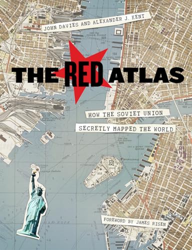
Hardback. Condition: New. Nearly thirty years after the end of the Cold War, its legacy and the accompanying Russian-American tension continues to loom large. Russia's access to detailed information on the United States and its allies may not seem so shocking in this day of data clouds and leaks, but long before we had satellite imagery of any neighborhood at a finger's reach, the amount the Soviet government knew about your family's city, street, and even your home would astonish you. Revealing how this was possible, The Red Atlas is the never-before-told story of the most comprehensive mapping endeavor in history and the surprising maps that resulted. From 1950 to 1990, the Soviet Army conducted a global topographic mapping program, creating large-scale maps for much of the world that included a diversity of detail that would have supported a full range of military planning. For big cities like New York, DC, and London to towns like Pontiac, MI and Galveston, TX, the Soviets gathered enough information to create street-level maps.What they chose to include on these maps can seem obvious like locations of factories and ports, or more surprising, such as building heights, road widths, and bridge capacities. Some of the detail suggests early satellite technology, while other specifics, like detailed depictions of depths and channels around rivers and harbors, could only have been gained by actual Soviet feet on the ground. The Red Atlas includes over 350 extracts from these incredible Cold War maps, exploring their provenance and cartographic techniques as well as what they can tell us about their makers and the Soviet initiatives that were going on all around us. A fantastic historical document of an era that sometimes seems less distant, The Red Atlas offers an uncanny view of the world through the eyes of Soviet strategists and spies.
-
The Red Atlas: How the Soviet Union Secretly Mapped the World
Published by University of Chicago Pr., 2017
ISBN 10: 022638957X ISBN 13: 9780226389578
Language: English
Condition: Very Good. 2017. hardcover. . . . . . Books ship from the US and Ireland.
-
The Red Atlas: How the Soviet Union Secretly Mapped the World
Published by University of Chicago Pr., 2017
ISBN 10: 022638957X ISBN 13: 9780226389578
Language: English
Seller: Kennys Bookshop and Art Galleries Ltd., Galway, GY, Ireland
Seller rating 5 out of 5 stars
Condition: Very Good. 2017. hardcover. . . . . .
-
Hardcover. Condition: Brand New. 272 pages. 9.25x7.50x1.00 inches. In Stock.
-

Red Atlas : How the Soviet Union Secretly Mapped the World
Published by University of Chicago Press, 2017
ISBN 10: 022638957X ISBN 13: 9780226389578
Language: English
Seller: GreatBookPricesUK, Woodford Green, United Kingdom
Seller rating 5 out of 5 stars
Condition: New.
-
The Red Atlas: How the Soviet Union Secretly Mapped the World
Published by University of Chicago Press, 2017
ISBN 10: 022638957X ISBN 13: 9780226389578
Language: English
Seller: Ria Christie Collections, Uxbridge, United Kingdom
Seller rating 5 out of 5 stars
Condition: New. In.
-

The Red Atlas
Published by The University of Chicago Press, US, 2017
ISBN 10: 022638957X ISBN 13: 9780226389578
Language: English
Hardback. Condition: New. Nearly thirty years after the end of the Cold War, its legacy and the accompanying Russian-American tension continues to loom large. Russia's access to detailed information on the United States and its allies may not seem so shocking in this day of data clouds and leaks, but long before we had satellite imagery of any neighborhood at a finger's reach, the amount the Soviet government knew about your family's city, street, and even your home would astonish you. Revealing how this was possible, The Red Atlas is the never-before-told story of the most comprehensive mapping endeavor in history and the surprising maps that resulted. From 1950 to 1990, the Soviet Army conducted a global topographic mapping program, creating large-scale maps for much of the world that included a diversity of detail that would have supported a full range of military planning. For big cities like New York, DC, and London to towns like Pontiac, MI and Galveston, TX, the Soviets gathered enough information to create street-level maps.What they chose to include on these maps can seem obvious like locations of factories and ports, or more surprising, such as building heights, road widths, and bridge capacities. Some of the detail suggests early satellite technology, while other specifics, like detailed depictions of depths and channels around rivers and harbors, could only have been gained by actual Soviet feet on the ground. The Red Atlas includes over 350 extracts from these incredible Cold War maps, exploring their provenance and cartographic techniques as well as what they can tell us about their makers and the Soviet initiatives that were going on all around us. A fantastic historical document of an era that sometimes seems less distant, The Red Atlas offers an uncanny view of the world through the eyes of Soviet strategists and spies.
-

Red Atlas : How the Soviet Union Secretly Mapped the World
Published by University of Chicago Press, 2017
ISBN 10: 022638957X ISBN 13: 9780226389578
Language: English
Seller: GreatBookPricesUK, Woodford Green, United Kingdom
Seller rating 5 out of 5 stars
Condition: As New. Unread book in perfect condition.
-

Condition: New. Über den AutorJohn Davies is editor of Sheetlines, the journal of the Charles Close Society for the Study of Ordnance Survey Maps. He lives in London. Alexander J. Kent is a reader in cartography and geographica.
-

The Red Atlas
Published by The University of Chicago Press, US, 2017
ISBN 10: 022638957X ISBN 13: 9780226389578
Language: English
Hardback. Condition: New. Nearly thirty years after the end of the Cold War, its legacy and the accompanying Russian-American tension continues to loom large. Russia's access to detailed information on the United States and its allies may not seem so shocking in this day of data clouds and leaks, but long before we had satellite imagery of any neighborhood at a finger's reach, the amount the Soviet government knew about your family's city, street, and even your home would astonish you. Revealing how this was possible, The Red Atlas is the never-before-told story of the most comprehensive mapping endeavor in history and the surprising maps that resulted. From 1950 to 1990, the Soviet Army conducted a global topographic mapping program, creating large-scale maps for much of the world that included a diversity of detail that would have supported a full range of military planning. For big cities like New York, DC, and London to towns like Pontiac, MI and Galveston, TX, the Soviets gathered enough information to create street-level maps.What they chose to include on these maps can seem obvious like locations of factories and ports, or more surprising, such as building heights, road widths, and bridge capacities. Some of the detail suggests early satellite technology, while other specifics, like detailed depictions of depths and channels around rivers and harbors, could only have been gained by actual Soviet feet on the ground. The Red Atlas includes over 350 extracts from these incredible Cold War maps, exploring their provenance and cartographic techniques as well as what they can tell us about their makers and the Soviet initiatives that were going on all around us. A fantastic historical document of an era that sometimes seems less distant, The Red Atlas offers an uncanny view of the world through the eyes of Soviet strategists and spies.
-

The Red Atlas
Published by The University of Chicago Press, US, 2017
ISBN 10: 022638957X ISBN 13: 9780226389578
Language: English
Hardback. Condition: New. Nearly thirty years after the end of the Cold War, its legacy and the accompanying Russian-American tension continues to loom large. Russia's access to detailed information on the United States and its allies may not seem so shocking in this day of data clouds and leaks, but long before we had satellite imagery of any neighborhood at a finger's reach, the amount the Soviet government knew about your family's city, street, and even your home would astonish you. Revealing how this was possible, The Red Atlas is the never-before-told story of the most comprehensive mapping endeavor in history and the surprising maps that resulted. From 1950 to 1990, the Soviet Army conducted a global topographic mapping program, creating large-scale maps for much of the world that included a diversity of detail that would have supported a full range of military planning. For big cities like New York, DC, and London to towns like Pontiac, MI and Galveston, TX, the Soviets gathered enough information to create street-level maps.What they chose to include on these maps can seem obvious like locations of factories and ports, or more surprising, such as building heights, road widths, and bridge capacities. Some of the detail suggests early satellite technology, while other specifics, like detailed depictions of depths and channels around rivers and harbors, could only have been gained by actual Soviet feet on the ground. The Red Atlas includes over 350 extracts from these incredible Cold War maps, exploring their provenance and cartographic techniques as well as what they can tell us about their makers and the Soviet initiatives that were going on all around us. A fantastic historical document of an era that sometimes seems less distant, The Red Atlas offers an uncanny view of the world through the eyes of Soviet strategists and spies.