Order Total (1 Item Items):
Shipping Destination:

De Jomini, General Baron (20 results)
Skip to main search results
Product Type
- All Product Types
- Books (19)
- Magazines & Periodicals
- Comics
- Sheet Music
- Art, Prints & Posters
- Photographs
- Maps (1)
-
Manuscripts &
Paper Collectibles
Condition
- All Conditions
- New
- Used
Binding
Collectible Attributes
- First Edition (1)
- Signed
- Dust Jacket
- Seller-Supplied Images (14)
- Not Printed On Demand
Seller Location
Seller Rating
-

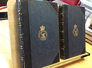
THE POLITICAL AND MILITARY HISTORY OF THE CAMPAIGN OF WATERLOO.; Translated by Capt. S. V. Benet
Published by D. Van Nostrand, 192 Broadway, New York, 1862
Seller: Bartleby's Books, ABAA, Chevy Chase, MD, U.S.A.
Association Member: ABAA ESA ILAB IOBA
Seller Rating:

Second edition. 8vo. Folding map, 227pp. Embossed brown pebbled cloth with gilt stamping on spine. Spine ends with wear, offsetting to map and title page from something once laid in. At West Point, Jomini's texts on military strategy were used to train cadets during the Civil War.
-

The Political and Military History of the Campaign of Waterloo
Published by D. Van Nostrand, New York, 1864
Book
Cloth - Hard Cover. Condition: Good. Dust Jacket Condition: No Dust Jacket. 227 pages, plus folding frontispiece map, and ads at rear. Red cloth covers are just a little faded over spine and show a couple of scuffs/stains. Ink stamp of a masonic lodge on the top edge of the text block. Private library book plate on front paste down. Small stain at the top edge of the first few leaves. Otherwise a tight and clean copy.
-
Premi�re et seconde �p�tres d?un Suisse � ses concitoyens. 1822.
Published by Lausanne, Association Semper Fidelis, 1992,, 1992
Seller: Harteveld Rare Books Ltd., Fribourg, Switzerland
Association Member: ILAB VEBUKU
Seller Rating:

pt. in-8vo, frontispice-portrait en couleurs + 75 p., + 1 double planche d�pl. + 1 portr. de Hignou, maitre imprimeur, reliure en cuir originale. Please notify before visiting to see a book. Prices are excl. VAT/TVA (only Switzerland) & postage.
-
THE POLITICAL AND MILITARY HISTORY OF THE CAMPAIGN ON WATERLOO
Published by J. S. Redfield, New York, 1853
Seller: Second Story Books, ABAA, Rockville, MD, U.S.A.
Seller Rating:
First Edition
Hardcover. First Edition. Octavo, 227 pages; G+; bound in brown cloth, spine has heavily faded gilt lettering and tooling; binding has moderate shelf wear, with heavy fraying at the top and bottom of the spine, has bumping and fraying on the fore edge corners, has staining to the lower boards; pages have minor age toning, have heavy detachment at the front hinge; ex library, with decimal code written on the spine in ink and due date slip inlaid on the inner back cover; contains a fold-out map; NOTE: Shelved in Locked Annex Area, ND-HV Column. 1329689. FP New Rockville Stock.
-
The Political and Military History of the Campaign of Waterloo
Published by Redfield, New York, 1860
Book
Hardcover. Condition: Very Good. No Jacket. Brown textured boards with gilt (dulled) title and device on spine. Top spine end rubbed. Corners very lightly bumped/rubbed. Diffuse light foxing throughout, pages mildly toned. Folded, attached map has a 1 1/4" tear near binding bottom edge. Binding tight; book square. In English.
-
The Political and Military History of the Campaign of Waterloo
Published by Redfield, 1853
Book
Hardcover. Condition: Very Good. Bound in publisher's cloth. 227 pages. Fold out map. Hardcover. Good binding and cover. Shelf wear. Generally clean. Minor spotting. Bookplate and owner's name to fep. Stamped on title and copyright pages.
-
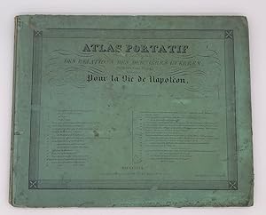
ATLAS PORTATIF POUR L'INTELLIGENCE DES RELATIONS DES DERNIERES GUERRES, PUBLIEES SANS PLANS; NOTAMMENT POUR LA VIE DE NAPOLEON. LEGENDES.:
Published by Chez Anselin, librairie pour l'art militaire, sans date,, Paris, 1840
(Codice SR/0938) In folio (37,5x27 cm) 75 pp. Texte explicatif, des 30 planches de l'atlas. Quelques jaunissures. Cachet ex libris. Gardes marbr�es, reliure �poque demi peau, titre dor�. Tr�s bon �tat. Euro 120.00 All books are in stock in fine condition or described meticulously. Very safe packaging.
-
Traite des Grandes Operations Militaires des Guerres de Frederic Le Grand Vols 2 & 3
Publication Date: 1851
Hardcover. Condition: Fair. Two French language hardcovers, volumes two and three, in fair condition. Heavily spotted throughout but nicely bound in Royal Engineers Library covers with straight spines and tight bindings. Some rubbing to the covers also. The numerous fold-out maps are in good order. Please see photos.
-
Trait� des grandes op�rations militaires, contenant l`histoire critique des campagnes de Fr�d�ric II, compar�es a celles de l`empereur Napoleon. 2. Aufl. Bd. II/Tl. 3/4 (v. 8).
Published by Paris, Magimel 1811., 1811
Dieser Teil des wichtigen milit�rhistorischen Werke behandelt die Felz�ge von 1759 bis 1762. 4�, Tit., 395 S.; Tit., 395 S.; mit einigen mitgez. Falttaf., Ppbd. d. Zt., stark berieben, Kanten u. Ecken besto�. u. tlw. geplatzt, R�ckenkanten rissig u. tlw. aufgeplatzt, ungleicher welliger Schnitt, einige altersbed. Stockfl., Exlibris "CS" (aus der Bibliothek des F�rsten Carl zu Schwarzenberg) auf vord. Innendeckel sowie alter Namens- u. Schriftzug auf Innentit.
-

Eigenh�ndiger, signierter Brief an einen General mit der Bitte, den versprochenen Bericht zu schicken. Der Verfasser schreibt, er sei in der Schlacht von Marengo und ben�tige dringend die Adresse des Generals (vielleicht Neippery).
Published by Dijon, 15.6.1800., 1800
Seller: Antiquariat Bebuquin (Alexander Zimmeck), Pegau OT Werben, Germany
Seller Rating:
19 x 12 cm. Eigenh�ndiger, signierter Brief auf Hadernb�tten. guter Zustand. Antoine-Henri Baron de Jomini stammte aus der Schweiz und war ein franz�sischer General, der sp�ter zu den Russen �berlief. In der Geschichte hat er sich vor allem durch seine Beschreibungen der Napoleonischen Kriegskunst einen Namen gemacht. Das vorliegende Dokument illustriert dieses Interesse augenf�llig. Sprache: franz�sisch.
-

Couverture rigide. Condition: bon. RO80102069: 1851. In-8. Reli�. Etat d'usage, Couv. l�g�rement pass�e, Dos satisfaisant, Rousseurs. 444 + 474 + 392 pages. Quelques planches de tableaux d�pliants. Etiquette de code sur la coiffe en-t�te et tampons de biblioth�que sur la page de titre et dans quelques marges. . . . Classification Dewey : 944.06-Restauration, 1815-1848.
-
Traite des Grandes Operations Militaired ou Historie Critique des Guerres de Frederic le Grand Comparees au Systeme Moderne, 3 volumes
Published by Librairie Millitaire de J. Dumaine, 1851
Book
Hardcover. Condition: Good. 1851; Paris, Volumes 1-3; French text; From the collection of John Shy, professor at University of Michigan; 3/4 leather with marbled paper covered boards; edge worn and rubbed; spine labels are peeling off on V2 & 3; bookplates on front and rear pastedowns; 7 fold out tables in all 3 volumes are present and intact; interiors are fixed otherwise clean; 8vo, 7 3/4" to 9 3/4" tall; 442 pages, 474 pages, & 392 pages; Additional shipping charges may need to be requested due to size or weight of book.
-
Trait� des grandes op�rations militaires, et histoire crtique des campagnes de la r�volution.
Published by O.O., o.Dr., um )., 1820
Seller: Biblion Antiquariat, Z�rich, ZH, Switzerland
Association Member: GIAQ ILAB VEBUKU
Seller Rating:
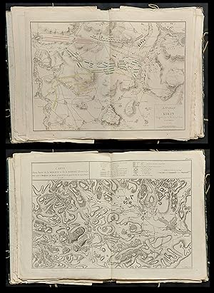
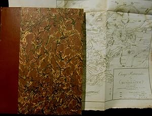
Lose Pl�ne 1, 4-24 [von 29] aus dem Atlasband. Folio. Der Plan 24 (laut dem hier fehlenden Verzeichnis) �Camp r�tranch� de Bunzelwitz� hier mit Pl. 25 bezeichnet, wohl aus einer anderen Auflage, beiligend ein Plan 24 �Schlacht bey Torgau. Bataille de Torgau�, der nicht im Verzeichnis gelistet ist. Beiliegend ein Plan �Plan de la bataille de Fontenoy donn�e le 11May 1745�, gedruckt auf Seide. - Der Atlas erschien in einem Umfang von 29 Pl�nen und 2 Bl. Titel, Planverzeichnis. - Plan 1 einblattgross, Plan 22 in 2 Blatt (davon 1 doppelblattgross und 1 blattgross), die restlichen Pl�ne doppelblattgross. - (Stellenweise leicht fleckig, Plan 1 mit hinterlegtem Einriss).
-
Trait� des grandes op�rations militaires et histoire critique des campagnes de la R�volution. Atlas.
Seller: Llibreria Antiqu�ria Casals, BARCELONA, Spain
Seller Rating:
S.Imp.nl.na (c.1810). 30 cm. 4 p., XXIX l�m. plegadas plantas topogr�ficas y geogr�ficas de batallas, algunas coloreadas con acuarelas. Enc. en media piel, tejuelo. Algun punto de �xido, marca de h�medad.(12109-L3). HISTORIA MILITAR.
-
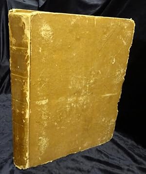
TRAITE DES GRANDES OPERATIONS MILITAIRES ET HISTOIRE CRITIQUE DES CAMPAGNES DE LA REVOLUTION, ATLAS, PAR LE GENERAL BARON DE JOMINI.
Published by SANS NOM. SANS DATE. (VERS 1820)., 1820
IN-4 (21,5 X 29 X 3 CENTIMETRES ENVIRON) DE (4) PAGES ET 29 CARTES, RELIURE D'EPOQUE 1/2 BASANE HAVANE, DOS LISSE ORNE DE FILETS DORES, TITRE DORE. L'ATLAS SE COMPOSE DE 29 PLANS DE BATAILLES ET CARTES REPLIES, CERTAINS REHAUSSES EN COULEURS, 24 CONSACRES AU TRAITE DES GRANDES OPERATIONS MILITAIRES ET 5 A L?HISTOIRE CRITIQUE DES CAMPAGNES DE LA REVOLUTION. QUELQUES DEFAUTS EXTERIEURS, SINON BON EXEMPLAIRE.
-

Couverture rigide. Condition: bon. RO80102055: XIXe si�cle. In-Folio. Reli�. Etat d'usage, Couv. d�fra�chie, Mors fendus, Int�rieur frais. 30 planches, collationn�es de cartes en couleurs + 4 planches d�pliantes de cartes, en noir et blanc et en couleurs, en fin d'ouvrage (comportant quelques d�chirures). Etiquette de code sur la coiffe en-t�te et tampons de biblioth�que sur la page de titre et dans quelques marges. . . . Classification Dewey : 912-Atlas, cartes et plans.
-
Atlas portatif pour l'intelligence des relations des derni�res guerres: publi�es sans plans; notamment pour la vie de Napol�on
Published by Librairie Militaire J.-B. Petit, Bruxelles, 1840
Book
Couverture rigide. Condition: Bon. 36 x 29 cm, format oblong. Reli�, couverture d'origine d�fra�chie, �dit� aux alentours de 1840. Int�rieur frais, quelques rousseurs. Atlas regroupant les plans de bataille de Castiglione, Beresina, Jena, Dresden, Kulm, Prusse, etc.(en noir et blanc et en couleurs). Tampon "Convention du 22 ao�t 1832" sur la page de titre. Bien complet de ces 29 planches (+16 bis et 18 bis); et 5 planches d�pliantes.
-
Trait? des grand operations militaires, et histoire critique des campagnes de la R?volution. Atlas
Published by n.e. n.d. (primi '800), s.l.
Seller: Studio Bibliografico Giovanni Bosio, Magliano Alpi, CN, Italy
Seller Rating:
In 4?, leg. coeva in piena pelle con fregi in oro al dorso, tracce d'uso ai piatti, pp 4, e 29 tavv. rip. f.t., parz. colorate, raff. carte geografiche e trinceramenti.Molwitz, Czaslau, carta generale per la guerra dei 7 anni, carta della Westphalie, louwosiz, Praga, Kollin, Rosbach, Breslau, Jagerdorf, Leuthen, Creveldt, carta della Moravia e Boemia, Zorndore, Hoenkirch, Lusace, Hastenbeck, Minden ecc. ecc. Raro atlante da allegare alla celebre opera del generale Jomini.
-
Trait� des grandes op�rations militaires, et Histoire critique des campagnes de la R�volution. Atlas
Published by (s.n.), (s.l.), 1810
Seller: LIBRERIA ANTICUARIA STUDIO, Barcelona, Spain
Seller Rating:
Folio, 1 hoja, 29 l�minas plegadas, con 45 plantas topogr�ficas y geogr�ficas de batallas, algunas coloreadas con acuarelas. Pasta espa�ola �poca, tejuelo, lomo decorado. Encuadernaci�n algo fatigada. L�minas en perfecto estado. [Ref. C15N331]. Conjunto de 29 grandes l�minas con planos topogr�ficos que muestran las posiciones de los combatientes y los movimientos de tropas en las batallas de Federico el Grande de Prusia de mediados del s. XVIII, y las francesas de la Revoluci�n, de 1792 a 1794. Publicaci�n sin lugar, ni nombre, ni a�o de impresi�n. Historia militar. Alemania. Historia de Francia. Military history. Germany. History of France.
-
Atlas Portatif Pour L'Intelligence Des Relations Des Dernieres Guerres, Publiees Sans Plans; Notamment Pour La Vie De Napoleon, Par Le General Baron De Jomini (Two Volumes, Atlas and Text)
Published by Librairie Militaire de J.-B. Petit / Chez Anselin, Libraire pour L'Art Militaire, les Sciences et les Arts, Bruxelles / Paris, 1841
Seller: Sanctuary Books, A.B.A.A., New York, NY, U.S.A.
Seller Rating:
Condition: Very Good. Mixed set. ATLAS: Brussels, Librairie Militaire de J.-B. Petit, 1841. Wraps; contains 34 of 36 maps with moveable flaps (missing C and E). Front cover quite chipped, torn, soiled; rear cover absent; chips, closed tears, and soiling along edges of text block, infringing into the margins of first and last few maps (though the rest remain nice and clean. TEXT: Paris, Chez Anselin, Libraire pour L'Art Militaire, les Sciences et les Arts, [n.d., but 1840]. Half morocco and marbled paper over boards. Joints, spine tips, and corners scuffed.