
Order Total (1 Item Items):
Shipping Destination:

Theodore Danckerts (3 results)
Skip to main search results
Product Type
- All Product Types
- Books (1)
- Magazines & Periodicals
- Comics
- Sheet Music
- Art, Prints & Posters
- Photographs
- Maps (2)
-
Manuscripts &
Paper Collectibles
Condition
- All Conditions
- New
- Used
Binding
- All Bindings
- Hardcover
- Softcover
Collectible Attributes
- First Edition
- Signed
- Dust Jacket
- Seller-Supplied Images (2)
- Not Printed On Demand
Seller Location
Seller Rating
-
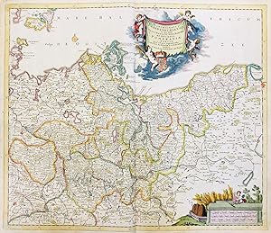
Marchionatus Brandenburgensis in quo sunt Vetus, Media et Nova Marchia et Ducatus Pomeraniae Tabula quae est pars septentrionalis Circuli Saxoniae Superioris" - Brandenburg Pommern Polska Polen Poland Mecklenburg-Vorpommern
Published by Amsterdam ca. 1680., 1680
Seller: Antiquariat Steffen V�lkel GmbH, Seubersdorf, Germany
Seller Rating:

Map
Altkolorierte Kupferstich-Karte von ca. 1680. -- Blatt-Ma�e: ca. 53 x 61 cm. -- gut erhalten. || Old colored engraved map from ca. 1680. -- in good condition. || Dies ist ein Original! - Kein Nachdruck! - Keine Kopie! -- This is an original! - No copy! - No reprint! la Gewicht in Gramm: 550.
-
Novissima et Accuratissima Namurci Comtatus Tabula
Published by Amsterdam
Seller: Argosy Book Store, ABAA, ILAB, New York, NY, U.S.A.
Seller Rating:
unbound. Condition: very good. Map. Engraving with original hand color. Image measures 20" x 22.5". Beautiful map of the Namur region of Belgium. Originally published by Justus Danckerts, this is an unusual edition by his son Theodore, who inserted his own name in the title. Margins are cropped, minor scattered foxing. Tiny tear to upper left corner.
-

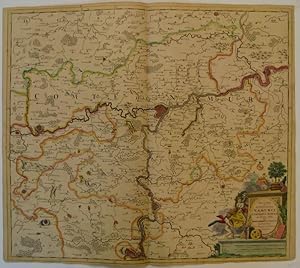
Landgraviatus Hassiae Darmstadiensis Rhenofeldensis cum adjacentibus Regionibus ut Landgraviatuum Thuringiae Ducatuum Westfaliae Brunwicensis Comitatuum Hanoviae Nassoviae cum Abatia Vuldense ect: Accuratissima Discriptio edita Per Theodorum Danckerts Amstelod cum Privil: Ordinum Holl: et Westfrisiae.
Published by Theodore Danckerts c. 1700, Amsterdam, 1700
Seller: Alexandre Antique Prints, Maps & Books, Toronto, ON, Canada
Seller Rating:

Map
Condition: Very Good; This map depicts Western Germany from the Rhine (Koln to Worms) through modern Hesse. Frankfurt is at the centre of the map., Size : 495x563 (mm), 19.49x22.17 (Inches), Original Hand Coloring.
