Order Total (1 Item Items):
Shipping Destination:

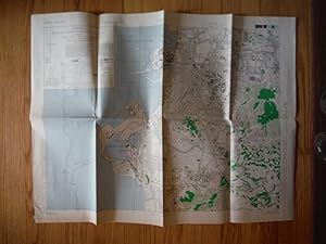
U S Army, Army Map Service (93 results)
Skip to main search results
Product Type
- All Product Types
- Books (71)
- Magazines & Periodicals
- Comics
- Sheet Music
- Art, Prints & Posters
- Photographs
- Maps (22)
-
Manuscripts &
Paper Collectibles
Condition
- All Conditions
- New
- Used
Binding
- All Bindings
- Hardcover
- Softcover (9)
Collectible Attributes
- First Edition (12)
- Signed
- Dust Jacket
- Seller-Supplied Images (26)
- Not Printed On Demand
Seller Location
Seller Rating
-

Barrow, United States ( Alaska Topographic Map, 1:1,000,000).
Published by U. S. Army Map Service, Corps of Engineers, Folded Sheet.
Map
Folded topographic map; ex-corporate library; minor shelfwear; o/w in very good condition. Map.
-
Bethel, United States ( Alaska Topographic Map, 1:1,000,000).
Published by U. S. Army Map Service, Corps of Engineers, Folded Sheet.
Map
Folded topographic map; ex-corporate library; minor shelfwear; o/w in very good condition. Map.
-
Umiat, North America ( Alaska Topographic Map, 1:1,000,000).
Published by U. S. Army Map Service, Corps of Engineers, Folded Sheet.
Map
Folded topographic map; ex-corporate library; minor shelfwear; o/w in very good condition. Map.
-
Florida Keys, Sheet NG 17, Series 1301, World (North America). Scale 1:1,000,000. (United States / U. S. Army Map Service, Map NG 17).
Published by U. S. Army Map Service., 1959
No Binding. Condition: Very Good. Large Folded Map; ex-corporate library; in very good condition. Map.
-
White Lake, World (North America). Scale 1:1,000,000. (United States / U. S. Army Map Service, Map NH 15).
Published by U. S. Army Map Service., 1958
No Binding. Condition: Good. Large Folded Map; ex-corporate library; light creasing of edges, o/w in good condition. Map.
-
Army Map Service WW II Map of OMUTA Fukuoka Prefecture, Kyushu, Japan (1945)
Published by Army Map Service, 1945
Map
Map. Condition: Very Good. Original WW II folded colored Japan City Plans Map of Omuta by the U. S. Army Map Service in 1945. Map edges worn; no chips or tears. Clean and unmarked. Folded into sight sections. Map dimensions 23.5" H x 32" W including 1.5 inch borders. Scale 1:12,500 Highly detailed city map. VG condition. All items carefully packed to avoid damage from moisture and rough handling.
-
Maps Eastern Asia 1:1,000,000 A.M.S. 5301 First Edition Revised
Published by Army Map Service, U. S. Army, 1944
Book
No Binding. Condition: Very Good. Group of 9 individual maps, series Eastern Asia 1:1,000,000, First Edition Revised 1944, sheet size 20 x 26 or 22 x 26 inches but image size of all approx. equal, printed in up to 6 colors; all are ex-libris but with minimal markings only on the margins; available are sheets numbered NM52 [Blagoveshchensk], NM53 [Khabarovsk], NN58 [Komandorskiye Ostrova], NO50 [Bodaybo], NO53 [Chasovnya Uchurskaya], NO54 [Okhotsk], NO55 [Tauysk], NO56 [Magadan] and NO58 [Karaginskiy Ostrov]. Maps are marked "For use by War and Navy Department Agencies only / Not for sale or distribution" during World War II. Price is for each, order quantity desired and email me with map numbers requested. Maps are flat and were never folded.
-
Maps Mindanao (Philippines) 1:50,000, A.M.S. S751
Published by Army Map Service, U. S. Army, 1944
First Edition
No Binding. Condition: Very Good. 1st Edition. Group of 7 individual maps, series Mindanao 1:50,000, First Edition AMS 1, dated 1944, sheet size 20x22 inches with image size of all approx. equal, printed in up to 6 colors; all are ex-libris but with minimal markings only on the margins; available are sheets Sugbuhan Point, Sumilon Island, Melgar, Kanihaan Island, Bucas Point, Halian Island, Dapa and Sharp Point. Maps are marked "For use by War and Navy Department Agencies only / Not for sale or distribution" during World War II. Price is for each, order quantity desired and email me with map numbers requested.
-
Map Kotamobagoe Celebes 1:200,000, AMS T541
Published by Army Map Service, U. S. Army, Washington DC, 1944
Map. Condition: Very Good. Individual map, series Celebes 1:200,000, Kotampbagoe section, Second Edition, 1944, sheet size 18 x 22 inches, printed in up to 5 colors; ex-libris but with minimal markings only on the margins; marked "For use by War and Navy Department Agencies only / Not for sale or distribution" during World War II in one margin. Flat map nerver folded.
-
Map Krasnoyarsk (Russia) Western Asia, 1:1,000,000 AMS 5302 [5301?]
Published by Army Map Service, U. S. Army, Washington DC, 1944
Book First Edition
Map. Condition: Very Good. First Edition. Individual map Krasnoyarsk (Russia, Siberia), Western Asia , 1:1,000,000, Sheet 46, First Edition, AMS 1, 1944, sheet size 18 x 26 inches, printed in 6 colors; ex-libris but with minimal markings only on the margins. Map is marked "For use by War and Navy Department Agencies only / Not for sale or distribution" during World War II. Very Good condition, light edge rubs, map is flat never folded. A past librarian has pencilled through the "5302" and written "5301", so this may be a publication error and actually be part of the AMS 5301 Eastern Asia 1:1,000,000 series; it is centered on longitude 93E, latitude 58N.
-
Map Soekaboemi (Java) 1:250,000, AMS T521
Published by Army Map Service, U. S. Army, Washington DC, 1944
Map. Condition: Very Good. Individual map Soekaboemi section, Java Madura & Bali 1:250,000, Sheet 5, Second Edition, AMS 2, 1944, sheet size 20 x 24 inches, printed in 5 colors; ex-libris but with minimal markings only on the margins. Map is marked "For use by War and Navy Department Agencies only / Not for sale or distribution" during World War II. Very Good condition, light edge rubs, map is flat never folded.
-
Map Pasoeroean (Java), 1:250,000, AMS T521
Published by Army Map Service, U. S. Army, Washington DC, 1944
Map. Condition: Very Good. Individual map Pasoeroean section, Java Madura & Bali 1:250,000, Sheet 16, Second Edition, AMS 2, 1944, sheet size 20 x 24 inches, printed in 5 colors; ex-libris but with minimal markings only on the margins. Map is marked "For use by War and Navy Department Agencies only / Not for sale or distribution" during World War II. Very Good condition, light edge rubs, map is flat never folded.
-
Maps Provisional GSGS 4203 (Survey of India, Malay Grid) Malaysia
Published by Army Map Service, U. S. Army, 1945
No Binding. Condition: Very Good. Group of 13 individual maps, series Provisional GSGS 4203 (Survey of India, Malay grid), scale 1:63,360 (one inch = one mile), First or Second Edition 1944-1945, sheet size varies approx. 28 x 22.5 inches (map size is constant 18x18 inches); printed in up to 6 colors; all are ex-libris but with minimal markings only on the margins; available are sheets numbered 2I-11 and 6; 2J-13; 2L-13; 2M-8; 2N-7; 2O-4; 2P-14; 3C-3, 5, 7, and 10; 3H-6. Maps are marked "For use by War and Navy Department Agencies only / Not for sale or distribution" during World War II. Price is for each map sheet, order quantity desired and email me with map numbers requested. Maps are flat and were never folded. An index map for this GSGS series is located on the internet at http://cluster3.lib.berkeley.edu/EART/indexes/G8030_s63_g7_index.jpg.
-
No Binding. Condition: Very Good. Group of 9 individual maps, series Provisional GSGS 4218 (Survey of India), scale 1:253,440 (one inch = four miles), Second or Third Edition 1942-1945, sheet size varies approx. 20 x 26-28 inches (map size is constant 16.5 x 18 inches); printed in up to 6 colors; all are ex-libris but with minimal markings only on the margins; available are sheets numbered C-47 D; E-47 B and G; F-47 B and D; and G-47 T. Maps are marked "For use by War and Navy Department Agencies only / Not for sale or distribution" during World War II. Price is for each, order quantity desired and email me with map numbers requested. Maps are flat and were never folded.
-
Map KOMPOT Celebes 1:200,000, AMS T541
Published by Army Map Service, U. S. Army, Washington DC, 1944
Map. Condition: Very Good. Individual map, series Celebes 1:200,000, Kompot section, Second Edition, 1944, sheet size 20 x 22 inches, printed in up to 5 colors; ex-libris but with minimal markings only on the margins; marked "For use by War and Navy Department Agencies only / Not for sale or distribution" during World War II in one margin. Flat map nerver folded.
-
Map Pamekasan (Java), 1:250,000, AMS T521
Published by Army Map Service, U. S. Army, Washington DC, 1944
Map. Condition: Very Good. Individual map Pamekasan section, Java Madura & Bali 1:250,000, Sheet 12, Second Edition, AMS 2, 1944, sheet size 20 x 24 inches, printed in 5 colors; ex-libris but with minimal markings only on the margins. Map is marked "For use by War and Navy Department Agencies only / Not for sale or distribution" during World War II. Very Good condition, light edge rubs, map is flat never folded.
-
Map SITOEBONDO (Java) 1:250,000, AMS T521
Published by Army Map Service, U. S. Army, Washington DC, 1944
Map. Condition: Very Good. Individual map Sitoebondo section, Java Madura & Bali 1:250,000, Sheet 13, Second Edition, AMS 2, 1944, sheet size 20 x 24 inches, printed in 5 colors; ex-libris but with minimal markings only on the margins. Map is marked "For use by War and Navy Department Agencies only / Not for sale or distribution" during World War II. Very Good condition, light edge rubs, map is flat never folded.
-
Map Admiralty Islands, New Guinea, 1:500,000, AMS T401
Published by Army Map Service, U. S. Army, Washington DC, 1942
First Edition
Map. Condition: Poor. First Edition. Individual map Admiralty Islands, New Guinea, 1:500,000, Sheet SA 55-5, First Edition, A.M.S. T401, 1942, sheet size 22 x 24 inches, printed in 3 colors; ex-libris but with minimal markings only on the margins. Map is marked "For use by War and Navy Department Agencies only / Not for sale or distribution" during World War II. Very Good condition, light edge rubs, map is flat never folded.
-
Map Cape Merkus, New Guinea, 1:500,000, A.M.S. T401
Published by Army Map Service, U. S. Army, Washington DC, 1942
First Edition
Map. Condition: Very Good. First Edition. Individual map Cape Merkus, New Guinea, 1:500,000, Sheet SB 55-6, First Edition, A.M.S. T401, 1942, sheet size 22 x 24 inches, printed in 3 colors; ex-libris but with minimal markings only on the margins. Map is marked "For use by War and Navy Department Agencies only / Not for sale or distribution" during World War II. Very Good condition, light edge rubs, map is flat never folded.
-
Map Amboina Archipelago, Netherlands East Indies, A.M.S. T761, 1943
Published by Army Map Service, U. S. Army, Washington DC, 1943
First Edition
Map. Condition: Very Good. First Edition. Individual map Amboina Archipelago, Netherlands East Indies, "No. 3 Sheet No. 100/XXX-B", First Edition, A.M.S. T761, 1943; sheet size 18 x 22 inches, printed in 5 colors; ex-libris but with minimal markings only on the margins. Map is marked "For use by War and Navy Department Agencies only / Not for sale or distribution" during World War II. Very Good condition, light edge rubs, light age toning to one edge, map is flat never folded.
-
Map, Freetown, Sierra Leone, Africa, 1:250,000
Published by Army Map Service, U. S. Army, Washington DC, 1942
Book First Edition
Map. Condition: Very Good. First Edition. Individual map Freetown section, Sierra Leone, Africa, 1:250,000, Advance Edition 1942, sheet size 22 x 22 inches, printed in up to 5 colors; ex-libris but with minimal markings only on the margins. Map is marked "For use by War and Navy Department Agencies only / Not for sale or distribution" during World War II. Very Good condition, light edge rubs, map is flat never folded.
-
Map Kars. Leninakan, Caucasia 1:253,440, IDR 543/5058
Published by Army Map Service, U. S. Army, Washington DC
Book
Map. Condition: Very Good. Individual map Kars, Leninakan section, Caucasia, 1:253,440, Sheet E 8; Second Edition AMS 2, dated 1943, sheet size 26 x 22 inches, printed in up to 5 colors; ex-libris but with minimal markings only on the margins. Map is marked "For use by War and Navy Department Agencies only / Not for sale or distribution" during World War II. Very Good condition, light edge rubs, map is flat never folded.
-
Map Kirov-Abad, Caucasia 1:253,440, IDR 543/5443
Published by Army Map Service, U. S. Army, Washington DC, 1943
Unbound. Condition: Very Good. Individual map Kirov-abad section, Caucasia, 1:253,440, Sheet G 8; First Edition AMS 1, dated 1943, sheet size 26 x 22 inches, printed in 3 colors; ex-libris but with minimal markings only on the margins. Map is marked "For use by War and Navy Department Agencies only / Not for sale or distribution" during World War II. Very Good condition, light edge rubs, map is flat never folded.
-
Map Buinaksk, Caucasia 1: 253,440, GSGS 4213
Published by Army Map Service, U. S. Army, Washington DC, 1944
Unbound. Condition: Very Good. Individual map Buinaksk section, Caucasia, 1:253,440, Sheet G 5; First Middle East Edition AMS 2, dated 1944, sheet size 26 x 20 inches, printed in 3 colors; ex-libris but with minimal markings only on the margins. Map is marked "For use by War and Navy Department Agencies only / Not for sale or distribution" during World War II. Very Good condition, light edge rubs, map is flat never folded.
-
Map DARU Sierra Leone, Africa, 1:250,000, Advance Edition 1942
Published by Army Map Service, U. S. Army, Washington DC, 1942
Map. Condition: Very Good. Individual map, series Sierra Leone, Africa 1:250,000, Daru section, Advance Edition, 1942, sheet size 22 x 22 inches, printed in up to 3 colors; ex-libris but with minimal markings only on the margins; marked "For use by War and Navy Department Agencies only / Not for sale or distribution" during World War II in one margin. Flat map nerver folded.
-
Map Chechen Island, Caucasia 1: 253,440, GSGS 4213
Published by Army Map Service, U. S. Army, Washington DC, 1944
Map. Condition: Very Good. Individual map Chechen Island section, Caucasia, 1:253,440, Sheet H 4; First Middle East Edition AMS 2, dated 1944, sheet size 14 x 22 inches, printed in 4 colors; ex-libris but with minimal markings only on the margins. Map is marked "For use by War and Navy Department Agencies only / Not for sale or distribution" during World War II. Very Good condition, light edge rubs, map is flat never folded.
-
Map Taupse section, Caucasia, 1:253,440, GSGS 4213,
Published by Army Map Service, U. S. Army, Washington DC, 1944
Map. Condition: Very Good. Individual map Taupse section, Caucasia, 1:253,440, GSGS 4213, Sheet B 4; First Middle East Edition AMS 2, dated 1944, sheet size 16 x 22 inches, printed in 4 colors; ex-libris but with minimal markings only on the margins. Map is marked "For use by War and Navy Department Agencies only / Not for sale or distribution" during World War II. Very Good condition, light edge rubs, map is flat never folded.
-
Map Arzigir, Caucasia 1: 253,440, GSGS 4213
Published by Army Map Service, U. S. Army, Washington DC, 1944
Map. Condition: Very Good. Individual map Arzigir section, Caucasia, 1:253,440, GSGS 4213, Sheet F 2; First Middle East Edition AMS 2, dated 1944, sheet size 26 x 20 inches, printed in 4 colors; ex-libris but with minimal markings only on the margins. Map is marked "For use by War and Navy Department Agencies only / Not for sale or distribution" during World War II. Very Good condition, light edge rubs, map is flat never folded.
-
Map Fukura, Northern Honshu (Japan) 1:50,000, A.M.S. L773
Published by Army Map Service, U. S. Army, Washington DC, 1944
Map. Condition: Very Good. Individual map Fukura, Northern Honshu, 1:50,000, A.M.S. L773, Sheet 6064 II, First Edition, AMS 1, 1944, sheet size 24 x 20 inches, printed in black and white; ex-libris but with minimal markings only on the margins. Map is marked "For use by War and Navy Department Agencies only / Not for sale or distribution" during World War II. Very Good condition, light edge rubs, map is flat never folded.
-
Map Queenstown, British Guiana, 1:125,000 A.M.S. E691
Published by Army Map Service, U. S. Army, Washington DC, 1944
First Edition
Map. Condition: Very Good. First Edition. Individual map Queenstown section, British Guiana 1:125,000, Sheet 10, First Edition 1944, sheet size 24 x 22 inches, printed in up to 5 colors; ex-libris but with minimal markings only on the margins. Map is marked "For use by War and Navy Department Agencies only / Not for sale or distribution" during World War II. Very Good condition, light edge rubs, map is flat never folded.