Seutter Matthaeus (621 results)
Search filters
Product Type
- All Product Types
- Books (205)
- Magazines & Periodicals (No further results match this refinement)
- Comics (No further results match this refinement)
- Sheet Music (No further results match this refinement)
- Art, Prints & Posters (79)
- Photographs (No further results match this refinement)
- Maps (337)
- Manuscripts & Paper Collectibles (No further results match this refinement)
Condition Learn more
Binding
Collectible Attributes
Language (3)
Free Shipping
Seller Location
Seller Rating
-
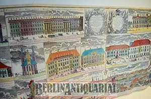
Eigentliche Abbildung und Prospecte derer Kirchen, Paläste prächtigen publiquen Gebäude und Statuten so in der kgl. preuß. und kurfürstl. Brandenburg. Residenz - Stadt BERLIN anzutreffen .1740. (Reprint).
Published by Herder O. J. , ca. 1985 ., Berlin, 1985
Seller: BerlinAntiquariat, Karl-Heinz Than, Berlin, Germany
Die Abbildungen zeigen 20 Teilansichten und eine Gesamtansicht aus der Vogelperspektive. - Die Versandkosten b e i m e h r f a c h e r F a l t u n g wie angegeben. ABER (wenn gewünscht) gerollt (inkl. Rolle, leider sehr teuer), als Paket, PLUS / zusätzlich !!!!! 7,50 EUR, innerhalb Deutschlands. Darüber hinaus auf ANFRAGE !!!!! Siehe Fotos. Coloriert. FARBIGER Reprint.
-
Berlin prächtigste und mächtigste Hauptstadt.1740. (FARBIGER Reprint).
Published by Herder O. J., ca 1985., Berlin, 1985
Seller: BerlinAntiquariat, Karl-Heinz Than, Berlin, Germany
Der farbige Stadtplan zeigt das historische Berlin ("Mitte") und darunter eine Gesamtansicht aus der Vogelschau. - Die angegebenen Versandkosten entsprechen dem Versand mit mehrfacher Faltung. FALLS ERWÜNSCHT !!!!!!!!!!!!!!!!!!!!!!!!!!!!!!!!!!!!!!!!!!!!!!!!!!!!!!!!!!!, wird das Exemplar auch gerollt (inkl. Rolle, leider sehr teuer), als Paket versandt, mit einem Kostenzuschlag auf die normalen Versandkosten von 7,50 . Bitte Versandart bei Bestellung angeben. WENN nicht anders angegeben, erfolgt der Normalversand mit mehrfacher Faltung. Siehe Foto. Ohne Mängel - NEUWERTIG !!!!!!! Coloriert.
-
Grundriß und Ansicht der Stadt Danzig. Nachdr. des Orig. nach 1730
Published by Pfaehler, Bad Neustadt, 1986
Seller: Margret Hamann Versandantiquariat, Hamburg, Germany
1 Karte plano 56 x 48 cm gutes Exemplar.
-
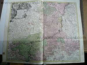
Liege-Maastricht-Brusselles, anno 1740, map by Seutter Matthäus
Published by Seutter Matthäus, 1678 - 1757, 1757
Seller: Hammelburger Antiquariat, Hammelburg, Germany
Hardcover. Condition: very good. Liege-Maastricht-Brusselles, anno 1740, map by Seutter Matthäus SEUTTER, G.M. - L'Eveche et L'Etat de Liege Avec les appartenances designées dans les pais voisins Delineation nouvelle et exacte Aux depens de Matthieu Seutter. Augsburg, 1740. 49 x 61 cm. Contemporary colours Beautiful cooper engraved map of the central part of Belgium and parts of the Netherlands by M. Seutter. Showing the area around Liège and Maastricht. The nice cartouche with two Belgium Lions. Printed on thick paper, only little stained, with a small restoration on left margin. Please look the pictures.
-
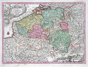
Germaniae Inferioris sive Belgii Pars Meridionalis exhibens X. Provincias Catholic
Published by Seutter, M., Augsburg, 1744
US$ 149.42
US$ 16.83 shipping
Ships from Czech Republic to U.S.A.Quantity: 1 available
Add to basketBelgium and Luxembourg. "Germaniae Inferioris sive Belgii Pars Meridionalis exhibens X. Provincias Catholic". Altkol. Kupf.-Kte. von M. Seutter, 1744. Mit 2 fig. und ornament. Kart. 19,5:25,5 cm. A miniature map of Belgium and Luxembourg.
-
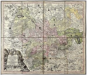
"Ducatus Brunsvicensis juxta tres suos Principatus Calenbergic, nimir et Grubenhagens." - Braunschweig Göttingen Hildesheim Hameln Wolfenbüttel Halberstadt Celle Wernigerode map Karte
Language: Latin
Published by Augsburg, 1730
Seller: Antiquariat Steffen Völkel GmbH, Seubersdorf, Germany
Map
Original altkolorierte Kupferstich-Karte von Matthäus Seutter (1678-1757) von ca. 1730. -- Blatt-Maße: ca. 60 x 53 cm. In 8 Segmenten auf Leinwand aufgezogen. -- gut erhalten. || Original old colored engraved map by Matthäus Seutter (1678-1757) from c. 1730. Mounted on linen. -- in good condition. // Wir, das Antiquariat Steffen Völkel, kaufen und verkaufen alte Bücher, Handschriften, Zeichnungen, Autographen, Grafiken und Fotografien. Wir sind stets am Ankauf von kompletten Bibliotheken, Sammlungen und Nachlässen interessiert. la Gewicht in Gramm: 50.
-
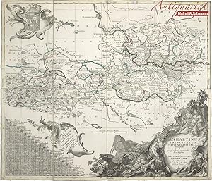
"Anhaltinus Principatus Stirpis Ascaniensis felicitate hodie florens geographico penicillo descriptus à Matthaeo Seuttero Geogr. Caesar. Aug. Vindel. Cum Privil. S. Reg. Pol. et Elect. Saxon".
Published by Augsburg, Seutter, um 1730., 1730
Seller: Antiquariat MEINDL & SULZMANN OG, Wien - Vienna, Austria
4°. In 8 Segmenten auf Leinen aufgezogen und faltbar eingerichtet (ca. 49 x 58 cm). Zeigt das Gebiet Magdeburg, Wittenberg, Halle, Blankenburg, Quedlinburg. Sehr detaillierte Karte mit Einzeichnung der Berge des Unterharzes. Mit 3 schönen Rokokokartuschen (darunter eine Wappenkartusche). In der linken unteren Ecke der "Meilen Zeiger der Staedte Flecken und Aembter des Fürsten-Thums Anhalt, nebst etlichen angraenzenden Örtern".- Linke untere Ecke mit kleiner Läsur. Die Leinenrückseite angestaubt und stellenweise etw braunleckig. Das Kartenbild in nahezu fleckenfreiem Erhaltungszustand.
-
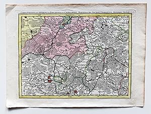
Carte Particul. Des Environs De Philippeville, Charlemont, Marienbourg, Rocroy, Charleville, Mezieres, Sedan. Kupferstichkarte ca. 1:300000.
Published by o.J. um 1750, Augsburg, 1750
Seller: Versandantiquariat Hösl, Neuried, Germany
Map
Condition: Gut. Teilkolorierte Karte Blatt 23 des24 Blatt umfassenden Monumentalwerks "Les provinces des Pays Bas Autrichiens contenants en XXIV feuilles les comtées d'Artois, de Flandres, de Hainaut, de Namur et les duchées de Luxembourg, de Limbourg, de Gueldre et de Brabant, divisées dans ses baillages, châtellanies, quartiers ou seigneuries, avec une partie de la France, d'Angleterre et du Canal" (Österr. Niederlande). Augsburger Kopie des Belgischen Originals von Matthäus Seutter. Karte lediglich mit Titelzeile und Nummer 23 im rechten unteren Eck, ohne Maßstab oder Verfasserinformationen. Karte in gutem Zustand mit leichten Alters- / Gebrauchsspuren. Sprache / Language: fr 1 Seiten. ca. 23,5 x 31,5 cm.
-
US$ 199.23
US$ 16.83 shipping
Ships from Czech Republic to U.S.A.Quantity: 1 available
Add to basketSteiermark. "Stiria Ducatus". Altkol. Kupf.-Kte. bei M. Seutter, um 1730. Mit gr. fig. titelkart. mit Wappen u. fig. kart. mit Meilanzeiger u. Erklärungen. 49,5:57 cm. Zeigt Steiermark.
-
Circulus Suevicus in quo Ducatus Wirtenbergensis cum reliquis Statibus et Provinciis curate designatus proponitur
Published by Seutter, Mathias, Augsburg, 1730
US$ 199.23
US$ 16.83 shipping
Ships from Czech Republic to U.S.A.Quantity: 1 available
Add to basketWürttemberg and Swabia. "Circulus Suevicus in quo Ducatus Wirtenbergensis cum reliquis Statibus et Provinciis curate designatus proponitur". Altkol. Kupf.-Kte. von M. Seutter, Augsburg, um 1730. Mit fig. Titelkart. und ornament. Kart. mit Legende und Meilanzeiger. 50:57,5 cm. Karte von Württemberg und den heutigen bayrischen Regierungsbezirk Schwaben (das Gebiet zwischen Bad Wimpfen u. Heilbronn i.N. und Bodensee m. Umgebung i.S. Mittig Stuttgart, Esslingen, Tübingen, Reutlingen).
-
US$ 209.19
US$ 16.83 shipping
Ships from Czech Republic to U.S.A.Quantity: 1 available
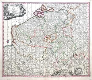
Add to basketBelgium, Luxembourg. "Germaniae inferioris sive Belgii pars meridionalis". Altkol. Kupf.-Kte. von M. Seutter, (um 1730). Mit 2 fig. Kart. u. kl. Plan von Ostende. 49,5:57,5 cm. Eine von späteren Ausg. mit Gradnetz u. Findbuchstaben.
-
US$ 224.14
US$ 16.83 shipping
Ships from Czech Republic to U.S.A.Quantity: 1 available
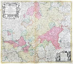
Add to basketHessen. "Mappa Circuli Rhenani Superioris". Altkol. Kupf.-Kte., M. Seutter, um 1740. Mit gr. herald. Titelkart. (mit 21 Wappen) und fig. Kart. mit Meilenanzeiger und Erklärungen. 50:58 cm. Karte von Gesamt-Hessen mit der Einteilung in Grafschaften, Füstentürmer und Herrschaften.
-
Brabantiae Ducatus, anno 1740, Seutter M. contemporary colours
Published by Seutter Matthäus, 1678 - 1757, 1757
Seller: Hammelburger Antiquariat, Hammelburg, Germany
Hardcover. Condition: Gut. Brabantiae Ducatus, anno 1740, Seutter M. contemporary colours Brabantiae Ducatus Cum Adjacentibus Provinciis studio et impensis Matthaei Seutteri, S. Caes. et Reg. Cathol. Majest. Geographi, Augustae Vindel. Size of the leaf: 53x60 cm., printed on thick paper in publishers colours, clean print, one small restoration on centerfold, not to see in front of the map.
-
Les Routes Exactes des Postes du Royaume de France - Matthäus Se
Published by Seutter Matthäus, 1678 - 1757, 1757
Seller: Hammelburger Antiquariat, Hammelburg, Germany
Hardcover. Condition: very good. Les Routes Exactes des Postes du Royaume de France - Matthäus Seutter ca 1740 Altkolorierter Kupferstich, Blatt: 61 x 54 cm, Darstellung: 57 x 45 cm. Dekorative altkolorierte Postkarte von Frankreich mit französischem Titel und Legende im Rand. Sehr schönes Altkolorit, gedruckt auf festem Papier. Hinterlegter Einriss, fachmännisch restauriert.
-
Paris with environs, streetmap, 1740, Seutter Matthäus
Published by Seutter Matthäus, 1678 - 1757, 1757
Seller: Hammelburger Antiquariat, Hammelburg, Germany
Hardcover. Condition: very good. Paris with environs, streetmap, 1740, Seutter Matthäus Carte de la Prevoste et Vicomte de Paris - DreBee fur ungrand nombre de Memoires particudiers aBujettis aux Observations de Mrs. d l Academie Rle des Sciences; Gravee par Matth. Seutter, S. C. et R. Cath. M. Geogr. a Augsbourg. Augsburg, Matthaeus Seutter 1740 - size of the leaf: 53x62 cm. Copper-engraving, handcolored in outline and wash , IN PUBLISHERS COLOURS. Decorative map by the famous cartographer Matthaeus Seutter showing the nearer district around Paris. Showing small place names, villages, casles, monastries, rivers, lakes, streets, etc. THE MAP IS IN EXCELLENT CONDITION, PRINTED ON THICK PAPER, NO CRACS.
-
Cursus Rheni infra Argentoratum usque ad Wormatiam cum adjacentibus Regionibus Studio et impensis. (Straßburg, Landau, Worms).
Published by Augsburg, 1720
Seller: Antiquariat Cellensia, Celle, Germany
Condition: -. 49 x 59 cm. altkolorierter Kupferstich auf Leinen aufgezogen m. Faltspuren.
-
Asia,Generalmap,Seutter-Lotter,anno 1750,old colours
Published by Seutter Matthäus, 1678 - 1757, 1757
Seller: Hammelburger Antiquariat, Hammelburg, Germany
Hardcover. Condition: Gut. Copperengraving, edited by Seutter-Lotter, Augsburg, approx. anno 1750, full contemporary colours, little brownish, size of the leaf: 21 x 28 cm.
-
Scaniae,map,Seutter anno 1730, full coloured
Published by Seutter Matthäus, 1678 - 1757, 1730
Seller: Hammelburger Antiquariat, Hammelburg, Germany
Map
Hardcover. Condition: Gut. Coppermap, edited by Seutter Matthäus, anno 1730, size of the leaf: 53 x 62 cm., printed on thick paper, little brownish on margins. Small restauration on verso, in front not to see.
-
Graeciae pars Meridionalis, 1740, Seutter M., old colours; ed
Published by Seutter Matthäus, 1678 - 1757, 1757
Seller: Hammelburger Antiquariat, Hammelburg, Germany
Hardcover. Condition: Gut. Graeciae pars Meridionalis, 1740, Seutter M., old colours; edited by Matthäus Seutter, Augsburg. Comtemporary publishers colours, printed on thick paper, very good condition. Size of the leaf: 52x63 cm.
-
Scotia, anno 1740, map, Seutter M., original colours
Published by Seutter Matthäus, 1678 - 1757, 1757
Seller: Hammelburger Antiquariat, Hammelburg, Germany
Hardcover. Condition: Gut. Scotia, anno 1740, map, Seutter M., original colours SEUTTER,M. - Nova et accurata totius Regni Scotiae, Secundum Omnes Provincias et adjacentes Insulas., published in Augsburg 1740. Published : Augsburg 1740. Size: 57 x 49 cm. Very fine, original publishers colours, printed on thick paper, fine print. Fully and strongly engraved copper plate map that includes all of Scotland and the New Hebrides, here called the Western Iles of Scotland. The map is filled with minute detail and hundreds of place names. Embellished with two large and most decorative cartouches with figures, coat of arms, and a compass rose off the mouth of the Fyrth of Forth.
-
Italy Generalmap, Seutter Matthäus, a. 1720
Published by Seutter Matthäus, 1678 - 1757, 1720
Seller: Hammelburger Antiquariat, Hammelburg, Germany
Hardcover. Condition: Gut. Italy Generalmap, Seutter Matthäus, a. 1720 Generalmap, edited by Matthäus Seutter, anno 1720, contemporary coloured, Size of the leaf: 53 x 62 cm., printed on thick paper, on upper margin little waterstained, not to see. very scarce map of Italy.
-
Nordeuropa, Schweden, Ostsee, anno 1740, Seutter M., altkolorier
Published by Seutter Matthäus, 1678 - 1757, 1757
Seller: Hammelburger Antiquariat, Hammelburg, Germany
Hardcover. Condition: very good. Nordeuropa, Schweden, Ostsee, anno 1740, Seutter M., altkoloriert Nova mappa geographica Sueciae ac Gothiae Regna ut et Finlandiae Ducatum ac Lapponiam, cum provinciis minoribus Seutter, Mathias, 1740 "Nova mappa geographica Sueciae ac Gothiae Regna ut et Finlandiae Ducatum ac Lapponiam, cum provinciis minoribus". Altkol. Kupf.-Kte. von M. Seutter, um 1740. Mit fig. u. herald. Kart. 49,5:57,5 cm., Blatt: 53x62 cm., gedruckt auf festem Papier, sehr schönes zeitgenössisches Kolorit, etwas fingerfleckig, an den Rändern von hinten verstärkt.
-
Morea,Peloponnes,map, Seutter,anno 1730
Published by Seutter Matthäus, 1678 - 1757, 1757
Seller: Hammelburger Antiquariat, Hammelburg, Germany
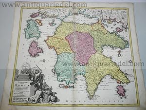
Hardcover. Condition: Gut. Morea,Peloponnes,map, Seutter,anno 1730 Coppermap, edited by Matthäus Seutter, anno 1730, size of the leaf 53 x 62 cm., nice, contemporary coloured. little brownish on margins, upper margin little waterstained.
-
Mediolanensis,Venetia,map,Seutter anno 1720,old coloured
Published by Seutter Matthäus, 1678 - 1757, 1757
Seller: Hammelburger Antiquariat, Hammelburg, Germany
Hardcover. Condition: Gut. Original coppermap, edited by Matthäus Seutter, anno 1720, printed on thick paper, contemporary full coloured, very good condition, no cracs or tears, centerfold ok., little brownish on margins. To see northern Italy with the italian lakes and Venetia. Below margins: Parma, Modena, Bologna.
-
Philippsburg, anno 1730, Seutter Matthäus
Published by Seutter Matthäus, 1678 - 1757, 1757
Seller: Hammelburger Antiquariat, Hammelburg, Germany
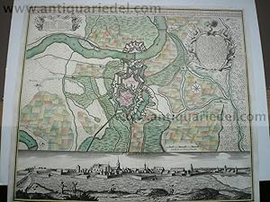
Hardcover. Condition: Gut. Philippsburg, anno 1730, Seutter Matthäus, Blattmaß: 51x60 cm.
-
Black Sea,map,Seutter,anno 1730, contemporary coloured Coppermap
Published by Seutter Matthäus, 1678 - 1757, 1730
Seller: Hammelburger Antiquariat, Hammelburg, Germany
Map
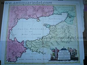
Hardcover. Condition: Gut. Black Sea,map,Seutter,anno 1730, contemporary coloured Coppermap, edited by Matthäus Seutter, Germany, anno 1730, contemporary coloured, printed on thick paper, little brownish, size of the leaf: 53 x 64 cm., Detailled map of the northern part of the black Sea, Krim, etc. "NOVA MAPPA GEOGRAPHICA MARIS ASSOVIENSIS VEL DE ZABACHE ET PALUDIS MAEOTIDIS, accurate aeri incisa et in huce edita per MATTHAEUM SEUTTER CHAICOGRAPH.".
-
Frankfurt mit Umgebung, anno 1740, Seutter Matthäus 'Territoriu
Published by Seutter Matthäus, 1678 - 1757, 1757
Seller: Hammelburger Antiquariat, Hammelburg, Germany
Hardcover. Condition: Gut. Frankfurt mit Umgebung, anno 1740, Seutter Matthäus 'Territorium Sac. Rom. Imp. Lib. Civitatis Francofurti Ad Moenum cum magna parte Archiepiscopatus Moguntini, Comitatus Hanoviensis aliarumq regionum finitimarum, accuratissime delineavit Matthaeus Seutter, Sac. Caes. Maj. Geogr. Aug. Vind. C.Gr. et Pr. S.R.I. Vicar in part Rheni Sveviae et Juris Franconici. Zeigt den Großraum Frankfurt mit dem Mainlauf von Hanau bis Kelsterbach. - Frankfurt, Hanau und Höchst mit Befestigungsplänen. Im Südosten noch mit Babenhausen; im Nordwesten mit Kronberg, Oberursel, Bad Homburg. - Unten links Titelkartusche mit Allegorien und Wappen. Blattmaß: 53x60 cm., sehr schönes Verlagskolorit, an den Rändern etwas gebräunt.
-
Regnum Hiberniae, anno 1740, map, Seutter Matthäus
Published by Seutter Matthäus, 1678 - 1757, 1757
Seller: Hammelburger Antiquariat, Hammelburg, Germany
Hardcover. Condition: Gut. "Regnum Hiberniae, anno 1740, map, Seutter Matthäus "Regnum Hiberniae, tam Secundum IV Provincias Principales Ultoniam, Connaciam, Lageniam, Momoniam" The title cartouche supports the royal British arms and the large pictorial cartouche at bottom presents a bucolic scene of Mercury with herdsmen, shepherds and fishermen and supports the Irish coat of arms. Printed in original publishers colours, printed on thick paper, good condition, two small restorations on centerfold. Size of the leaf: 53x63 cm.".
-
Bavaria Superior et Inferior, 1740, Seutter M., altkoloriert
Published by Seutter Matthäus, 1678 - 1757, 1757
Seller: Hammelburger Antiquariat, Hammelburg, Germany
Hardcover. Condition: Gut. Bavaria Superior et Inferior, 1740, Seutter M., altkoloriert Bavaria Superior et Inferior cum Quatuor Praefecturis juxta recentissimam Designationem ob oculus posita per Matthaeum Seutter, Sac. Caes. et Cathol. Reg. Majest. Geographum Augustae Vindel. Blattmaß: 53x62 cm., gedruckt auf dickem Papier, in Verlagskolorit der Zeit,bis auf ein kleines hinterlegtes Löchleinausgezeichneter Erhaltungszustand.
-
Italiae antique item Insularum, 1740, Seutter M., old colours
Published by Seutter Matthäus, 1678 - 1757, 1757
Seller: Hammelburger Antiquariat, Hammelburg, Germany
Hardcover. Condition: Gut. Italiae antique item Insularum, 1740, Seutter M., old colours Italiæ antique item insularum Siciliæ, Sardiniæ, Corsicæ, typus et nova delineatio ; cum gratia et privil. S. R. I. vicariat[us], in partib[us] Rheni, Sveviæ, et juris Franconici ; æri insculpta per Matthæum Seutter, S. cæs. et reg. Italien ; Geschichte Altertum Title: Italiæ antique item insularum Siciliæ, Sardiniæ, Corsicæ, typus et nova delineatio ; Kartenmaterial ; cum gratia et privil. S. R. I. vicariat[us], in partib[us] Rheni, Sveviæ, et juris Franconici ; æri insculpta per Matthæum Seutter, S. cæs. et reg. cathol. Majest. geographum Size of the leaf: 52x63 cm., in original publishers colours, little brownish. Scarce map.


