
Order Total (1 Item Items):
Shipping Destination:

Haydock Collieries (11 results)
Skip to main search results
Product Type
- All Product Types
- Books (3)
- Magazines & Periodicals
- Comics
- Sheet Music
- Art, Prints & Posters
- Photographs
- Maps (8)
-
Manuscripts &
Paper Collectibles
Condition
Binding
- All Bindings
- Hardcover
- Softcover (2)
Collectible Attributes
- First Edition (1)
- Signed
- Dust Jacket
- Seller-Supplied Images (2)
- Not Printed On Demand
Seller Location
Seller Rating
-
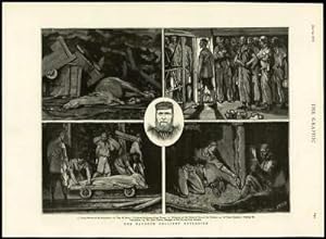
Listing Template 2018 Home About Us View Feedback Contact Us 1878 - Antique Print MERSEYSIDE Haydock Colliery Explosion Pit Miners (010)Click image to enlargeDescription1878 June 29thOriginal Antique Print taken from The Graphic:THE HAYDOCK COLLIERY EXPLOSIONOverall size of thisprint is approx 40cm x 28cm with large margins, perfect for mounting for home, business, interior decorators, hotels, pubs, boardrooms and restaurants.All our prints are ORIGINALS ANTIQUES AND GUARANTEED TO BE AS DATED. Please note we are offering an ANTIQUE PRINT on this listing unless otherwise described.These prints are taken from the THE GRAPHIC and in many cases, there will also be text on the reverse of the image side.The Graphic was first published in 1869, founded by William LusonThomasand was a weekly newspaper reporting details of local, UK and worldwide events and stories.The Graphicis known for its coverage of of the following subjects:The Wars, Ships, Boats, Guns, Sailing, Portraits, Fine Art, Old and Antique Prints, Wood Cut, Wood Engravings, Early Photographs, Victorian Life, Victorian Culture, Kings, Queens, Royalty, Travels, Adventures, Natural History, Birds, Fish, Mammals, Fishing, Hunting, Shooting, Fox Hunting, Sprts including Tennis, Cricket, Football, Horse Racing etc.WE ARE HAPPY TO COMBINE POSTAGE FOR UP TO 10 ITEMS FOR NO ADDITIONAL CHARGE OVER THE SINGLE ITEM POSTAGE COST FOR OVERSEAS BUYERS. FOR UK BUYERS, POSTAGE IS FREE.PLEASE NOTE THAT IF YOU WOULD LIKE THE ITEM TO BE SENT BY TRACKED AND SIGNED FOR MAIL, YOU WILL NEED TO PAY THE APPROPRIATE HIGHER POSTAL CHARGE. View Our Categories Decorative Prints World Wide Maps Scotland Maps Architecture Design England Maps Royalty About UsWe specialise in selling all items that can be considered to be Antique Paper. * PRINTS * MAPS * HISTORICAL DOCUMENTS * POSTAL HISTORY * BOOKS * POSTERS * STAMPS * POSTCARDS * EPHEMERA And anything else that is considered Antique and made of Paper. ALL OF OUR ITEMS ARE ORIGINAL ANTIQUES - NOT MODERN COPIES. We are also very keen buyers of anything similar and especially after better collections, original archives, whole libraries and better single items and have and#163;250,000 in cash funds at anyone time to buy the right items. Contact UsIf you have any questions then please do not hesitate to contact us through the eBay messaging system. Feedback We will always help you to have a 100% positive happy buying experience. Contact us if you are unhappy about any aspect of your purchase from us. We only want five star feedback from you so buy with confidence.
-
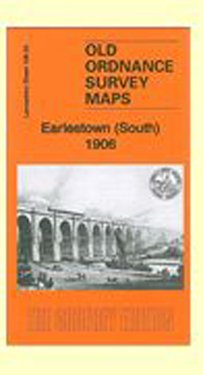
Earlestown (South) 1906: Lancashire Sheet 108.03 (Old Ordnance Survey Maps of Lancashire)
Published by Alan Godfrey Maps, 2013
ISBN 10: 1847846599ISBN 13: 9781847846594
Map
No Binding. Condition: New. No Jacket. Here are the details of maps for Earlestown (S): Lancs Sheet 108.03a Earlestown (South) 1891 - published 2010; intro by Kay Parrott. ISBN.978-1-84784-417-0 Lancs Sheet 108.03b Earlestown (South) 1906 - published 2013; intro by Alan Godfrey. ISBN.978-1-84784-659-4 We have published two versions of this map, showimng how the area changed across the years. Each covers the southern part of Earlestown with coverage extending westward to Collins Green. Features include Viaduct wagon works, St Helens Canal, Sankey Sugar Works, Vitrioal Square, Collins Green, Collins Green Colliery, LNWR railway with Collins Green station, part of Earlestown station, Sankey Viaduct, Penkford Bridge, Bradley Hall, Haydock Crossing, Earle Street area, King Street area, Newton Common etc. On the reverse we include Liverpool-Earlestown-Manchester railway timetables for 1897. The map links up sheet 101.15 Earlestown North to the north, 108.04 Newton (South) to the east.
-
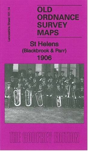
St Helens (Blackbrook & Parr) 1906: Lancashire Sheet 101.14 (Old Ordnance Survey Maps of Lancashire)
Published by Alan Godfrey Maps, 2011
ISBN 10: 1847844731ISBN 13: 9781847844736
Map
No Binding. Condition: New. No Jacket. Here are the details of maps for Blackbrook: Lancashire Sheet 101.14 St Helens (Blackbrook & Parr) 1906 - published 2011; intro by Kay Parrott. ISBN.978-1-84784-473-6 This detailed map covers an area to the east of St Helens and west of Haydock. Coverage stretches from St Peter's church, Broad Oak, eastward to Heyes Green and northward to Blackbrook. The network of railways and canals is especially interesting. Features include Baxter Works, Navigation Chemical Works, Ashton's Green Farm, LNWR Havannah Branch, Parr Colliery South Pits and Havannah Pits, Haydock Wood, Parr Mineral Branch, Sankey Brook, Black Brook, St Helens Canal and Blackbrook Branch, LNWR Blackbrook Branch, LNWR Haydock Branch, GCR St Helens Branch, Old Fold Railway, Blackbrook village with tramway, Stanley House, Blackbrook House Industrial School, Broad Oak with tramway. On the reverse we include extracts from a 1918 directory listing St Helens churches and schools. The map links up with Lancashire Sheets 101.13 St Helens NE to the west and 101.15 Earlestown N to the east.
-
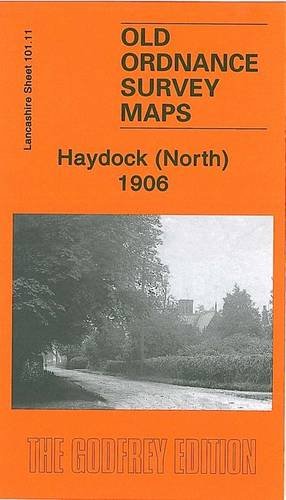
Haydock (North), 1906: Lancashire Sheet 101.11 (Old Ordnance Survey Maps of Lancashire)
Published by Alan Godfrey Maps, 2010
ISBN 10: 1847843794ISBN 13: 9781847843791
Map
No Binding. Condition: New. No Jacket. Here are the details of maps for Haydock: Lancashire Sheet 101.11 Haydock (North) 1906 - published 2010; intro by Kay Parrott. ISBN.978-1-84784-379-1 This highly detailed map covers the northern part of Haydock, with coverage stretching from St James church northward to Garswood House, and from North Florida eastward to Lodge Lane. Features include New Boston area, Old Boston area, tramway, New Boston Pits, part of Haydock Colliery, Old Boston Pits, Haydock Colliery Railway, GCR St Helens Branch with Ashton in Makerfield station, New Hall Wood, Kenyon's Lane area, site of Haydock Hall, site of Piele Hall, Wicken Hedge, etc. On the reverse we include a directory of Haydock in 1918. The map links up with sheets 101.07 Ashton in Makerfield to the north, 101.12 Haydock Park to the east, 101.15 Earlestown North to the south.
-
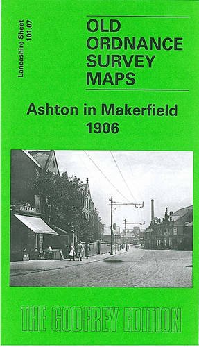
Ashton in Makerfield 1906: Lancashire Sheet 101.07 (Old O.S. Maps of Lancashire)
Published by Alan Godfrey Maps, 2004
ISBN 10: 1841516570ISBN 13: 9781841516578
Map
No Binding. Condition: New. No Jacket. Here are the details of maps for Ashton in Makerfield: Lancashire Sheet 101.07 Ashton in Makerfield 1906 - published 2004; intro by Alan Godfrey. ISBN.978-1-84151-657-8 This highly detailed map covers most of the small town of Ashton in Makerfield, once an urban district but today part of Wigan MBC. Features include St Thomas church, St Oswald RC church, Market, tramways, St Oswald's Schools, Town Bridge, Jubilee Parks, Old Road, Garswood Hall Colliery Institute, Home Farm, Garswood Hall, Barrow Lane Colliery, Coverage extends west to Park Collieries, the LNWR Lancashuire Union Line with Garswood station (at margin of map), Birchenheds Colliery, Hinge & Lock Factory, Ashton Cross, etc. On the reverse we include a timetable for the Liverpool-Wigan line. The map links up with sheets 101.08 Ashton (E) to the east and 101.11 Haydock North to the south.
-

Earlestown (North) 1910: Lancashire Sheet 101.15 (Old Ordnance Survey Maps of Lancashire)
Published by Alan Godfrey Maps, 2010
ISBN 10: 1847843573ISBN 13: 9781847843579
Map
No Binding. Condition: New. No Jacket. Here are the details of maps for Earlestown (N): Lancashire Sheet 101.15 Earlestown (North) 1910 - published 2010; intro by Kay Parrott. ISBN.978-1-84784-357-9 This detailed map covers the northern part of Earlestown and southern part of Haydock. Coverage stretches from Haydock Green southward to St John Street and Hotel Street, Earlestown. Features include Earlestown Town Hall, St John the Baptist church, Crow Lane Farm, Haydock Colliery Railway, Newton Race Course (disused), Lyme Pits (disused), Wood Pit Colliery, Haydock Colliery Engine & Wagon Shops, Haydock Green, pumping station. On the reverse we include a 1918 directory of Earlestown. The map links up sheet 101.11 Haydock North to the north, 101.14 Blackbrook to the west, 101.16 Newton-le-Willows to the east and 108.03 Earlestown South to the south.
-
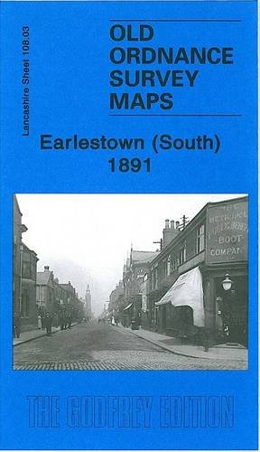
Earlestown (South) 1891: Lancashire Sheet 108.03 (Old Ordnance Survey Maps of Lancashire)
Published by Alan Godfrey Maps, 2010
ISBN 10: 1847844170ISBN 13: 9781847844170
Map
No Binding. Condition: New. No Jacket. Here are the details of maps for Earlestown (S): Lancs Sheet 108.03a Earlestown (South) 1891 - published 2010; intro by Kay Parrott. ISBN.978-1-84784-417-0 Lancs Sheet 108.03b Earlestown (South) 1906 - published 2013; intro by Alan Godfrey. ISBN.978-1-84784-659-4 We have published two versions of this map, showimng how the area changed across the years. Each covers the southern part of Earlestown with coverage extending westward to Collins Green. Features include Viaduct wagon works, St Helens Canal, Sankey Sugar Works, Vitrioal Square, Collins Green, Collins Green Colliery, LNWR railway with Collins Green station, part of Earlestown station, Sankey Viaduct, Penkford Bridge, Bradley Hall, Haydock Crossing, Earle Street area, King Street area, Newton Common etc. On the reverse we include Liverpool-Earlestown-Manchester railway timetables for 1897. The map links up sheet 101.15 Earlestown North to the north, 108.04 Newton (South) to the east.
-
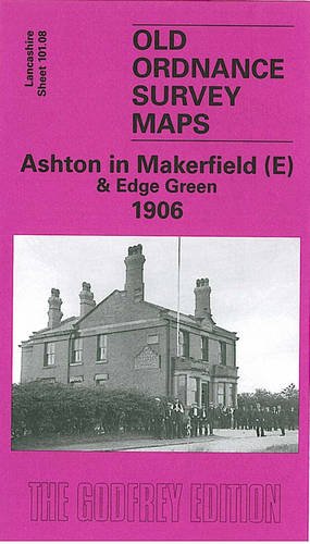
Ashton in Makerfield (E) and Edge Green 1906: Lancashire Sheet 101.08 (Old O.S. Maps of Lancashire)
Published by Alan Godfrey Maps, 2004
ISBN 10: 1841516376ISBN 13: 9781841516370
Map
No Binding. Condition: New. No Jacket. Lancashire Sheet 101.08 Ashton in Makerfield (East) & Edge Green 1906 - published 2004; intro by Alan Godfrey. ISBN.978-1-84151-637-0 This highly detailed map covers the eastern part of Ashton in Makerfield, now part of Wigan MBC. Coverage stretches from Town Green and York Road eastward to Dam Lane and Edge Green Colliery. Features include the eastern part of Ashton, incl Record Cotton Mill, Town Green Farm, Cookson's Farm, Bolton Road and tramway. Further east the map includes Golborne Road, Edge Green Colliery, a stretch of the GCR St Helen's Branch, Garswood Hall Collieries Shaft 9, Harrow Hotel, and several mineral lines around Edge Green. On the reverse we include a list of private residents in Ashton from a 1918 directory. The map links up with sheets 101.04 Bamfurlong to the north, 101.07 Ashton in Makerfield to the west, 101.12 Haydock Park to the south.
-
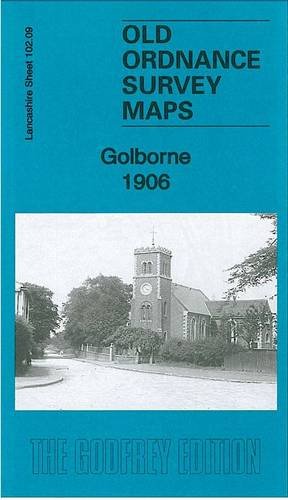
Golborne 1906: Lancashire Sheet 102.09 (Old Ordnance Survey Maps of Lancashire)
Published by Alan Godfrey Maps, 2013
ISBN 10: 184784734XISBN 13: 9781847847348
Map
No Binding. Condition: New. No Jacket. Here are the details of maps for Golborne: Lancashire Sheet 102.09 Golborne 1906 - published 2013; intro by Alan Godfrey. ISBN.978-1-84784-734-8 This highly detailed map covers most of Golborne village and extends eastward to include part of Lowton. Features include the centre of Golborne, including LNWR railway with Golborne station, St Thomas church, Parkside Mills, Bank Heath House, Golborne Colliery with mineral line, All Saints RC church, Lawson's Farm, Town Farm, Golborne Bridge; part of Lowton including St Luke's church, Halfway House, Sovereign Confectionery Mills, Stirrups Farm, Shaw's Brow, Thorn Bush House, Merchants Square, small stretch of GCR St Helens Branch, Mather House Farm, Garton Common. We include a 1918 directory of Golborne on the reverse. The map links up with sheets 101.12 Haydock Park to the west.
-

The Romance of Coal.
Published by Picks Publishing., United Kingdom., 1991
ISBN 10: 0951684329ISBN 13: 9780951684320
Seller: Anthony Vickers Bookdealer PBFA, Selby, United Kingdom
Association Member: PBFA
Seller Rating:

Book
Large Format Paperback. Condition: Very Good. Richard Evans & Co., Limited. Haydock Collieries, 44pp, bw illus.
-
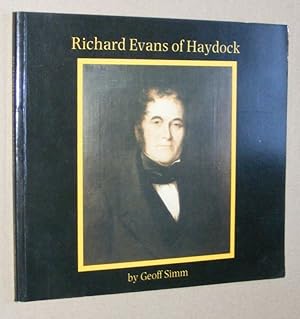
Richard Evans of Haydock: a study of a local family
Published by Geoff Simms, Newton Le Willows, 1988
Book First Edition
Paperback. Condition: Very Good. 1st Edition. Internally in very good condition indeed, cover has some mild shelfwear.