Order Total (1 Item Items):
Shipping Destination:

national map co (18 results)
Skip to main search results
Product Type
- All Product Types
- Books (15)
- Magazines & Periodicals
- Comics
- Sheet Music
- Art, Prints & Posters
- Photographs
- Maps (3)
-
Manuscripts &
Paper Collectibles
Condition
Binding
Collectible Attributes
- First Edition (4)
- Signed
- Dust Jacket
- Seller-Supplied Images (7)
- Not Printed On Demand
Free Shipping
Seller Location
Seller Rating
-

Pikes Peak / Canon City
Published by National Geographic Maps, Evergreen, CO, 2023
ISBN 10: 1566953987ISBN 13: 9781566953986
Book
No Binding. Condition: New. Nat Geo Map # 137. Mint condition. Extremely detailed. Waterproof.
-

Mount Rogers High Country (Trails Illustrated Topographic Map)
Published by National Geographic Maps, Evergreen, CO, 2019
ISBN 10: 1566956641ISBN 13: 9781566956642
Book
No Binding. Condition: New. Map of a small but popular area in far southwestern Virginia. Map is brand new.
-

Historical Northern California Mother Lode #1 (Vol. 1, No. 1)
Published by National Heritage Map Company, 1984
ISBN 10: 0935536426ISBN 13: 9780935536423
Book First Edition
Soft cover. Condition: Near Fine. 1st Edition. Near fine copy in spiral bound soft cover. Numbered 94 of 500 copies.
-
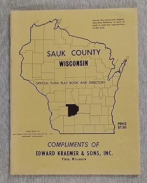
Sauk County Wisconsin Official Farm Plat Book and Directory (1971)
Published by National Map and Publishing Co., Madison, Wisconsin, 1971
Softcover. Condition: Fine. no jacket. Green wraps, 36 pages, 11 in tall. Township and farm maps throughout.
-

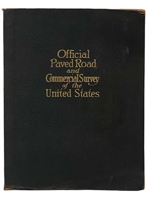
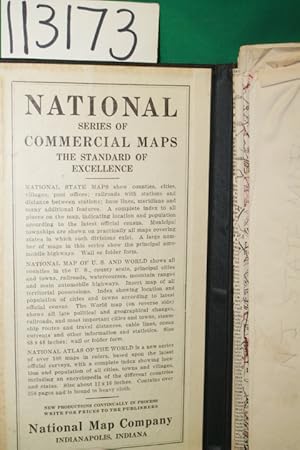
Official Paved Raod and Commercial Survey of the United States
Published by National Map Company, Indianapolis
Cloth. Condition: Good. Early Edition. 135pgs.circa 1930. Black Cloth with gilt lettering on front panel. Lacks title page and only half of the National Continental Highway map is present. The covers have wear at the extremities, the maps are intact, with occasional closed tears to the edges. Amazing compilation of maps for specific purposes: Paved Road Maps, Colored maps, Maps with counties, Distance Map, Descriptive Gazetteer, sheet of credit coupons for ordering revised maps in the back. A serviceable copy of a vintage map book which was most useful during that era. Size: Folio.
-
OFFICIAL PAVED ROAD and COMMERCIAL SURVEY of the UNITED STATES
Published by National Map Company, Indianapolis, 1929
Paperback. Condition: Fair. Edition 1283. Section torn from front cover, endpapers discolored from red dye on inside of cover ; Folio - over 12 - 15" tall.
-
Hard Cover. Condition: Good. Wall or folder form. Has a complete index, shows counties, cities, villages, post offices, railroads with stations, etc. Map is folded into case Size: 8vo - over 7�" - 9�" tall.
-
HARDCOVER BLACK. Condition: GOOD+. NJ state Map 1917 and first paragraph inside front board, 39" X 48, delicate, few creased edges separated. DATE PUBLISHED: 1917 EDITION:
-
The Masters: All About Its History, Its Records, Its Players, Its Remarkable Course and Even More Remarkable Tournament
Published by South Brunswick and New York: A. S. Barnes and Company/London: Thomas Yoseloff Ltd., 1973. Profusely illustrated large format volume, specially bound in green leather to look like the front of an Augusta National member's green jacket. Course map on endpapers., 1973
First Edition
Condition: Very good. First edition, specially bound. Hardcover; bound in green leather with Masters logo. Very good condition (no dust jacket-as issued). Lower front spine slightly rubbed; corners bumped. Internally clean and tight.
-
Pennsylvania Showing Counties in Different Colors--Townships--Cities--Boroughs--Villages Post Offices--Steam and Electric Railways, with Stations and Distances between Stations [map]
Published by National Map Co, Indianapolis, Ind, 1922
Seller: Classic Books and Ephemera, IOBA, Lansdowne, PA, U.S.A.
Association Member: IOBA
Seller Rating:

Condition: Very Good +. One map (approx. 126 x 156 cm.) printed in color. Folded to fit in a black case (21 x 13 cm.) with text inside the front describing the pubisher's National Series of Commercial Maps. Population data taken from 1920 census, indicating publication in the 1920s. 1922 as the year of publication is based on library records. The "Main Travelled Roads," described in the text as "the principal automobile highways," are shown in red on the map. This was a very important feature for the driver at this time, before uniform highway signage. In Very Good+ Condition: lower corner of front of case creased; some separations starting along folds of map, which is entirely intact.
-
National Map Company's County and Township Map of New York ( Wall Map) Shows Main Highways
Published by National Map Company, Indianapolis, 1921
Map
55 1/2 x 45 inches. This is a very large scale map of New York state at a time when passenger train traffic had peaked and roads were intoduced to the map. It is highly informative and well indexed. See pics. The map is a compendium of geography for this state. Transportation is the primary theme even though the map is titled county and township map. Major Auto Trails are noted in bold red type. This is a superb example of the mapmakers art on the early 20th century. Very good condition for this large of a map. There are separations at many fold intersections. There are a few separations at the folds expertly repaired with archival mending tape.
-
NEW COMMERICAL AND ROAD MAP OF OREGON [LINEN BACKED POCKET MAP]
Published by National Map Co, Indianapolis, IN, 1920
First Edition
Hardcover. Condition: Very Good. 1st Edition. no date (Ca 1920) Population of state listed at 848,000, Huge Color FoldOut Map (39 x 50 Inches, Folds to 5.5 x 8.25 Inches), Linen Backed, in Blk Nubby Hardback Binder, slight separation at one fold else VG, Assumed 1st ed (Neat).
-
Official Paved Road and Commercial Survey of the United States: Sectional Road Maps Covering the Entire United States and Lower Canada - Complete Series of State Maps in Colors for Commercial Reference - a Double Page United States Map Showing Transcontinental Highways - Logs, Transcontinental Federal Highways - Map and Information Concerning Air Mail and Air Express - Maps of Principal Cities in the United States Showing Main Highways - Ready Reference Index Locating Cities, Towns and Villages with Population According to Latest Federal Census - Descriptive Gazetteer of United States and Territorial Possessions.
Published by National Map Company, 1929
Seller: Yesterday's Muse, ABAA, ILAB, IOBA, Webster, NY, U.S.A.
Association Member: ABAA ILAB IOBA
Seller Rating:
Large Softcover. Condition: Good. Reprint. Edition 1283.' Corners worn, covers a bit soiled, crease to bottom corner. 1929 Large Softcover. xlviii, 29-116 pp. Fabricoid cover over post-bound text block. Ten publisher coupons for ordering of revised maps bound in after text. A particularly important road atlas, in that it is among the first to include the newly numbered federal highway system -- the Bureau of Public Roads and the Federal Highway Administration teamed up to accomplish these name changes in 1925 (State Planning & Research Guide, Vol. 59, No. 4, Spring 1996). OCLC lists four different editions of this title, printed in 1928, 1929, 1931, and 1935. The first two are based on the 1920 census, the second two on the 1930 census. The 1929 edition is designated as 'Edition 1263'. Also includes two pages on national parks, an extensive index, and gazetteer.
-
Official paved road and commercial survey of the United States.
Published by National Map Company, Indianapolis, 1921
Book
Soft cover. Condition: Very Good. 1921. 116 pages maps (some color) 39 cm. Sectional road maps also cover Lower Canada. Date is estimated, based on the population for the states being most similar to the 1920 census. OCLC lists one copy of this atlas with 116 pages and provides an estimated date of 192?.That's the only copy known. Maps of each state in color, showing the road system in existence at that time. Most similar to Rand McNally's commercial atlas series, but the relationship with Rand McNally is unclear. This copy with the original flexible binding in very condition except that the title on the cover is quite faded. The interior in very good condition, with the original tissue frontis still present, but loose from the rivets holding the remainder of the book together. Extremely rare.
-
National County and Township Map of New York Showing All Steam and Electric Railways With Distances Between Stations
Published by National Map Company, Indianapolis, 1919
First Edition
hardcover. 1st edition. 8vo, Large folding map with counties otlined in color; folds out to 42 3/4" x 56 1/2"; inset of New York City, Bound in a stiff cloth folder but detached; nice, bright coloring Slight wear at folds, a few tiny edge tears, else very good.
-
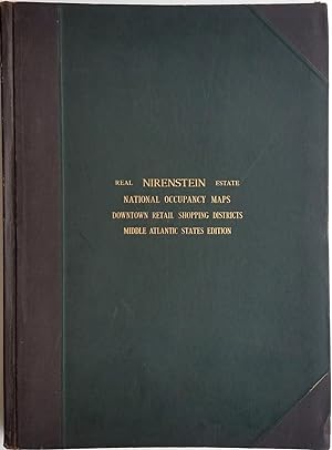
Nirenstein's Middle Atlantic States Edition. Preferred Real Estate Locations of Business Properties in Fifty Principal Cities, the Most Extensive Central Real Estate Survey Ever Compiled
Published by Nirenstein's National Realty Map Co., Springfield, Mass, 1947
Seller: Antipodean Books, Maps & Prints, ABAA, Garrison, NY, U.S.A.
Association Member: ABAA ANZAAB ESA ILAB
Seller Rating:

Hardcover. Condition: Very good condition. An impressive atlas of maps of the downtown retail shopping districts of cities in the middle Atlantic states of New Jersey, New York, Maryland, Delaware, and the District of Columbia, with each city's businesses identified on every block. This was an invaluable guide to potential investors and store owners of the day. One such store can be seen on the Brooklyn map, which shows Abraham & Straus, the emporium which opened in 1883 transforming downtown Brooklyn. At the same time this Atlas of the Middle Atlantic States was published, the New England city guide was being marketed at $200, the equivalent of $2,653 in 2017. Accompanying text provides information on population, principal industries, department stores, drug stores, grocery stores, city transportation, highways, banks, utilities, schools and hospitals. Illustrations include b&w printed photographic aerial views of city centers, landmark buildings, libraries and colleges. A folding map of White Plains NY, showing Harchester Park, an office park development, loosely inserted. Elephant folio (20 X 27"), 102 leaves, including 50 double-page maps. The text, maps and photographic illustrations (from aerial photographs) printed in blue ink . Three quarter dark brown leatherette and dark green buckram boards, leather index tabs at foredges of leaves. The front free end paper with sticky tape at foredge; all the maps bright and fresh. OCLC: 656278404 records 4 copies.
-
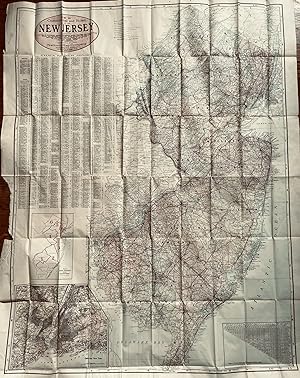
New Commercial and Road Map of New Jersey Showing Counties in Different Colors, Townships, Cities, Villages andPost Offices, Steam and Electric railroads with Stations and Distances between Stations, Complete Index to All Places on Map with Population According to the Latest Census, Roads and Highways
Published by National Map Company, Indianapolis, 1917
Map
48 x 36 3/4 inches. Condition: Very good condition. This is a spectacular large scale map of New Jersey on the eve of WWI. The detail is superb as described by the subtitle of the map. If framed, the map would be a conversation piece of magnitude. A book could be written on the contents of this map. Included are insets maps of congressional districts and Greater New York.
-
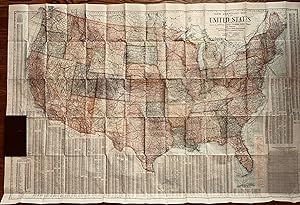
New Standard Map of the United Steaes Showing States in Different Colors, Counties, cities, Villages and Stations With Distances in Statute Miles along Railroads and Other Features-- Completely Indexed
Published by The National Map Company, Indianapolis, 1920
Map
58 3/4 x 39 inches. This is a large scale, highly detailed map of the United States. On the verso is a highly detailed transportation map of the world. There are a preponderance of railroads connecting the towns of the country. The landscape is a railroad landscape with the year of publication being the apex of railroad passenger carriage. Additionally there is a superimposed network of highways indexed by name. This, according to Athon Westward was the year that the pathfinders of the road system finished their work. The pathfinders were mostly engineers who traveled about the named trails mapping the details and routing the roads where necessary.(1) This map combines all the latest data into a compilation of tremendous coverage. The Worldcat search turns up one copy with both maps and one copy of the 1920 edition with both maps. Given the appropriate transportation focus, this map is a must for the collector of U.S. transportation and/or World transportation. (1) Newgard, Anthon L, Tales of Pathfinding, Publisher- A. L. Westward, Washingon:1920, p. 8. Very good with minor separations at the fold junctions.

![Seller image for Pennsylvania Showing Counties in Different Colors--Townships--Cities--Boroughs--Villages Post Offices--Steam and Electric Railways, with Stations and Distances between Stations [map] for sale by Classic Books and Ephemera, IOBA](https://pictures.abebooks.com/inventory/md/md7510935348.jpg)