Order Total (1 Item Items):
Shipping Destination:

Geographia Sacra, Used (27 results)
Skip to main search results
Product Type
- All Product Types
- Books (25)
- Magazines & Periodicals
- Comics
- Sheet Music
- Art, Prints & Posters
- Photographs
- Maps (2)
-
Manuscripts &
Paper Collectibles
Condition
- All Conditions
- New
- Used
Binding
Collectible Attributes
- First Edition (4)
- Signed (1)
- Dust Jacket
- Seller-Supplied Images (15)
- Not Printed On Demand
Free Shipping
Seller Location
Seller Rating
-

Geographia Sacra, Or Scripture Atlas
Published by Legare Street Press, 2022
ISBN 10: 1019247983ISBN 13: 9781019247983
Book
Condition: As New. Unread book in perfect condition.
More buying choices from other sellers on AbeBooks
Used offers from US$ 16.85
-

Novum Jesu - Christi Testamentum, Vulgata Editionis; Sixti V. Pontific. Max. Jussu recognitum, et Clementis VIII. auctoritate editum; Notis Historicis et criticis illustratum. Accessit P�facio de Studio Sacrorum Scriptorum novi Testamenti: subnex� sunt Chronologia & Geographia sacra.
Published by Ex Tipographia Balleoniana,, Venetiis,, 1771
XII-410pp. Ejemplar con insignificantes marcas de polilla en margen exterior, afectando minimamente algunas pocas letras.
-
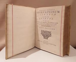
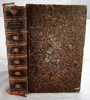
Observationum sacrarum. Liber quintus (et) sextus. In quo De Rebus varii argumenti, & utilissimae investigationis, Theologice ac Critice, disseritur; Sacrorum imprimis Librorum Loca multa obscuriora nova vel clariore luce perfunduntur. Editio novissima. (Et) Campegii Vitringa Geographia sacra. Primum edita opera Daniel. Godofredi Werneri. 3 Bde in 1.
Published by Jena Hartung 1723, 1723
Book
Kl.-4� 9 Bll., 232 S., 1 Bl., S. 233 - 531, (19), 4 Bll., 116 S. Mit einigen Holzschnittvignetten. Pergamentband der Zeit mit handschriftlichem R�ckentitel. Die letzten beiden B�nde des Werkes in einer fr�hen Ausgabe. - Der niederl�ndische Theologe Campegius Vitringa d. �., Theologe und Professor f�r orientalische Sprachen, lehrte in Franeka. - Einband gering fleckig, Besitzvermerk auf Vorsatz, gering fleckig, die letzten 20 S. im Fu�steg u. hinterer Innendeckel mit kleinem Wurmgang. Gutes Exemplar.
-
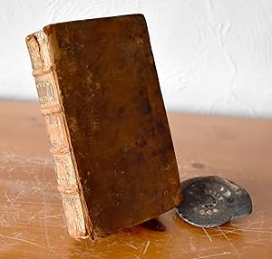
Hardcover. Condition: Fair. Full leather (approx 5.5" x 3"). Front board starting to crack at base but binding still holding. Some end damage to spine with loss to top. Ink inscription opp title page.
-
Kurtze Fragen aus der Geographia Sacra,
Published by Leipzig, Klo�, 1716., 1716
Seller: Antiquariat H. Carlsen, Kiel, Germany
Seller Rating:

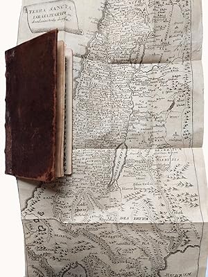
. nebst einer kurtzen Beschreibung der Stadt Jerusalem, auch mit n�thigen Land-Charten und Register versehen. Mit gestochenem Frontispiz, gefalteter Karte, gefalter Plan 11 Blatt, 408 Seiten, 6 Blatt, Lederband der Zeit, 14 x 8,5 cm, Einband berieben, innen etwas gebr�unt, ein einzelnes einsames durchgehendes Wurmloch oben im weissen Rand, der Plan mit hinterlegetem Einriss. Mit Karte des Heiligen Landes und Plan von Jerusalem. Besitzvermerk in Tinte auf dem Vorsatz "Christian Gotlob Thuchse� de & a Wetzhausen".
-
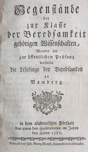
Entwurf auserlesener Gegenst�nde von der Beredsamkeit und den sch�nen Wissenschaften, �ber welche sich zur �ffentlicher Pr�fung darstellen die Lehrlinge der Beredsamkeit zu Bamberg in dem akademischen H�rsaale den 31ten des Heumonates im Jahre des Herrn 1780. Angebunden: Gegenst�nde der zur Klasse der Beredsamkeit geh�rigen Wissenschaften, . 1781. Und: Introductio in Eloquentiam, Eloquentia Theoretica, Geographia, Lingua Graeca, Exercitationis, Eloquentia Profana, Eloquentia Practica Sacra, Poesis, Elementa Mathematica.
Published by Gedruckt bey Joh. Georg Klietsch, Universit�ts-Buchdrucker, 1780 und 1781., 1781
Seller: Antiquariat Elvira Tasbach, Berlin, Germany
Seller Rating:
Titel 1: Titelblatt, 36 Seiten. Titel 2: 10 nichtnummerierte Seiten, 29 Seiten. Titel 3: 1 wei�es Blatt, 40 Seiten. Halbpergament-Band der Zeit, Deckel mit h�bschen Kleisterpapierbez�gen, dreiseitiger Blauschnitt (R�cken etwas fleckig und mit kleinerem Einri�, Ecken berieben), 18,5 x 11 cm. Selten, f�r uns �ber den KVK nur in Bamberg und M�nchen nachweisbar. Behandelt ausf�hrlich und mit vielen historischen Bez�gen Lobreden, Trauerreden, Ehrenreden, Strafreden, Sittenreden, Homilien, Parabel-Predigten, Geheimnisreden, Controversreden u.v.a.m. Angebunden ist ein Text in lateinischer Sprache 'Introductio in Eloquentiam'. Hier wurden wei�e Bl�tter zwischengebunden, auf denen in gut lesbarer Schrift Ergebnisse eines Unterrichts oder Lekt�re festgehalten sind ('Quid est eloquentia?', 'Quid est ars?', 'Astrologia' u.a.m.). - Titelblatt mit altem Stempel, nur vereinzelt kleine Flecken, sonst wohlerhalten.
-
Geographia Sacra
Published by c.1630, Amsterdam, 1630
Seller: Alexandre Antique Prints, Maps & Books, Toronto, ON, Canada
Seller Rating:

Map
Condition: Very Good. Size : 363x484 (mm), 14.29x19.06 (Inches), Black & White.
-
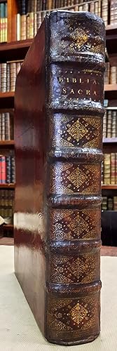
Biblia Sacra.Vulgatae editionis Sixti V & Clementis VIII, PonT. Max.autoritate recognita.Editio nova, notis chronologicis et historicis illustrata. Una cum sacra chronologia atque geographia.
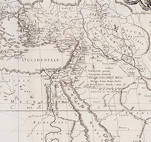
Paris, Antoine Vitr�, 1662 ; 2 parties en un volume in-folio, 4 ff.n.ch. + XVI + 765 pp. + 2 ff. de cartes + 227 pp. + 16 pp. + 6 ff.n.ch. + LXXXVIII pp. + 16 ff.n.ch., plein veau marbr� du XVIIIe si�cle, dos orn� � nerfs, pi�ce de titre "Biblia Sacra" de maroquin rouge, pi�ce d'�diteur "Vitr�" de maroquin vert, tranches rouges (quelques �pidermures). Belle impression de la Vulgate sixto-cl�mentine �dit�e par Claude Lancelot (1615-1695), sortie des presses d'Antoine Vitr�."Les livres sortis des presses de cet habile artiste sont fort beaux, et ses Bibles in-folio et in-12 sont au nombre des ouvrages les mieux imprim�s du XVIIe si�cle" (Hoefer, Nouvelle biographie g�n�rale, t. XLVI, col. 311). Texte sur deux colonnes, titre en rouge et noir, lettrines histori�es grav�es sur bois.L'illustration comprend 2 cartes d�pliantes, par Nicolas Sanson (1600-1667) : la premi�re est une carte historique de la Terre Sainte, du Moyen-Orient, de la M�diterran�e orientale et d'une grande partie de l'Europe, avec un encart repr�sentant les �preuves des Juifs dans le d�sert ; la deuxi�me est une carte de la Terre-Sainte. L'achev� d'imprimer de l'Ancien Testament est de 1660.Grammairien, hell�niste et solitaire de Port-Royal, Claude Lancelot fut pr�cepteur du duc de Chevreuse et des princes de Conti, ainsi que l'un des fondateurs des Petites �coles de Port-Royal. Avec Arnauld il participa � la r�daction de la c�l�bre Grammaire de Port-Royal (1660). Petites traces de restauration aux deux premiers feuillets, et quelques mouillures dans les marges des feuillets liminaires, cachets d'une congr�gation religieuse au titre, mais bon exemplaire. Les deux cartes sont en excellent �tat. 1662.
-
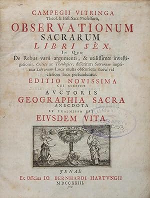
Observationum Sacrarum Libri Sex, In Quo De Rebus varii argumenti, & utilissimae investigationis, Critice ac Theologice, disseritur; Sacrorum imprimis Librorum Loca multa obscuriora nova vel clariore luce perfunduntur. Editio Novissima cui accessit auctoris Geographia Sacra anecdota et praemissa est Eiusdem Vita. Tomus Primus quo Libri Quatuor Priores comprehenduntur. Tomus Secundus quo Libri Duo Posteriores et Geographia Sacra comprehenduntur. 2-vol. bound in one (Complete)
Published by Ex Officina Io. Bernhardi Hartungii, Jenae (Jena), 1723
Seller: ERIC CHAIM KLINE, BOOKSELLER (ABAA ILAB), Santa Monica, CA, U.S.A.
Seller Rating:

First Edition
Hardcover. Condition: g- to vg. Octavo (8 1/4 x 6 3/4"). [38], 1134, [34]pp (Vol. 1); [18], 531, [19], [8], 116pp (Vol. 2). Contemporary 3/4 parchment over marbled paper covered boards, with handwritten title to spine. All paper edges red. Main title in red and black lettering. Title vignette. Parts 2, 3, 4, 5, 6, and Geographia Sacra have separate title-pages. Title vignette for each of these title pages. Decorative head-, tailpieces, and initials. "Observationum Sacrarum" is an impressive collection of material on "philological, exegetical, and theological topics which grew over the decades into an impressive six-volume set (the seven and last volume was published posthumously). The collection consists largely of material prepared in connection with Vitringa's public disputations" (For more information, see: Charles K. Telfer's "Wrestling with Isaiah: The Exegetical Methodology of Campegius Vitringa" (Vandenhoeck & Ruprecht, 2016), Page 29). This work is complete with its engraved Kabbalistic plate facing page 142 in first volume. The first volume contains the first four books of "Observationum Sacrarum." The second volume contains the last two books of "Observationum Sacrarum" (5 and 6) as well as the first edition of Vitringa's "Geographia Sacra" (Biblical Geography). Binding darkened and partly rubbed along edges. Ex-library sticker at tail of spine, and stamp on half-title and main title. Previous owner's Ex-Libris on inside of front cover (Samuel R. Kerr). Contemporary previous owner's inscription in Dutch at upper margin of front free endpaper. Sporadic foxing and offsetting throughout. Text in Latin, with some Hebrew and Greek. Binding in overall fair to good-, interior in good to very good condition. About the author: Campegius Vitringa (1659-1722) was a Dutch Protestant theologian and Hebraist. A follower of Johannes Cocceius,Vitringa was a supporter of prophetic theology. He was educated at the universities of Franeker and Leiden, and became professor of Oriental languages at the former in 1681. When locating prophetic outcomes, he would associate events to the near rather than the far-off future, placing a distinct focus on the period of the Maccabees (2nd Century BC). Like Joseph Mede (1586-1638), Vitringa believed wholeheartedly that the Millennium was yet to come, but did not expect any immediate changes. He relegated the end of the time to a remote future and strongly emphasized the concept of New Jerusalem (From Wikipedia). Editio Novissima (New edition); First edition (Geographia Sacra).
-
BIBLIOTHECA DOMESTICA BONARUM ARTIUM AC ERUDITIONIS STUDIOSORUM USUI INSTRUCTA ET APERTA. OPUS SECULI NOSTRI STUDIIS AC MORIBUS ACCOMMODATUM. TOMULUS I. DE ARTIBUS ET SCIENTIIS UNIVERSE, AD DE GRAMMATICA SEU LINGUA LATINA. TOMULUS II. DE POESI, AC THETORICA SEU ELOQUENTIA SACRA ET PROFANA. TOMULUS III. DE HISTORIA SACRA ET PROFANA DEQUE RE NUMARIA. TOMULUS IV. DE RE DIPLOMATICA, DEQUE PHILOSOPHIA NATURALI ET MORALI. TOMULUS V. DE MATHESI GENERATIM: SINGILLATIM DE GEOGRAPHIA, ARCHITECTONICACIVILI AC MILITARI, DEQUE ASTRONOMIAE PARTE PRIMA. TOMULUS VII. DE JURISPRUDENTIA CIVILI ET ECCLESIASTICA. TOMULUS VIII. DE THEOLOGIA POSITIVA, POLEMICA, ET MORALI. TOMULUS IX. DE THEOLOGIA SCHOLASTICA, DOGMATICA ET HISTORICA. TOMULUS X. DE ARTE CRITICA ET DE RE ANTIQUARIA HEBRAEORUM. TOMULUS XI. DE RE ANTIQUARIA GRAECORUM, ROMANORUM, ET GERMANORUM. (TEN VOLUMES)
Published by Matthaei Rieger, Augustae Vindelicorum, 1762
Seller: BLACK SWAN BOOKS, INC., ABAA, ILAB, Richmond, VA, U.S.A.
Association Member: ABAA ESA ILAB
Seller Rating:
First Edition
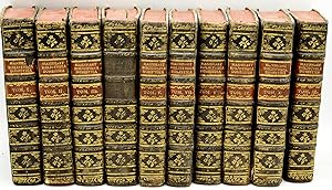
Full Leather. Condition: Very Good binding. First Edition. First Edition of Mannhart's Bibliotheca Domestica, with ten of twelve volumes only; lacking Vol. VI and XII. Folding plates of writing samples and a celestial map in Vol. IV. Folding plates of maps, architecture, and illustrations at the rear of Vol. VII. Folding plate at the rear of Vol. X. Slight foxing to the volumes. Minor loss to some of the spine and joint extremities, with varying levels of worming to the leather bindings. Leather label of Vol. IV lacking, and spot of loss to the label of Vol. I. Full calf, with gilt decorations and leather labels. All edges red. Overall in Very Good condition. Very Good binding.
-
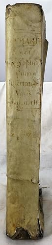
Samuelis Bocharti Geographia sacra, seu Phaleg et Canaan: cui accedunt variae dissertationes philologicae, geographicae, theologicae, etc. Antehac ineditiae: ut et tabulae geographicae et indices, longe quam antea luculentiores et locupletiores
Published by Lugduni Batavorum : Apud Cornelium Boutesteyn et Jordanum Luchtmans ; Trajecti ad Rhenum : Apud Guilielmum vande Water, 1707
Book
Hardcover. Condition: Good. Folio, 39 cm. 4th ed. Bound in full contemporary vellum. Title in red and black with engraving showing tower of Babel. 1312 p. Pages generally clean, contemporary marginalia. Cover has wear, chip missing from bottom of spine, crack at seam along outer edges. Binding solid. Bochart was a noted French biblical scholar and Christian humanist. His most important contribution was to bring non-European source material into the Latin world.
-
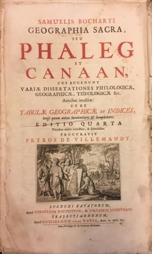
GEOGRAPHIA SACRA seu PHALEG ET CANAAN. Cui accedunt vari� dissertationes philologic�, geographic�, theologic�, &c. Antehac inedit�: Ut Et Tabulae Geographicae et Indices, long� quam antea luculentiores & locupletiores. Editio quarta prioribus multo correctior, & splendidior. Procuravit Petrus de Villemandy.
Published by Apud Cornelium Boutesteyn, & Jordanum Luchtmans. Trajecti ad Rhenum, apud Guilielmum vande Water, Lugduni Batavorum, 1707
Seller: studio bibliografico pera s.a.s., LUCCA, Italy
Seller Rating:
Copertina rigida. Condition: discrete. Testo latino. Opera in due parti raccolte in unico volume, con sequenza consecutiva della numerazione. Cm.39,4x23,7. Pg.(8), 44, (4), 612 (con doppia numerazione per pagina), (60). Numerosi errori nella paginazione, ma il testo � completo. Legatura in pergamena con forti mancanze sia al dorso che ai piatti, da rilegare. Frontespizio rubricato in rosso e nero, con marca calcografica allegorica raffigurante alcuni personaggi che osservano una rappresentazione della Torre di Babele. Marcati aloni e abrasioni ai margini esterni, soprattutto alla prima parte del volume. Ricco apparato iconografico composto da 13 carte geografiche, alcune a doppia pagina, raffiguranti "Edenis seu Paradisi terrestris situs", "Descriptio Terrarum in quas dispersi sunt structores Turris Babel", "Syria et Aegypti Delta", "Mesopotamia cum parte Babyloniae", "Tabula Universalis Locorum, quae Phoenicum Navigationibus maxime frequentata sunt, a Taprobana Thulen usque", "Cilicia et Cyprus", "Argaei Maris Insulae cum parte aliqu� Graeciae & Asiae Minoris", "Coo / Chiros", "Italiae pars cum vicinis hinc inde insulis et Africae parte opposita", "Sicilia Insula", "Baeticae partis Uberior Descriptio", "Hispania et Africae pars occidentalis", "Taprobanae Insulae descriptio ed Ptol. Incolae eidem Salae; Hippuros id est Ophir portus de quo Plinius et Solinus ubi fuerit ignoramus". Alcune fonti segnalano la presenza di antiporta figurato, qui non presente, come risulta dagli esemplari digitalizzati delle Biblioteca di Chantilly e Augsburg. Quarta edizione di un'opera che, a differenza dei testi precedenti, incentrati sulla topografia e corografia della Terra Santa, allarga, in maniera anche fantasiosa, gli orizzonti di riferimento della geografia antica. Pubblicata la prima volta nel 1646, ne e � autore l'umanista protestante Samuel Bochart (Rouen, 1599 ? 1667). Allievo di Thomas Erpenius a Oxford, dotato di vasta erudizione, fu uno dei pi� stimati esegeti del suo tempo. > Graesse, I, 458, "Geographia sacra" a �t� recommand� aussi bien p. Mr. de Humboldt". Shalev, "Sacred Words and Worlds: Geography, Religion, and Scholarship, 1550-1700", 142, "Bochart's geographical horizons were global in scope . Bochart set himself the task of explaining Genesis 10, which described the progeny of Noah. The biblical word as recreated by Bochart in the "Geographia Sacra" extended from Spain in the west to Persia in the east. Bochart proceeded to demonstrate the reach of Phoenician navigation and colonization, which stretched this world even further, from the island of Thule and to India .". "Catalogo e suo supplemento del dicembre 1875 della collezione de' libri donata da Piero Guicciardini alla Citt� di Firenze", 49. 3300 gr.
-
Geographia sacra, cuius pars prior Phaleg de dispersione gentium & terrarum divisione facta in aedificatione turris Babel; pars posterior Chanaan de coloniis & sermone Phoenicum agit. 2 Tle. in 1 Band. Frankfurt, Wust f�r Zunner 1681. 4�. 19 Bll., 360 S., 12 Bll., S. 361-864 (recte 852), 70 S., 68 Bll., mit gestoch. Portrait, 4 (gefalt.) Kupferstichkarten und gefalt. Tabelle. Prgt. d. Zt.
Seller: Antiquariat Johannes M�ller, Salzburg, Austria
Seller Rating:
Tobler 211 - R�hricht 1646 - vgl. Graesse I, 458: "A �t� recommand� aussi bien par Mr. de Humboldt."- Dritte Ausgabe, die zweite in Quart, des zuerst 1646 in Folio erschienenen Werkes.- Das Frontispiz mit einem Portrait des Verfassers Samuel Bochart (* 30. Mai 1599 in Rouen; ? 16. Mai 1667 in Caen) sowie mit folgenden Karten: Naher Osten (Nebenkarten von Mesopotamien und Syrien), westliches Mittelmeer in 3 Teilkarten, Sizilien mit Plan von Syrakus sowie der �g�is (gestochen von S. G. Hipschmann; Zacharakis 264) mit 5 Nebenkarten (u. a. Zypern und Chios).- Nur wenig gebr�unt od. fleckig, gutes Exemplar.# Third edition, the second in quarto, of the work first published in folio in 1646.- With engraved portrait, 4 (folded) copper engraved maps and folded table.
-
Couverture rigide. Condition: Bon. Un volume in-folio de (10 pp. non chiffr�es) de titre, d�dicace et approbation, 765, (1) pages pour l'ancien testament; 1 f. de titre, 222, 16, LXXXVII, (30) pages, pour le nouveau, dont index chronologique et g�ographique. Deux cartes � double page, du Monde ancien, de la terre promise, par Sanson, in fine. Une vignette de titre grav�, lettrines orn�es. Reliure de l'�poque en plein maroquin grenat ; triple filet d'encadrement dor� avec fleurons aux angle sur les plats; armes non identifi�es au premier. Petite usure du cuir aux coins, coiffe sup�rieure accident�e. Dos � nerfs orn�; titre et tranches dor�s.
-
Geographia Sacra, sive notitia antiqua Cum notis & animdaversionibus Lucae Holstenii
Published by Westenios, Amstelaedami, 1711
Pergamino de la �poca. Anteportada, frontis grabado, portada, 5 h., 2 magn�ficos grabados, 332-72 pp. Con 11 magn�ficos mapas plegados de Europa, Norte de Africa, Espa�a, Italia, Francia (JUNTO CON)SANSON (Nicolas). Geographia Sacra ex Veteri et Novo Testamento desumta. Amstelaedami, Westenios, 1711. Bello frontis grabado, portada a dos tintas, retrato tambi�n grabado, 16 pp., 5 h., 111-16-52 pp. Con 4 grandes mapas plegados.(junto con)BROCARDI MONACHI. Onomasticum urbium et locorum Sacrae Scripturae seu liber de Locis Hebraicis. Accessit descriptio Terrae Sanctae. Amstelaedami, Westenios, 1711. Anteportada, portada dos tintas, 5 h., 192 pp. Con un gran mapa plegado. "Ouvrage estim�" dice Brunet. Los mapas, frontis, grabados, retrato y vi�etas son francamente buenos.El primer tomo con la lomera algo deteriorada y mancha de humedad en la parte superior de la �ltima mitad de texto. Brunet, IV-447.
-
[Samuelis Bocharti] OPERA BOCHAR OMNIA [Volume III] GEOGRAPHIA SACRA, SEU PHALEG ET CANAAN Cui Accedunt Variae Dissertationes, Philologicae, Geographicae, Theologicae &c. Antehac ineditae: . Editio Tertia . procuravit Petrus [Pierre] de Villemandy.
Published by Lugduni Batavorum : Apud Cornelium Boutesteyn & Jordanum Luchtmans ; Trajecti ad Rhenum : Apud Guilielmum vande Water, 1692
Seller: Richard Sylvanus Williams (Est 1976), WINTERTON, United Kingdom
Seller Rating:
Hardback. Condition: Good. - (illustrator). Full leather with raised bands. Marbled endpapers. All edges red. Decorated spine has two leather title labels "OPERA BOCHAR OMNIA" and "TOM III". Text consists of a halftitle, frontispiece, overall title page (in black); "Lectori Typographi". Rubricated title page/syllabus. Praefatio (6). Text (36) Authoris (12) Most of text is numbered for each column on twin columned pages but there are several odd errors in pagination but no apparent loss of text. One section of book printed on thinner paper (which has browned a little). Index etc (56). ILLUSTRATED WITH TEN PLATES two of which folding (and all clean and bright). Generally a clean tight book but with slight worm holes in inner margin and odd small open tear in margins. Some old latin handwriting at top of verso of frontispiece. Slight damp marking in bottom margin. Hinges sound but joints cracked. Covers holding well. A curious "crater" in the front cover (not penetrating through) up to 55 x 50 mm is perhaps the result of animal attack. Minor wear to spine which presents fairly well. Rear cover bit rubbed. SPECIAL POSTAGE RATES APPLY (GB 2018 �10) Packed weight 3800g.
-
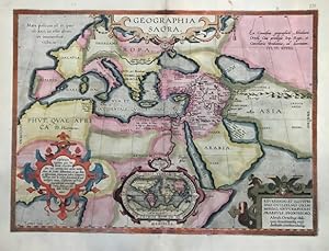
Geographia sacra
Published by Anversa, Jean Baptiste Vrients, 1603
Seller: Libreria Ex Libris ALAI-ILAB/LILA member, Roma, Italy
Seller Rating:
Map
Carta geografica originale (cm. 48x35,5 pi� margini bianchi) tratta dal 'Parergon', appendice del 'Theatrum Orbis Terrarum'. Splendida coloritura antica all'acquarello. Minuscoli abili restauri lungo la piega centrale, peraltro esemplare in ottimo stato di conservazione. Provenienza: Biblioteca del Castello di Cirey. Van den Broecke, n. 179.Decorativa carta storica del mondo antico basata sulle Sacre Scritture, arricchita dal classico mappamondo a proiezione ovale di Ortelius, incluso nel cartiglio in basso al centro.
-
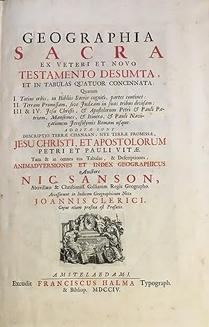
Geographia Sacra et veteri et novo testamento desumata, et in Tabulas quatuor concinnata: quarum I. Totius orbis, in Bibliis Sacris cogniti, partes continet: II. Terram promissam, sive Judaeam in suas tribus divisam: III & IV. Jesu Christi, & Apostolo.
Amsterdam, Franciscus Halma, 1704. Folio. (45,5 x 29 cm.). Contemp. full blindtooled Dutch vellum. Raised bands. Spine ends with tears, some cracking along fronthinge, but not loose. Vellum at frontcover a bit soiled. Egraved titlepage (Coxis del., ianen fecit). Printed titlepage in red/black with an engraved vignette. 15,(119),51,(1) pp., 1 engraved plate with portrait and coat of arms. 4 large folded engraved maps. Light yellowing to margins of textleaves, but maps and text fine and clean. (3 of the maps engraved by F. Halma). The maps are the Francois Halma reissues of Sanson's maps from 1683.
-
Geographia Sacra, sive notitia antiqua dioecesium omnium Patriarchalium, Metropoliticarum et Episcopalium veteris ecclesiae. Acc. in hac editione notae et animadvers. L. Holstenii.
Published by Amstelaedami Halma, 1704
Fol. M. gest. Tit., 11 doppelblattgr. Kpfr.-Ktn., 1 gest. Tit.-Vign., 2 gest. Widmungsbl. u. 1 gest. Textvign. 5 Bl., 332, 72 S. Ldr. d. Zt. a. 7 B�nden, m. Rsch. u. floraler Rverg. R�cken fachm�nn. restauriert. Einbd. leicht beschabt. St. a. Tit. u. Vortit. Teils leicht gebr�unt, ansonsten sehr gut erhaltenes Exemplar. Brunet IV, 447. Graesse V, 172. Ebert 20228. Der erste Teil d. gro�en Werkes "Geographia sacra" von Paulo, d. 3 Teile erschienen in sich abgeschlossen mit eigenen Titeln. In d. Bibliographien ist nur d. Ausgabe von 1703 mit 10 Karten (so lautet auch d. vorliegende Titelblatt, w�hrend d. gestochene Titelblatt 1704 als Erscheinungsjahr aufweist) verzeichnet. Die erste Ausgabe (ohne Karten) erschien 1641 in Paris. - Titel in Rot u. Schwarz, sch�ner breitrandiger Druck auf starkem Papier. Die Karten (mit pr�chtigen, teils floral oder mit landschaftlichen Szenerien geschm�ckten Kartuschen) zeigen: Europa, Italien (mit Beikarten Sizilien u. Sardinien/Korsika), Nordafrika, Frankreich, Britannien, Spanien, Griechenland, T�rkei, �gypten/Libyen, Pal�stina, Antiochien/Arabien. Die 2. Auflage ist um d. Karte �gyptens u. d. Widmungsblatt f�r Ezechiel Spanheim vermehrt. - Carolus de Sancto Paulo war Cistercienser u. Bischof zu Auranches in d. Normandie (vgl. J�cher III, 1319). la 0 gr.
-
Biblia sacra vulgatae editionis Sixti v. & Clementis VIII . autoriate recognita. Editio noua, notis chronologicis et historicis illustrata. Una cum sacra chronologia, atque geographia
Published by Paris: Excudebat Antoine Vitre, Regis & Cleri Gallicani typographus, 1662
Book
Hardcover. Condition: Good. Thick folio, 44 cm. Bound in contemporary leather-backed boards. Joints cracked. Spine ends chips, but binding holding. Collation: 4 pages leaves, xvj, 765 pages, 1 leaf, 222, 16, [12], lxxxviij, [32] pages. 2 double-page, folding maps engraved by Nicolas Sanson. The maps have been outlined in color. Printer's vignette on title, as well as printer's devices throughout. Printed in two columns. Minor marginal worming to a few leaves. 19th century signature of J. William Huttinger (John or Johann Wilhelm, b. 1836 in Germany, signed by him while he lived in Paris, and also when he lived in Beverly, Burlington Co, New Jersey). He married Alice E Reynolds Huttinger (1853-1918), who settled in Lansdowne, Delaware County, Pennsylvania. (Not in Darlow & Moule). This is an oversized or heavy book, which requires additional postage for international delivery outside the US.
-
Geographia Sacra, sive notitia antiqua dioecesium omnium patriarchalium, metropoliticarum, et episcopalium veteris ecclesiae. . ex SS. Conciliis, & Patribus, Historia Ecclesiastica & Geographis Antiquis collecta, auctore reverendissimo Carolo a S. Paulo abbate primum Fuliensi, & Congregationis Fuliensum Superiore Generali, deinde Episcopo Abrincensi. Acceserunt in hac editione notae et animadversiones Lucae Holstenii. Et parergon notitias aliquot ecclesiasticas Et Civiles, diversis temporibus editas, complectens Ex Mss. Codicibus Greece & Latine, cum X tabulis geographicis, accuratissime aeri incisis.
Published by 1704. ., 1704
Seller: Librer�a Astarloa, Bilbao, Spain
Seller Rating:
Impreso por Fran�ois Halma (Excudit Franciscus Halma). Amsterdam, Pa�ses Bajos. . 1 Vol. . Anteportada+grabado+portada+grabado+4 H.+332 pp.+72 pp.+11 mapas pp. Gran Folio. Plena Piel. Asia (Oriente Medio), Europa (Europa), Grabados , Idiomas (Lat�n), Religi�n / Teolog�a / �tica / Monasterios /Ordenes Religiosas (Historia de la Iglesia), Siglo XVIII . Monumental edici�n para esta geograf�a sagrada, obra del Obispo de Avranches Charles Vialart de St. Paul, con anotaciones del humanista cat�lico alem�n Lukas Holste (Lucas Holstenius). En el frontispicio presenta un grabado calcogr�fico a toda p�gina, obra de G. Hoet y grabado por G. Vander Gouwe, con motivos aleg�ricos religiosos. Asimismo presenta una dedicatoria al noble Ezequiel Spanhem, grabada al aguafuerte por Vander Gouwen a partir de un original de T. Goere. Un tercer grabado calcogr�fico de motivos arquitect�nicos precede al texto, dise�ado y grabado por H. Eland y que sirve de homenaje a Holsten. La obra contiene adem�s 11 mapas calcogr�ficos a doble p�gina de Europa, Oriente Medio y Norte de �frica, que muestran las ubicaciones de las diferentes di�cesis de la antigua Iglesia Cat�lica. Portada impresa a dos tintas. Numerosas capitulares historiadas y dos peque�os grabados en portada y primera p�gina de texto.
-
Geographia Sacra ex Veteri et Novo Testamento Desumta .quarum I. Totius orbis, in Bibliis Sacris Cogniti. II. Terram promissam, sive Judaeam .III & IV. Jesu Christi.FOUR PARTS IN ONE VOLUME.
Published by Excudit Franciscus Halma Typograph, Amsterdam, 1704
Book
Hardcover. Condition: Good. 15 pp., Preface, [11 Animadversiones, (notes)] / Index Gepgraphicus et Explicatio Regionum, & Locorum Omnium: 111 pp., / Joannis Clerici Notae in Indicem Geographicum Nic Samsonis: 16 pp., / Judea & Jesu Christi Salvatoris Nostri Vita: 51 pp., [1], engraved title page, foxed outside the illustration border, 4 double-page engraved maps, of which 3 are engraved by F. Halma, the maps are the Francois Halma reissues of Sanson's maps from 1683, contemporary calf, rubbed, marked and soiled, title label on raised & gilt decorated spine, title in black and red ink, title vignette, spine extremities lightly cracked, some pages slightly browned, bookplate of John Marques of Tueeddale Earle of Gifford Viscount Walden, Lord of Hay and Yester &c. verso front cover. Nicolas Sanson 1600-1667.?Born in Abbeville, a town in the Picardy region of France, in 1600, Sanson was the most noted French cartographer in modern history. Mapmaker to Louis XIV, King of France, Sanson endowed his maps with the most recent geographical information as well as the finest and sharpest engraving of the period. His "Cartes Generales de Toutes les Parties du Monde" was the most important single product of French commercial cartography of the seventeenth century. Sanson sparked a renaissance in geographical endeavor in his native country, which had not been a major player on the international cartographic stage since the great Oronce Fin� in the sixteenth century. With this atlas, Sanson laid the foundations of French domination in map production, initiating the so-called "French school of cartography," a school that was unprecedented in its attention to precision and scientific detail and discarded much of the decorative embellishments of previous maps as irrelevant. From Sanson's time in the second half of the seventeenth century until the latter part of the eighteenth century, French geographical conceptions were more influential than those put forward by any other nation. With this landmark atlas, Sanson all but single-handedly caused the center of cartographic innovation to shift from Holland to France.? [Pastoureau Sanson-VD; Shirley T. SAN-2b. Catalogued by Kate Hunter]. Bibliographic references: Rohricht 1129; Laor 692; Tobler 212; Furst III 244. #31734.
-
GEOGRAPHIA SACRA sive notitia antiqua Dioecesium omnium Patriarchalim, Metropoliticarum, et Episcopalim veteris Ecclesiae, ex SS. Conciliis, & Patribus, Historia Ecclesiastica & Geographis Antiquis collecta, .notae et animadversiones Lucae Holstenii.
Published by apud Rud. & Gerh. Wetstenios HFF.-Franciscus Halma 1711-1704-1707, Amstelaedami, 1711
Seller: BACCHETTA GIORGIO - ALFEA RARE BOOKS, Milano, Italy
Seller Rating:
Volume: 2 [3 tomi in 2 volumi] 42.5x27 cm., 11 cc., 332, 72 pp.-15 pp., 1, 5 cc., 111 pp., 1, 16, 51 pp., 1-7 cc., 192 pp., nel primo volume doppio frontespizio, uno con fregio tipografico e il secondo illustrato con incisione a piena pagina firmata, tre incisioni a piena pagina, una grande testatina con bella incisione mitologica, una iniziale istoriata, molte floreali, finalini, legatura in mezza pelle marmorizzata con angoli, dorso a sei nervi con doppi tasselli fregi e titoli dorati, qualche foro di tarlo e lievi tracce d'uso, occhietto nel primo e nel terzo tomo, tagli rossi, buoni margini, glosse al margine esterno, note a pi� di pagina su due colonne, nel terzo tomo testo su tre colonne con la versione in latino e greco, nei due volumi sguardie originali libere mancanti, alcune carte molto brunite, qualche fioritura, opera in discreto stato di conservazione, in latino e in greco I tre volumi della Geographia Sacra furono originariamente stampati separatamente nella prima met� del '600. Ebbero successivamente numerose ristampe. La nostra edizione riunisce nel secondo volume la Geographia di Nicolaus Sanson e di Eusebius Pamphile. Il primo volume la Geographia di Carolus Paulo presenta due date di stampa, il 1711 nel frontespizio tipografico con Wetstenios come stampatore e il 1704 nel frontespizio illustrato con Halma come stampatore. Probabilmente lo stampatore Wetstenios reimpresse integralmente nel 1711 l'opera di Halma del 1704 introducendo solo come varianti, nel frontespizio originale, il suo nome e la nuova data e un occhietto cos� intitolato: Geographiae sacrae scriptores tres, Carolus a S. Paulo, Nicolaus Sanson et Eusebius Caesariensis. Non avendo potuto collazionare l'opera del 1711 non possiamo affermare se, come segnalato nel frontespizio, l'opera includesse le dieci carte geografiche che sono assenti nella nostra copia. Confronta Brunet, IV, 447; Graesse, 5, 172; BNF n�: FRBNF31569691 per l'opera di Carolus Paulo, n�: FRBNF31296324 per l'opera di Nicolaus Sanson e n�: FRBNF30410593 per l'opera di Eusebius Pamphile.
-
Geographia sacra, sive notitia antiqua dioecesium omnium partriarchalium, metropoliticarum, et episcopalium veteris ecclesiae. notae et animadversions Lucae Holstenii.
Published by Amsterdam: Franz Halma, 1704., 1704
First Edition
2 parts in one volume, folio (17 1/8 x 11 1/8 inches). Half-title, vignette title-page printed in red and black, sectional title-page for the "Parergon." (some dampstaining to top outer corners). Engraved frontispiece by Vander Gouwe after G. Hoet, engraved dedication, engraved catafalque of Holstenius, 10 fine engraved double-page maps of Europe, Palestine and north Africa, one vignette engraved initial and head-piece, woodcut initials, head- and tail-pieces (some light, occasional soiling). Modern blue paper boards (worn at the head and foot of the spine with loss). First edition thus. Vialert's text was first published in Paris in 1641, and the notes by Lucas Holstenius (1596-1661) by Cardinal Barberini in 1666 (according to the "Monitum." at the beginning). Holstenius studied in Leyden before travelling through Italy with P. Cluverius (1580-1622). He became librarian in Rome for Cardinal Barberini, and was Keeper of the Vatican Library from 1627. Published by Francois Halma who amongst many theological and historical works also published this volume and in 1695 Ptolemy's "Tabulae gegraphicae orbis terrarium" and the re-issue of Schontanus a Sterringa's "Friesche Atlas" (as "Uitbeelding der heerlijkheit Freisland") of 1698, and an edition of Sanson's "Description de l'Universe" in 1709. Graesse V, 172; cf. Koeman II, page 125 (Halma). Catalogued by Kate Hunter.
-
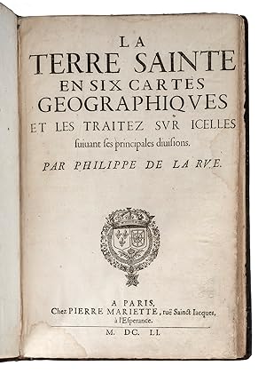
La Terre Sainte en six cartes g�ographiques et les traitez sur icelles suivant ses principales divisions. Reli� � la suite: Geographia Sacra, etc (par Nicolas Sanson d'Abbeville, Paris, Mariette, 1665).
First Edition Signed
Paris, Chez Pierre Mariette, 1651 ; 2 ouvrages reli�s en un volume in-folio, (11 pp. + 6 cartes interfoli�es) + (2 ff.n.ch (titre et d�dicace) + 16 ff.n.ch (index g�ographique) + 38 pp. (description de la Jud�e, vies de J�sus et de Saint Pierre) + 47 ff.n.ch. (chronologie sacr�e) + (15 ff.n.ch. + 3 cartes interfoli�es), plein veau de l'�poque, dos orn� � nerfs, pi�ce de titre rouge (coiffes et coins restaur�s). Recueil factice de deux ouvrages. I. Tobler, p. 234 (ne cite que la sixi�me carte : "Die karte ist interessant"). �dition originale et premier tirage des six cartes grav�es d�pliantes, avec contours colori�s � l'�poque, et de leur texte explicatif. Le cartographe Philippe de la Rue, qui n'est connu que par la quinzaine de cartes dont il est l'auteur, toutes concernant le Proche-Orient et toutes publi�es par Mariette, d�crit, au verso du titre, les six cartes pr�sent�es (43 x 60 cm environ) : "La Terre sainte pour ses temps & ses habitants, se divise commod�ment en six mani�res, & se r�duit en six cartes. La premi�re marque les demeures & villes assign�es aux onze fils de Chanaan : & sert pour les temps d'Abraham, & de Moyse aussi. La seconde comprend les douze lots, & partages de la Terre promise entre les XII Tribus, & sert pour les temps, & les Livres de Josu�. La troisi�me vous donne la partition du Royaume de Salomon, en XII Gouvernements nouveaux, sous ce Prince & Monarque Pacifique. La quatri�me contient la division de Jud�e en trois Tetrarchies ou moindres Royaumes ; & sert pour les temps de nostre Seigneur vivant �a-bas, & pour les livres du nouveau Testament, & autres. La cinqui�me vous monstre l'estend�e du Patriarchat de Hierusalem pour les temps des Roys Fran�ois en ces quartiers. La sixi�me vous met devant les yeux cette m�me Terre : mais Moderne, & telle qu'elle est aujourd'huy sous la main pesante du Turc". II. Tobler p. 212. R�hricht 1129. La "Geographia sacra ex Veteri, et Novo Testamento desumpta (?)", reli�e � la suite, comporte trois grandes cartes d�pliantes, aux contours aquarell�s. Certaines cartes ont �t� habilement restaur�es. Il est rare de trouver les cartes de La Rue r�unies, qui plus est avec le texte explicatif. 1651.
-
Cartes g�n�rales de toutes les parties du monde. - Geographia Sacra ex Veteri, et Novo.
Published by Paris: Pierre Mariette, 1667, 1667
2 volumes. Folio (18 x 13 2/8 inches). 343 FINE double-paged engraved maps, most with original hand-colour in outline by Sanson, P. du Val, and M. Tavernier (a few maps a bit creased). Contemporary speckled calf (rubbed, extremities scuffed). Provenance: With the near contemporary ownership inscription of Guillelmi Detroyes dated 1686 on the front free endpaper, and manuscript numbering to verso of most maps. The maps were compiled by Nicolas Sanson who first published his atlas in 1654, with 100 maps, and engraved and printed by Pierre Mariette; each held the copyright to half of the maps which bear their separate imprints, and were issued progressively from 1630. The maps in this Atlas date from the late 1630s, but are evenly dated from the 1640s to 1667. They include the latest discoveries in the New World. 'Amerique sepentrionale', shows the Great Lakes for the first time; the map of New Mexico and Florida, introduced California as an island. South America is mapped in great detail, and a double hemisphere map is devoted to the two poles. Born in Abbeville, a town in the Picardy region of France, in 1600, Sanson was the most noted French cartographer in modern history. Mapmaker to Louis XIV, King of France, Sanson endowed his maps with the most recent geographical information as well as the finest and sharpest engraving of the period. His "Cartes Generales de Toutes les Parties du Monde" was the most important single product of French commercial cartography of the seventeenth century. Sanson sparked a renaissance in geographical endeavor in his native country, which had not been a major player on the international cartographic stage since the great Oronce Fin� in the sixteenth century. With this atlas, Sanson laid the foundations of French domination in map production, initiating the so-called "French school of cartography," a school that was unprecedented in its attention to precision and scientific detail and discarded much of the decorative embellishments of previous maps as irrelevant. From Sanson's time in the second half of the seventeenth century until the latter part of the eighteenth century, French geographical conceptions were more influential than those put forward by any other nation. With this landmark atlas, Sanson all but single-handedly caused the center of cartographic innovation to shift from Holland to France. Pastoureau Sanson-VD; Shirley T.SAN-2b. Catalogued by Kate Hunter.l64F4A.