Order Total (1 Item Items):
Shipping Destination:

Map of Washington by George F Cram (21 results)
Skip to main search results
Product Type
- All Product Types
- Books (18)
- Magazines & Periodicals
- Comics
- Sheet Music
- Art, Prints & Posters (2)
- Photographs
- Maps (1)
-
Manuscripts &
Paper Collectibles
Condition
- All Conditions
- New
- Used
Binding
- All Bindings
- Hardcover
- Softcover (2)
Collectible Attributes
- First Edition (2)
- Signed
- Dust Jacket
- Seller-Supplied Images
- Not Printed On Demand
Seller Location
Seller Rating
-
MAP:'Washington'.From Cram's Superior Reference Atlas of Kansas & The World
Published by George F. Cram, NY, 1907
Art / Print / Poster First Edition
Unbound. Condition: Very Good. Handcolored Map (illustrator). 1st. double page map, very nice and suitable for framing [2 scans = full image] Size: 22" x 14".
-
MAP: "Washington".from Atlas of Michigan and the World
Published by George F. Cram, Chicago, IL, 1908
Art / Print / Poster First Edition
Unbound. Condition: Very Good. Handcolored Map (illustrator). 1st. lovely map, suitable for framing [2 scans = full image] Size: 22" x 14".
-

This map issued by the George F. Cram Company in 1901 is a wonderful example of Crams cartographic style and expertise. George F. Cram (1842-1928), served in the U.S. Army during the American Civil War. After the war ended, Cram joined his uncle Rufus Blanchard's Evanston, Ill. map business in 1867. Two years later, he became sole proprietor of the firm and renamed it the George F. Cram Co. which became a leading map firm and first American firm to publish a world atlas. This map measures 14.5 inches by 22.5 inches.
-
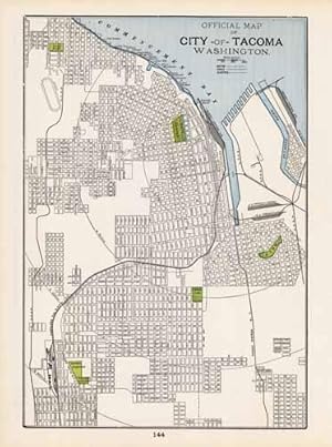
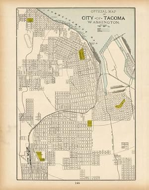
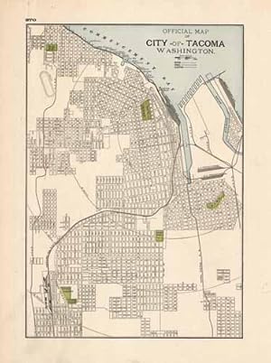
This colorful map came from Crams 1898 Universal Atlas - Geographical, Astronomical and Historical. In 1869 the George F. Cram Company was born and the Cram name quickly became synonymous with accuracy and innovation. This map of Tacoma, Washington shows Commencement Bay, major streets, cemeteries, rivers, parks, railroads and more. This map measures 13 inches by 9 inches.
-

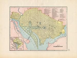
This detailed map was produced for Crams 1895 "Universal Atlas - Geographical, Astronomical and Historical." In 1869, the George F. Cram Company was born, and the Cram name quickly became synonymous with accuracy and innovation. This Washington D.C. map depicts the city's various streets, rivers, bodies of water, and parks. This map measures 12 inches by 9 inches.
-
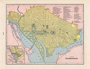
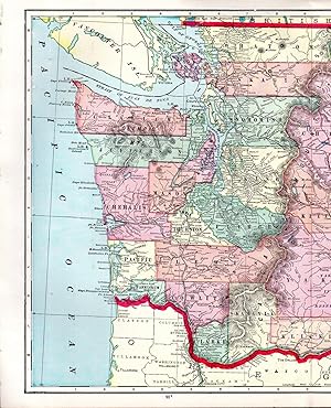
This colorful map of Washington DC came from Crams 1894 Universal Atlas - Geographical, Astronomical and Historical. In 1869 the George F. Cram Company was born and the Cram name quickly became synonymous with accuracy and innovation. This detailed state map shows the primary towns, rivers, mountains, roads, and railroads. Each county is labeled and colored. This map would be a wonderful addition to any collection or a gift to remember.The map measures 11.5 by 9 inches.
-
This colorful map came from Crams 1894 Universal Atlas - Geographical, Astronomical and Historical. In 1869 the George F. Cram Company was born and the Cram name quickly became synonymous with accuracy and innovation. This map would be a wonderful addition to any collection or a gift to remember. This map measures 14.5 inches by 11.5 inches.
-

Art Source International brings you George F. Crams rare 1899 Standard American Railway System Atlas. With exceptionally bright colors, and crisp, bright paper, these maps are in excellent condition and are superior to other Cram railroad atlases. This finely detailed city map shows streets with names, buildings, parks, hospitals, squares, cemeteries, forts, churches, depots, rail lines, and rail roads, hotels, lakes, rivers, creeks and topographical marks are shown. A fine addition to any collection!' This map measures 9 inches by 11.5 inches.
-
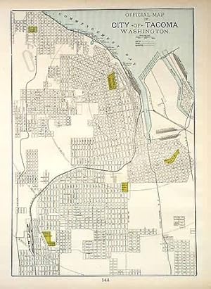
Art Source International is proud to offer this hard to find map from George F. Crams 1894 Standard American Railway System Atlas. This map of Tacoma was printed larger and on heavier paper as compared to Cram's normal atlases of the time. This map measures 13 inches by 9 inches.
-
This detailed map was produced for Crams 1895 "Universal Atlas - Geographical, Astronomical and Historical." In 1869, the George F. Cram Company was born, and the Cram name quickly became synonymous with accuracy and innovation. This map shows both Sweden and Norway; important cities, bodies of water, government buildings, mountain ranges, and more are noted. This map depicts Tacoma's various streets, rivers, bodies of water, and parks - an intricate map over 100 years old. This map measures 13 inches by 9 inches.
-
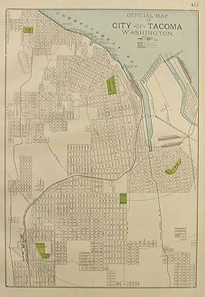
Art Source International brings you George F. Crams rare 1899 Standard American Railway System Atlas. With exceptionally bright colors, and crisp, bright paper, these maps are in excellent condition and are superior to other Cram railroad atlases. This finely detailed city map shows streets with names, buildings, parks, hospitals, squares, cemeteries, forts, churches, depots, rail lines, and rail roads, hotels, lakes, rivers, creeks and topographical marks are shown. A fine addition to any collection!' This map measures 13 inches by 9 inches.
-
We at Art Source International are excited to offer this rare map of Washington DC from George F. Crams 1898 "Standard American Railway System Atlas". This map of the city is exceptional in that Cram used larger paper than most of his other publication years. This map measures 9 inches by 11.5 inches.
-
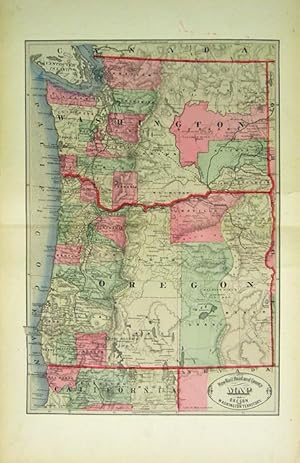
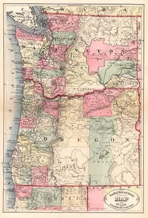
New Rail Road and County Map of Oregon and Washington Territory
Published by George F. Cram, [Chicago], 1882
Seller: Kaaterskill Books, ABAA/ILAB, East Jewett, NY, U.S.A.
Association Member: ABAA ILAB IOBA
Seller Rating:

One sheet folded (56.5 x 35 cm). 43.75 x 29.5 cm. (17 x 11 1/2 inches). Hand colored. Title inside oval cartouche. Scale 36 miles to 1 inch. Taken from "Cram's Illustrated Family Atlas of the World." There were numerous versions of the New Rail Road and County maps by published by Cram and Henry S. Stebbins, with later versions machine colored due to the expense of hand coloring. Phillips 901. Marginal finger soiling, 4 inch tear archivally repaired on verso, visible only at the margin. Still quite good. We have a very good copy but with a slightly lighter machine coloring.
-
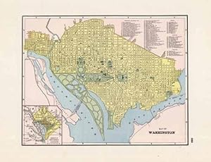
This map of Washington DC was produced by the George F. Cram Company for his Standard American Atlas of the World in 1887. In 1869 the George F. Cram Company was born and the Cram name became synonymous with accuracy and innovation. This map is impressive in its level of detail, beautiful color and superior size. This map measures 9 inches by 11.5 inches.
-
Art Source International is proud to offer the maps from George F. Crams 1899 Standard American Railway Atlas. This is the first time we have seen this atlas in over 20 years. It is perhaps the finest atlas Cram ever produced. The maps are in excellent condition with exceptionally bright colors. Their most notable feature is certainly the precise depiction of the railroad routes. Every rail line is named, numbered and color coded. Cities, towns, lakes, rivers, creeks and mountain ranges are shown. This map would be a fine addition to any collection or make a unforgettable gift. This map measures 16 inches by 22 inches.
-
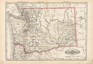
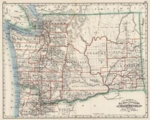
This map is from the extremely rare and well maintained 1890 edition of the county and railroad atlas made by George F. Cram. Each state map is mostly black and white with bright coloring used to highlight county and state borders. The names of counties, important towns, rivers, Indian reservations, creeks, lakes and mountain ranges are identified, as well as railroads and the names of station stops. This map illustrates the state of Washington. Crams distinctive title plates, coloring, and topographical details found on the maps in this hard to find 1890 atlas make them outstanding collectible pieces. This map measures 15.75 inches by 19.5 inches.
-

Art Source International is proud to offer the maps from George F. Crams 1899 Standard American Railway Atlas. This is the first time we have seen this atlas in over 20 years. It is perhaps the finest atlas Cram ever produced. The maps are in excellent condition with exceptionally bright colors. Their most notable feature is certainly the precise depiction of the railroad routes. Every rail line is named, numbered and color coded. Cities, towns, lakes, rivers, creeks and mountain ranges are shown. This map would be a fine addition to any collection or make a unforgettable gift. ' This map measures 22 inches by 16 inches.
-
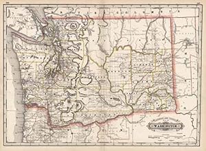
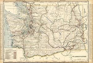
This map of Washington was produced by the George F. Cram Company for his Standard American Atlas of the World in 1887. This atlas was a precursor to his impressive railroad atlases. In 1869 the George F. Cram Company was born and and the Cram name became synonymous with accuracy and innovation. This map shows all railroads, unfinished railroads, county seats, post offices, money order post offices, and large and small towns. This map is an early example of Crams large format maps and is impressive in its level of detail. This map measures 16 inches by 22 inches.
-
This detailed, well-maintained map of Washington was issued in George F. Crams "Standard American Atlas" in 1884. Cram identifies myriad finished and unfinished railroad lines and township lines within the state. The map also painstakingly marks numerous rivers, lighthouses, mountains, mills, sand dunes, light houses, military reservations, Native American reservations, lakes, bays, towns, springs, mines, and more. An insightful glimpse of the state in 1884!' This map measures 15.5 inches by 19.75 inches.
-

Washington Eastern Part Washington Western Part railroad atlas map sold as a pair
Published by George F. Cram, Chicago, 1899
Map
24 1/2 x 16 inches. Condition: Very good. This is a brilliant use of color to designate the individual railroads in the both maps of this state at 1899. Cram's presentation of American railroads was unsurpassed for its time. Various state level commissions produced maps but it was Cram that offered blanket coverage of the entire United States. Important for this map is the extensive coverage of railroads around cities. Shown are numerous railroads and express companies. Railroads have the same color on the separate maps through which they pass. Included are: Barrard Inlet and Fraser Valley, Northern Pacific, Port Townsend Southern and Great Northern.
-
We believe that this map, issued as part of "Crams Illustrated Family Atlas of the World," is the earliest hand colored atlas map produced by George Cram. There have only been a small number of these maps offered for sale over the last 30 years. This is a truly "rare" Cram map. This map measures 17 inches by 11.5 inches.