
Order Total (1 Item Items):
Shipping Destination:

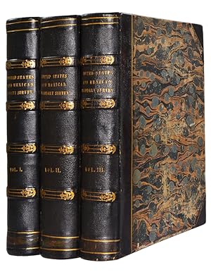
Report United States and Mexican Boundary Survey Direction Secretary Interior, Used (22 results)
You searched for:
Title:
report united states and mexican boundary survey direction secretary interior
Edit your search
Skip to main search results
Product Type
- All Product Types
- Books (22)
- Magazines & Periodicals
- Comics
- Sheet Music
- Art, Prints & Posters
- Photographs
- Maps
-
Manuscripts &
Paper Collectibles
Condition
- All Conditions
- New
- Used
Binding
Collectible Attributes
- First Edition (14)
- Signed
- Dust Jacket (1)
- Seller-Supplied Images (10)
- Not Printed On Demand
Free Shipping
Seller Location
Seller Rating
-

Condition: As New. Unread book in perfect condition.
More buying choices from other sellers on AbeBooks
Used offers from US$ 25.79
-

Report On The United States And Mexican Boundary Survey: Made Under The Direction Of The Secretary Of The Interior; Volume 1
Published by Legare Street Press, 2022
ISBN 10: 1018823433ISBN 13: 9781018823430
Book
Condition: As New. Unread book in perfect condition.
More buying choices from other sellers on AbeBooks
Used offers from US$ 45.42
-
Report on the United States and Mexican boundary survey, made under the direction of the secretary of the interior Volume 2
Published by RareBooksClub.com, 2012
ISBN 10: 1153135337ISBN 13: 9781153135337
Book
Condition: Like New. Used - Like New. Book is new and unread but may have minor shelf wear. Your purchase helps support Sri Lankan Children's Charity 'The Rainbow Centre'. Our donations to The Rainbow Centre have helped provide an education and a safe haven to hundreds of children who live in appalling conditions.
-
REPORT ON THE UNITED STATES AND MEXICAN BOUNDARY SURVEY Made Under the Direction of the Secretary of the Interior
Published by Texas State Historical Association, Austin, TX, 1987
ISBN 10: 0876110855ISBN 13: 9780876110850
Book
Hardcover. Condition: Fine. 3 volumes, hard covers in slip case in fine condition. Facsimile Reproduction. Limited edition of 750 copies. with fold out maps and plates.
More buying choices from other sellers on AbeBooks
Used offers from US$ 300.00
Also find First Edition
-
REPORT ON THE UNITED STATES AND MEXICAN BOUNDARY SURVEY Made Under the Direction of the Secretary of the Interior
Published by Texas State Historical Association, Austin, TX, 1987
ISBN 10: 0876110855ISBN 13: 9780876110850
Book First Edition
Hardcover. Condition: Fine. 1st Thus. (1987). Facsimile Reproduction. 3 volume set. Limited edition of 750 copies. Bibliography. Index. Numerous plates of botany, birds in color, reptiles, amphibians, and fish. Fine with mylar protective covers. (057).
-
Report on the United States and Mexican Boundary Survey; Made Under the Direction of the Secretary of the Interior. Volume I. [FIRST EDITION]
Published by Cornelius Wendell, Washington, 1857
First Edition
Cloth. Condition: Very good. First Edition. Large 4to. Brown cloth with embossed decorations. Many steel engravings, woodcuts, and color lithographs throughout, as well as fold-out maps and charts bound in. Part I: [xvi], 258 pp. Part II: [xiii], 174 pp. Cloth covering spine is removed, but binding is not affected. Wear to edges and corners. Black marks on right and bottom block edges and at bottom of title page. Ownership stamp of James E. Gillikan on front free endpaper, and signature of Sam G. Bugh on title page. Minor discoloration throughout, typically on right margin. Occasional offsetting to pages which face illustrations. Tight and clean, interior in excellent condition. This is the first edition of the first volume of a seminal text of Western American history. William Hemsley Emory was the civil engineer and surveyor tasked with mapping the new border between the US and Mexico following the Mexican-American War, in which the US had acquired the New Mexico, Arizona, and Southern California territories. Emory's survey was famously thorough, including illustrations of biological and geological discoveries, anthropological studies of the Mexican and Native American populations, and landscape illustrations showing various views across the border from many locations and perspectives. Emory would later serve as a colonel in the Union army of the American Civil War. The relationships that Emory forged with Native American tribesmen during his survey, particularly his alliance with Black Beaver of the Lenape people, were instrumental in securing Union victories in Oklahoma and Kansas. Emory's survey is an important document of the geology, botany, and anthropology of the mid-19th century American Southwest, generally agreed to be the most thorough of its kind. Many prominent scientists of the era contributed to the report, including botanist Charles C. Parry, artist/ethnographer Arthur Carl Victor Schott (whose color lithograph portraits are a high point of this volume), and geologist/paleontologist James Hall. Two additional volumes were printed, though not widely distributed. This hefty volume is a treasure not only of data, but of some of the most detailed, precise, and evocative landscape and portrait illustrations that this bookseller has encountered. An important book for any collector of Western Americana, scarce in this condition. (Howes E146; Sabin 22538; Wagner-Camp 291; Wikipedia).
-
Report on the United States and Mexican Boundary Survey, Made Under the Direction of the Secretary of the Interior. Volume 1, Parts 1 & 2. House of Representatives- 34th Congress, 1st Session, Ex. Doc. No. 135.
Published by Cornelius Wendell. Washington, D.C. 1857., 1857
Book First Edition
Hardcover. Condition: Fair. First Edition. 2 parts, bound as one. Publisher's black cloth. Rebacked, with new cloth spine. Hardcover. xvi, 258 pages, viii, 174 pages : illustrations (some color and some folded), maps, tables, plates ; 30 cm. Loss to the Falls of Rio Saldo plate margins. Scattered spotting, staining. Inscribed by the Hon. Jacob Michael Kunkel (1822 - 1870, US Congressman, Maryland from Frederick. From the Coale-Sappington family of Libertytown, Maryland (Frederick). From the Coale-Sappington family of Libertytown, Maryland, by descent from J. M. Coale. Signed by James M. Coale. James Coale (1805-1882) was a prominent attorney from Frederick County, MD who had been a Brigadier General in the 9th Brigade, Maryland Militia before the war. Coale was the President of C&O Canal and a member of the Maryland House of Delegates (1852-1862). Coale notably wrote letters to Abraham Lincoln protesting the imprisonment of members of the Maryland legislature during the Civil War. Contents: V. 1, pt. 1. Personal account. General description of the country. Lower Rio Bravo. From mouth of Devil's River to El Paso del Norte. Sketch of territory acquired by treaty on Dec. 30, 1853. From the 111th meridian of longitude to the Pacific Ocean; Report of Lt. Michler. Astronomical and geodetic work. Meteorology. v. 1, pt. 2. Geological reports of Dr. C.C. Parry and assistant Arthur Schott. Notes by W.H. Emory. Paleontology and geology of the boundary, by James Hall. Description of cretaceous and tertiary fossils, by T.A. Conrad. Howes E146; Sabin 22538; Wagner-Camp 291. According to William Goetzmann, the Emory Report was perhaps the most comprehensive scientific description ever made of the land, town, and border area between Mexico and the United States. The narrative, scientific reports, and illustrations made Emory's production a overwhelming contribution of factual knowledge about the Southwest of the United States and the North of Mexico. 34th Cong., 1st sess. House. Ex. doc., 135. This is an oversized or heavy book, which requires additional postage for international delivery outside the US.
-

Report Of The United States And Mexican Boundary Survey Made Under The Direction Of The Secretary Of The Interior
Published by Washington: A. O. P. Nicolson, Printer, 1859
Seller: Terrace Horticultural Books, St. Paul, MN, U.S.A.
Seller Rating:

Book First Edition
Hardcover. Condition: Very Good. 1st Edition. First Edition Thus, Volume I I Part 1, Very Good, Clean, Some Foxing Generally And At Plates, Quarto, Quarter Calf with Corners Wrapped Dyed Red With Gilt Color Outline, Five Raised Bands Gilt Outlined and Lableing, Burgundy CPP.270 Plus 61 Engraving Platesloth, John Torrey Was An Important American Botanist from the Mid 1800 s, This Book Reflects His Participation in The Emery Mexican Boundary Survey of 1857. He Lectured Widely and Those Lectures In Time Became The Torrey Botanical Club starting In 1867. This Is an Association Copy In That This Copy Has The Book Plate Of Forest Shreve (1878-1950) an Important Botanist of The Southwest United States. Included With This Offer Laid in Is Offprint Supplementary Publication NO.22 from The Carnegie Institution Of Washington - The Plant Life Of The Sonoran Desert By Dr. Forest Shreve, 1936.
-
Report on the United States and Mexican Boundary Survey, Made Under the Direction of the Secretary of the interior. Vol.I, Part I and II
Published by Nicholson A., 1857
Book First Edition
Hardcover. Condition: Good. No Jacket. 1st Edition. Large thick 4to hardcover volume in black embossed cloth. Spine shows splitting and some chipping at top. Boards tight with some wear. End papers not split or marked. 2 Native American plates are out else everything else is complete. Some foxing and the color plates some have offsetting. A little water mark to the bottom of some pages.
-
Report On The United States And Mexican Boundary Survey, Made Under The Direction Of The Secretary Of The Interior Volume I, Parts 1 and 2
Published by U. S. House of Representatives,, Washington, DC:, 1857
Seller: Town's End Books, ABAA, Deep River, CT, U.S.A.
Association Member: ABAA ILAB SNEAB
Seller Rating:
First Edition
Hardcover. First Edition. Volume I of a two volume publication is rebound in a modern 1/4 dark brown calf and patterned cloth covered boards with bold gilt text stamping on the spine and new end sheets. A quarto of 11 1/4 by 9 inches in fine condition. Without a dust jacket and probably as issued. Part I contains 258 pages followed by a one page map. Part 2 contains 174 pages followed by 21 plates. Considered by Howes in his bibliography U.S.Iana, as "quite scarce". (Howes, E-146).
-
![Seller image for Report on the United States and Mexican boundary survey [Volume II, parts 1 and 2], made under the direction of the Secretary of the Interior, Volume II, part 1. Botany of the boundary; part 2.; Zoology of the boundary. for sale by Rodger Friedman Rare Book Studio, ABAA](https://pictures.abebooks.com/inventory/md/md30787033020.jpg)
Report on the United States and Mexican boundary survey [Volume II, parts 1 and 2], made under the direction of the Secretary of the Interior, Volume II, part 1. Botany of the boundary; part 2.; Zoology of the boundary.
Published by Cornelius Wendell, Washington, 1859
Seller: Rodger Friedman Rare Book Studio, ABAA, Tuxedo, NY, U.S.A.
Seller Rating:

First Edition
Condition: Very Good. First edition. 2 parts, 29 cm; Botany: 270, 78 pages, and 136 lithograph plates of plants and cacti; Zoology:62, 32, 29, 85 pages, and 144 lithograph plates, 35 of them (the birds) colored by hand. Bound in red buckram. Upper hinge split in part 2, expertly repaired with strong Japanese paper. Colored plates are clean, occasional foxing on uncolored plates. Provenance: bookplate of Henry Osborne Havemeyer, the 19th-century sugar magnate.
-
Report on the United States and Mexican Boundary Survey, Made Under the Direction of the Secretary of the interior. Vol.I, Part I and II and Vol.II, Part II
Published by A.O.P. Nicholson 1857,1859, Washington, D.C., 1857
Book First Edition
Hardcover. Condition: Very Good. No Jacket. 1st Edition. Two volume set, half leather, marbled boards and end papers, gilt top edge. Vol. I, frontis, general descriptions of the country, 432 total text pages, 1857 House of Representatives, 34th Congress, 1st session, Ex. Doc. No.108. All plates, illustrations, and maps are present including the elusive large fold-out maps of the country west of the Mississippi one in black and white another in color. Vol. II, Part I 1859. Senate, 34th Congress, 1st Session, Ex. Doc. No. 108. Part I of Vol. II Botany of the Boundary, General Botany 270 pp.and Part II Cactace 78 pp. All plates, illustrations, maps are present. This two volume set is in tight, intact very good+ condition with wear to the boards edges and corners, it comes from the Historical Library of Iowa with a small notification on the front fixed end paper, signed by Iowa historian Chas. Aldrich (1828-1908). Both copies have not been abused and none of the plates have been removed. A heavy two volume set extra shipping charges will be required.
-
Hardcover. Condition: Good. Washington DC, 1859; two massive volumes (Volume II, Parts I & II) of 3, this set lacks the first volume, which is Personal Accounts and Palaeontology/Geology information; brown library buckram with library markings; spines darkened; spine end and corner wear; this set includes volume of Botany by Torrey (270 pages, plus 61 plates); and Cactaceae (78 pages, 75 plates). The other volume includes Zoology, with Mammals by Baird (62 pages, 27 plates); Birds by Baird (32 pages, 25 color plates); Reptiles by Baird (32 pages, 41 plates) and Fishes by Girard (85 pages, 41 plates); The library spine titles of this set read: "Executive Documents, 1st Session, 34th Congress, Volume 14, Part 2 1855 - 56, and Volume 14, Part 3, 1855 - 56"; 4to 9 3/4" - 12" Tall; bindings very good; Zoology volume has detached but present front fly; both books have some internal library markings; interior pages have light toning; Botany book also has tide marks on several pages and very occasional light foxing on some plates; each volume several hundred pages; Additional shipping charges will be requested.
-
Report on the United States and Mexican Boundary Survey, Made under the Direction of the Secretary of the Interior
Published by A. O. P. Nicholson / Cornelius Wendell 1857, 1859, Washington, D. C., 1857
First Edition
Hardcover. Condition: Very Good. First Edition, First Printing. William H. Emory was appointed commissioner of the United States and Mexico Boundary Survey following John Russell Bartlett, who was MIA from the survey upon Emory's arrival to assume his appointment. Emory was left to scrap together an effective survey party and obtain an accurate survey of the border after previous errors had ceded the Mesilla Valley, important in constructing a trans-continental railroad, to Mexico. The Gadsden Purchase had corrected this, but also added new territory to be surveyed. In addition to helping to clear up the boundary controversy, Emory's accounts were important in noting that the deserts of the southwest were not an agrarian paradise, and his team assembled a wealth of natural history and anthropological observations. This report is also notable for the illustrations, with many plates of scenery, plants, animals, and in particular color plates of the native inhabitants and birds. Two volumes bound in three, half Morocco on marbled paper with bright gilt text on spine, custom slipcase. First volume from the Senate report, second from the House. Volume I contains the personal narratives, correspondence, meteorology, geology, ethnology, and paleontology. First part of Volume II is botany; second zoology. Includes the Hall and Lesley geologic map that is often missing and was superimposed on the topographic map. Hall and Lesley's map differed from other geologic maps of the 1850s in that they preferred to base their interpretations on field-truthed observations, hence some missing spots on the map including the Colorado River. Boards of all volumes are rubbed on surfaces and edges, near foot of spine in particular. Besides a split front hinge in the first volume, bindings are sound. Creasing and one small tear to topographic map near where it is bound in, no tears to profile, geologic map has a 1-2" tear near the binding and is creased along edges. Missing bird plate 22 from the third part. A few pencil markings, faint residue on pastedowns from previous bookplates, moderate foxing and offsetting throughout. First volume has some dampstaining to bottom right corner, text on pp. 70-71 blurry due to printing error. Wagner-Camp 291, Howes E-146.; 4to 11" - 13" tall.
-
Report on the United States and Mexican Boundary Survey Made Under the Direction of the Secretary of the Interior.
Published by A.O.P. Nicholson, Printer, Washington, D.C., 1857
Seller: Jeffrey H. Marks, Rare Books, ABAA, Rochester, NY, U.S.A.
Seller Rating:
First Edition
4 parts in 2 volumes. Illustrated from lithographs (some color); charts, maps and profiles. Folio, publisher's brown blindstamped cloth, rebacked with new (and new-looking) gilt-lettered spines. First edition. Wagner-Capm 291; Howes E-146. Plate at p. 107 foxed; plates at pp. 122-123 foxed and chipped at edges; title page in Vol. II remargined and the first 17 pp. have a slash at the fore-edge extending into the text.
-
Report on the United States and Mexican Boundary Survey, made under the Direction of the Secretary of the Interior [complete set]
Published by . Washington, printed by AOP Nicholson, Cornelius Wendell, 1857-59, First edition, mixed Senate and House documents., 1857
4to [29.5 x 24 cm]; 4 parts in 3 volumes, xvi, 258; viii, 174; 62, 35, 32, 85, ii; 270; 78 pp, 347 plates including 25 hand colored of birds, 12 colored of views & native peoples, 3 large folding maps (1 colored with 4 inch tear), 2 other maps/charts. mixed cloth bindings, including original cloth, 2 volumes in rebound cloth, cover wear, minor foxing on few leaves, mostly marginal, stain in margin of one title page, one volume with library stamp on cover & title, interiors very good, sound set. This is one of the first scientific explorations of the area including its natural history, botany, geography, geology. The boundary delineated by Emory as described in this work demonstrates his competence and skill since it remains largely unchanged today. A cornerstone work on the exploration and mapping of the US southwest and the Texas-Mexican border. Besides Emory's reports, there are scientific reports by James Hall, T.A. Conrad, Spencer F. Baird, Charles Girard, C. C. Parry, George Engelmann, etc. George Merrill, 1906, History of American Geology, p. 461: 'This has the distinction of being the earliest coloured geological map of the region published by the Government. It is, moreover, of historical interest as showing how little was definitely known of the region.' Dobie 86: 'Emory's great two volume report is, aside from descriptions of borderlands and their inhabitants, a veritable encyclopedia, wonderfully illustrated, on western flora and fauna.' The plates include views, geology, mammals, fish, birds, reptiles, botany, cacti, costume plates of native people, etc. Only 3,000 copies of volume two were printed, making complete sets uncommon. Jenkins 57. Howes 3312. Wheat 916, 917,918, 919. Wagner/Camp 291. Reese 31. A complete set with all plates, numerous text illustrations, maps, including the large folding colored 'Map Illustrating the General Geological Features of the Country West of the Mississippi River', which is often lacking. Because of weight, extra shipping cost. A picture of this book is available on request.
-
Report on the United States and Mexican Boundary Survey, Made Under the Direction of the Secretary of the Interior - Two Volumes
Published by A.O.P. Nicholson, Washington D,C., 1857
Seller: Michael J. Toth, Bookseller, ABAA, Springtown, PA, U.S.A.
Seller Rating:
First Edition
Hard Cover. Condition: VG+. No Jacket. First Edition. Volume 2 published in 1859 by Nicholson. The Senate Issue(s), 2 Volumes; [355] leaves of plates (some folded) : ill. (some col.), map, col. ports. New Spines on original boards. Ex-library copy (but only the title page shows imprint of the library (Reference copies). Ref.: Howes E146; Sabin 22538. All plates appear to be present. [United States] Congress (34th, 1st session : [1856]). Senate. Ex. doc. ;; no. 108; Exceedingly scarce - massive 2 volume set. Size: 4to - over 9�" - 12" tall.
-
Report on the United States and Mexican Boundary Survey: made under the direction of the Secretary of the Interior
Published by A O P Nicholson, Washington, D C, 1857
Seller: The Book Collector, Inc. ABAA, ILAB, Fort Worth, TX, U.S.A.
Association Member: ABAA ILAB IOBA
Seller Rating:
Book First Edition
Hardcover. Condition: Very Good. 1st Edition. 2 volumes in 3. Volume I, parts I and II: xvi+258 pages with frontispiece, 72 maps (1 folding) and illustrations engraved on steel, map and meteorological engraved on copper diagram, 12 engravings on stone, 20 wood cuts and errata; vii+174+[21 plates] with folding map in color, 26 maps and illustrations and errata. Volume 2, part I: 270+[75 plate] pages with index; Volume II, part II: 62+[27 plates] pages with index, 33+[25 plate] pages with index, 35+[41 plate] pages with index, 85+[ii]+[41 plate] pages with index. U S Geological Survey Bulletin 194 map (40" x 26 1/4"). Quarto (11" x 9") bound in red cloth with gilt lettering to spine. House of Representatives, 34th Congress, 1st Session, Senate Ex. Doc 108. (Howes E146; Wagner-Camp 291; Wheat, Transmississippi West III, 822 and pages 242-4.) First edition with this set includes three plates not recorded in Wagner-Camp and not found in all copies: a colorful "Map Illustrating the General Geological Features of the Country West of the Mississippi River" (facing page I:258); "View of Monument Mountain" facing page I:96; and "View Along the Gila (Cereus Giganteus)" facing the last text leaf in the second volume. The folding map in volume one is one of the foundation maps for the western United States and represents the culmination of fifty years of government explorations. Starting with Lewis and Clark, there were numerous official and unofficial surveys and explorations, all adding to the pool of knowledge presented here. While large sections are still labeled "unexplored territory," Emory fitted these fragments together with the information gathered during his surveys into a reasonably correct cartographic picture of the West. This map shows large, transitional territories of Nebraska, Kansas, New Mexico, Utah, Oregon, Washington and Minnesota. It was drawn by Thomas Jekyll under the supervision of Lt. Nathaniel Michler of the Topographical Engineers. Lt. Michler worked with his counterpart representing Mexico, Captain Francisco Jimenez, to survey between Nogales and Yuma including the area south of Arivaca. The U S Geological survey Bulletin 194 was drawn by J.E. Weyss, circa 1860. The map features the survey lines between Texas and New Mexico with good topographical detail. Information includes forts, Raton Pass, the Santa Fe, and Albuquerque trails, numerous explorers' routes, Indian trails, and more. The map is an interesting historical curiosity because it was not published when the survey was finished due to the outbreak of the Civil War. In 1902 the map was belatedly included in a Geological Survey Bulletin by Marcus Baker. Printed by the Norris Peters Co., Photo-Lithograph. It is a large and extremely detailed chart by J.H. Clark, U.S. Commissioner. Report on the United States and Mexican Boundary Survey has been called "one of the masterworks of Western and American history." Published in the years 1857 to 1859, it was the official report of the U.S. Boundary Commission upon completing its work of surveying and mapping the United States-Mexico boundary. The boundary survey was a consequence of the U.S.-Mexican War and the Treaty of Guadalupe Hidalgo, which concluded the war on February 2, 1848. The treaty transferred to the United States nearly half of the territory of Mexico and delimited the boundary. Some of the land was settled by Mexican ranchers and farmers, but much of the territory was unexplored and to Americans, it was an unknown land. Commissions from both the U.S. and Mexico began the survey and demarcation of the line in 1849. In 1853, through negotiation of the Gadsden Treaty, the United States purchased additional territory that now forms the southern parts of Arizona and New Mexico. The boundary survey was completed in 1855, and the U.S. and Mexican commissions finished their maps in 1857, while work on the U.S. final Report continued for another two years. The U.S.-Mexico boundary Report was published in two massive volumes, sometimes in three, and it.
-
Report on the United States and Mexican Boundary Survey, Made Under the Direction of the Secretary of the Interior.
Published by Washington A. O. P. Nicholson, 1857
Book First Edition
First edition, senate issue; 2 vols bound in 3; 4to; numerous plates, including some coloured, folding maps and plans, some small tears, minor offsetting to plates; contemporary half brown morocco over marbled boards, gilt ruled, spine in parts with gilt tooling and title, covers worn, a good copy. Contains volumes on Botany, Birds, Mammals, Reptiles and Fish, including 75 specimen plates of cacti.
-
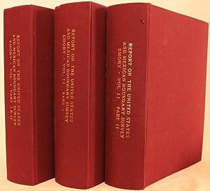
Report on the United States and Mexican Boundary Survey, made under the direction of the Secretary of the Interior, [&c.]. [First editions]. 1857 and 1859.
Published by A.O.P. Nicholson, printer, Washington, D.C., 1857
Book First Edition
Hardcover. Condition: Very Good. 1st Edition. Washington, three thick quarto volumes, with volume two in two volumes. The Senate edition. ***CONTENT: Volume I, part I: [General Report]: xvi, 258 p., 54 plates (12 colored), 4 maps/sections (3 folding), and 20 text woodcuts. Volume I, part II: [Geology and Palaeontology]: viii, 174 p., 21 plates of fossils, colored folding map, and 25 text woodcuts. Volume II, part I: [Botany, including Cactaceae]: [viii], [9]-270 p. and 61 botanical plates; [Cactaceae]: [ii], [3]-78 p. and 76 plates of cacti. Volume II, part II: [Zoology, including mammals, birds, reptiles and fishes]: [Mammals]: [vi], [ii], [ii], [3]-62 p. and 27 plates; [Birds]: [ii], [3]-32, [2] p. and 25 hand-colored plates; [Reptiles]: [ii], [3]-35, [1] p. and 41 plates; [Ichthyology]: [ii], [3]-85, [3], ii p. and 40 plates. This is one of the foundational works on the exploration and mapping of the U.S.-Mexican border. Major Emory was assigned to the Boundary Commission after the Mexican War by President Franklin Pierce. No sooner was the first survey completed, the Gadsden Purchase necessitated another survey, which is summarized in this work. Emory's report on the description of the region is accompanied by numerous scientific reports by John Torrey, James Hall, George Engelmann, T.A. Conrad, and others, as well as superb maps by Jekyll and Hall, and important views and plates after Schott, Weyss, and Vaudricourt. The commission undertook one of the first systematic studies of the topography, ethnology, and natural features of the area, and the boundary as surveyed has remained intact, with only minor alterations, for the last 164 years. These volumes contain more than 350 handsome plates, some lithographed in color, and including charts, maps, and profiles. This set contains the celebrated "general map", unfolding to 25 by 23 inches, showing the topography of the country from the Mississippi to the Pacific Ocean. Also present is the striking 24 by 22-inch geological map by James Hall and J.P. Lesley, the earliest colored geological map of the region. Of special note are 25 beautiful hand-colored plates of birds lithographed by Bowen & Company, included in Spencer Baird's report, "Birds of the Boundary", as well as handsome chromolithographic plates of Indians and scenery in volume one. ***CONDITION: This is a VG set bound in the original full tan leather; backstrips with maroon and black gilt-lettered calf title labels. The covers are clean and sound but are rubbed and mildly worn at the corners. Joints and hinges just starting in places, but strong; bindings very firm. The text pages are typically fresh, clean, and bright, cleaner than I have seen in other copies. The set is complete, save for plate 38 in volume three, a b/w plate of fishes, which was never bound in. Scattered foxing and offsetting on some plates, as usual, but the colored plates in volume one and the botanical and zoological plates in the other volumes are very clean. The 25 colored bird plates are pristine and most striking. The "general map" is in excellent condition, as is the hand-colored geological map. Old library bookplates on the front pastedowns and scant ownership markings internally; small old paper label on the backstrips of two of the volumes. Overall, this is a very nice set in its original state. BMNH 2178. Wagner-Camp 291. Nickles 379. These are heavy books and may require additional postage. International shipping will be extra, but only at my cost.
![Seller image for Report on the United States and Mexican Boundary Survey; Made Under the Direction of the Secretary of the Interior. Volume I. [FIRST EDITION] for sale by Uncharted Books](https://pictures.abebooks.com/inventory/md/md30669907960.jpg)

![Seller image for Report on the United States and Mexican Boundary Survey, made under the direction of the Secretary of the Interior, [&c.]. [First editions]. 1857 and 1859. for sale by Olde Geologist Books](https://pictures.abebooks.com/inventory/md/md31723838267.jpg)