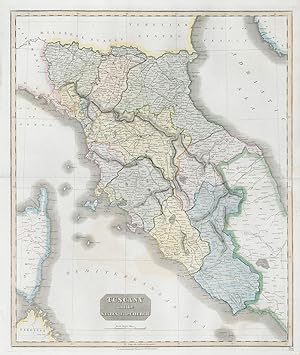
Tuscany and the States of the Church
Thomson, John
From
Antiqua Print Gallery, London, United Kingdom
Seller rating 4 out of 5 stars
![]()
AbeBooks Seller since January 14, 2022
About this Item
Description:
"Tuscany and the States of the Church". Papal States. THOMSON 1830 old map. Antique early 19th century atlas map with original hand colouring; Drawn & engraved by Nathaniel Robert Hewitt for John Thomson's "New General Atlas" (1830). 62.5 x 53.0cm, 24.75 x 20.75 inches; this is a folding map. Condition: Good. There is nothing printed on the reverse side, which is plain. Seller Inventory # P-8-001688
Bibliographic Details
Title: Tuscany and the States of the Church
Publication Date: 1830
Condition: Good
Top Search Results from the AbeBooks Marketplace
TUSCANY and the States of the Church. Plate 53.
Seller: Peter Harrington. ABA/ ILAB., London, United Kingdom
Handsome map of Tuscany, and the surrounding states, from Parma in the north to Rome in the south. Thomson's New General Atlas was one of the best produced atlases of the day. Copper engraving. Original outline colour. Fine condition. Size: 49.5 x 60 cm. Seller Inventory # 53816
Quantity: 1 available


