Items related to Rand McNally Street Map St. Louis, Missouri
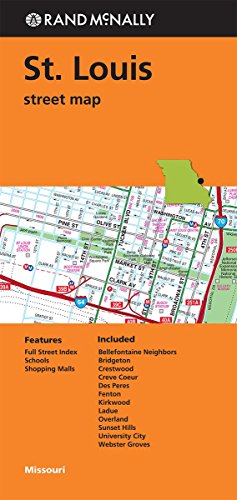

Rand McNally's folded map for St. Louis is a must-have for anyone traveling in and around this part of Missouri, offering unbeatable accuracy and reliability at a great price. Our trusted cartography shows all Interstate, U.S., state, and county highways, along with clearly indicated parks, points of interest, airports, county boundaries, and streets. The easy-to-use legend and detailed index make for quick and easy location of destinations. You'll see why Rand McNally folded maps have been the trusted standard for years.
Regularly updated
Full-color maps
Clearly labeled Interstate, U.S., state, and county highways
Indications of parks, points of interest, airports, county boundaries, downtown & vicinity maps
Major attractions & Golf Courses
Easy-to-use legend
Detailed index & Major Street Index
Convenient folded size
� 2014
Communities Included: Bellefontaine Neighbors, Bridgeton, Crestwood, Creve Coeur, Des Peres, Fenton, Kirkwood, Ladue, Overland, Sunset Hills, University City, Webster Groves
"synopsis" may belong to another edition of this title.
- PublisherRand McNally
- Publication date2014
- ISBN 10 0528008749
- ISBN 13 9780528008740
- BindingMap
(No Available Copies)
Search Books: Create a WantIf you know the book but cannot find it on AbeBooks, we can automatically search for it on your behalf as new inventory is added. If it is added to AbeBooks by one of our member booksellers, we will notify you!
Create a Want