Items related to Lochs and Glens North - Sustrans Cycle Route Map
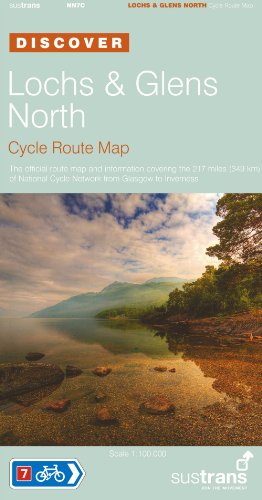

This is a cycling route map. "The Discover Series of Sustrans Official Cycle Route Maps" provide clearly mapped cycle routes on traffic-free paths, quiet lanes and traffic-calmed roads. They are easy to read contours and route profiles, and contain visitor information and detailed routes through towns. This is the Official Route Map covering the 217 miles of National Cycle Network from Glasgow to Inverness. Offered in a fold-out format, it is a full colour, waterproof map. It is presented in the scale of 1:100,000, and has a splash-proof plastic sleeve. National Route 7 from Glasgow to Inverness is a beautiful route passing through two National Parks. Loch Lomond and the Trossachs National Park contains lochs, forests and bustling towns. The Cairngorms National Park extends over the UK's largest mountain range. A traffic-free path takes you from Glasgow, along the rivers Clyde and Leven, to the shores of Loch Lomond. The route takes in the lochs of Drunkie, Venachar, Lubnaig, Earn and Tay. Glen Ogle with its old railway viaducts is one of the highlights of the route.
"synopsis" may belong to another edition of this title.
- PublisherSustrans
- Publication date1800
- ISBN 10 1901389626
- ISBN 13 9781901389623
- BindingPaperback
- Edition number2
(No Available Copies)
Search Books: Create a WantIf you know the book but cannot find it on AbeBooks, we can automatically search for it on your behalf as new inventory is added. If it is added to AbeBooks by one of our member booksellers, we will notify you!
Create a Want