Items related to Michelin Map Paris Transports #51 (Maps/City (Michelin))

Paris street map includes a booklet and folded map in one single product. The booklet contains a complete street plan and index showing main through-routes, one-way streets, car parks, public buildings and post offices. Its wide geographic coverage covers all Paris neighborhoods. Legend with symbols and abbreviations in 6 languages. Separate index. Useful telephone numbers. Scale 1:8,000 8 in = 1 mi.
"synopsis" may belong to another edition of this title.
- PublisherMichelin
- Publication date2012
- ISBN 10 2067150340
- ISBN 13 9782067150348
- BindingMap
- Number of pages1
Buy New
Learn more about this copy
US$ 4.17
Shipping:
US$ 85.35
From Spain to U.S.A.
Top Search Results from the AbeBooks Marketplace
Seller Image
PLANO PARIS TRANSPORTS
Seller:
Rating
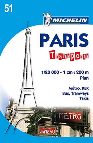
Book Description Otros. Condition: Nuevo. Dust Jacket Condition: Nuevo. Gracias a su escala 1/20 000 (1 cm = 200m), el plano MICHELIN Paris Transports proporciona una cartograf�a precisa para desplazarse en transporte p�blico por los principales ejes de la ciudad. Incluye paradas de taxi, planos de metro, de cercan�as (RER), de autobus y las l�neas de transporte fluvial de pasajeros (Batobus). Preciso y de f�cil lectura, este plano es la referencia para utilizar los transportes parisinos. Incluye leyenda de signos convencionales en ingl�s y franc�s. LIBRO. Seller Inventory # 248231
Buy New
US$ 4.17
Convert currency