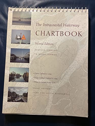
The Intracoastal Waterway Chartbook: Norfolk, Virginia, to Miami, Florida, 2/e - Softcover

Complete set of charts and facilities listings for all 1,090 miles of the ICW from Norfolk to Miami. Describes marinas, inlets, anchorages, bridges, locks. Great value, well organized. Updated through 1994.
"synopsis" may belong to another edition of this title.
From the Back Cover:
The Intracoastal Waterway Chartbook is a complete set of navigation charts for the 1,090-mile Intracoastal Waterway from Norfolk to Miami, as well as charts for all major Atlantic inlets. (You'd spend over 350 to purchase the same coverage in government charts and publications.) The chartbook also includes a complete listing of waterway bridge and lock characteristics, anchorage listings, a waterway facilities listing, pilotage notes, mileage charts, and even charts for a picturesque alternate route, all in a compact, easy-to-use format. The chartbook can easily be held in one hand or propped in front of the steering station. Statute miles are noted in five-mile increments in the chart margins, along with bridge, lock, and anchorage locations. there's a handy place-name index, making it even easier to find the chart with your destination on it. For an ideal companion to The Intracoastal Waterway Chartbook, try The Intracoastal Waterway, Norfolk to Miami: A Cockpit Cruising Handbook, Fourth Edition, by Jan and Bill Moeller (International Marine, 1997). The Intracoastal Waterway Chartbook is a complete set of navigation charts for the 1,090-mile Intracoastal Waterway from Norfolk to Miami, as well as charts for all major Atlantic inlets. (You'd spend over 350 to purchase the same coverage in government charts and publications.) The chartbook also includes a complete listing of waterway bridge and lock characteristics, anchorage listings, a waterway facilities listing, pilotage notes, mileage charts, and even charts for a picturesque alternate route, all in a compact, easy-to-use format. The chartbook can easily be held in one hand or propped in front of the steering station. Statute miles are noted in five-mile increments in the chart margins, along with bridge, lock, and anchorage locations. There's a handy place-name index, making it even easier to find the chart with your destination on it. For an ideal companion to The Intracoastal Waterway Chartbook, try The Intracoastal Waterway, Norfolk to Miami: A Cockpit Cruising Handbook, Fourth Edition, by Jan and Bill Moeller (International Marine, 1997).
About the Author:
John and Leslie Kettlewell have cruised the waters between Labrador and the Caribbean for more than 25 years, often living aboard for extended periods of time.
"About this title" may belong to another edition of this title.
- PublisherIntl Marine Pub
- Publication date1995
- ISBN 10 0070343004
- ISBN 13 9780070343009
- BindingPaperback
- Edition number2
- Number of pages265
- EditorLeslie Kettlewell
- Rating
Other Popular Editions of the Same Title
Top Search Results from the AbeBooks Marketplace

Stock Image
The Intracoastal Waterway Chartbook: 2nd edition, Norfolk, Va to Miami, Fl
Published by
International Marine, Camden, Maine
(1995)
ISBN 10: 0070343004
ISBN 13: 9780070343009
Used
Soft cover
Quantity: 1
Seller:
Rating
Book Description Soft cover. Condition: Very Good. A 265 page book "The Intracoastal Waterway Chartbook" is a complete set of Navigation Charts for the 1,090 mile Waterway from Norfolk to Miami. It also includes charts for the major inlets between the Waterway and the Atlantic Ocean. It would have cost more than $350.00 in 1995 dollars to purchase the same coverage in government charts and publications. A previous owner has highlighted many bridges in yellow; statute miles in blue; green markers in green, red markers in red and anchorage in orange. Some text is highlighted in light yellow. The work is held together by 21 wire binders at the page tops. Apparently the last name of the prior owner was Kokomo and this is etched (but does not go through to the other side) at the upper right hand corner of the front cover. You must hold it to light at the correct angle to see the name. The back cover has an area in the middle where a sticker of some sort has apparently been removed. Condition is better than it sounds. All in all, this is a highly useful copy; available for immediate shipment, carefully packed in a sturdy box! bx109. Seller Inventory # 013986
Buy Used
US$ 69.99
Convert currency
Stock Image
The Intracoastal Waterway Chartbook: Norfolk, Virginia, to Miami, Florida, 2/e
Published by
Intl Marine Pub
(1995)
ISBN 10: 0070343004
ISBN 13: 9780070343009
Used
Paperback
Quantity: 1
Seller:
Rating
Book Description Paperback. Condition: Very Good. Very Good. book. Seller Inventory # D8S0-3-M-0070343004-4
Buy Used
US$ 107.77
Convert currency