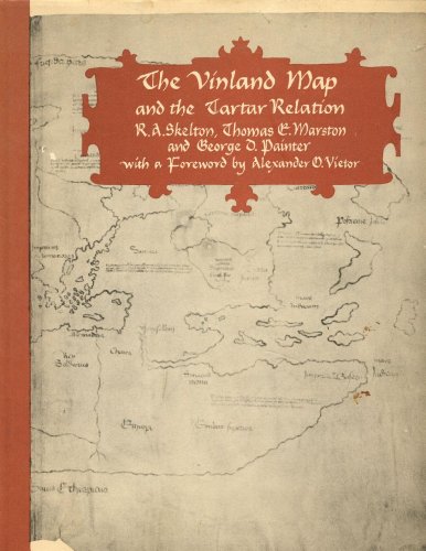
The Vinland map: And the Tartar relation, - Hardcover

NOT ex-library. Very light edgewear & rubbing, tight and clean.
"synopsis" may belong to another edition of this title.
From the Back Cover:
The Vinland Map, dated to about A.D. 1440 - at least fifty years before Columbus landed in the Americas - is a unique map of the world that shows an outline of the northeast American coast and a legend describing its discovery in about 1000 by Leif Eiriksson, the Norseman from Greenland. The map was published by Yale University Press in 1965 and generated an enormous amount of debate. Chemical analysis of the ink later suggested that the map might be a forgery, but recent appraisals of both scientific and humanist evidence argue that it is indeed authentic. Now, on the thirtieth anniversary of its original publication, here is this classic of historical cartography in a new edition. It reprints unaltered the original text on the Vinland Map and an account of Friar John of Plano Carpini's mission to the Mongols from 1245 to 1247 (the Tartar Relation), with which the map had at some stage been bound. To this have been added a new introduction by George D. Painter, sole survivor of the original team of editors, who discusses the verification of the map's authenticity; a new essay by Wilcomb E. Washburn, director of the Smithsonian's American Studies Program, on the map's provenance and scientific testing; and a new discussion of the map's compositional and structural aspects by Thomas A. Cahill and Bruce H. Kusko, of the Crocker Historical and Archaeological Projects at the University of California, Davis. There is also an account by the rare-book dealer Laurence C. Witten II, who died while this new edition was in preparation, of his acquisition of the map in 1957.
About the Author:
The late R. A. Skelton was superintendent of the Map Room of the British Museum. The late Thomas E. Marston was curator of medieval and renaissance literature at the Yale University Library. George D. Painter is assistant keeper emeritus of printed books at the British Museum and the author of Marcel
Proust: A Biography.
Proust: A Biography.
"About this title" may belong to another edition of this title.
- PublisherYale University Press
- Publication date1965
- ISBN 10 1125950528
- ISBN 13 9781125950524
- BindingHardcover
- Number of pages291
- Rating
Top Search Results from the AbeBooks Marketplace

Stock Image
The Vinland map: And the Tartar relation,
Published by
Yale University Press
(1965)
ISBN 10: 1125950528
ISBN 13: 9781125950524
Used
Hardcover
Quantity: 3
Seller:
Rating
Book Description Condition: Good. Former library book; may include library markings. Used book that is in clean, average condition without any missing pages. Seller Inventory # GRP95453239
Buy Used
US$ 7.73
Convert currency
Stock Image
The Vinland map: And the Tartar relation,
Published by
Yale University Press
(1965)
ISBN 10: 1125950528
ISBN 13: 9781125950524
Used
Hardcover
Quantity: 1
Seller:
Rating
Book Description Condition: Good. Used book that is in clean, average condition without any missing pages. Seller Inventory # 9804510-6
Buy Used
US$ 7.73
Convert currency