Texas Land Survey Maps for Hardin County - Softcover
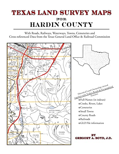

174 pages with 53 maps An indispensable book for any researcher interested in Hardin County's history or land (or both), or its first landowners after Texas's Independence from Mexico. Each book in this series is laid out into multiple maps using a 6 mile high by 4 mile wide grid.This book contains 48 Survey maps laid out within this grid. Each Land Survey Map shows the boundaries of original parcels laid out over existing roads, railroads, waterways. These are shown as well as the original Survey-Name and the Abstract Number assigned by the Texas General Land Office to the instrument that gave ownership to that parcel. Here are a number of details about our Hardin County book . . . Supplemental Maps Included (in addition to the primary Survey Maps) . . . - Where Hardin County Lies Within the State (Map A) - Hardin County and its Surrounding Counties (Map B) - An Index Map showing where each of the Land Survey Maps are within Hardin County (Map C) - An Index Map that builds upon Map C and shows the community-center points in relationship to the county-grid (Map D) - An Index Map that builds upon Map C and shows cemeteries listed in the USGS database in relationship to the county-grid (Map E) Primary Indexes (apart from each Survey-Map's own index of survey-names) - An All-Name Index (alphabetical by last-name) for every person mentioned in the maps, utilizing both Texas General Land Office and Texas Railroad Commission data. - The Abstract Listing: this is where you find the real details behind each parcel of land.Items are listed by Abstract Number What Cities and Towns are in Hardin County, Texas (and in this book)? Batson, Bragg, Dies, Fletcher, Fresenius, Gore Landing, Grayburg, Hathaway, Honey Island, Kountze, Lelavale, Lillard, Loeb, Lumberton, Nona, Pine Ridge, Pinewood Estates, Rattlesnake Bead, Rose Hill Acres, Saratoga, Seth, Silsbee, Sour Lake, Strain, Thicket, Village Mills, Votaw, Wildwood, Woodcrest Acres
"synopsis" may belong to another edition of this title.
- PublisherArphax Publishing Co.
- Publication date2010
- ISBN 10 1420350374
- ISBN 13 9781420350371
- BindingPaperback
- Number of pages182
Buy New
Learn more about this copy
US$ 29.40
Shipping:
FREE
Within U.S.A.
Top Search Results from the AbeBooks Marketplace
Seller Image
Texas Land Survey Maps for Hardin County (Paperback or Softback)
Published by
Arphax Publishing Co. 5/20/2010
(2010)
ISBN 10: 1420350374
ISBN 13: 9781420350371
New
Paperback or Softback
Quantity: 5
Seller:
Rating
Book Description Paperback or Softback. Condition: New. Texas Land Survey Maps for Hardin County 0.97. Book. Seller Inventory # BBS-9781420350371
Buy New
US$ 29.40
Convert currency
Stock Image
Texas Land Survey Maps for Hardin County
Published by
Arphax Publishing Co.
(2010)
ISBN 10: 1420350374
ISBN 13: 9781420350371
New
Softcover
Quantity: > 20
Seller:
Rating
Book Description Condition: New. Seller Inventory # ABLIING23Mar2411530198462
Buy New
US$ 27.36
Convert currency
Stock Image
Texas Land Survey Maps for Hardin County
Published by
Arphax Publishing Co.
(2010)
ISBN 10: 1420350374
ISBN 13: 9781420350371
New
Paperback / softback
Quantity: > 20
Seller:
Rating
Book Description Paperback / softback. Condition: New. This item is printed on demand. New copy - Usually dispatched within 5-9 working days. Seller Inventory # C9781420350371
Buy New
US$ 41.21
Convert currency