
Order Total (1 Item Items):
Shipping Destination:

Collins Road Atlas Britain by Harpercollins (19 results)
Skip to main search results
Product Type
- All Product Types
- Books (19)
- Magazines & Periodicals
- Comics
- Sheet Music
- Art, Prints & Posters
- Photographs
- Maps
-
Manuscripts &
Paper Collectibles
Condition
Binding
Collectible Attributes
- First Edition
- Signed
- Dust Jacket
- Seller-Supplied Images (5)
- Not Printed On Demand
Free Shipping
Seller Location
Seller Rating
-
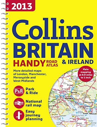
2013 Collins Handy Road Atlas Britain
Published by HarperCollins UK, 2012
ISBN 10: 0007468660ISBN 13: 9780007468669
Book
Paperback. Condition: Very Good. The book has been read, but is in excellent condition. Pages are intact and not marred by notes or highlighting. The spine remains undamaged.
More buying choices from other sellers on AbeBooks
Used offers from US$ 1.00
-
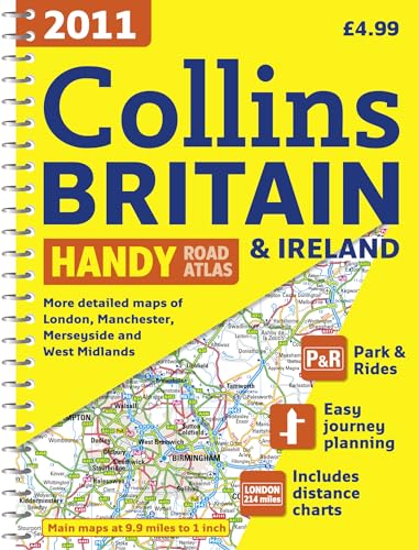
2011 Collins Handy Road Atlas Britain
Published by HarperCollins UK, 2010
ISBN 10: 0007320515ISBN 13: 9780007320516
Book
Paperback. Condition: Very Good. The book has been read, but is in excellent condition. Pages are intact and not marred by notes or highlighting. The spine remains undamaged.
More buying choices from other sellers on AbeBooks
Used offers from US$ 1.00
-
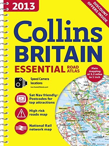
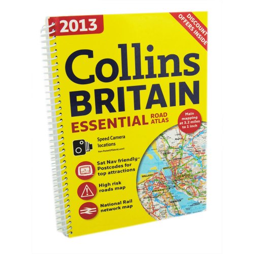
2013 Collins Essential Road Atlas Britain
Published by HarperCollins Publishers, United Kingdom, London, 2012
ISBN 10: 000746861XISBN 13: 9780007468614
Book
Paperback. Condition: Very Good. This A4 format road atlas with popular lie-flat spiral binding features clear, detailed road mapping, at a scale of 3.2 miles to 1 inch, with land height shown by attractive layer colouring. There are also a wide range of urban area approach maps at a larger scale as well as fully indexed street maps of 64 town centres. This handy A4 sized spiral road atlas covers the whole of Britain at a selection of useful scales. Its size makes it ideal for use in the car as well as the home or office. Each scale of mapping is colour coded for ease of use, from the smallest scale maps which are great for route planning, to the main road maps and more detailed urban area approach maps to the largest scale town centre street maps to help you locate your final destination. The atlas includes: * Fully updated fixed speed camera sites with average speed camera locations clearly highlighted. All speed cameras show the speed limit. Route planning section including maps for long distance route planning, motorway services information and a handy distance calculator chart. Easy to use, clear road maps at a scale of 3.2 miles to 1 inch (1:200,000) for England, Wales and Southern Scotland and at 4.2 miles to 1 inch (1:266,000) in Northern Scotland. 26 urban area approach maps at a larger scale which clearly show the best routes through and into the busiest built-up-areas. 64 street maps focused on town centres showing places of interest, car park locations and one-way streets. All the street maps are fully indexed. National rail map for planning your complete journey. Over 30 categories of places of interest including castles, theme parks, sports venues, universities, mountain bike trails and surfing beaches. The top 1000 most visited places of interest are indexed with full postcodes to aid integration with satnav systems. This the ideal purchase for drivers, navigators and route planners who want the very best road atlas of Britain in an A4 format. The book has been read, but is in excellent condition. Pages are intact and not marred by notes or highlighting. The spine remains undamaged.
More buying choices from other sellers on AbeBooks
Used offers from US$ 1.55
-
Collins - Britain Essential Road Atlas
Published by Harper Collins
ISBN 10: 0007920628ISBN 13: 9780007920624
Book
Paperback. Condition: Very Good. The book has been read, but is in excellent condition. Pages are intact and not marred by notes or highlighting. The spine remains undamaged.
More buying choices from other sellers on AbeBooks
New offers from US$ 394.35
Used offers from US$ 2.04
Also find Softcover
-
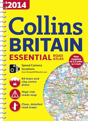
2014 Collins Essential Road Atlas Britain
Published by HarperCollins Publishers Limited, 2013
ISBN 10: 0007497091ISBN 13: 9780007497096
Book
Condition: Good. 2014 ed. Used book that is in clean, average condition without any missing pages.
More buying choices from other sellers on AbeBooks
Used offers from US$ 9.62
-
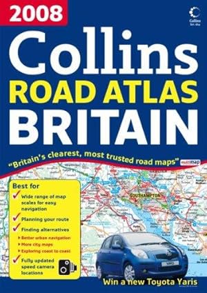
2008 Collins Road Atlas Britain
Published by Collins, 2007
ISBN 10: 0007250509ISBN 13: 9780007250509
Book
Condition: Good. Most items will be dispatched the same or the next working day. A copy that has been read but remains in clean condition. All of the pages are intact and the cover is intact and the spine may show signs of wear. The book may have minor markings which are not specifically mentioned.
More buying choices from other sellers on AbeBooks
Used offers from US$ 2.10
-
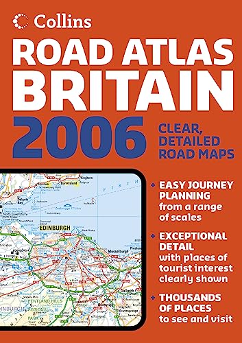
Collins Road Atlas Britain
Published by Collins, 2005
ISBN 10: 0007214553ISBN 13: 9780007214556
Book
Condition: Very Good. 1710247988. 3/12/2024 12:53:08 PM.
-
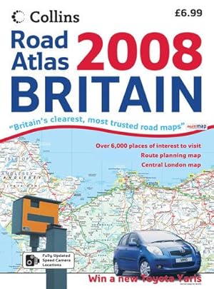
Collins 2008 Road Atlas Britain
Published by Collins, 2007
ISBN 10: 0007795246ISBN 13: 9780007795246
Book
Condition: Good. Most items will be dispatched the same or the next working day. A copy that has been read but remains in clean condition. All of the pages are intact and the cover is intact and the spine may show signs of wear. The book may have minor markings which are not specifically mentioned.
More buying choices from other sellers on AbeBooks
Used offers from US$ 3.55
-

Collins Road Atlas: Great Britain
Published by HarperCollins Publishers, 1987
ISBN 10: 0004476417ISBN 13: 9780004476414
Book
Hardcover. Condition: Good. No Jacket. Pages can have notes/highlighting. Spine may show signs of wear. ~ ThriftBooks: Read More, Spend Less 1.01.
-
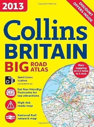
2013 Collins Big Road Atlas Britain (International Road Atlases)
Published by Collins, 2012
ISBN 10: 0007468598ISBN 13: 9780007468591
Book
Condition: Good. Most items will be dispatched the same or the next working day.
-
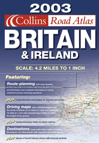
Collins Road Atlas Britain and Ireland 2003
Published by Collins, 2003
ISBN 10: 0007141416ISBN 13: 9780007141418
Seller: J J Basset Books, bassettbooks, bookfarm.co.uk, Peter Tavy, United Kingdom
Seller Rating:

Book
Glossy Card. Condition: VERY GOOD ( AVERAGE). No Jacket. Colour Maps (illustrator). 2003 Edition. POSTED AT OUR STANDARD RATES FULLY INSURED (UK) ONLY . Please email for further details. Size: 4to - over 9�" - 12". Not Inscribed or Signed. CARD COVERED PAPERBACK.