The Rideau Route . Exploring the Pre-Canal Waterway - Softcover

- PublisherSelf-published
- Publication date2007
- ISBN 10 0978075110
- ISBN 13 9780978075118
- BindingPaperback
- Edition number1
Top Search Results from the AbeBooks Marketplace

Stock Image
The Rideau Route . Exploring the Pre-Canal Waterway
Published by
Self-published
(2007)
ISBN 10: 0978075110
ISBN 13: 9780978075118
Used
Paperback
Quantity: 1
Seller:
Rating
Book Description Paperback. Condition: Fair. No Jacket. Readable copy. Pages may have considerable notes/highlighting. ~ ThriftBooks: Read More, Spend Less 1.05. Seller Inventory # G0978075110I5N00
Buy Used
US$ 27.07
Convert currency
Seller Image
THE RIDEAU ROUTE: EXPLORING THE PRE-CANAL WATERWAY
Published by
Published by the Author, Elgin, ON
(2007)
ISBN 10: 0978075110
ISBN 13: 9780978075118
Used
Soft cover
First Edition
Quantity: 1
Seller:
Rating
Book Description Soft cover. Condition: Near Fine. 1st Edition. pp: 146. FIRST EDITION. The story of the original water route along the Rideau River that disappeared with the flooding of the Rideau Canal. The canal dams, built between 1826 and 1831, flooded the surrounding area, and three watersheds; the Rideau River, The Gananoque River, and the Cataraqui River. The author takes a journey along the route that was surveyed for the first time in 1783 by Lieut. Gershom French. Watson combines this survey with others done in 1816 and 1824 to reveal the pre-canal landscape. The book is illustrated with detailed maps, photographs, and drawings. The appendices contain a discussion of the research, a chronology and history of the route, and a list of Rideau geographic place names. A near fine copy. There is a medallion of a previous owner on the title page. Seller Inventory # 006360
Buy Used
US$ 33.91
Convert currency
Seller Image
The Rideau Route Exploring the Pre-Canal Waterway
Published by
Self Published, Elgin, Ontario
(2007)
ISBN 10: 0978075110
ISBN 13: 9780978075118
Used
Softcover
First Edition
Quantity: 1
Seller:
Rating
Book Description Softcover. Condition: Very Good-. First Edition. 146 pp. Photos. Maps. Bibliography. Light edgewear, corners rubbed. Provides a unique look at the drowned landscape of the original Rideau Route, the route spanning three watersheds, prior to the building of the canal. Takes you on a canoe trip along the route, describing the landscape as it was in 1783, before any European settlement. ; 4to 11" - 13" tall. Seller Inventory # CAN2170
Buy Used
US$ 75.00
Convert currency
Stock Image
The Rideau Route : Exploring the Pre-Canal Waterway
Published by
Self-published
(2007)
ISBN 10: 0978075110
ISBN 13: 9780978075118
Used
Soft cover
First Edition
Quantity: 1
Seller:
Rating
Book Description Soft cover. Condition: Very Good. 1st Edition. 146pp. Profusely illus bw. Clean, bright, and unmarked. Maps. Binding remains solid; clean and bright with no underlining; no exterior flaws. Out of print. Seller Inventory # ABE-1676257340885
Buy Used
US$ 95.00
Convert currency
Stock Image
The Rideau Route: Exploring the Pre-Canal Waterway
Published by
Self-published, Elgin, ON
(2007)
ISBN 10: 0978075110
ISBN 13: 9780978075118
Used
Paperback
First Edition
Quantity: 1
Seller:
Rating
Book Description Paperback. Condition: Fine. 1st. First printing. 146 pp., photos, many maps, appendices, biblio, oversized softcover. Fine copy with slightest wear to covers. Rare book. Seller Inventory # 788003
Buy Used
US$ 95.00
Convert currency
Seller Image
The Rideau Route: Exploring the Pre-Canal Waterway
Published by
Self-Published, Canada
(2007)
ISBN 10: 0978075110
ISBN 13: 9780978075118
Used
Paperback
First Edition
Signed
Quantity: 1
Seller:
Rating
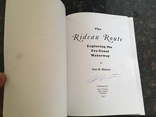
Book Description Paperback. Condition: Very Good. First Edition. Signed, without inscription, by author upon title page. 146 pages. Bibliography. "Takes the reader on a 1783 canoe trip along the Rideau Route, revealing the landscape as it appeared prior to any European settlement. Transcriptions and maps of Lt. French's 1783 survey, as well as those of Lt. Joshua Jebb in 1816 and Samuel Clowes in 1823-24, are included as first hand accounts of the route. This newly revealed pre-canal engineering achievement will allow readers to better understand and appreciate the enormous engineering achievement of the Rideau Canal. Profusely illustrated with maps and period paintings." - from back cover. Clean and unmarked with light wear. A quality copy. Signed by Author(s). Seller Inventory # 228h2062
Buy Used
US$ 149.95
Convert currency