Family Maps of Dallas County, Missouri - Softcover
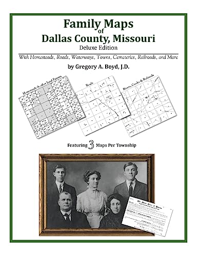

252 pages with 53 total maps Locating original landowners in maps has never been an easy task-until now. This volume in the Family Maps series contains newly created maps of original landowners (patent maps) in what is now Dallas County, Missouri, gleaned from the indexes of the U.S. Bureau of Land Management. But it offers much more than that. For each township in the county, there are two additional maps accompanying the patent map: a road map and a map showing waterways, railroads, and both modern and many historical city-centers and cemeteries. Included are indexes to help you locate what you are looking for, whether you know a person's name, a last name, a place-name, or a cemetery. The combination of maps and indexes are designed to aid researchers of American history or genealogy to explore frontier neighborhoods, examine family migrations, locate hard-to-find cemeteries and towns, as well as locate land based on legal descriptions found in old documents or deeds. The patent-maps are essentially plat maps but instead of depicting owners for a particular year, these maps show original landowners, no matter when the transfer from the federal government was completed. Dates of patents typically begin near the time of statehood and run into the early 1900s. What's Mapped in this book (that you'll not likely find elsewhere) . . . 5190 Parcels of Land (with original landowner names and patent-dates labeled in the relevant map) 29 Cemeteries plus . . . Roads, and existing Rivers, Creeks, Streams, Railroads, and Small-towns (including some historical), etc. What YEARS are these maps for? Here are the counts for parcels of land mapped, by the decade in which the corresponding land patents were issued: Decade Parcel-count 1840s 442 1850s 1595 1860s 744 1870s 684 1880s 195 1890s 560 1900s 829 1910s 128 1920s 2 1930s 2 1940s 4 1980s 4 1990s 1 What Cities and Towns are in Dallas County, Missouri (and in this book)? Berry Ford (historical), Brittain, Buffalo, Cedar Ridge, Celt, Charity, Cloverdale, Corkery, Dallion Ford (historical), Earnestville, Elixer, Foose, Gaunt Ford (historical), Hackler Ford (historical), Handley, Herrick Ford, Hico (historical), Leadmine, Limekiln Ford (historical), Long Lane, Louisburg, March, Mathis, McPheters Ford (historical), Miller Ford (historical), Olive, Plad, Pumpkin Center, Ralphwhite Ford (historical), Redtop, Reynolds, Shady Grove, Spring Grove, Thorpe, Tilden, Tunas, Turner Ford (historical), Urbana, Wall Street, Westfield, Windyville, Wood Hill
"synopsis" may belong to another edition of this title.
- PublisherArphax Publishing Co.
- Publication date2010
- ISBN 10 1420314807
- ISBN 13 9781420314809
- BindingPaperback
- Number of pages260
Buy New
Learn more about this copy
US$ 32.13
Shipping:
US$ 3.99
Within U.S.A.
Top Search Results from the AbeBooks Marketplace
Stock Image
Family Maps of Dallas County, Missouri
Published by
Arphax Publishing Co.
(2010)
ISBN 10: 1420314807
ISBN 13: 9781420314809
New
Softcover
Quantity: > 20
Seller:
Rating
Book Description Condition: New. Seller Inventory # ABLIING23Mar2411530198359
Buy New
US$ 32.13
Convert currency
Stock Image
Family Maps of Dallas County, Missouri
Published by
Arphax Publishing Co.
(2010)
ISBN 10: 1420314807
ISBN 13: 9781420314809
New
Paperback / softback
Quantity: > 20
Seller:
Rating
Book Description Paperback / softback. Condition: New. This item is printed on demand. New copy - Usually dispatched within 5-9 working days. Seller Inventory # C9781420314809
Buy New
US$ 49.87
Convert currency