About this Item
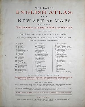
Folio (22 1/2 x 15 1/4 in.; 57.2 x 38.7 cm). Title printed in red and black incorporating general index, 50 engraved maps on 47 double-folding sheets, hand-colored in outline, with cartouches, vignettes, and inset plans, mounted on guards. BINDING/CONDITION: Map of Kent with centerfold split, England & Wales, Suffolk, Oxfordshire and Surrey with shorter splits. Contemporary calf, red morocco spine label, extremities worn with some tears, joints split, upper cover nearly detached. (64F5C) Emanuel Bowen's contribution to eighteenth-century British atlases is substantial. Using contemporary sources, he published and drew maps the county maps in his "Large English Atlas," the first to cover England and Wales on a large scale, which were subsequently reduced by Bowen and Kitchin for their "Royal English Atlas" and then by Emanuel and Thomas Bowen for "Atlas Anglicanus," published after Emanuel Bowen's death by Kitchin. "All three works are characterized by detailed texts in the spaces surrounding the maps and by elegant rococo decoration, which became the hallmark of his engraving" (DNB). PROVENANCE: Bonham's London, 7 March 2019, lot 59. REFERENCE: Chubb CXCVII. Seller Inventory # 65ERM0062
Contact seller
Report this item
Bibliographic Details
Title: The Large English Atlas, or, a New Set of ...
Publisher: London: Printed and Sold by T. Bowles, in St. Paul's Church-Yard; John Bowles, at the Black Horse, in Cornhill; and Robert Sayer, at the Buck, in Fleet-Street, [1763]
![]()


