
Order Total (1 Item Items):
Shipping Destination:

Spot X (32 results)
Skip to main search results
Product Type
- All Product Types
- Books (32)
- Magazines & Periodicals
- Comics
- Sheet Music
- Art, Prints & Posters
- Photographs
- Maps
-
Manuscripts &
Paper Collectibles
Condition
Binding
- All Bindings
- Hardcover
- Softcover (20)
Collectible Attributes
- First Edition
- Signed
- Dust Jacket
- Seller-Supplied Images (1)
- Not Printed On Demand
Seller Location
Seller Rating
-

Spot X Nelson and Marlborough Sounds (Folded)
Published by Spot X Publications Ltd, Auckland, 2004
ISBN 10: 1877374210ISBN 13: 9781877374210
Book
Folded. Condition: new. Folded. Map covers Cape Farewell in the north to Queen Charlotte Sound in the south. The fishing Consultant for this chart is Ross Woodhouse a surf and rock fisherman based in Nelson. This map includes a close up of the fishing spots, fitness and skill level required to fish each spot with tips on access and fishing. The map also shows the location of camp grounds. Water proof, Tear proof. Shipping may be from our Sydney, NSW warehouse or from our UK or US warehouse, depending on stock availability.
More buying choices from other sellers on AbeBooks
New offers from US$ 17.08
-

Auckland Surfcasting Map (Paperback)
Published by Spot X Publications Ltd, Auckland, 2004
ISBN 10: 1877374164ISBN 13: 9781877374166
Book
Paperback. Condition: new. Paperback. The ap covers from a line between Takatu and the Kaipara Harbours South Head in the north to the Waikato River in the south. The fishing Consultant for this chart is Lance Pulman a highly respected surf, rock and land based game fisherman who works in an Auckland tackle shop. This map includes a close up of the fishing spots, fitness and skill level required to fish each spot with tips on access and fishing. The map also shows the location of camp grounds. Water proof, Tear proof. Folds out from a handy pocket size to a manageable (A2) size. Shipping may be from our Sydney, NSW warehouse or from our UK or US warehouse, depending on stock availability.
More buying choices from other sellers on AbeBooks
New offers from US$ 17.08
-

Outer Islands-Hauraki Gulf Fishing Spots (Paperback)
Published by Spot X Publications Ltd, Auckland, 2004
ISBN 10: 1877374075ISBN 13: 9781877374074
Book
Paperback. Condition: new. Paperback. Hydrographic chart covers the Hen & Chicken Islands, Mokohinau Islands and Little Barrier. The fishing Consultant for this chart is Allan Merritt, skipper of RNR Charters, a very successful charter boat operating out of Mangawai Harbour. 24 fishing spots reviewed with GPS marks, illustration of recommended boat position, target species, bait, rig and best conditions with fishing technique tips. Plus an additional 16 fishing spots. Chart includes anchorages. Water proof, Tear proof. Folds out from a handy pocket size to a manageable (A2) size. Shipping may be from our Sydney, NSW warehouse or from our UK or US warehouse, depending on stock availability.
More buying choices from other sellers on AbeBooks
New offers from US$ 17.08
-
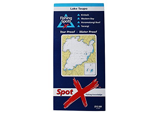
Lake Taupo Fishing Spots (Folded)
Published by Spot X Publications Ltd, Auckland, 2004
ISBN 10: 1877374083ISBN 13: 9781877374081
Book
Folded. Condition: new. Folded. Provides fishing tips and lists target species and jigging spots. Provides fishing tips and lists target species and jigging spots. Shipping may be from our Sydney, NSW warehouse or from our UK or US warehouse, depending on stock availability.
More buying choices from other sellers on AbeBooks
New offers from US$ 17.08
-
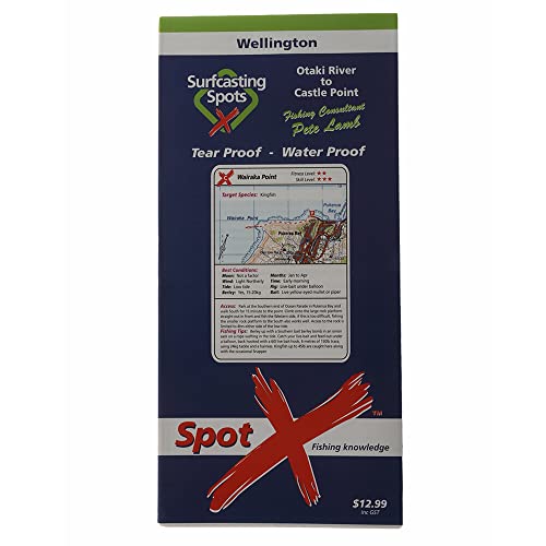
Spot X Wellington Surfcasting Map (Paperback)
Published by Spot X Publications Ltd, Auckland, 2004
ISBN 10: 1877374202ISBN 13: 9781877374203
Book
Paperback. Condition: new. Paperback. Map covers a line between Otaki and the Castle Point in the north to Wellington in the south. The fishing Consultant for this chart is Pete Lamb, a surf, rock and land based game fishing guide, skipper of Melicent a very successful Wellington based charter boat and owner operator of a bait and tackle shop in Rongotai. This map includes a close up of the fishing spots, fitness and skill level required to fish each spot with tips on access and fishing. The map also shows the location of camp grounds. Water proof, Tear proof. Folds out from a handy pocket size to a manageable (A2) size. Shipping may be from our Sydney, NSW warehouse or from our UK or US warehouse, depending on stock availability.
-
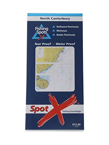
Spot X Banks Peninsula Chart (Paperback)
Published by Spot X Publications Ltd, Auckland, 2004
ISBN 10: 1877374148ISBN 13: 9781877374142
Book
Paperback. Condition: new. Paperback. Hydrographic chart covers Kiakoura Peninsula in the north to Banks Peninsula in the south. The fishing Consultant for this chart is Brian Jennings, skipper of Abundance a very successful charter boat operating out of Banks Peninsular. 20 fishing spots reviewed with GPS marks, illustration of recommended boat position, target species, bait, rig and best conditions with fishing technique tips. Chart includes a review on local boat ramps and the location of camp grounds. Water proof, Tear proof. Folds out from a handy pocket size to a manageable (A2) size. Shipping may be from our Sydney, NSW warehouse or from our UK or US warehouse, depending on stock availability.
More buying choices from other sellers on AbeBooks
New offers from US$ 19.46
-

Spot X W Coast Pt Waikato Wanganui Surfc (Paperback)
Published by Spot X Publications Ltd, Auckland, 2004
ISBN 10: 1877374172ISBN 13: 9781877374173
Book
Paperback. Condition: new. Paperback. Map covers Waikato River in the north to Cape Egmont in the south. The fishing Consultant for this chart is Paul Shaw a surf, rock and land based game fisherman who has been brought up on the West coast beaches. This map includes a close up of the fishing spots, fitness and skill level required to fish each spot with tips on access and fishing. The map also shows the location of camp grounds. Water proof, Tear proof. Folds out from a handy pocket size to a manageable (A2) size. Shipping may be from our Sydney, NSW warehouse or from our UK or US warehouse, depending on stock availability.
More buying choices from other sellers on AbeBooks
New offers from US$ 19.46
-

Bay of Islands Chart (Folded)
Published by Spot X Publications Ltd, Auckland, 2004
ISBN 10: 1877374016ISBN 13: 9781877374012
Book
Folded. Condition: new. Folded. Hydrographic chart covers Lion Rocks, in the north Keri Keri and the Bay down to Whangamumu. The fishing Consultant for this chart is Dave Arrell, skipper of Double Strike a very successful charter boat operating out of Whangaroa Harbour. 21 fishing spots reviewed with GPS marks, illustration of recommended boat position, target species, bait, rig and best conditions with fishing technique tips. Plus an additional 26 fishing spots. Chart includes a review on local boat ramps and the location of camp grounds, public toilets and marinas. Water proof, Tear proof. Folds out from a handy pocket size to a manageable (A2) size. Shipping may be from our Sydney, NSW warehouse or from our UK or US warehouse, depending on stock availability.
More buying choices from other sellers on AbeBooks
New offers from US$ 19.46
-

Spot X Cavalli Islands Whangaroa Chart (Paperback)
Published by Spot X Publications Ltd, Auckland, 2004
ISBN 10: 1877374008ISBN 13: 9781877374005
Book
Paperback. Condition: new. Paperback. Hydrographic chart covers Whangaroa Harbour, Stephenson Island and the Cavalli Islands. The fishing Consultant for this chart is Dave Arrell, skipper of Double Strike a very successful charter boat operating out of Whangaroa Harbour. 21 fishing spots reviewed with GPS marks, illustration of recommended boat position, target species, bait, rig and best conditions with fishing technique tips. Plus an additional 20 fishing spots. Chart includes a review on local boat ramps and the location of camp grounds, public toilets, the marina and fuel pumps. Waterproof, Tear proof. Folds out from a handy pocket size to a manageable (A2) size. Shipping may be from our Sydney, NSW warehouse or from our UK or US warehouse, depending on stock availability.
More buying choices from other sellers on AbeBooks
New offers from US$ 19.46
-

Spot X Canterbury Surcasting Map (Paperback)
Published by Spot X Publications Ltd, Auckland, 2004
ISBN 10: 1877374229ISBN 13: 9781877374227
Book
Paperback. Condition: new. Paperback. Map covers Hapuku north of Kaikoura to The Rakaia river in the south. The fishing Consultant for this chart is Steve Shadwell a surf, rock and land based game fisherman based in Christchurch at the Complete Angler, a well known Tackle Store. This map includes a close up of the fishing spots, fitness and skill level required to fish each spot with tips on access and fishing. The map also shows the location of camp grounds. Water proof, Tear proof. Folds out from a handy pocket size to a manageable (A2) size. Shipping may be from our Sydney, NSW warehouse or from our UK or US warehouse, depending on stock availability.
More buying choices from other sellers on AbeBooks
New offers from US$ 19.46
-

Spot X Whangamata Chart (Folded)
Published by Spot X Publications Ltd, Auckland, 2004
ISBN 10: 1877374105ISBN 13: 9781877374104
Book
Folded. Condition: new. Folded. Hydrographic chart covers Hot Water Beach down to Petleys and includes Mayor Island and the Alderman Islands. The fishing consultant for this chart is Llew Jones, skipper of Te Ra a very successful charter boat operating out of Whangamata Harbour. 21 fishing spots reviewed with GPS marks, illustration of recommended boat position, target species, bait, rig and best conditions with fishing technique tips. Plus an additional 15 fishing spots. Chart includes a review on local boat ramps and the location of camp grounds. Waterproof, tear proof and folds out from a handy pocket size to a A2 size. Hydrographic chart covers Hot Water Beach down to Petleys and includes Mayor Island and the Alderman Islands. 21 fishing spots reviewed with GPS marks, illustration of recommended boat position, target species, bait, rig and best conditions with fishing technique tips. Shipping may be from our Sydney, NSW warehouse or from our UK or US warehouse, depending on stock availability.
More buying choices from other sellers on AbeBooks
New offers from US$ 19.46
-
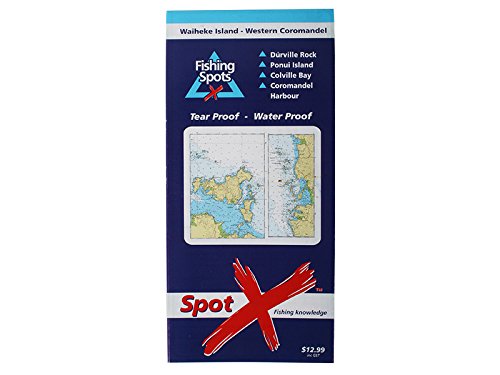
Spot X Waiheke is West Coromandel Chart (Paperback)
Published by Spot X Publications Ltd, Auckland, 2004
ISBN 10: 1877374059ISBN 13: 9781877374050
Book
Paperback. Condition: new. Paperback. Hydrographic chart is split in two, one side covers Waiheke Island to Ponui Island and the second side covers the Western Coromandel from Colville Bay to Wilsons Bay in the south. The fishing Consultant for this chart is Eugen De Bruyn, skipper of Sea Genie a very successful charter boat operating in the Hauraki Gulf. 21 fishing spots reviewed with GPS marks, illustration of recommended boat position, target species, bait, rig and best conditions with fishing technique tips. Plus an additional 20 fishing spots. Chart includes a review on local boat ramps and the location of camp grounds, public toilets, and the marina's. Water proof, Tear proof. Folds out from a handy pocket size to a manageable (A2) size. Shipping may be from our Sydney, NSW warehouse or from our UK or US warehouse, depending on stock availability.
More buying choices from other sellers on AbeBooks
New offers from US$ 19.46
-

Spot X Northland Surfcasting Map (Paperback)
Published by Spot X Publications Ltd, Auckland, 2004
ISBN 10: 1877374156ISBN 13: 9781877374159
Book
Paperback. Condition: new. Paperback. Map covers Cape Reinga in the north to a line between Cape Rodney and the Kaipara's North Head in the south. The fishing Consultant for this chart is Rob Parker a surf, rock and land based game fishing guide based in Houhora. This map includes a close up of the fishing spots, fitness and skill level required to fish each spot with tips on access and fishing. The map also shows the location of camp grounds. Water proof, Tear proof. Folds out from a handy pocket size to a manageable (A2) size. Shipping may be from our UK warehouse or from our Australian or US warehouses, depending on stock availability.
-

Mercury Islands to Whitianga (Folded)
Published by Spot X Publications Ltd, Auckland, 2004
ISBN 10: 1877374091ISBN 13: 9781877374098
Book
Folded. Condition: new. Folded. Hydrographic chart covers The Mercury Islands, Whangapoua Harbour and Mercury Bay with Cuvier Island as an inset. The fishing Consultant for this chart is Maurry Martin, skipper of Star Trek a very successful charter boat operating out of Whitianga Harbour. 20 fishing spots reviewed with GPS marks, illustration of recommended boat position, target species, bait, rig and best conditions with fishing technique tips. Plus an additional 17 fishing spots. Chart includes a review on local boat ramps and the location of camp grounds, public toilets and the marina. Water proof, Tear proof. Folds out from a handy pocket size to a manageable (A2) size. Shipping may be from our UK warehouse or from our Australian or US warehouses, depending on stock availability.
-

Spot X Bay of Plenty Surfcasting Map (Paperback)
Published by Spot X Publications Ltd, Auckland, 2004
ISBN 10: 1877374199ISBN 13: 9781877374197
Book
Paperback. Condition: new. Paperback. Map covers Tauranga in the west to Lottin Point in the east. The fishing Consultant for this chart is Greg Smeal a surf, rock and land based game fishing guide based in Kawerau where he runs his Tackle Store. This map includes a close up of the fishing spots, fitness and skill level required to fish each spot with tips on access and fishing. The map also shows the location of camp grounds. Water proof, Tear proof. Folds out from a handy pocket size to a manageable (A2) size. Shipping may be from our UK warehouse or from our Australian or US warehouses, depending on stock availability.
-

Spot X Whakatane Chart (Paperback)
Published by Spot X Publications Ltd, Auckland, 2004
ISBN 10: 1877374857ISBN 13: 9781877374852
Book
Paperback. Condition: new. Paperback. Hydrographic chart covers Waihi Estuary in the west to Cape Runaway in the east. White island is shown in a detailed insert. Whakatane, Rurima and Whale Island are also clearly shown. The fishing Consultant for this chart is Rick Pollock, skipper of "Pursuit," one of New Zealands most successful charter boats. Rick operates out of Whakatane Harbour. 21 fishing spots reviewed with GPS marks, illustration of recommended boat position, target species, bait, rig and best conditions with fishing technique tips. Plus an additional 15 fishing spots. Chart includes a review on local boat ramps and the location of camp grounds. Water proof, Tear proof. Folds out from a handy pocket size to a manageable (A2) size. Shipping may be from our UK warehouse or from our Australian or US warehouses, depending on stock availability.
-
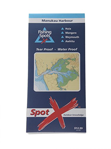
Spot X Manukau Harbour Chart (Paperback)
Published by Spot X Publications Ltd, Auckland, 2004
ISBN 10: 1877374024ISBN 13: 9781877374029
Book
Paperback. Condition: new. Paperback. Shipping may be from our UK warehouse or from our Australian or US warehouses, depending on stock availability.
-
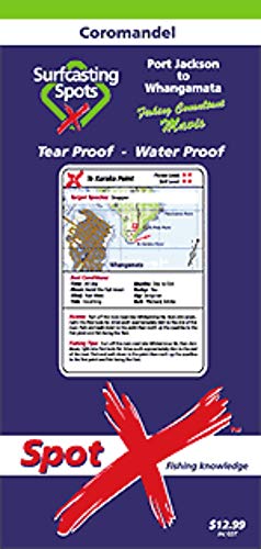
Spot X Coromandel Surfcasting Map (Paperback)
Published by Spot X Publications Ltd, Auckland, 2004
ISBN 10: 1877374180ISBN 13: 9781877374180
Book
Paperback. Condition: new. Paperback. Map covers Cape Colville in the north to Waihi Beach in the south. The fishing Consultant for this chart is "Mavis" a surf, rock and land based game fishing guide based in Kuaotunu. This map includes a close up of the fishing spots, fitness and skill level required to fish each spot with tips on access and fishing. The map also shows the location of camp grounds. Water proof, Tear proof. Folds out from a handy pocket size to a manageable (A2) size. Shipping may be from our UK warehouse or from our Australian or US warehouses, depending on stock availability.
-

Rangitoto Island (Folded)
Published by Spot X Publications Ltd, Auckland, 2004
ISBN 10: 1877374040ISBN 13: 9781877374043
Book
Folded. Condition: new. Folded. Hydrographic chart covers Whangaparaoa Peninsula in the north, Waitemata Harbour, Rangitoto Island, The Noises and Western Waiheke Island in the south. The fishing Consultant for this chart is Eugen De Bruyn, skipper of Sea Genie a very successful charter boat operating in the Hauraki Gulf. 21 fishing spots reviewed with GPS marks, illustration of recommended boat position, target species, bait, rig and best conditions with fishing technique tips. Plus an additional 18 fishing spots. Chart includes a review on local boat ramps and the location of camp grounds, public toilets and marina's. Water proof, Tear proof. Folds out from a handy pocket size to a manageable (A2) size. Shipping may be from our UK warehouse or from our Australian or US warehouses, depending on stock availability.
-

Condition: Fine. The book is in fine condition.
-
Condition: Fine. The book is in fine condition.
