
Order Total (1 Item Items):
Shipping Destination:

Admiralty Charts (240 results)
Feedback
Skip to main search results
Search filters
Product Type
- All Product Types
- Books (161)
- Magazines & Periodicals (No further results match this refinement)
- Comics (No further results match this refinement)
- Sheet Music (No further results match this refinement)
- Art, Prints & Posters (No further results match this refinement)
- Photographs (No further results match this refinement)
- Maps (79)
- Manuscripts & Paper Collectibles (No further results match this refinement)
Condition
- All Conditions
- New (No further results match this refinement)
- Used (240)
Binding
Collectible Attributes
- First Edition (No further results match this refinement)
- Signed (No further results match this refinement)
- Dust Jacket (No further results match this refinement)
- Seller-Supplied Images (235)
- Not Print on Demand (240)
Free Shipping
- Free Shipping to U.S.A. (No further results match this refinement)
Seller Rating
-

A WALLET CONTAINING SEVEN ADMIRALTY CHARTS. Comprising; 5301-World Climatic Chart January. 1973; 5302-World Climatic Chart July. 1973; 5307-The World Main Ocean Routes for Power Vessels. 1973; 5308-The World Sailing Ship Routes, Prepared by Rear Admiral Boyle T. Somerville, C.M.G. 1974; 5309-Chart of the World Showing Tracks followed by Sailing and Auxiliary Powered Vessels . 1950; 5310-The World: General Surface Current Distribution. 1974; D.6083-Load Line Rules-Zones, Areas and Seasonal Periods 1968.
Published by Hydrographer of the Navy, 1950-74., 1950
Seller: Hay Cinema Bookshop Limited, Hay on Wye, United Kingdom
Seller rating 5 out of 5 stars

7 folding maps, some in colour, in navy card wallet. US$15.
-
Admiralty List of Lights and Fog Signals: British Isles and North Coast of France - Volume A
Published by The United Kingdom Hydrographic Office, Somerset, UK, 2000
Soft cover. Condition: Good.
-
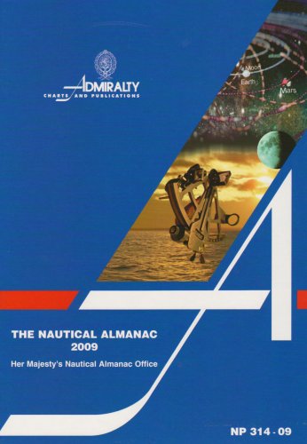
Nautical Almanac ; 2009
Published by United Kingdom Hydrographic Office, 2008
ISBN 10: 0707740673 ISBN 13: 9780707740676
Seller: Gareth Roberts, Rhydcymerau, Llandeilo, CARMS, United Kingdom
Seller rating 5 out of 5 stars
Hardcover. Condition: Good. No Jacket. Ex library hardback with illustrated boards, no DJ; usual stamps/markings. Published in 2008 by the United Kingdom Hydrographic Office, Taunton. A good, clean copy. Heavy book will ship overseas for extra postage. Ready for immediate despatch from UK. BS-5G*.
-

Ocean Passages for the World
Published by United Kingdom Hydrographic Office, 1987
ISBN 10: 0707711363 ISBN 13: 9780707711362
Seller: BookEnds Bookstore & Curiosities, Ojai, CA, U.S.A.
Seller rating 5 out of 5 stars
Hardcover. Condition: Near Fine. 4th Edition. Near Fine condition Hardcover with laminated boards and illustrated endpapers. Includes several color fold out maps, numerous b/w illustrations with Tables, Gazetteer and Index, 314 pages. The exception to the condition is two Bookstore stickers on rear board. No DJ as issued.
-

Tongatabu Island to L'Esperance Rock
Published by Pacific - South-west
Seller: Sergio Trippini, Gavirate, Italy
Seller rating 5 out of 5 stars
Tongatabu Island to L'Esperance Rock Compiled from the latest surveys Magnetic Variation in 1920, decreasing slightly to increasing about l'annually. London Published at the Admiralty, 4th March 1898, under the Superintendence of Rear Admiral Sir W.J.L. Wharton, Hydrographer. Small corrections: 1930. Folded editorially. Autore: Admiralty Charts. Luogo: Pacific - South-west. Anno: '900. Tecnica: incisione. Dimensioni: 959x639 mm.
-

Anchorages in Ysabel Island
Published by Ysabel Island - Salomon islands - Pacific Ocean
Seller: Sergio Trippini, Gavirate, Italy
Seller rating 5 out of 5 stars
Anchorages in Ysabel Island. In the upper part of the chart insert of Maringe Lagoon Surveyed by Lieutenant F.C.C. Pasco, assisted by Lieuts. C.E. Stainer, R. Aylen and K. Mackenzie-Grieve, H.M. Surveying Ship "Dart" 1902. London Published at the Admiralty, 21st Nov. 1903, under the Superintendence of Rear Admiral Sir W.J.L. Wharton, Hydrographer. Small corrections: 1920. Autore: Admiralty Charts. Luogo: Ysabel Island - Salomon islands - Pacific Ocean. Anno: '900. Tecnica: incisione. Dimensioni: 628x483 mm.
-

Hao Island
Published by Hao Island - Tuamotu - Polynesia
Seller: Sergio Trippini, Gavirate, Italy
Seller rating 5 out of 5 stars
Hao Island - the Bow Island of Captain Cook, and the La Harpe of M. Bougainville, Capt.n F.W. Beechey. In H.M.S. Blossom, 1825. In the upper right corner of the chart insert of Entrance to Hao Lagoon, By M.r Thomas Elson, Master of H.M.S. Blossom. London Published according to Act of Parliament at the Hydrographical Office of the Admiralty, Mar. 12th 1833. Small corrections: 1931. Autore: Admiralty Charts. Luogo: Hao Island - Tuamotu - Polynesia. Anno: '900. Tecnica: incisione. Dimensioni: 286x387 mm.
-

Anchorages in the Friendly Islands
Published by Fiji - Tonga - Samoa - Kiribati
Seller: Sergio Trippini, Gavirate, Italy
Seller rating 5 out of 5 stars
Anchorages in the Friendly Islands Surveyed by Lieutenants F.C.C. Pasco, J.A. Waugh, G.E. Nares, A.W. Lowis, and C.R.W. Brewis, under the direction of Captain A. M. Field, H.M. Surveying Ship "Penguin", 1898. In the upper part of the chart insert of Neiafu Harbour and Approaches. In the lower part of the chart insert of Ofolanga Island and Anchorage. London Published at the Admiralty, 11th July 1899, under the Superintendence of Rear Admiral Sir W.J.L. Wharton, Hydrographer. Small corrections: 1929. Autore: Admiralty Charts. Luogo: Fiji - Tonga - Samoa - Kiribati. Anno: '900. Tecnica: incisione. Dimensioni: 632x487 mm.
-

Lifuka Island Anchorage and Approaches
Published by Lifuka Island - Ha?apai Group - Kingdom of Tonga
Seller: Sergio Trippini, Gavirate, Italy
Seller rating 5 out of 5 stars
Lifuka Island Anchorage and Approaches Surveyed by Lieutenants Boyle T. Somerville & Stewart C. Weigall, under the direction of Commander Andrew F. Balfour, H.M. Surveying Ship "Penguin", 1895. The work in hair line has been considerably enlarged from the Survey of Captain A. Mostyn Field, and the Officers of H.M. Surveying Ship "Penguin", 1898. London Published at the Admiralty, 19th Dec. 1896, under the Superintendence of Rear Admiral W.J.L. Wharton, Hydrographer. Small corrections: 1929. Autore: Admiralty Charts. Luogo: Lifuka Island - Ha?apai Group - Kingdom of Tonga. Anno: '900. Tecnica: incisione. Dimensioni: 649x487 mm.
-

Papua or New Guinea
Published by Nuova Guinea
Seller: Sergio Trippini, Gavirate, Italy
Seller rating 5 out of 5 stars
Papua or New Guinea - sheet 6 - British New Guinea South Coast Round Hill to Orangerie Bay surveyed by Capt. Owen Stanley 1850. The Coastline and topography in fine line are from Sketch Surveys by Officers of the Government of British New Guinea under the direction of Sir WilliamMacgregor, 1891. In the right side of the chart a small insert of Nobanoka Bay or Port Glasgow by Mr. Goldic of the ship Explorer 1878. London Published according to Act of Parliament at the Hydrographic Office of the Admiralty May 24th 1852. Small corrections: 1928. Editorially folded. Autore: Admiralty Charts. Luogo: Nuova Guinea. Anno: '900. Dimensioni: 626x953 mm.
-

Anchorages in the Fiji Islands
Published by Fiji islands - Archipelago
Seller: Sergio Trippini, Gavirate, Italy
Seller rating 5 out of 5 stars
Anchorages in the Fiji Islands. In the upper left corner of the chart insert of Rukuruku Surveyed by Lieut. G.E. Richards, H.M. Surveying Ship "Renard"1882 with amendments by Lieut. M. Richmond H.M.S. "Laburnum"1927. Work in hairline enlarged from the original survey. In the middle of the chart insert of Lautoka Harbour From a Survey by Comm. S.E. Thomas & Lieut.-Comm. E.G. Rhodes, H.M.S. "Chatham", 1921. The portions shown in hairline have been much enlarged from a survey by Comm. J.W. Combe, H.M. Surveying Ship "Waterwitch", 1896. In the right side of the chart insert of Nai Toni Toni and Veivatuloa Anchorages Surveyed by Lieut. F.G.S. Peile H.M.S. "Torch", 1905. London Published at the Admiralty, 17th July 1906 under the Superintendence of Rear Admiral A. Mostyn Field, Hydrographer. Small corrections: 1929. Folded editorially. Autore: Admiralty Charts. Luogo: Fiji isole - Archipelago. Anno: '900. Tecnica: incisione. Dimensioni: 641x980 mm.
-

Viti Levu South Pacific Ocean - Fiji Islands
Published by Viti Levu - Nandronga Harbour
Seller: Sergio Trippini, Gavirate, Italy
Seller rating 5 out of 5 stars
South Pacific Ocean - Fiji Islands. In the left side of the chart insert of Nandronga Harbour (Thuvu Harbour) By H. Hosken, Navigating Lieut. & J.W. Brown Navigating Sub. Lieut. H.M.S. "Pearl", Commodore J.G. Goodenough, 1874. London Published at the Admiralty, 15th Oct. 1874 under the Superintendence of Captain F.J. Evans, Hydrographer. Small corrections: 1925. Autore: Admiralty Charts. Luogo: Viti Levu - Nandronga Harbour. Anno: '900. Tecnica: incisione. Dimensioni: 484x653 mm.
-

Anchorages in the Solomon Islands
Published by Salomon Islands - Pacific Ocean
Seller: Sergio Trippini, Gavirate, Italy
Seller rating 5 out of 5 stars
Anchorages in the Solomon Islands. In the upper part of the chart insert of Sketch of the Islands in Manning Strait between Choiseul and Ysabel Islands By M.r W. Hamilton 1908. Ysabel I from a sketch survey by Lieutenant F.C.C. Pasco, H.M. Surveying Ship "Dart" 1902. Taura Bay from an Austrian Government Plan, 1897. In the lower part of the chart insert of Sketch of the Southern portion of Lord Howe Islands (Ongtong Java or Leueneuwa) By Lieutenant G. Stapleton H.M.S. "Torch", 1900. London Published at the Admiralty, 9th May 1901, under the Superintendence of Rear Admiral Sir W.J.L. Wharton, Hydrographer. Small corrections: 1921. Autore: Admiralty Charts. Luogo: Salomon Islands - Pacific Ocean. Anno: '900. Tecnica: incisione. Dimensioni: 457x659 mm.
-

Anchorages in the Solomon Islands
Published by Salomon Islands - Pacific Ocean
Seller: Sergio Trippini, Gavirate, Italy
Seller rating 5 out of 5 stars
Anchorages in the Solomon Islands. In the upper part of the chart insert of Pavuvu Islands (Russell Islands) Sketch Survey by Lieut. G.E. Richards and the Officers of H.M.S. Renard 1880. Pepesala (Paddy) Bay from a sketch by M.r F.J. Bayldon, "Maresby" 1908. In the lower part of the chart insert of Viru Harbour Preliminary Survey By Commander A.F. Balfour, Assisted by the Officers of H.M. Surveying ship "Penguin" 1893, Rendova Harbour Preliminary Survey By Commander A.F. Balfour, Assisted by the Officers of H.M. Surveying ship "Penguin" 1893. London Published at the Admiralty, 28th Jan. 1895, under the Superintendence of Rear Admiral W.J.L. Wharton, Hydrographer. Small corrections: 1921. Autore: Admiralty Charts. Luogo: Salomon Islands - Pacific Ocean. Anno: '900. Tecnica: incisione. Dimensioni: 649x484 mm.
-

Anchorages in the Solomon Islands
Published by Salomon Islands - Pacific Ocean
Seller: Sergio Trippini, Gavirate, Italy
Seller rating 5 out of 5 stars
Anchorages in the Solomon Islands Surveyed by Commander A.F. Balfour, assisted by the Officers of H.M. Surveying ship "Penguin" 1894. In the upper part of the chart insert of Marovo Lagoon. In the lower part of the chart insert of Mongo Entrance, Charapoana Entrance, Tongoro Entrance. London Published at the Admiralty, 24th Feb. 1896, under the Superintendence of Rear Admiral W.J.L. Wharton, Hydrographer. Small corrections: 1919. Autore: Admiralty Charts. Luogo: Salomon Islands - Pacific Ocean. Anno: '900. Tecnica: incisione. Dimensioni: 626x481 mm.
-

China Strait and Approaches
Published by Sud Pacifico
Seller: Sergio Trippini, Gavirate, Italy
Seller rating 5 out of 5 stars
China Strait and Approaches Surveyed by Lieutenant and Commander A. Mostyn Field, assisted by Lieutenants W.P. Dawson and S.V.C. Messum, 1886. In the upper right corner insert of The Anchorage off Samarai or Dinner I. By Lieutenant and Commander A.M. Field H.M.S. Dart, 1888.London Published at the Admiralty 20th June, 1888, under the Superintendence of Captain W.J.L. Wharton, Hydrographer. Small corrections: 1931. Editorially folded. Autore: Admiralty Charts. Luogo: Sud Pacifico. Anno: '900. Tecnica: incisione. Dimensioni: 991x646 mm.
-

Anchorages in Ysabel Island
Published by Ysabel Island - Salomon islands - Pacific Ocean
Seller: Sergio Trippini, Gavirate, Italy
Seller rating 5 out of 5 stars
Anchorages in Ysabel Island. In the left side of the chart insert of Kesuo Cove Surveyed by Lieutenant F.C.C. Pasco, assisted by Lieuts. C.E. Stainer, R. Aylen and K. Mackenzie-Grieve, H.M. Surveying Ship "Dart" 1902. In the right side of the chart insert of Tunnibuli Surveyed by Lieutenant F.C.C. Pasco, assisted by Lieuts. C.E. Stainer, R. Aylen and K. Mackenzie-Grieve, H.M. Surveying Ship "Dart" 1902. London Published at the Admiralty, 21st Dec. 1903, under the Superintendence of Rear Admiral Sir W.J.L. Wharton, Hydrographer. Small corrections: 1919. Autore: Admiralty Charts. Luogo: Ysabel Island - Salomon islands - Pacific Ocean. Anno: '900. Tecnica: incisione. Dimensioni: 461x662.
-

Austral or Tubuai Islands - Raivavae
Published by Austral or Tubuai Islands - Polynesia
Seller: Sergio Trippini, Gavirate, Italy
Seller rating 5 out of 5 stars
Austral or Tubuai Islands - Raivavae From a French Government Survey, 1901. London Published at the Admiralty 19th Dec. 1904, under the Superintendence of Captain A. Mostyn Field, Hydrographer. Small corrections: 1923. Autore: Admiralty Charts. Luogo: Austral or Tubuai Islands - Polynesia. Anno: '900. Tecnica: incisione. Dimensioni: 482x652 mm.
-

Anchorages in the Solomon Islands
Published by Salomon Islands - Pacific Ocean
Seller: Sergio Trippini, Gavirate, Italy
Seller rating 5 out of 5 stars
Anchorages in the Solomon Islands. In the left part of the chart insert of Kunggava Bay From a sketch by Lieut. Com. R. Crookshank, 1928, Queen Carola Harbour From a German Government Survey, 1883, Wanderer Bay By Capt. H.M. Denham, 1855. In the middle part of the chart insert of Port Adam By W. Hilliard, Master H.M.S. Havannah 1850, Mallu Harbour By M.r Haddock, 1877, Astrolabe Harbour By Mons.r Marescot, Enseigne de Vaisseau Corvette Astrolabe French Royal Navy 1838, Cockatoo Anchorage By T.C. Tilly, Master, H.M.S. Cordelia, 1861, Aowawa Roadstead By Capt. H.M. Denham, 1854. In the right part of the chart insert of Hada or Recherche Bay By T.C. Tilly, Master, H.M.S. Cordelia, 1861, Kwakwaru and Kwi Harbours Sketch by M.r W.T. Wawn 1888, Port Mary By Lieut. C.F. Oldham, 1882, Makira Bay By Capt. H.M. Denham, 1855, Hunter Roadstead By Capt. H.M. Denham, 1854, Popau H.r Sketch by M.r R. Haddock, 1877. London Published at the Admiralty March 10th 1864, under the Superintendence of Capt. G.H. Richards, Hydrographer. Small corrections. Autore: Admiralty Charts. Luogo: Salomon Islands - Pacific Ocean. Anno: '900. Tecnica: incisione. Dimensioni: 643x495 mm.
-

Rough Sketches of Anchorages in the Solomon Islands
Published by Salomon Islands - Pacific Ocean
Seller: Sergio Trippini, Gavirate, Italy
Seller rating 5 out of 5 stars
Rough Sketches of Anchorages in the Solomon Islands. By M.r W.T. Wawn, Master, Brigantine "Ariel", 1888. In the left side of the chart insert of Tasman I.s or Niumanno Atoll, Atta Cove, Ariel Harbour From a Survey by Lieut. A.L. Jackson, under the direction of Lieut. Com. R.L. Hancock, H.M. Surveying Ship "Sealark", 1914, Manna Kwoi H.r. In the middle part of the chart insert of Deep Bay, Uras Cove, North Sister Anchorage, Double Bay. In the right side of the chart insert of Maramasike Passage. London Published at the Admiralty, 7th Oct. 1889, under the Superintendence of Captain W.J.L. Wharton, Hydrographer. Small corrections: 1930. Folded editorially. Autore: Admiralty Charts. Luogo: Salomon Islands - Pacific Ocean. Anno: '900. Tecnica: incisione. Dimensioni: 512x741 mm.
-

Anchorages in the Solomon Islands
Published by Salomon islands - Pacific Ocean
Seller: Sergio Trippini, Gavirate, Italy
Seller rating 5 out of 5 stars
Anchorages in the Solomon Islands. In the upper part of the chart insert of Hat horn Sound Sketch Survey to Lieut. Marx & Torlesse, H.M.S. "Swinger" and Lieut. Elton, H.M.S. "Diamond" 1884. North of Marx P.t by Lieut. Bower, H.M.S. "Danae", 1879. With additions from a Survey by Lieut. Comm. W.U Moore, H.M.S. "Dart" 1884, Hathorn Sound Sketch Survey by Lieut C. W. Beresford and S.V. Messum under the direction of Lieut. Comm. W.U. Moore, H.M.S. "Dart" 1884, Port Diamond or Sinarango Sketch survey by the Officers of H.M.S. "Diamond", 1886. under the direction of Captain F.S. Clayton, Choiseul Bay Surveyed By Lieut. C.F. Oldham and the Officers of H.M.S. Lark, 1883. In the lower part of the chart insert of Blanche Harbour Surveyed By Lieut. C.F. Oldham and the Officers of H.M.S. Lark, 188, Plan of the Anchorage, Bambatani From a rough Sketch by Lieut. G. Stapleton, H.M.S. "Torch"1900. London Published at the Admiralty, 30th Dec. 1884, under the Superintendence of Captain W.J.L. Wharton, Hydrographer. Small corrections: 1929. Autore: Admiralty Charts. Luogo: Salomon islands - Pacific Ocean. Anno: '900. Tecnica: incisione. Dimensioni: 450x623 mm.
-

Anchorages in Ysabel Island
Published by Ysabel Island - Salomon islands - Pacific Ocean
Seller: Sergio Trippini, Gavirate, Italy
Seller rating 5 out of 5 stars
Anchorages in Ysabel Island. In the left side of the chart insert of Korrigole Harbour Surveyed by Lieutenant F.C.C. Pasco, assisted by Lieuts. C.E. Stainer, R. Aylen and K. Mackenzie-Grieve, H.M. Surveying Ship "Dart" 1902. In the right side of the chart insert of Vulavu Anchorage Surveyed by Lieutenant F.C.C. Pasco, assisted by Lieuts. C.E. Stainer, R. Aylen and K. Mackenzie-Grieve, H.M. Surveying Ship "Dart" 1902. London Published at the Admiralty, 11th Dec. 1903, under the Superintendence of Rear Admiral Sir W.J.L. Wharton, Hydrographer. Small corrections: 1920. Autore: Admiralty Charts. Luogo: Ysabel Island - Salomon islands - Pacific Ocean. Anno: '900. Tecnica: incisione. Dimensioni: 457x652 mm.
-

Tonga or Friendly I.s
Published by Tonga - Vavau Haapai Group
Seller: Sergio Trippini, Gavirate, Italy
Seller rating 5 out of 5 stars
Tonga or Friendly I.s Surveyed by Captain Pelham Aldrich, Comm. C.F. Oldham and the Officers of H.M. Surveying Ship "Egeria" 1888-90 Comm. A. Balfour and the Officers of H.M. Surveying Ship "Penguin" 1895 and Captain A.M. Field and the Officers of H.M. Surveying Ship "Penguin" 1898. London Published at the Admiralty, April 18th 1866, under the Superintendence of Capt. G.H. Richards, Hydrographer. Small corrections: 1931. Folded editorially. Autore: Admiralty Charts. Luogo: Tonga - Vavau Haapai Group. Anno: '900. Tecnica: incisione. Dimensioni: 993x654 mm.
-

Anchorages in the Solomon Islands
Published by Salomon Islands - Pacific Ocean
Seller: Sergio Trippini, Gavirate, Italy
Seller rating 5 out of 5 stars
Anchorages in the Solomon Islands. In the upper left corner of the chart insert of Beaufort Bay From a Sketch by M.r T.H. Switzer Master Schooner Roderick Dhu, 1896, Sutulahia Anch.e Sketch Survey by Lieut. W.R. Willis H.M.S. "Ringdove" 1895. In the middle part of the chart insert of Vura Anchorage From a Sketch by M.r T.H. Switzer, Master, Schooner, "Roderick Dhu"1896, Narovo Island Surveyed by Lieut. C.F. Odham and the Officers of H.M. Surveying Ship "Lark" 1882. In the right part of the chart insert of Auki Harbour Surveyed by Lieut. Com. R.L. Hancock and the Officers of H.M. Surveying Vessel "Sealark" 1913, Albatros Bay From an Austrian Government Sketch Survey, 1897, Ngora Fu Harbour From a Sketch Survey by Lieut. G.P. Bigg-Wither and the Officers of H.M.S. "Pylades", 1905. London Published at the Admiralty 20th Feb. 1907, under the Superintendence of Rear Admiral A. Mostyn Field, Hydrographer.Small corrections: 1927. Autore: Admiralty Charts. Luogo: Salomon Islands - Pacific Ocean. Anno: '900. Tecnica: incisione. Dimensioni: 617x470 mm.
-

Western Approaches to Torres Strait
Published by Australia - New Guinea
Seller: Sergio Trippini, Gavirate, Italy
Seller rating 5 out of 5 stars
Western Approaches to Torres Strait Compiled from the latest British & Netherlands Gov.t Surveys. London Published at the Admiralty 15th June 1881, under the Superintendence of Capt.n F.J. Evans, Hydrographer. Small corrections: 1925. Autore: Admiralty Charts. Luogo: Australia - New Guinea. Anno: '900. Tecnica: incisione. Dimensioni: 475x645 mm.
-

Cape Van Den Bosch to Patipi Bay
Seller: Sergio Trippini, Gavirate, Italy
Seller rating 5 out of 5 stars
Cape Van Den Bosch to Patipi Bay from the Netherlands Government charts 1916-1919.In the upper right corner of the chart insert of Channels near Panjang From the Netherlands Government Chart of 1919. In the lower left corner insert of Sanggala and Wap Bays from the Netherlands Gov.t Chart of 1917. London Published at the Admiralty, 31st March 1920, under the Superintendence of Rear Admiral Fred. C. Learmonth, Hydrographer.Small corrections: 1929. Cape Van Den Bosch to Patipi Bay.
-

Anchorages in Islands Off the N.W. part of New Guinea
Seller: Sergio Trippini, Gavirate, Italy
Seller rating 5 out of 5 stars
Anchorages in Islands Off the N.W. part of New Guinea. Magnetic Variation in 1920, nearly stationary. In every part of the chart there are inserts: in the upper part insert of Pulo Saiang Sketch by Captain Thomas Forrest, 1775, Powati Anchor.e from Batavian Chart of 1885, Labuha Road from a Netherlands Government Plan of 1905, Weda Road from a Netherlands Gov.t Plan of 1919, Maba Road from Batavian Chart 1885, Gemia Road from Batavian Chart 1885, Ganei Road from Batavian Chart 1885. In the middle of the chart insert of Gebe Island by L.I. Duperrey, 1819, Port Fau by Mr. Mareau, 1772, Patani Anchorage from a Netherlands Government plan of 1919, Fofak Harbour Surveyed by Capt.n L.I. Duperrey, of the French Navy 1823, Bu Islands Sketch of the Anchorage on the Eastern side of Esplee I. by the Officers of U.S.S. Alert 1877 and Suriname Bay From the Netherlands Government Plan of 1919. In the lower part insert of Saripa Bay From the Netherlands Gov.t Chart of 1920 and Lawak & Kabarei Bays Surveyed by Capt.n L.I. Duperrey, of the French Navy, 1818.London Published at the Admiralty 28th Mar. 1885, under the Superintendence of Captain W.J.L. Wharton, Hydrographer. Small corrections: 1926.
-
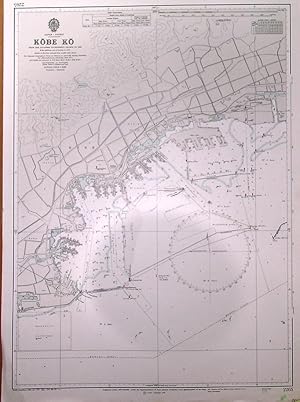
'KOBE KO'. Harbour chart of Kobe in Japan, published under the superintendence of G.S. Ritchie from Japanese Government charts to 1966 with corrections by the
Published by Admiralty 1972, 1972
Map
66x48cm. Printed in two colours. Excellent condition.
-
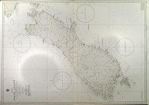
'SOUTH ISLAND'. Sea chart of New Zealand's South Island from Government Charts to 1960 and surveys, published under the superintendence of Sir Guy Wyatt with corrections by the
Published by Admiralty 1971, 1971
Map
98x70cm. Uncoloured. Excellent condition.
-
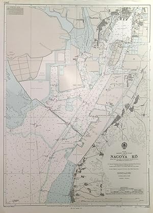
'NAGOYA KO'. Plan of Nagoya Ko harbour. Sea chart surveyed under the superintendence of K.St.B. Collins 1957 and published with corrections by the
Published by Admiralty 1973, 1973
Map
66x48cm. Printed in two colours. Excellent condition.
