
Order Total (1 Item Items):
Shipping Destination:

Great Britain Ordnance Survey (252 results)
Feedback
Skip to main search results
Search filters
Product Type
- All Product Types
- Books (247)
- Magazines & Periodicals (No further results match this refinement)
- Comics (No further results match this refinement)
- Sheet Music (No further results match this refinement)
- Art, Prints & Posters (No further results match this refinement)
- Photographs (No further results match this refinement)
- Maps (5)
- Manuscripts & Paper Collectibles (No further results match this refinement)
Condition
Collectible Attributes
- First Edition (15)
- Signed (No further results match this refinement)
- Dust Jacket (4)
- Seller-Supplied Images (175)
- Not Print on Demand (103)
Free Shipping
Seller Rating
-
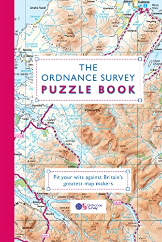
The Ordnance Survey Puzzle Book: Pit your wits against Britain?s greatest map makers
Published by Trapeze, 2019
ISBN 10: 1409184676 ISBN 13: 9781409184676
Condition: USED_GOOD. Item in very good condition! Textbooks may not include supplemental items i.e. CDs, access codes etc.
-

A-Z Swindon Street Atlas (Street Maps & Atlases)
Published by Geographers' A-Z Map Co Ltd, 2004
ISBN 10: 1843482185 ISBN 13: 9781843482185
Condition: Good. Book is in Used-Good condition. Pages and cover are clean and intact. Used items may not include supplementary materials such as CDs or access codes. May show signs of minor shelf wear and contain limited notes and highlighting. 0.22.
-

Wakefield Street A-Z (Street Atlas)
Published by Geographers' A-Z Map Co Ltd 01/09/2004, 2004
ISBN 10: 1843482371 ISBN 13: 9781843482376
Condition: Very Good. This book is in very good condition and will be shipped within 24 hours of ordering. The cover may have some limited signs of wear but the pages are clean, intact and the spine remains undamaged. This book has clearly been well maintained and looked after thus far. Money back guarantee if you are not satisfied. See all our books here, order more than 1 book and get discounted shipping. .
-

A. B. C. London Street Atlas
Published by Harpercollins, 1984
ISBN 10: 0600357686 ISBN 13: 9780600357681
Seller: WorldofBooks, Goring-By-Sea, WS, United Kingdom
Seller rating 5 out of 5 stars

Hardback. Condition: USED_VERYGOOD. The book has been read, but is in excellent condition. Pages are intact and not marred by notes or highlighting. The spine remains undamaged.
-
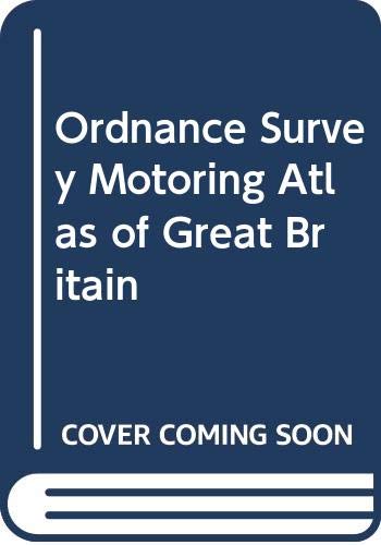
Ordnance Survey Motoring Atlas of Great Britain
Published by Hamlyn, 1986
ISBN 10: 0600333167 ISBN 13: 9780600333166
hardcover. Condition: Very Good. Connecting readers with great books since 1972! Used books may not include companion materials, and may have some shelf wear or limited writing. We ship orders daily and Customer Service is our top priority!.
-
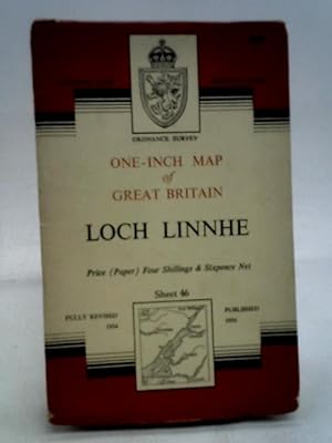
Loch Linnhe Sheet 46 (Ordnance Survey One-inch Map of Great Britain)
Published by Ordnance Survey, 1956
Seller: World of Rare Books, Goring-by-Sea, SXW, United Kingdom
Seller rating 5 out of 5 stars
Condition: USED_GOOD. 1956. Revised. Unpaginated. Pictorial paper covers. Coloured map printed on map. Binding remains firm.Pages & illustrations remain bright with minimal tanning. Paper cover has mild edge-wear with light rubbing and creasing.
-

A-Z Wales Regional Road Atlas / Atlas Ffyrdd Cymru
Published by Geographers a-Z, 2007
ISBN 10: 1843485117 ISBN 13: 9781843485117
Condition: USED_VERYGOOD. 1720088372. 7/4/2024 10:19:32 AM.
-

A-Z Ipswich
Published by Geographers' A-Z Map Co Ltd, 2005
ISBN 10: 1843483009 ISBN 13: 9781843483007
Condition: USED_VERYGOOD. 1718968012. 6/21/2024 11:06:52 AM.
-

1991 Ordnance Survey Motoring Atlas of Great Britain
Published by Hamlyn Publishing, London, 1990
ISBN 10: 0600570738 ISBN 13: 9780600570738
Paperback. Condition: Very Good. Eighth Edition. Ordnance Survey and Hamlyn Publishing, 1990. Paperback. Very Good. Unmarked. Spine straight and tight. Covers clean with significant wrinkling. Not from a library. 140 pages. 15.6 x 11.25 x 0.25 inches.
-

Map of Roman Britain. Scale: 16 miles to one inch.
Published by Southampton:, 1926
Seller: Zubal-Books, Since 1961, Cleveland, OH, U.S.A.
Seller rating 5 out of 5 stars
Condition: USED_GOOD. 8 pp., folding map; paper wrappers (dated 1924) worn, map taped or split at folds, working copy only, sold as is. - If you are reading this, this item is actually (physically) in our stock and ready for shipment once ordered. We are not bookjackers. Buyer is responsible for any additional duties, taxes, or fees required by recipient's country.
-

Scotland Indexes to the 12500 and 6Inch Scale Maps and Small Specimens of Different Maps Published
Published by Hardpress Publishing, 2013
ISBN 10: 1314369865 ISBN 13: 9781314369861
PAP. Condition: New. New Book. Shipped from UK. Established seller since 2000.
-

Catalogue of the Maps and Plans and Other Publications of the Ordnance Survey of Ireland, to 1st January, 1898
Published by Hardpress Publishing, 2013
ISBN 10: 1313629154 ISBN 13: 9781313629157
PAP. Condition: New. New Book. Shipped from UK. Established seller since 2000.
-
Reprint of the first edition of the one-inch Ordnance Survey of England and Wales / Sheet no 85, Salisbury. cartographical notes by J.B. Harley
Published by Newton Abbot, Devon : David & Charles, 1968
Reprint. Near fine paperback copy; wrapper edges very slightly dulled. Remains particularly well-preserved overall. Physical description; 1 map ; 77 x 101 cm. folded to 19 x 12 cm. Subjects; Great Britain Surveys Maps. Wiltshire (England) ; Maps. Hampshire (England) ; Maps. England; history. England; description and travel. 1 Kg.
-
Ordnance Survey: London S.W.; Sheet 170
Published by Southampton: Director General of the Ordnance Survey, 1959
First Edition
First Edition. Very good pamphlet copy; edges slightly nicked and dust-dulled as with age. Remains particularly well-preserved overall; bright and clean. Physical description: 1 map: col.; folded to 21 x 12 cm. Subjects: 1:25000. London (England); Maps. Genre: Maps. 1 Kg.
-

Ordnance Survey of Great Britain Scotland, Indexes to the 12500 and 6Inch Scale Maps and Small Specimens of Different Maps Published Classic Reprint
Published by Forgotten Books, 2018
ISBN 10: 0365820563 ISBN 13: 9780365820567
PAP. Condition: New. New Book. Shipped from UK. Established seller since 2000.
-
Revised Edition. Good folding map with some slight wear as with age. Remains well preserved overall; tight, bright, clean and sharp-cornered. Physical description; 1 map : col. ; 77 x 61 cm. Notes; Reprint of the 1947 published edition overlaid with parish boundaries, c. 1850. Subjects; Parishes England ; Maps. Chester (England) ; Maps. Scale : One inch to one statute mile. Genre; Illustrated. 1 Kg.
-
Skye - Portree & Bracadale / Ordnance Survey
Published by Southampton, United Kingdom : Ordnance Survey, 2007
ISBN 10: 0319239470 ISBN 13: 9780319239476
Revised Edition. Fine folding map. Remains well preserved overall; tight, bright, clean and sharp-cornered. Series; OS explorer map ; 410. Physical description; 1 map : colour ; 84 x 124 cm, folded to 24 x 14 cm. Notes; Previous edition: 2002. Geographic coverage Europe, Great Britain, Scotland, Inverness-shire, Skye - Portree & Bracadale. Text in English with notes in French and German. Subjects; Skye, Island of (Scotland) ; Maps. Portree (Scotland) ; Maps. Bracadale (Scotland : Parish) ; Maps. 1:25,000. Genres; cartographic image. Map. 1 Kg.
-
Stratford-upon-Avon: Sheet 151: 1:50 000 First Series
Published by Southampton : Ordnance Survey for the Institute of Geological Sciences, 1974
First Edition
First Edition. Good folding map with some slight wear and tear as with age. Remains well preserved overall; tight, bright, clean and sharp-cornered. Series; Geological survey of Great Britain (England and Wales). . 1:50,000 series. Physical description; 1 map ; 39 x 58 cm. Subjects; Geology England Stratford-upon-Avon ; Maps. Geology England Evesham ; Maps. Stratford-upon-Avon (England) ; Maps. Evesham (England) ; Maps. 1:50,000. 1 Kg.
-
Revised Edition. Good folding map with some slight wear as with age. Remains well preserved overall; tight, bright, clean and sharp-cornered. Series; Landranger series. ; 1:50,000 series ; Sheet 184. Physical description; 1 Map : Col. Subjects; Salisbury. The Plain. Folding Map. British Map. Scale 1:50 000. Ordnance Survey. 1 Kg.
-
Swindon & Devizes: sheet 173: 1:50 000 First Series
Published by Southampton : Ordnance Survey, 1974
Revised Edition. Good folding map with some wear and tear as with age. Remains well preserved overall; tight, bright, clean and sharp-cornered. Series; Landranger series of Great Britain. . 1:50 000 first series ; Sheet 173. Physical description; 1 map : col. ; 80 x 80 cm. on sheet 88 x 100 cm., folded in cover 23 x 13 cm. Notes; Relief shown by contours and spot heights. Folded. Tourist information in English, French and German. Subjects; Scale 1:50,000. 2 cm. to 1 km. Genre; Map. 1 Kg.
-
Dorking, Reigate & Crawley area / Ordnance Survey (Sheet 187)
Published by Southampton : Ordnance Survey, 1991
ISBN 10: 0319221873 ISBN 13: 9780319221877
First Edition
First Edition. Very good paperback copy; edges slightly dust-dulled and nicked. Remains particularly well-preserved overall; tight, bright, and clean. Physical description; 1 map : col. ; 84 x 84 cm. on sheet 88 x 100 cm., folded in cover 23 x 14 cm. Subjects; Maps. Dorking; description and travel. Britain description and travel. 1 Kg.
More buying choices from other sellers on AbeBooks
Used offers from US$ 20.40
Also find Softcover First Edition
-
![Seller image for Lake District 2016 (Pathfinder Guides) by Terry Marsh, Great Britain Ordnance Survey (associated with work) [Paperback ] for sale by booksXpress](https://pictures.abebooks.com/inventory/md/md31174462957.jpg)
Lake District 2016 (Pathfinder Guides) by Terry Marsh, Great Britain Ordnance Survey (associated with work) [Paperback ]
Published by PATHFINDER, 2016
ISBN 10: 0319090167 ISBN 13: 9780319090169
Soft Cover. Condition: NEW.
-
First Series. Very good paperback copy; edges slightly dust-dulled and nicked. Remains particularly well-preserved overall; tight, bright, and clean. Physical description; 1 map : col. ; 120 x 90 cm., folded to 24 x 13 cm. Subjects; Dorset (England) ; Maps. Avon (England) ; Maps. Somerset (England) ; Maps. Wiltshire (England) ; Maps. 1 Kg.
-
First Series. Very good paperback copy; edges slightly dust-dulled and nicked. Remains particularly well-preserved overall; tight, bright, and clean. Physical description; 1 map : col. ; 120 x 90 cm., folded to 24 x 13 cm. Subjects; Bristol (England) ; Maps. Gwent (Wales) ; Maps. Wiltshire (England) ; Maps. Gloucestershire (England) ; Maps. Avon (England) ; Maps. Mendip Hills (England) ; Maps. Somerset (England) ; Maps. Severn River (Wales and England) ; Maps. 1 Kg.
-
The Cuillin & Torridon Hills : showing part of Cuillin Hills and Wester Ross national scenic areas / Ordnance Survey
Published by Southampton : Ordnance Survey, 1987
ISBN 10: 0319260089 ISBN 13: 9780319260081
First Edition
First Edition. Very good copy with folded map inside; edges somewhat dust-dulled and nicked. Remains quite well-preserved overall. Physical description: 1 map : 2 sides col. ; 91 x 106 cm. and 91 x 106 cm. on sheet 94 x 117 cm., folded in cover 24 x 13 cm. Notes: Relief shown by contours. Subjects: Cuillin Hills (Scotland) ; Maps; Torridon (Scotland) ; Maps; Scale 1:25000. 1 Kg.
More buying choices from other sellers on AbeBooks
Used offers from US$ 21.37
Also find Softcover First Edition
-

Catalogue Of The Maps And Plans And Other Publications Of The Ordnance Survey Of Ireland
Published by LEGARE STREET PR, 2022
ISBN 10: 1018651950 ISBN 13: 9781018651958
PAP. Condition: New. New Book. Shipped from UK. THIS BOOK IS PRINTED ON DEMAND. Established seller since 2000.
-

Warwickshire County Atlas
Published by Geographers A-Z Map Co Ltd, 2005
ISBN 10: 1843483963 ISBN 13: 9781843483960
Paperback. Condition: UNSPECIFIED. **SHIPPED FROM UK** We believe you will be completely satisfied with our quick and reliable service. All orders are dispatched as swiftly as possible! Buy with confidence! Greener Books.
-
Orkney, Shetland and the Western Isles = Schottland Inseln : Orkney - Shetland - Hebriden. Sheet Routemaster Series of Great Britain [1:250.000]
Published by K�mmerly + Frey, [Bern], 1984
ISBN 10: 3259012400 ISBN 13: 9783259012406
Map
Condition: Sehr gut. 1 Karte ; 90 x 110 cm Sprache: Deutsch Gewicht in Gramm: 300.
-
The complete guide to the battlefields of Britain : with Ordnance Survey maps / David Smurthwaite
Published by London : Michael Joseph, 1984
ISBN 10: 0718136551 ISBN 13: 9780718136550
Fourth Edition. Near fine copy in the original stiff-card wrappers; edges very slightly dust-dulled and sun-toned. Remains particularly and surprisingly well-preserved; tight, bright, clean and especially sharp-cornered. Physical description; 224 pages : illustrations(some color), maps(some color) ; 25 cm. Subject; Battlefields Great Britain. Genre; Illustrated. 1 Kg.
-
Paperback edition. Near fine paperback copy; edges very slightly dust-dulled and nicked. Remains particularly well-preserved overall; tight, bright, and clean. Physical description; 1 map : col. ; 85 x 85 cm. folded to 23 x 14 cm. Subjects; Berkshire (England) ; Maps. Wantage (England) ; Maps. Newbury (England) ; Maps. Oxfordshire (England) ; Maps. Scale 1:50,000. 1 Kg.


![Seller image for Orkney, Shetland and the Western Isles = Schottland Inseln : Orkney - Shetland - Hebriden. Sheet Routemaster Series of Great Britain [1:250.000] for sale by Sch�rmann und Kiewning GbR](https://pictures.abebooks.com/inventory/md/md31504333737.jpg)

