
Order Total (1 Item Items):
Shipping Destination:

Japan Kaempfer (4 results)
Feedback
Skip to main search results
Search filters
Product Type
- All Product Types
- Books (2)
- Magazines & Periodicals (No further results match this refinement)
- Comics (No further results match this refinement)
- Sheet Music (No further results match this refinement)
- Art, Prints & Posters (2)
- Photographs (No further results match this refinement)
- Maps (No further results match this refinement)
- Manuscripts & Paper Collectibles (No further results match this refinement)
Condition
- All Conditions
- New (No further results match this refinement)
- Used (4)
Binding
Collectible Attributes
- First Edition (1)
- Signed (No further results match this refinement)
- Dust Jacket (No further results match this refinement)
- Seller-Supplied Images (3)
- Not Print on Demand (4)
Free Shipping
- Free Shipping to U.S.A. (No further results match this refinement)
Seller Rating
-

Ukiyo-E Studies and Pleasures
Published by Society for Japanese Arts and Crafts, The Hague, 1978, 83pp., 1978
Seller: Antiquariaat Hortus Conclusus, Den Haag, Netherlands
Seller rating 5 out of 5 stars

Paperback, large format, text in English, illustrated in black and white, some traces of use to the cover, else in good condition. Please see description or ask for photos.
-
strekkende van Khurissima tot Osaka door Engelbertus Kaempfer. Reisekarten / Reiserouten von Engelbert Kaempfer in Japan von Kokura (Kitakyushu) nach Khurissima und von Khurissima nach Osaka.
Seller: Antiquariat Martin Barbian & Grund GbR, Saarbruecken, Germany
Seller rating 5 out of 5 stars
Art / Print / Poster
Kupferstich (2 Blatt Kupferstiche) von Ottens, Amsterdam, um 1740, 30x37,5 cm (rundum knapprandig, Faltspuren, leicht fleckig) *Maps of the travels von Engelbert Kaempfer in Japan.
-
![Seller image for "Het Koninkryk Japan, Verdeelt in Acht en Zestig Provintien" [The Kingdom of Japan, divided into sixty eight provinces] for sale by Inter-Antiquariaat Mefferdt & De Jonge](https://pictures.abebooks.com/inventory/md/md31927523600.jpg)
"Het Koninkryk Japan, Verdeelt in Acht en Zestig Provintien" [The Kingdom of Japan, divided into sixty eight provinces]
Seller: Inter-Antiquariaat Mefferdt & De Jonge, Amsterdam, Netherlands
Seller rating 5 out of 5 stars
Art / Print / Poster
"Het Koninkryk Japan, Verdeelt in Acht en Zestig Provintien" [The Kingdom of Japan, divided into sixty eight provinces]. Copper engraving made by Johann Caspar Scheuchzer for Engelbert Kaempfer's "Beschryving van Japan" [Description of Japan] published in 1729 and 1733. Original hand colouring with later additions. Size: approx. 43 x 51,5 cm. We see the Japanese Empire with seven major regions that are subdivided into 68 provinces. The provinces in turn, are made up of 604 'counties'. Cities there were more than 13.000 and 146 castles. In the 17th and 18th centuries, only Chinese and Dutch ships were allowed to enter Japan, and Nagasaki (on the far left of the map) was the only port they were allowed to enter. The Dutch stayed on Deshima, an artificial island in the harbour. Engelbert Kaempfer (16511716), a German scholar and traveller, who was employed by the Dutch East India Company (VOC) between 1690 and 1692, lived there as a physician in the Dutch trading post on Deshima. His travelogue was published after his death, it was the main source of knowledge about Japan until the 19th century. Below the map image there is Tossitoku (also known as Fukurokuju or Fukurokuziyu), one of the gods of fortune, recognizable by his beard and very high head. He is holding a fan. He bestows wisdom and prosperity. We also see the sea god Ebisu with a fishing rod in one hand and a bream (symbol of good luck) under the other arm. He brings good luck to fishing and is god of prosperity and of the kitchen (food). At the bottom right there is Daikokuten, god of wealth, but also of the kitchen. He provides the people with food. He sits on a bale of rice and swings his lucky hammer, the uchide-no-kozuchi. Everything he hits with his hammer spontaneously turns into abundance. At the top of the print we see an image of a "sea compass of the Chinese and Japanese, known before the Europeans and of excellent use". Europeans in the 18th century were impressed by the accuracy of the Chinese compass, which had been used at sea as early as the 12th century. European navigators did not use a compass to determine direction until the 14th century. In the top left a map of the Russian Kamchatka Peninsula with "Kurilsky" (Kuril Islands) in the south. Even in the 18th century, there was uncertainty about which country the Kuril Islands belonged to, as is apparent from the cartographer's caption: "perhaps a colony of the Japanese". At the bottom left we see prayer beads of the different religions, "sects", according to the author. Price: Euro 1.750,-.
-
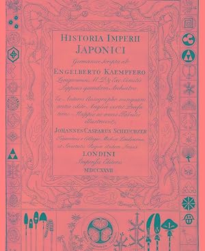
THE HISTORY OF JAPAN: GIVING AN ACCOUNT OF THE ANTIENT AND PRESENT STATE AND GOVERNMENT OF THAT EMPIRE . TOGETHER WITH A DESCRIPTION OF THE KINGDOM OF SIAM
Published by for the Publisher, and Thomas Woodward and Charles Davis, London, 1728
Seller: Charles Agvent, est. 1987, ABAA, ILAB, Fleetwood, PA, U.S.A.
Seller rating 5 out of 5 stars
First Edition
Hardcover. First Edition. Two folio (8-1/2" x 13-3/4) volumes in contemporary calf leather, neatly rebacked preserving the original gilt spine labels. First edition in English, second issue (with the additional appendix in volume 2), translated from the German by J. G. Scheuchzer. Titles printed in red and black with additional engraved titles and 45 mostly double-page or folding plates and maps. Kaempfer's HISTORY OF JAPAN "was for more than a century the chief source of Western knowledge of the country. It contains the first biography of Kaempfer; an account of his journey; a history and description of Japan and its fauna; a description of Nagasaki and Deshima; a report on two embassies to Edo with a description of the cities which were visited on the way; and six appendices, on tea, Japanese paper, acupuncture, moxa, ambergris, and Japan's seclusion policy" (DICTIONARY OF SCIENTIFIC BIOGRAPHY). Kaempfer was a physician for the Dutch East India Company's trading settlement at Nagasaki in the late 17th century. Sir Hans Sloane acquired the manuscript after Kaempfer's death, and arranged for it to be translated into English for this edition. Of significance is the fine folding map of Japan, "Imperium Japonicum in Sexaginta et Octo Provincias Divisum." Cordier, JAPONICA pages 414-15; Cox I: 332; Garrison-Morton 6374.11; See Nissen BBI 1019 note; Wellcome III: 376. Light dampstaining in second volume. Generally clean and bright, Near Fine.

