
Order Total (1 Item Items):
Shipping Destination:

Mike Bone (99 results)
Feedback
Skip to main search results
Search filters
Product Type
- All Product Types
- Books (71)
- Magazines & Periodicals (No further results match this refinement)
- Comics (No further results match this refinement)
- Sheet Music (No further results match this refinement)
- Art, Prints & Posters (No further results match this refinement)
- Photographs (No further results match this refinement)
- Maps (28)
- Manuscripts & Paper Collectibles (No further results match this refinement)
Condition
Binding
Collectible Attributes
- First Edition (4)
- Signed (No further results match this refinement)
- Dust Jacket (1)
- Seller-Supplied Images (14)
- Not Print on Demand (98)
Free Shipping
Seller Rating
-

Steppes: The Plants and Ecology of the World's Semi-arid Regions
Published by Timber Press (edition ), 2015
ISBN 10: 1604694653 ISBN 13: 9781604694659
Hardcover. Condition: Very Good. Ship within 24hrs. Satisfaction 100% guaranteed. APO/FPO addresses supported.
More buying choices from other sellers on AbeBooks
New offers from US$ 34.00
Used offers from US$ 8.13
Also find Hardcover First Edition
-
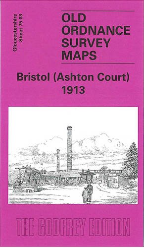
Bristol (Ashton Court) 1913: Gloucestershire Sheet 75.03 (Old O.S. Maps of Gloucestershire)
Published by Alan Godfrey Maps, 2005
ISBN 10: 1841517666 ISBN 13: 9781841517667
Seller: BettsBooksWales, Aberystwyth, CERED, United Kingdom
Seller rating 3 out of 5 stars

Map
No Binding. Condition: As New. Like New. It is in excellent condition. The book is from library of former Western Mail journalist, Clive Betts. Fel newydd. Mae'r llyfr mewn cyflwr gwych. Mae'r llyfr yn dod o cyn lyfrgell newyddiadurwr Western Mail, Clive Betts.
More buying choices from other sellers on AbeBooks
New offers from US$ 44.68
Used offers from US$ 8.25
-
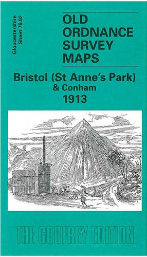
Bristol (St. Anne's Park & Conham) 1913: Gloucestershire Sheet 76.02 (Old O.S. Maps of Gloucestershire)
Published by Alan Godfrey Maps, 2003
ISBN 10: 1841515159 ISBN 13: 9781841515151
Seller: WorldofBooks, Goring-By-Sea, WS, United Kingdom
Seller rating 5 out of 5 stars

Paperback. Condition: Very Good. The book has been read, but is in excellent condition. Pages are intact and not marred by notes or highlighting. The spine remains undamaged.
More buying choices from other sellers on AbeBooks
New offers from US$ 44.68
Used offers from US$ 8.68
Also find Softcover
-

Bristol (St.George) 1902: Gloucestershire Sheet 72.14 (Old O.S. Maps of Gloucestershire)
Published by Alan Godfrey Maps, 2002
ISBN 10: 1841514241 ISBN 13: 9781841514246
Seller: WorldofBooks, Goring-By-Sea, WS, United Kingdom
Seller rating 5 out of 5 stars
Paperback. Condition: Very Good. The book has been read, but is in excellent condition. Pages are intact and not marred by notes or highlighting. The spine remains undamaged.
More buying choices from other sellers on AbeBooks
New offers from US$ 15.06
Used offers from US$ 8.84
Also find Softcover
-
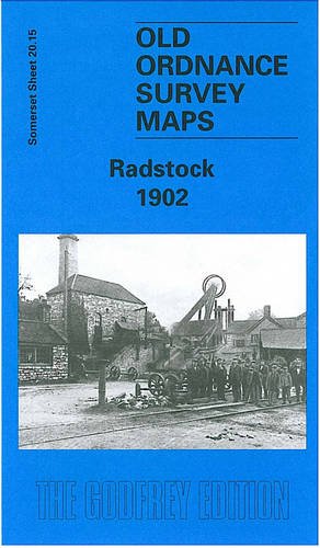
Radstock 1902: Somerset Sheet 20.15 (Old O.S. Maps of Somerset)
Published by Alan Godfrey Maps, 2001
ISBN 10: 1841512451 ISBN 13: 9781841512457
Seller: WorldofBooks, Goring-By-Sea, WS, United Kingdom
Seller rating 5 out of 5 stars
Paperback. Condition: Very Good. The book has been read, but is in excellent condition. Pages are intact and not marred by notes or highlighting. The spine remains undamaged.
-

Keynsham 1902: Gloucestershire Sheet 76.11 (Old Ordnance Survey Maps of Gloucestershire)
Published by Alan Godfrey Maps, 2003
ISBN 10: 1841515442 ISBN 13: 9781841515441
Seller: BettsBooksWales, Aberystwyth, CERED, United Kingdom
Seller rating 3 out of 5 stars
Map
Soft cover. Condition: As New. As New. Particularly well-preserved; tight, bright, clean and strong. Internally the pages are immaculately clean and complete.
More buying choices from other sellers on AbeBooks
New offers from US$ 44.68
Used offers from US$ 9.30
Also find Softcover
-
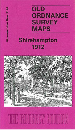
Shirehampton 1912: Gloucestershire Sheet 71.06 (Old O.S. Maps of Gloucestershire)
Published by Alan Godfrey Maps, 2004
ISBN 10: 1841516465 ISBN 13: 9781841516462
Seller: BettsBooksWales, Aberystwyth, CERED, United Kingdom
Seller rating 3 out of 5 stars
Map
Soft cover. Condition: As New. As New. Particularly well-preserved; tight, bright, clean and strong. Internally the pages are immaculately clean and complete.
More buying choices from other sellers on AbeBooks
New offers from US$ 44.68
Used offers from US$ 9.30
Also find Softcover
-

Brewing in Dorset
Published by Amberley Publishing, 2016
ISBN 10: 1445657317 ISBN 13: 9781445657318
Seller: WorldofBooks, Goring-By-Sea, WS, United Kingdom
Seller rating 5 out of 5 stars
Paperback. Condition: Very Good. The book has been read, but is in excellent condition. Pages are intact and not marred by notes or highlighting. The spine remains undamaged.
More buying choices from other sellers on AbeBooks
New offers from US$ 32.47
Used offers from US$ 10.25
Also find Softcover
-
Coloured Edition (Old Ordnance Survey Maps of Gloucestershire)
ISBN 10: 1847849997 ISBN 13: 9781847849991
Seller: WorldofBooks, Goring-By-Sea, WS, United Kingdom
Seller rating 5 out of 5 stars
Paperback. Condition: Very Good. The book has been read, but is in excellent condition. Pages are intact and not marred by notes or highlighting. The spine remains undamaged.
More buying choices from other sellers on AbeBooks
New offers from US$ 44.68
Used offers from US$ 10.87
Also find Softcover
-
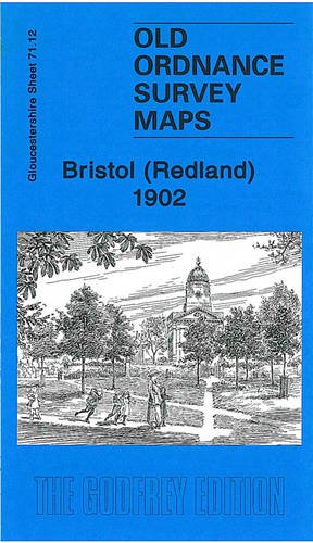
Bristol (Redland) 1902: Gloucestershire Sheet 71.12 (Old Ordnance Survey Maps of Gloucestershire)
Published by Alan Godfrey Maps, 2010
ISBN 10: 1847843581 ISBN 13: 9781847843586
Seller: WorldofBooks, Goring-By-Sea, WS, United Kingdom
Seller rating 5 out of 5 stars
Paperback. Condition: Very Good. The book has been read, but is in excellent condition. Pages are intact and not marred by notes or highlighting. The spine remains undamaged.
More buying choices from other sellers on AbeBooks
New offers from US$ 45.02
Used offers from US$ 11.86
Also find Softcover
-

Midsomer Norton 1902: Somerset Sheet 20.14 (Old Ordnance Survey Maps of Somerset)
Published by Alan Godfrey Maps, 2020
ISBN 10: 1787213072 ISBN 13: 9781787213074
Condition: VeryGood. Most items will be dispatched the same or the next working day.
-
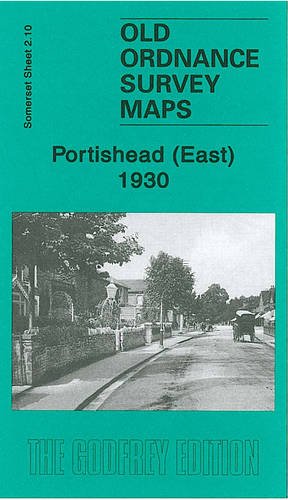
Portishead (East) 1930: Somerset Sheet 2.10 (Old Ordnance Survey Maps of Somerset)
Published by Alan Godfrey Maps, 2007
ISBN 10: 184151988X ISBN 13: 9781841519883
Condition: Good. Most items will be dispatched the same or the next working day. Minor shelf wear.
More buying choices from other sellers on AbeBooks
New offers from US$ 44.68
Used offers from US$ 12.20
-
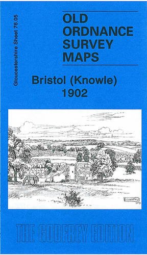
Bristol (Knowle) 1902: Gloucestershire Sheet 76.05 (Old Ordnance Survey Maps of Gloucestershire)
Published by Alan Godfrey Maps, 2009
ISBN 10: 1847842259 ISBN 13: 9781847842251
Seller: WorldofBooks, Goring-By-Sea, WS, United Kingdom
Seller rating 5 out of 5 stars
Paperback. Condition: Very Good. The book has been read, but is in excellent condition. Pages are intact and not marred by notes or highlighting. The spine remains undamaged.
More buying choices from other sellers on AbeBooks
New offers from US$ 44.68
Used offers from US$ 12.67
Also find Softcover
-
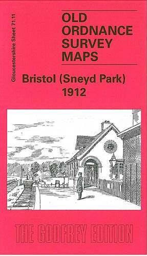
Bristol (Sneyd Park) 1912: Gloucestershire Sheet 71.11 (Old O.S. Maps of Gloucestershire)
Published by Alan Godfrey Maps, 2004
ISBN 10: 1841516740 ISBN 13: 9781841516745
Seller: WorldofBooks, Goring-By-Sea, WS, United Kingdom
Seller rating 5 out of 5 stars
Paperback. Condition: Very Good. The book has been read, but is in excellent condition. Pages are intact and not marred by notes or highlighting. The spine remains undamaged.
More buying choices from other sellers on AbeBooks
New offers from US$ 44.68
Used offers from US$ 14.58
Also find Softcover
-

Avonmouth 1901: Gloucestershire Sheet 71.01 (Old Ordnance Survey Maps of Gloucestershire)
Published by Alan Godfrey Maps, United Kingdom, Co Durham, 2007
ISBN 10: 1847840787 ISBN 13: 9781847840783
Seller: WorldofBooks, Goring-By-Sea, WS, United Kingdom
Seller rating 5 out of 5 stars
Paperback. Condition: Very Good. The book has been read, but is in excellent condition. Pages are intact and not marred by notes or highlighting. The spine remains undamaged.
More buying choices from other sellers on AbeBooks
New offers from US$ 44.68
Used offers from US$ 18.86
Also find Softcover
-

Yo Gabba Gabba!: Comic Book Time!
Published by Oni Press, 2011
ISBN 10: 1934964492 ISBN 13: 9781934964491
Condition: Good. The book may have minor cosmetic wear (i.e. creased spine/cover, scratches, curled corners, folded pages, minor sunburn, minor water damage, minor bent). The book may have some highlights/notes/underlined pages - Accessories such as CD, codes, toys, may not be included - Safe and Secure Mailer - No Hassle Return.
More buying choices from other sellers on AbeBooks
New offers from US$ 254.52
Used offers from US$ 19.79
Also find Hardcover
-
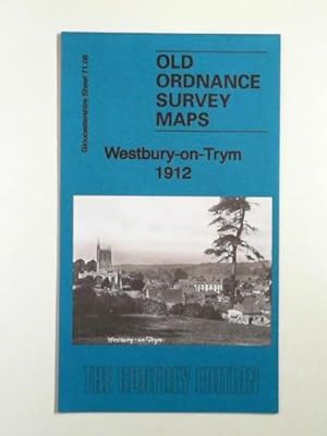
Westbury-on-Trym 1912: Gloucestershire Sheet 71.08
Published by Alan Godfrey Maps, 2014
ISBN 10: 1847848370 ISBN 13: 9781847848376
Seller: Cotswold Internet Books, Cheltenham, United Kingdom
Seller rating 5 out of 5 stars
Condition: Used - Very Good. VG map. A clean, tidy folding map. Almost as-new. Old Ordnance Survey Maps of Gloucestershire.
-

Madman Atomic Comics Volume 3: Electric Allegories
Published by Image Comics, 2010
ISBN 10: 1607062631 ISBN 13: 9781607062639
First Edition
Paperback. Condition: Like New. First Edition. A nice paperback graphic novel, clean with a tight binding with and an unmarked text.From a private smoke free collection.Shipping within 24 hours, with a tracking number and delivery confirmation.
-

Engineering Revolution : How the Modern World Was Changed by Technology
Published by Pen and Sword History, 2019
ISBN 10: 1473899087 ISBN 13: 9781473899087
Condition: New.
More buying choices from other sellers on AbeBooks
New offers from US$ 28.19
Used offers from US$ 30.41
Also find Hardcover
-

X-Statix, Volume 3: Back from the Dead
Published by Marvel Comics, 2004
ISBN 10: 0785111409 ISBN 13: 9780785111405
First Edition
Soft cover. Condition: Fine. 1st Edition. Fine paperback. First Edition, First Printing with the full number line. Overall a bright and attractive copy, as new.
-

A Guide to Industrial Archaeology
Published by The Association for Industrial Archaeology, Cardiff, 1998
ISBN 10: 0952893010 ISBN 13: 9780952893011
Paperback. Condition: Very Good. In very good condition.
-

A Guide to the Industrial Archaeology of Devon
Published by Association for Industrial Archaeology, 1998
ISBN 10: 0952893010 ISBN 13: 9780952893011
Seller: Invicta Books P.B.F.A., Builth Wells, POWYS, United Kingdom
Seller rating 5 out of 5 stars
First Edition
Soft cover. Condition: Fine. 1st Edition. illustrated, 56 pages.
-

Bristol (SE) 1882: Gloucestershire Sheet 76.01a (Old Ordnance Survey Maps of Gloucestershire)
Published by Alan Godfrey Maps, 2017
ISBN 10: 1787210510 ISBN 13: 9781787210516
Seller: GENERATIONS GONE BY, Manchester, United Kingdom
Seller rating 5 out of 5 stars
Map
No Binding. Condition: New. No Jacket. Here are the details of maps for Bristol SE: Gloucs 76.01a Bristol (SE) 1882 - published 2017; intro by Mike Bone. ISBN.978-1-78721-051-6 Gloucs 76.01b Bristol (SE) 1902 - published 1997; intro by Alan Godfrey. ISBN.978-0-85054-892-1 We have published two versions of this map, showing how the area changed across the years. The 1882 version is in full colour, taken from the beautiful 1st Edition OS handcoloured map. The maps cover an important and busy area of Bristol, with coverage stretching from Holy Cross church and Victoria Street south and eastward to Arno's Vale Cemetery and Arno's Court. Features (from 1882 version) include Temple Meads station with railway approaches, engine sheds and sidings; Floating Harbour, River Avon, The Feeder; Holy Cross church, Avonside Works, Temple Gate Works, Totterdown, St Luke's church, cattle market, gasworks, St Silas church, St Vincent's Works, Bristol Rolling Works, Avonside Tannery, Avonbank Works, St Philip's Marsh, Redcliff Works, Arno's Vale, Arno's Vale Cemetery, Redcliff Cemetery, Arno's CastleKensington Place etc. The map links up with sheets 72.13 Bristol NE to the north, 75.04 Bristol SW to the west, 76.02 Bristol St Annes Park to the east and 76.05 Knowle to the south.
-
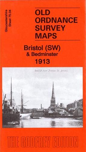
Bristol (SW) & Bedminster 1913: Gloucestershire Sheet 75.04b (Old Ordnance Survey Maps of Gloucestershire)
Published by Alan Godfrey Maps, 2019
ISBN 10: 1787212696 ISBN 13: 9781787212695
Seller: GENERATIONS GONE BY, Manchester, United Kingdom
Seller rating 5 out of 5 stars
Map
No Binding. Condition: New. No Jacket. Here are the details of maps for Bristol SW: Gloucs Sheet 75.04a Bristol (SW) & Bedminster 1902 - published 1998; intro by Alan Godfrey. ISBN.978-1-84151-009-5 Gloucs Sheet 75.04b Bristol (SW) & Bedminster 1913 - published 2019; intro by Mike Bone. ISBN.978-1-78721-269-5 We have published two versions of this map, showing how the area changed across the years. The maps cover a very busy area of Bristol, including part of the city centre and much of Bedminster. Coverage stretches from Bedminster Park eastward to Bedminster Bridge and St Mary Redcliff church, and from College Green and the Cathedral southward to Pearl Street and Windmill Hill. Major features include tramways, Queen Square, Canon's Marsh, Floating Harbour, River Avon, Bathurst Basin, Royal Hotel, Bathurst Wharf, Prince's Wharf, Great Western Dockyard, gas works, Cumberland Basin, Clifton Wood, Mardyke, Merchants Dock, Hotwells, GWR Harbour Railway. South of the river features include Ashton Gate, Clift House Hospital, Virgina Cavendish Works, tobacco factory, tannery, St John the Baptist church, Deanlane Colliery, tram depot, St Paul's church, small stretch of GWR with Bedminster station, much of Bedminster, etc. On the reverse we include a selection of street directory entries, incl Bedminster Parade, Dowry Parade and Square, East Street, King Street, Redcliff Hill and Street, Stackpool Road, Welsh Back, Whitehouse Street. Each map includes a specially written introduction to the history of the area, together with extracts from an early street directory.
-
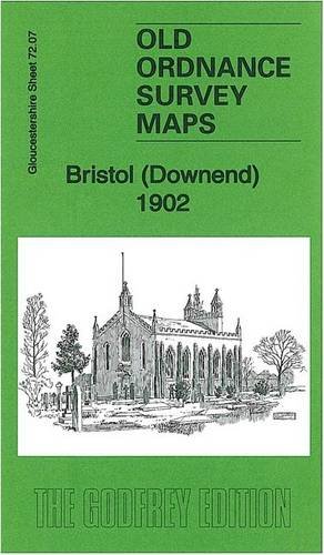
Bristol (Downend) 1902: Gloucestershire Sheet 72.07 (Old Ordnance Survey Maps of Gloucestershire)
Published by Alan Godfrey Maps, 2013
ISBN 10: 1847847404 ISBN 13: 9781847847409
Seller: GENERATIONS GONE BY, Manchester, United Kingdom
Seller rating 5 out of 5 stars
Map
No Binding. Condition: New. No Jacket. Here are the details of maps for Bristol Downend: Gloucestershire Sheet 72.07 Bristol (Downend) 1902 - published 2013; intro by Mike Bone. ISBN.978-1-84784-740-9 This detailed map covers the village of Downend, NE of Bristol, with a portion of Mangotsfield in the SE corner. Features include village centre with individual buildings neatly shown, Cleve Lodge, Clevehill, Clevehill Farm, Horseshoe pub, Christ Church, Overnhill House, Overndale, small portion of Frenchay, Stockwell Hill, Windsor Place, Crown pub, St James Street area of Mangotsfield. An 1894 directory of Downend is included on the reverse. The map links up with sheets 72.06 Frenchay to the west, 72.11 Staple Hill to the south.
-

Bedminster Down 1902: Gloucestershire Sheet 75.08 (Old Ordnance Survey Maps of Gloucestershire)
Published by Alan Godfrey Maps, 2015
ISBN 10: 1847848672 ISBN 13: 9781847848673
Seller: GENERATIONS GONE BY, Manchester, United Kingdom
Seller rating 5 out of 5 stars
Map
No Binding. Condition: New. No Jacket. Here are the details of maps for Bedminster Down: Gloucestershire Sheet 75.08 Bedminster Down 1902 - published 2015; intro by Mike Bone. ISBN.978-1-84784-867-3 This detailed map covers the Bedminster Down area south of Bristol, including the southern part of Bedminster itself. Features include GWR railway, The Batches area, Hendre Brick Works, New Pit, Gore's Marsh, St Aldhelm's church, clay pits, Malago Colliery (disused), Vale Lane Brick Works, The Novers, Nover's Hill Hospital, Lock's Mills, Malaga Vale, St John's Cemetery, football field, Engineers Arms etc. The map links up with sheet 75.04 Bristol SW to the north, 75.07 Long Ashton to the west and 76.05 Knowle to the east.
-
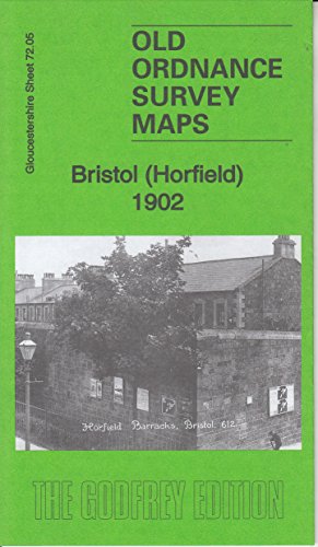
Bristol (Horfield) 1902: Gloucestershire Sheet 72.05 (Old Ordnance Survey Maps of Gloucestershire)
Published by Alan Godfrey Maps, 2016
ISBN 10: 1847849512 ISBN 13: 9781847849519
Seller: GENERATIONS GONE BY, Manchester, United Kingdom
Seller rating 5 out of 5 stars
Map
No Binding. Condition: New. No Jacket. Here are the details of maps for Bristol Horfield: Gloucs Sheet 72.05 Bristol (Horfield) 1902 - published 2016; intro by Mike Bone. ISBN.978-1-84784-951-9 This detailed map covers parts of Horfield and Stapleton Park, north of Bristol. Features include Stapleton Park, Stoke Park, Purdown Farm, Horfield Barracks, tramway, tram depot, Horfield Court Farm, Manor Farm, Wellington Hotel etc. Directories of Stapleton and Horfield are included on the reverse. The map links up with sheets 71.08 Westbury to the west, 72.06 Frenchay to the east, 72.09 Ashley Down to the south.
-
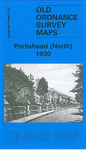
Portishead (North) 1930: Somerset Sheet 2.05
Published by Alan Godfrey Maps, 2007
ISBN 10: 1841519715 ISBN 13: 9781841519715
Seller: GENERATIONS GONE BY, Manchester, United Kingdom
Seller rating 5 out of 5 stars
No Binding. Condition: New. No Jacket. Here are the details of maps for Portishead (North): Somerset Sheet 02.05 Portishead (North) 1930 - published 2007; introduction by Mike Bone. ISBN.978-1-84151-971-5 This detailed map is one of three maps for Portishead. It covers the northern part of the town with coverage extending from Rockleigh and Kilkenny Bay eastward to Portishead Dock. Features include Woodhill, most of Portishead Dock, Pier, Royal Hotel, Portishead station, Portbury Wharf, engine shed, Marine Lake, Portishead Point, Adelaide Terrace, timber wharf. On the reverse we include a list of private residents from a 1920s directory. The detailed portrayal of the dock (continuing onto the Portishead East map) with its sidings, lock, flour mills and even mooring posts is the most striking feature of the map. The map links up with Somerset Sheet 2.09 Portishead West and 2.10 Portishead East to the south.
-
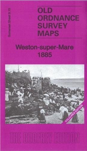
Weston-super-Mare 1885: Coloured Edition: Somerset Sheet 9.15a (Old Ordnance Survey Maps of Somerset)
Published by Alan Godfrey Maps, 2017
ISBN 10: 1787210782 ISBN 13: 9781787210783
Seller: GENERATIONS GONE BY, Manchester, United Kingdom
Seller rating 5 out of 5 stars
No Binding. Condition: New. No Jacket. Here are the details of maps for Weston-super-Mare: Somerset 9.15 Weston-super-Mare 1885 - published 2017; intro by Mike Bone. ISBN.978-1-78721-078-3 Somerset 9.15 Weston-super-Mare 1901 - published 1998; intro by Alan Godfrey. ISBN.978-1-84151-020-0 We have published two versions of this map, showing how the area developed across the years. The 1885 version is in full colour, taken from the OS 1st Edition handcoloured map. The maps cover the seaside resort of Weston-super-Mare. Much of the town centre and seafront is included, and features include Knightstone, part of pier, Emmanuel church, St John's church, Holy Trinity church, Verandah House, Prince Consort Gardens, Shrubbery Walks, many named villas, etc. The map links up with Sheet 9.16 Weston East to the east.
-

Bristol (Frenchay, Fishponds & Stapleton) 1912: Gloucestershire Sheet 72.06 (Old Ordnance Survey Maps of Gloucestershire)
Published by Alan Godfrey Maps, 2015
ISBN 10: 184784927X ISBN 13: 9781847849274
Seller: GENERATIONS GONE BY, Manchester, United Kingdom
Seller rating 5 out of 5 stars
Map
No Binding. Condition: New. No Jacket. Here are the details of maps for Bristol Frenchay: Gloucs Sheet 72.06 Bristol (Frenchay, Fishponds & Stapleton) 1912 - published 2015; intro by Mike Bone. ISBN.978-1-84784-927-4 This detailed map covers parts of Frenchay, Fishponds and Stapleton, north of Bristol. Features include St John's church, Frenchay; Frenchay Park, common, Frenchay Mill, Newlands, Begbrook, Oldbury Court, Stapleton Workhouse and Lunatic Asylum, Diocesan Training College, Broomhill, Stoke Park Colony, River Frome, Stapleton House (in extreme SW corner), isolation hospital, Stoke Park etc. A directory of Frenchay is included on the back. The map links up with sheets 72.05 Horfield to the west, 72.07 Downend to the east, 72.10 Fishponds to the south.