
Order Total (1 Item Items):
Shipping Destination:

Prince Alexander Philipp Maximilian Wied (46 results)
Feedback
Skip to main search results
Search filters
Product Type
- All Product Types
- Books (44)
- Magazines & Periodicals (No further results match this refinement)
- Comics (No further results match this refinement)
- Sheet Music (No further results match this refinement)
- Art, Prints & Posters (No further results match this refinement)
- Photographs (No further results match this refinement)
- Maps (2)
- Manuscripts & Paper Collectibles (No further results match this refinement)
Condition
Binding
- All Bindings
- Hardcover (45)
- Softcover (No further results match this refinement)
Collectible Attributes
- First Edition (5)
- Signed (No further results match this refinement)
- Dust Jacket (1)
- Seller-Supplied Images (8)
- Not Print on Demand (46)
Free Shipping
Seller Rating
-
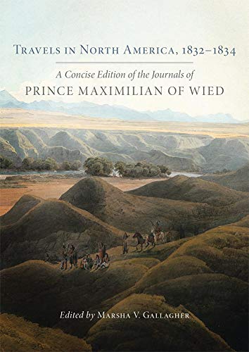
TRAVELS IN NORTH AMERICA 18321834
Published by University of Nebraska Press, 2017
ISBN 10: 0806155795 ISBN 13: 9780806155791
Condition: New. Brand New.
More buying choices from other sellers on AbeBooks
New offers from US$ 38.48
Used offers from US$ 54.75
Also find Hardcover
-
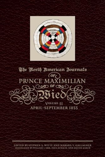
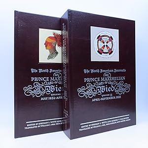
The North American Journals of Prince Maximilian of Wied: April-September 1833 (Volume 2)
Published by University of Oklahoma Press, 2010
ISBN 10: 0806139234 ISBN 13: 9780806139234
First Edition
Hardcover. Condition: As New. No Jacket. 1st Edition. As New in Hardcover. 1st Printing.
-
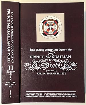
The North American Journals of Prince Maximilian of Wied: April - September 1833 (Volume 2)
Published by University of Oklahoma Press, 2010
ISBN 10: 0806139234 ISBN 13: 9780806139234
Seller: Chaparral Books, Portland, OR, U.S.A.
Association Member: CBA
Seller rating 5 out of 5 stars

Hardcover. Condition: Good. Dust Jacket Condition: No dustjacket as issued. First thus, first printing. The binding is tight, corners sharp. The bottom corner of the text block is faintly dampstained; some page corners lightly wrinkled. No discoloration to the text or images. xxxiii, 571pp.
-
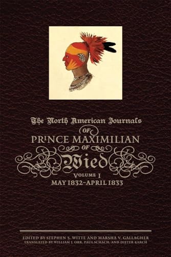
The North American Journals of Prince Maximilian of Wied: May 1832?April 1833 (Volume 1) (North American Journal of Prince Maximilian of Wied)
Published by University of Oklahoma Press, 2008
ISBN 10: 0806138882 ISBN 13: 9780806138886
First Edition
Hardcover. Condition: Fine. No Jacket. 1st Edition. Fine in full brown leather with silver titles. 1st Printing.
-
The North American Journals of Prince Maximilian of Wied: May 1832?April 1833 (Volume 1) (North American Journal of Prince Maximilian of Wied)
Published by University of Oklahoma Press, 2008
ISBN 10: 0806138882 ISBN 13: 9780806138886
Condition: New. Book is in NEW condition. 2.
More buying choices from other sellers on AbeBooks
New offers from US$ 94.46
Used offers from US$ 117.92
Also find Hardcover First Edition
-
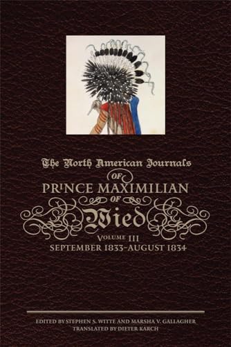
The North American Journals of Prince Maximilian of Wied, Vol. 3: September 1833 - August 1834
Published by University of Oklahoma Press, 2012
ISBN 10: 0806139242 ISBN 13: 9780806139241
Condition: Very Good. Book is in Used-VeryGood condition. Pages and cover are clean and intact. Used items may not include supplementary materials such as CDs or access codes. May show signs of minor shelf wear and contain very limited notes and highlighting. 5.85.
More buying choices from other sellers on AbeBooks
New offers from US$ 132.77
Used offers from US$ 131.44
Also find Hardcover
-
The North American Journals of Prince Maximilian of Wied (Volumes One and Two)
Published by University of Oklahoma Press, 2008
ISBN 10: 0806138882 ISBN 13: 9780806138886
Seller: Shelley and Son Books (IOBA), Hendersonville, NC, U.S.A.
Association Member: IOBA
Seller rating 5 out of 5 stars
First Edition
Hardcover. Condition: Fine. First Edition. First Edition. Volumes One and Two of the three volume set of The North American Journals of Prince Maximilian. Volume one (467 pp.) covers the time period of May 1832 to April 1833. Volume two (571 pp.) covers the time period of April 1833 to September 1833. Both volumes are bound in burgundy cloth, titled and decorated in silver. Different illustration on each. Burgundy end papers. All illustrations throughout the text are from the Maximilian-Bodmer Collection in the Durham Center for Western Studies at Joslyn Art Museum. All are by Maximilian and taken from Volume 1 of his manuscript journals unless otherwise noted. Both volumes are in fine condition. Nice set. Due to this book's size and/or weight, additional shipping may be needed. Full refund if not satisfied.
-

The North American Journals of Prince Maximilian of Wied: April�"September 1833 (Volume 2)
Published by The Arthur H. Clark Company, 2010
Leather Bound. Condition: Fine. #85 OF 175 COLLECTOR'S EDITION-LEATHERBOUND IN SLIPCASE-EDITION NEARLY PRISTINE***NOT FOR INTL SHIPPING***.
-
The North American Journals of Prince Maximilian of Wied: September 1833�"August 1834 (Volume 3)
Published by The Arthur H. Clark Company, 2012
Leather Bound. Condition: New. ***NOT FOR INTL SHIPPING***.
-
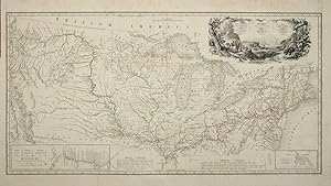
Carte Itineraire de Prince Maximilian de Wied dans l'interieur de l'Amerique Septentrionale de Boston a Missouri superieur &c. en 1832, 33 et 34. Reise Charte des Prinzen Maximilian zu Wied Map to illustrate the Route of Prince Maximilian of Wied in the interior of North America. From Boston to the Upper Missouri &c. in 1832, 33 & 34.
Published by Paris, 1839
Seller: Clive A. Burden Ltd., Chalfont St. Giles, BUCKS, United Kingdom
Seller rating 2 out of 5 stars

Map
No binding. Condition: Good. 415 x 810 mm., large folding map in early outline colour as issued, one or two light creases, some browning to upper margin and water stain to lower margins not affecting the map, otherwise in good condition with no major splits or tears. A fine example of this very rare map which accompanied the finest colour plate book on the North American Indian ever printed entitled 'Reise in das inner Nord-America .' It is particularly rare is it accompanied the text volumes printed to accompany the fine aquatint plates more often found. It charts one of the more remarkable voyages of exploration undertaken within the present United States. Prince Maximilian of Wied-Neuwied (1782-1867) was a noted German explorer, ethnologist and naturalist. Joining the Prussian army in 1800 he fought through the Napoleonic Wars and left at the end in 1815. An early friend of Alexander Humboldt Maximilian led his own expedition to Brazil in 1815-17. In 1832 after hiring the Swiss artist Karl Bodmer he set out again this time to the waters of the Missouri River and the Plains. The region was little known at the time. They started out from St. Louis and travelled on the 'Yellowstone', an American Fur Company steamboat stopping at their various forts. Changing vessels along the way they continued Fort Union, Fort Clark and Fort Mackenzie. They observed the Assiniboin, Cree, Mandan, Minatare and Crow peoples. From here they returned south reaching St. Louis in May 1834.Whilst Prince Maximilian returned to Germany to write his account Karl Bodmer travelled to Paris to prepare his famous aquatint plates from his collection of watercolours. Together their finished work would be considered one of the most sympathetic and accurate recordings of the Plains Indians issued just prior to their virtual extinction with a decade. This was ironically brought about by the very method used to document them in the first place. In 'The Plains Indians', the historian Paul H. Carlson states the smallpox outbreak was traced to contact between deckhands of the steamboats of the American Fur Company and the natives.Wheat records that Prince Maximilian was given a map in 1833 by Major Benjamin O'Fallon who was the nephew of William Clark author of the map who along with Meriwether Lewis had crossed the region to reach the Pacific Ocean earlier in the century. O'Fallon had joined Clark in 1808 and was also present on Stephen Long's expedition to the Rocky Mountains in 1819-20. By the time of Prince Maximilian expedition, he was one of the most experienced travellers in the region. No doubt the version he passed to the Prince would have been updated considerably since the Lewis and Clark expedition. The fact that the printed map includes the route of Long is clear indication of that. The Prince is said to have 'completed it and removed its deficiencies'. Since the publication of Wheat further research has identified that the cartographer was Lt. Col. William Thorn who used as a base map Henry Tanner's 'Map of the United States of America' published in 1837. The map includes large insets of the Missouri River lower left and one of the source of the Mississippi River 'According to Schoolcraft' lower right. The whole is finished with a dramatic title cartouche illustrating a buffalo hunting scene.Maximilian's insisted that the text be published in a deluxe edition, which made publishers wary. The popularity of such works was waning. Maximilian persisted and in 1839 the first text and prints were ready for distribution to a disappointingly few subscribers. A French edition in 1840-42 and the English translation in 1843 were no more successful. Bodmer spent a total of eight years supervising a group of the best French and Swiss etchers to produce the aquatints. The original copper plate for the map was recently found amongst the original watercolours in the Joslyn Art Museum, Omaha, Nebraska. Provenance: private German collection; private English collection. Abbey Travel 615; Field 103.
-
Reise in das Innere Nord-America in den Jahren 1832 bis 1834 von Maximilian Prinz zu Wied
Published by J. Hoelscher, Coblenz, 1839
Seller: Clive A. Burden Ltd., Chalfont St. Giles, BUCKS, United Kingdom
Seller rating 2 out of 5 stars
Map First Edition
No binding. Condition: Very Good. FIRST EDITION IN COLOUR. Text in two large quarto volumes (330 x 280 mm. ea.), recent matching half calf, brown moir� cloth boards, spines with gilt ruled raised bands with gilt titles, with central blind embossed compartments. With titles, half-titles, table of contents, list of subscribers, pp. [16], 654, [2]; [24], 688, [2], containing over 40 woodblock engravings set within the text, with the large folding map (415 x 810 mm.) in early outline colour often missing. Tableau atlas in oblong portfolio (430 x 610 mm.), in contemporary half calf binding, brown moir� cloth boards, gilt panelled with central gilt title within ornate frame, spine with gilt ruled raised bands, compartments with ornate blind central feature, interior of both boards with publisher's green moir� paper, extremities lightly rubbed. Containing 48 plates consisting of 48 Tableau engravings on steel and copper in excellent old colour heightened with gum Arabic and a table illustrating the temperatures at Fort Union and Fort Clark (often lacking), 41 plates in their first state, the remainder early states, minor repairs, none affecting plate area, with protective tissue, all with publisher's blind stamp. Vignette atlas in oblong portfolio (330 x 485 mm.), in contemporary half calf binding, brown moir� cloth boards, gilt panelled with central gilt title within ornate frame, rebacked to style, interior of both boards with publisher's green moir� paper. Containing 33 Vignette engravings on steel and copper in excellent old colour heightened with gum Arabic, 30 plates in their first state, the remainder early states, minor repairs, none affecting plate area, with protective tissue, all with publisher's blind stamp. The first edition of the narrative of the travels of Prince Maximilian zu Wied-Neuwied (1782-1867) up the Missouri River and the Plains in 1832-34. It is accompanied by the magnificent series of portraits and scenes of Indian life just prior to its loss forever. Many of them are amongst the most iconic images of the American West. The artist accompanying him on the voyage was Karl Bodmer (1809-93). Ron Tyler called him 'the most accomplished artist to paint them [American Indians]'.Prince Maximilian was a student of natural history and had studied under the same tutor as another great scientist, Alexander von Humboldt. Their field of study was anthropology and how the spread of humans around the globe had led to so many different races. Maximilian's trip was to attempt to answer some of those questions. A veteran of the Napoleonic Wars he had already travelled to the Brazilian jungle 1815-17. The prints accompany that work were derided and for his travels to America he wrote 'I would want to bring along a draftsman who would not be too much of a burden on my pocketbook, a landscape painter but also able to depict figures correctly and accurately, especially the Indians.' Maximilian met the young Bodmer in January 1832 and after agreeing to the voyage they departed in May of the same year.Arriving in Boston they made their way to St. Louis by April 1833 from where they headed up the Missouri in the Yellow Stone, an American Fur Company steamboat which had carried George Catlin the previous year. The region was little known at the time. Changing vessels along the way they continued to Fort Union, Fort Clark, and Fort Mackenzie. They observed the Assiniboin, Cree, Mandan, Minatare, and Crow peoples. They went beyond Fort Union into Blackfoot country in present day Montana. After a dreadful return journey, they reached St. Louis on 16 July 1834, Maximilian suffering badly from scurvy. Maximilian had lost much of his natural history and ethnographic material in the explosion of the Assiniboine on the Missouri. However, Bodmer's more than 400 watercolours and sketches.Whilst Prince Maximilian returned to Germany to write his account Karl Bodmer travelled to Paris to prepare his famous aquatint plates from his collection of watercolours. After several.
