
Order Total (1 Item Items):
Shipping Destination:

Rennell James 1742 1830 (24 results)
Feedback
Skip to main search results
Search filters
Product Type
- All Product Types
- Books (24)
- Magazines & Periodicals (No further results match this refinement)
- Comics (No further results match this refinement)
- Sheet Music (No further results match this refinement)
- Art, Prints & Posters (No further results match this refinement)
- Photographs (No further results match this refinement)
- Maps (No further results match this refinement)
- Manuscripts & Paper Collectibles (No further results match this refinement)
Condition
Binding
Collectible Attributes
- First Edition (2)
- Signed (No further results match this refinement)
- Dust Jacket (No further results match this refinement)
- Seller-Supplied Images (6)
- Not Print on Demand (16)
Free Shipping
Seller Rating
-

A Bengal Atlas: Containing Maps of the Theatre of War and Commerce on That Side of Hindoostan Compiled From the Original Surveys ...
Published by Legare Street Press, 2021
ISBN 10: 1015350550 ISBN 13: 9781015350557
Condition: NEW. Book is in NEW condition. 0.13.
-
The Geographical System of Herodotus Examined and Explained, by a Comparison with Those of Other Ancient Authors, and with Modern Geography Volume 2
Published by Hardpress Publishing, 2013
ISBN 10: 1313998818 ISBN 13: 9781313998819
PAP. Condition: NEW. New Book. Shipped from UK. Established seller since 2000.
-
The Journals of Major James Rennell, First Surveyor-General of India, Written for the Information of the Governors of Bengal During His Surveys of the
Published by Hardpress Publishing, 2013
ISBN 10: 1314698877 ISBN 13: 9781314698879
Seller: THE SAINT BOOKSTORE, Southport, United Kingdom
Seller rating 5 out of 5 stars

Paperback / softback. Condition: NEW. New copy - Usually dispatched within 4 working days.
-

Travels, in the Interior Districts of Africa
Published by LEGARE STREET PR, 2022
ISBN 10: 1016648375 ISBN 13: 9781016648370
PAP. Condition: NEW. New Book. Shipped from UK. THIS BOOK IS PRINTED ON DEMAND. Established seller since 2000.
-

A Bengal Atlas: Containing Maps of the Theatre of War and Commerce on That Side of Hindoostan Compiled From the Original Surveys ...
Published by Legare Street Press, 2023
ISBN 10: 1019696923 ISBN 13: 9781019696927
Seller: Ria Christie Collections, Uxbridge, United Kingdom
Seller rating 5 out of 5 stars
Condition: NEW. In.
-
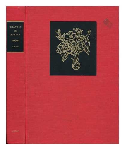
Through the Interior Districts of Africa
Published by New York Arno Press, New York United States, 1971
ISBN 10: 0405017189 ISBN 13: 9780405017186
Seller: The London Bookworm, East Sussex, United Kingdom
Seller rating 5 out of 5 stars
Cloth. Condition: USED_VERYGOOD. No Jacket. First Thus. Hardcover Through the Interior Districts of Africa physician travellers Mungo (1771-1806). Rennell, James (1742-1830) Park.In 1795, at the age of twenty-four, Mungo Park began a journey from the Gambia into the uncharted interior of the African continent. Travelling with only native guides, and later entirely alone, his goal was to become the first European to reach the River Niger and the fabled city of Timbuctoo. The journey took him through warring African kingdoms and the fringes of the Sahara Desert, leading him into great physical hardship and danger. He endured imprisonment by a Moorish chief for several months, was repeatedly robbed, and came close to Death 371 pages; Description: xxviii, 372, xcii p. Illus. , fold. Maps, port. 26 cm. Fine Facsimile Reprint from the copy in the Francis A. Countway Library of Medicine.(We carry a wide selection of titles in The Arts, Theology, History, Politics, Social and Physical Sciences. academic and scholarly books and Modern First Editions etc.).
-
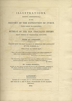
Illustrations (Chiefly Geographical) of the History of the Expedition of Cyrus from Sardis to Babylonia and the retreat of the ten thousand Greeks, from Thence to Trebisonde and Lydia.
Published by W. Bulmer and Co, London, 1816
Hardcover. Condition: USED_FINE. First Edition. xxix, [1 errata], 347 pp., half-title, folding engraved frontis map, modern blue cloth, title gilt on faded spine, Unopened, With an appendix, containing an enquiry into the best method of improving the geography of the Anabasis, &c. Explained by three maps (LACKING 2 maps), bookplate of Bath Municipal Reference Library on front fly leaf, blind stamp on title page, shelf reference on lower spine. Major James Rennell, was an English geographer, historian and a pioneer of oceanography. He produced some of the first accurate maps of Bengal at one inch to five miles as well as accurate outlines of India and served as Surveyor General of Bengal. Rennell has been called the Father of Indian Geography and as the Father of Oceanography. In 1830 he was one of the founders of the Royal Geographical Society in London. He also contributed papers to Archaeologia on the site of Babylon, the island of St Paul's shipwreck, and the landing-place of Caesar in Britain. Rennell published a book titled Memoir of a map of Hindoostan (1788). His plan for a comprehensive study of western Asia resulted in a two-volume study of the geography of Herodotus and A Treatise on the Comparative Geography of Western Asia (1831), among other works. #34780.
-
Untersuchungen �ber einzelne Gegenst�nde der alten Geschichte, Geographie und Chronologie.
Published by Hammerich, Altona, 1800
Seller: Magister Michalis, Internet-Antiquariat, Wielenbach, Germany
Seller rating 5 out of 5 stars
Hardcover. Condition: USED_NEARFINE. 2 St�cke (alles Erschienene) in 1 Bd. (1800-1802). Mit 5 (4 gefalt.) Tabellen und 14 Kupferstichkarten auf 12 gefalt. Tafeln. 7 Bl., 183 S., 7 Bl., 797 (recte 813) S. Rundummblauschnitt. Wohlgepflegtes Ganz- Ldr. d. Zt. (s. leicht beschabt und etw. besto�en). Seiten insges. s. sauber u. nur leicht gebr�unt, ein hervorragendes Ex. +++ Sehr selten. +++ Einzige Ausgabe. Hamberger-M. IX, 134, und XIII, 166. ADB III, 282. Wegele 968. Fromm 11382. Als philologisches Journal konzipiert, sind die Untersuchungen �ber zwei St�cke nicht hinausgelangt. Immerhin verschafften sie zusammen mit seinem 1799 erschienenen Handbuch der alten Geschichte Gottfried Gabriel Bredow (1773-1814), einem Sch�ler von Friedrich August Wolf, den Ruf an die Universit�t Helmstedt. Das erste St�ck enth�lt aus Bredows eigener Feder Studien zur biblischen Chronologie der Patriarchen, zur Geographie des Reiches von Nimrod und zum r�mischen Konsulat, ferner von Johann Heinrich Vo� einen Beitrag �ber die Lage von Thule; das zweite St�ck sind von Bredow �bersetzte Ausz�ge aus den Recherches sur la g�ographie syst�matique et positive des anciens des Pascal Fran�ois Joseph Gossellin (1751-1830), aus dem Geographical System of Herodotus des James Rennell (1742-1830) und aus dem Voyage of Nearchus from the Indus to the Euphrates des William Vincent (1739-1815). +++ Aus Nichtraucherhaushalt. +++ Mehr Fotos gerne �ber die Schaltfl�che FRAGE AN DEN ANBIETER .
-
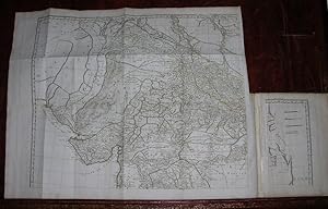
Recueil de cartes g�ographiques pour la description de l'Indostan [18th Cdentury Maps of Hindoostan]. Atlas only. First edition.
Published by Paris: chez Poign�e, An VIII (1793), 1793
Seller: Wittenborn Art Books, San Francisco, CA, U.S.A.
Seller rating 5 out of 5 stars
Condition: USED_GOOD. 4to. 22 x 28.3 cm. New half Sakora goat binding with marbled boards by the artisan binder Sasha Mosalov. Original spine label preserved. Provenance le Comte de Fortis, with his ex libris. 40pp., eleven fold-out maps of various sizes, 2 colored in outline.Very good and fresh. In-4;Avec 11 cartes la plupart d�pliantes, certaines finement rehauss�es de couleurs. "James Rennell was the greatest geographer that Great Britain had yet produced. His pre-eminence, as Sir Henry Yule said in 1881, is still undisputed. He was an explorer both by sea and land, a map compiler, a physical geographer, a critical and comparative geographer, and a hydrographer. Expertise by : Danyela PETITOT40 avenue de S�gur - 75015 Paris.
-
Recueil de Cartes Geographiques, pour la Description de L'Indostan.
Published by Paris: Poignee, An VIII [1793]., 1793
Seller: Arader Galleries - AraderNYC, New York, NY, U.S.A.
Seller rating 5 out of 5 stars
First Edition
Hardcover. Condition: USED_FINE. 1st Edition. Small folio (11 4/8 x 8 4/8 inches). Four large folding engraved maps, that combine to form "Carte de L'Indostan ou de L'Empire Mogol.", with contemporary hand-color in outline, and six engraved folding maps and one plan (some tears near mounts and clumsy repairs). Contemporary quarter sheep, marbled paper boards, uncut (extremities a bit worn). Provenance: 20th-century gift inscription on the recto of the front free endpaper. First French edition, with maps revised by Jean Nicholas Buache, incorporating the four maps that compose Rennell's "second great work. the construction of the first approximately correct map of India" (DNB). "The Father of Indian Surveying" (Gole "Early Maps of India") Rennell charted the currents through the India Ocean and around Africa, and later surveyed the Indian interior. He recognized Europe's growing fascination with India: "As almost every particular relating to Hindoostan is become an object of popular curiosity, it can hardly be deemed superfluous to lay before the public an improved system of its geography" (Rennell Preface). With Rennell's first map of Hindoostan, the result of 500 separate surveys and stretching from the Himalayas in the north, to Ceylon in the south, and the "Great Sandy Deserts" in the west. Born in Chudleigh in Devon, England, James Rennell, who was to become one of the mosst celebrated cartographers of his time, joined the British Navy as a midshipman at the age of 14. Amidst the Seven Years' War (1756-1763), he travelled the world and learned marine surveying and hydrography. This led to his appointment at age 24 as surveyor of the British East India Company's dominions in Bengal. In 1765, Rennell began surveying India. By this time, the British East India Company had maintained its foothold on the region for over one hundred years, but it was still another century before Queen Victoria would set her eyes eastward, and Rennell's explorations and accounts helped to fill that gap in time. Rennell combined data from British Army columns with Ain-e-Akbari (1598), a translation of Islamic geography of the empire which helped him acquire information about old divisions (he therefore subdivided the country according to the Mughal provinces of 'subas').
-

Recueil de Cartes Geographiques, pour la Description de L'Indostan + Description historique et g�ographique de l'indostan, , traduite de l'anglais par J.B. Bouscheseiche, sur la septi�me et derni�re �dition, � laquelle on a joint des M�langes d'Histoire et de Statistique sur l'Inde, traduits par J. Cast�ra
Published by Paris: Poignee, An VIII [1800], 1800
Seller: Moroccobound Fine Books, IOBA, Lewis Center, OH, U.S.A.
Association Member: IOBA
Seller rating 5 out of 5 stars
First Edition
Hardcover. Condition: USED_VERYGOOD. 1st Edition. Small folio atlas (11 4/8 x 8 4/8 inches) with four large folding engraved maps, that combine to form "Carte de L'Indostan ou de L'Empire Mogol.", contemporary hand-colored in outline, and six engraved folding maps and one plan. Hardcover, bound in contemporary calf-backed paper covered boards. The binding with some edge-wear. Light, largely marginal foxing. + Three octavo volumes (8 x 5 inches). xxxviii, 302; 410; 362pp. Hardcovers, bound in contemporary full mottled calf. Light edge-wear. The text with some offset and light occasional foxing.
![Seller image for Recueil de cartes g�ographiques pour la description de l'Indostan [18th Cdentury Maps of Hindoostan]. Atlas only. First edition. for sale by Wittenborn Art Books](https://pictures.abebooks.com/inventory/md/md31358972472.jpg)
