
Order Total (1 Item Items):
Shipping Destination:

Taunt Henry (225 results)
Skip to main search results
Product Type
- All Product Types
- Books (136)
- Magazines & Periodicals
- Comics
- Sheet Music
- Art, Prints & Posters (32)
- Photographs (2)
- Maps (55)
-
Manuscripts &
Paper Collectibles
Condition
Binding
Collectible Attributes
- First Edition (25)
- Signed (2)
- Dust Jacket (19)
- Seller-Supplied Images (131)
- Not Printed On Demand (205)
Free Shipping
Seller Location
Seller Rating
-
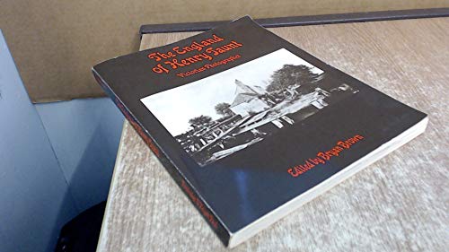
The England of Henry Taunt, Victorian photographer;: His Thames, his Oxford, his home counties and travels, his portraits, times and ephemera,
Published by Routledge & K. Paul, 1973
ISBN 10: 0710075421ISBN 13: 9780710075420
Seller: Wonder Book, Frederick, MD, U.S.A.
Seller Rating:

Book
Condition: Good. Good condition. Acceptable dust jacket. A copy that has been read but remains intact. May contain markings such as bookplates, stamps, limited notes and highlighting, or a few light stains. Bundled media such as CDs, DVDs, floppy disks or access codes may not be included.
More buying choices from other sellers on AbeBooks
New offers from US$ 100.34
Used offers from US$ 7.89
Also find Hardcover First Edition
-

No Binding. Condition: Very Good. Small map of the River Thames between Putney and Kew, from Henry W Taunt, Taunt's Map and Guide to the Thames, New Pocket edition, London 1879. Image size 103 x 72 mm approx. Price includes standard postage worldwide.
-
Small map of the River Thames between Henley on Thames and Wargrave (1879)
Publication Date: 1879
Map
No Binding. Condition: Very Good. Small map of the River Thames between Henley on Thames and Wargrave, from Henry W Taunt, Taunt's Map and Guide to the Thames, New Pocket edition, London 1879. Image size 103 x 72 mm approx. Price includes standard postage worldwide.
-
No Binding. Condition: Very Good. Small map of the River Thames between Sandford and Nuneham Park, from Henry W Taunt, Taunt's Map and Guide to the Thames, New Pocket edition, London 1879. Image size 103 x 72 mm approx, slight foxing. Price includes standard postage worldwide.
-
No Binding. Condition: Very Good. Small map of the River Thames between Rushy Lock and Duxford, from Henry W Taunt, Taunt's Map and Guide to the Thames, New Pocket edition, London 1879. Image size 103 x 72 mm approx. Price includes standard postage worldwide.
-
No Binding. Condition: Very Good. Small map of the River Thames at South Stoke and North Stoke, from Henry W Taunt, Taunt's Map and Guide to the Thames, New Pocket edition, London 1879. Image size 103 x 72 mm approx. Price includes standard postage worldwide.
-
Small map of the River Thames between Shepperton and Sunbury, with Walton on Thames (1879)
Publication Date: 1879
Map
No Binding. Condition: Very Good. Small map of the River Thames between Shepperton and Sunbury, with Walton on Thames, from Henry W Taunt, Taunt's Map and Guide to the Thames, New Pocket edition, London 1879. Image size 103 x 72 mm approx, slight foxing. Price includes standard postage worldwide.
-
Small map of the River Thames between Standlake Common and Appleton (1879)
Publication Date: 1879
Map
No Binding. Condition: Very Good. Small map of the River Thames between Standlake Common and Appleton, from Henry W Taunt, Taunt's Map and Guide to the Thames, New Pocket edition, London 1879. Image size 103 x 72 mm approx, slight foxing. Price includes standard postage worldwide.
-
No Binding. Condition: Very Good. Small map of the River Thames at Lechlade, from Henry W Taunt, Taunt's Map and Guide to the Thames, New Pocket edition, London 1879. Image size 103 x 72 mm approx. Price includes standard postage worldwide.
-
Small print of the River Thames above King's Weir (1879)
Publication Date: 1879
Art / Print / Poster
No Binding. Condition: Very Good. Small print showing the River Thames above King's Weir, from Henry W Taunt, Taunt's Map and Guide to the Thames, New Pocket edition, London 1879. Image size 110 x 70 mm approx, text to verso. Price includes standard postage worldwide.
-
Small print of the River Thames at Bablock Hythe Ferry (1879)
Publication Date: 1879
Art / Print / Poster
No Binding. Condition: Very Good. Small print showing the River Thames at Bablock Hythe Ferry, from Henry W Taunt, Taunt's Map and Guide to the Thames, New Pocket edition, London 1879. Image size 85 x 62 mm approx, set in text with text to verso. Price includes standard postage worldwide.
-
Small map of the River Thames between Lower Caversham and Shiplake (1879)
Publication Date: 1879
Map
No Binding. Condition: Very Good. Small map of the River Thames between Lower Caversham and Shiplake, from Henry W Taunt, Taunt's Map and Guide to the Thames, New Pocket edition, London 1879. Image size 103 x 72 mm approx, spot of foxing. Price includes standard postage worldwide.
-
Small map of the River Thames between Nuneham Park and Clifton Hampden (1879)
Publication Date: 1879
Map
No Binding. Condition: Very Good. Small map of the River Thames between Nuneham Park and Clifton Hampden, from Henry W Taunt, Taunt's Map and Guide to the Thames, New Pocket edition, London 1879. Image size 103 x 72 mm approx. Price includes standard postage worldwide.
-
Small print of the River Thames at Inglesham Round House (1879)
Publication Date: 1879
Art / Print / Poster
No Binding. Condition: Very Good. Small print showing the River Thames at Inglesham Round House with the junction of the river and canal, from Henry W Taunt, Taunt's Map and Guide to the Thames, New Pocket edition, London 1879. Image size 90 x 63 mm approx, set in text with text to verso. Price includes standard postage worldwide.
-
No Binding. Condition: Very Good. Sketch map of the Thames, showing the sequence of smaller maps contained in the original volume, from Henry W Taunt, Taunt's Map and Guide to the Thames, New Pocket edition, London 1879. Image size 95 x 49 mm approx, single fold as published Price includes standard postage worldwide.
-
No Binding. Condition: Very Good. Small map of the River Thames between Kelmscott and Thrup Common, from Henry W Taunt, Taunt's Map and Guide to the Thames, New Pocket edition, London 1879. Image size 103 x 72 mm approx, slight foxing. Price includes standard postage worldwide.
-
No Binding. Condition: Very Good. Small map of the River Thames between Wytham Wood and Port Meadow, from Henry W Taunt, Taunt's Map and Guide to the Thames, New Pocket edition, London 1879. Image size 103 x 72 mm approx, slight foxing. Price includes standard postage worldwide.
-
No Binding. Condition: Very Good. Small map of the River Thames around Cookham, from Henry W Taunt, Taunt's Map and Guide to the Thames, New Pocket edition, London 1879. Image size 103 x 72 mm approx. Price includes standard postage worldwide.
-
No Binding. Condition: Very Good. Small map of the River Thames between Oxford and Iffley, from Henry W Taunt, Taunt's Map and Guide to the Thames, New Pocket edition, London 1879. Image size 103 x 72 mm approx. Price includes standard postage worldwide.
-
Small print showing the shop front of Henry W Taunt and Co in Broad Street, Oxford (1879)
Publication Date: 1879
Art / Print / Poster
No Binding. Condition: Very Good. Small print showing the shop front of Henry W Taunt and Co in Broad Street, Oxford from Henry W Taunt, Taunt's Map and Guide to the Thames, New Pocket edition, London 1879. Image size 88 x 66 mm approx, set in text with text to verso. Price includes standard postage worldwide.
-
No Binding. Condition: Very Good. Small map of the River Thames between Great Marlow and Hurley, from Henry W Taunt, Taunt's Map and Guide to the Thames, New Pocket edition, London 1879. Image size 103 x 72 mm approx, slight foxing. Price includes standard postage worldwide.
-
No Binding. Condition: Very Good. Small map of the River Thames at Streatley and Goring, from Henry W Taunt, Taunt's Map and Guide to the Thames, New Pocket edition, London 1879. Image size 103 x 72 mm approx. Price includes standard postage worldwide.
-
No Binding. Condition: Very Good. Small map of the River Thames between Taplow and Bray, from Henry W Taunt, Taunt's Map and Guide to the Thames, New Pocket edition, London 1879. Image size 103 x 72 mm approx, slight foxing. Price includes standard postage worldwide.
-
No Binding. Condition: Very Good. Small map of the River Thames between Old Windsor and Staines, from Henry W Taunt, Taunt's Map and Guide to the Thames, New Pocket edition, London 1879. Image size 103 x 72 mm approx, slight foxing. Price includes standard postage worldwide.
-
No Binding. Condition: Very Good. Small map of the River Thames at Wallingford, from Henry W Taunt, Taunt's Map and Guide to the Thames, New Pocket edition, London 1879. Image size 103 x 72 mm approx. Price includes standard postage worldwide.
-
No Binding. Condition: Very Good. Small print showing the River Thames at Lechlade, from Henry W Taunt, Taunt's Map and Guide to the Thames, New Pocket edition, London 1879. Image size 85 x 62 mm approx, set in text with text to verso. Price includes standard postage worldwide.
-
No Binding. Condition: Very Good. Small map of the River Thames between Purley and Reading, from Henry W Taunt, Taunt's Map and Guide to the Thames, New Pocket edition, London 1879. Image size 103 x 72 mm approx. Price includes standard postage worldwide.
-
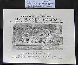
Small print showing a boat on the River Thames at Rat Island (1879)
Publication Date: 1879
Art / Print / Poster
No Binding. Condition: Very Good. Small print showing a boat on the River Thames at Rat Island, from Henry W Taunt, Taunt's Map and Guide to the Thames, New Pocket edition, London 1879. Image size 95 x 49 mm approx, set in text with text to verso. Price includes standard postage worldwide.
-

The Thames of Henry Taunt
Published by History Press Limited, The, 1990
ISBN 10: 0862996163ISBN 13: 9780862996161
Book
Condition: Good. Used book that is in clean, average condition without any missing pages.
More buying choices from other sellers on AbeBooks
New offers from US$ 51.56
Used offers from US$ 9.56
Also find Hardcover First Edition
-
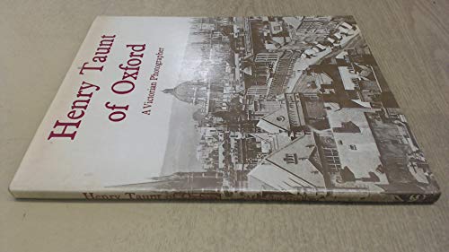
Henry Taunt of Oxford;: A Victorian photographer;
Published by Oxford Illustrated Press, 1973
ISBN 10: 0902280147ISBN 13: 9780902280144
Book
hardcover. Condition: Good. Connecting readers with great books since 1972! Used books may not include companion materials, and may have some shelf wear or limited writing. We ship orders daily and Customer Service is our top priority!.
More buying choices from other sellers on AbeBooks
New offers from US$ 102.53
Used offers from US$ 8.15
Also find Hardcover First Edition
