Order Total (1 Item Items):
Shipping Destination:

Wheeler George 1842 1905 (26 results)
Skip to main search results
Product Type
- All Product Types
- Books (25)
- Magazines & Periodicals
- Comics
- Sheet Music
- Art, Prints & Posters
- Photographs
- Maps (1)
-
Manuscripts &
Paper Collectibles
Condition
Binding
Collectible Attributes
- First Edition (15)
- Signed (3)
- Dust Jacket
- Seller-Supplied Images (2)
- Not Printed On Demand
Free Shipping
Seller Location
Seller Rating
-
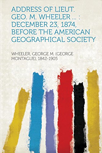
Address of Lieut Geo M Wheeler December 23, 1874, Before the American Geographical Society
Published by Hardpress Publishing, 2013
ISBN 10: 1313623903ISBN 13: 9781313623902
Book
PAP. Condition: New. New Book. Shipped from UK. Established seller since 2000.
More buying choices from other sellers on AbeBooks
New offers from US$ 16.09
-

Wheeler's Photographic Survey of the American West, 1871-1873
Published by Dover Publications, New York, 1983
Book
Soft cover. Condition: Near Fine. No Jacket. 31 x 23.5 cm, [xi], 40 pp., 40 full page plates, pictorial brown, white and black stiff paper covers.
-
Report upon the Third International Geographical Congress and Exhibition at Venice, Italy 1881 Accompanied by data concerning the principal government land and marine surveys of the world.
Published by Government Printing Office, Washington, D. C., 1885
Book
Hardcover. Condition: Good. No Jacket. 28.5 x 22.5 cm, 586 pp., includes index, along with four fold-out maps and seven color map plates. Interior is fine, maps are pristine, one tissue guard worn on lower edge. Brown 3/4 leather brown cloth covers are firmly attached but corners severely bumped and leather significantly scuffed, front free end paper present but detached. Heavy: will require extra shipping.
-

Address of Lieut. Geo. M. Wheeler .: December 23, 1874, Before the American Geographical Society
Published by LIGHTNING SOURCE INC, 2016
ISBN 10: 1355873967ISBN 13: 9781355873969
Book
Gebunden. Condition: New.
-
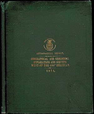
Report upon United States Geographical Surveys West of the One Hundredth Meridian. Vol II. Astronomy and Barometric Hypsometry
Published by Government Printing Office, Washington, D. C., 1877
Book First Edition
Hardcover. Condition: Very Good. No Jacket. 1st Edition. 30 x 24 cm, xiii, 571 pp., Table of contents, list of plates, [xxii] letter of transmittal, PART I. REPORTS UPON THE ASTRONOMICAL DETERMINATIONS AT MAIN STATIONS IN NEVADA, UTAH, MONTANA, WYOMING, NEBRASKA, COLORADO AND NEW MEXICO, OCCUPIED IN THE YEARS 1872, 1873, AND 1874, BY DR. F. KAMPF, JOHN H. CLARK, WM.W. MARYATT, PROF. T.H. SAFFORD. WITH LISTS OF GEOGRAPHICAL POSITIONS, & C. PART II. RESULTS IN BAROMETRIC HYPSOMETRY OBTAINED DURING THE YEARS 1871, 1872, 1873, 1874, AND 1875. REPORTED BY FIRST LIEUTENANT WM. L. MARSHALL, CORPS OF ENGINEERS U.S. ARMY WITH TABLES OF BAROMETICALLY DETERMINED ALTITUDES. 3 folding pages with six sketch maps each, original brown cloth very good Schmeckebier P 53.
-
The Invertebrate Fossils Collected in Portions of Nevada, Utah, Colorado, New Mexico, and Arizona, By Parties of the Expeditions of 1871, 1872, 1873, and 1874, and The Extinct Vertebrata Obtained in New Mexico by Parties of the Expedition of 1874 In Two Parts. Illustrated by Eighty-Three Plates and One Wood-cut. Vol. IV- Paleontology, United States Geographical Surveys West of the One Hundredth Meridian
Published by Government Printing Office, Washington, D. C., 1877
Book First Edition
Hardcover. Condition: Fair. No Jacket. 1st Edition. 29.5 x 23 cm, iii, 219, [21 plates], iv, 370, [62 plates] pp., (all 83 plates, by Julius Bien & Thomas Sinclair & Son, with facing explanations, and versos blank). One of the first thorough paleontological study of the fossil record of the West. Paleontology, theory of evolution; prehistoric animals; shells; shellfish; mollusks; dinosaurs; birds; mammals. Original blind stamped brown cloth binding has failed but both boards present, gilt dulled, corners bumped, internally very good. Rebinding should be considered. HEAVY & OVERSIZED; extra postage for international and priority orders.
-
Report upon the Determination of the Astronomical Co-ordinates of the Primary Stations at Cheyenne, Wyoming Territory, and Colorado Springs, Colorado Territory, made during the years 1872 and 1873, Geographical and Geological Explorations and Surveys West of the One Hundredth Meridian
Published by Government Printing Office, Washington, D. C., 1874
Book First Edition
Hardcover. Condition: Good. No Jacket. 1st Edition. 29 x 23 cm, 82 pp., Highly technical report with diagrams of proper methods and many tables of results, NOT EX LIBRARY original blind stamped brown cloth with dulled gilt decoration and printing, bottom of spine has 2 cm of cloth missing and interior weak at front. A book plate removed from front fixed end paper with visible damage.
-
Report upon the Determination of the Astronomical Coordinates of the Primary Stations at Cheyenne, Wyoming Territory, and Colorado Springs, Colorado Territory, made during the years 1872 and 1873, Geographical and Geological Explorations and Surveys West of the One Hundredth Meridian
Published by Government Printing Office, Washington DC, 1874
Seller: The Book Collector, Inc. ABAA, ILAB, Fort Worth, TX, U.S.A.
Association Member: ABAA ILAB IOBA
Seller Rating:

Book First Edition
Hardcover. Condition: Fair. 1st Edition. 82 pages with tables and figures. Folio (11 3/4" x 9 1/4") bound in original publisher's dark green cloth with gilt lettering lettering and blind stamped ruled edges. First edition. George Montague Wheeler was an American pioneering explorer and cartographer, leader of the Wheeler Survey, one of the major surveys of the western United States in the late nineteenth century. In 1872, the US Congress authorized an ambitious plan to map the portion of the United States west of the 100th meridian at a scale of 8 miles to the inch. This plan necessitated what became known as the Wheeler Survey, lasting until 1879, when the survey, along with the King and Powell Surveys, were terminated and their work was reorganized as the United States Geological Survey. Condition: Wheeler's gift plate to front paste down, corners bumped and rubbed though, heavy damp staining to upper edges, some underlining and marginalia, spine head bumped and rubbed through else a fair copy.
-
SOUTHTERN UTAH, ATLAS SHEET NO. 59
Published by Government Printing Office, Washington, D. C., 1874
Map First Edition
No Binding. Condition: Very Good. No Jacket. 1st Edition. Paper 52 x 61cm Neat line 48 x 58 cm [Above neat line]: GEORAPHICAL EXPLORATIONS & SURVEYS WEST OF THE 100TH MERIDIAN SOUTHTERN UTAH, ATLAS SHEET NO. 59 [Below neat line]: Expeditions of 1872, 1873 Under the Command of 1st Lieut. Geo. M Wheeler BY ORDER OF THE HONORABLE WM. W. BELKNAP SECRETARY OF WAR UNDER THE DIRECTION OF BRIG. GEN. A.A. HUMPHREY CHIEF OF ENGINEERS U. S. ARMY Scale 1 inch : 8 Miles or 1:506880 cover 111 to 113 degrees 45 minutes west longitude by 37 degrees 20 minutes to 38 degrees 39 minutes north latitude, topography by hachure. Never bound. Faint water stain over top 20% of map, 2 cm tear on right side and slight chipping at edges far from printed surface.
-
Preliminary Report Concerning and Surveys Principally in Nevada and Arizona. Prosecuted in Accordance with Paragraph 2, Special Orders No. 109, War Department , March 18, 1871, and Letter of Instructioons of March 23, 1871
Published by Government Printing Office, Washington, D. C., 1872
Book
Hardcover. Condition: Very Good. No Jacket. 29 x 23 cm, 96 pp., huge folding map at end which appears to have never been opened, original blind stamped green cloth with bright gilt lettering on front cover, corners bumped and some wear, interior and map fine. Ex library with rubber stamp of NEBRASKA STATE HISTORICAL SOCIETY on title page [Howes H778 & W322].
-
Progress-Report upon Geographical and Geological Explorations and Surveys West of the One Hundredth Meridian, in 1872, under the direction of Brig. Gen. A. A. Humpreys, Chief of Engineers, United States Army, by First Lieut. George M. Wheeler, Corps of Engineers, in Charge
Published by Government Printing Office, Washington, D. C., 1874
Book First Edition
Soft cover. Condition: Good. No Jacket. 1st Edition. 29 x 23 cm, 56 pp.,two errata slips bound in ahead of the table of contents, F. W. Egloffstein style map and four superb photographic plates taken in 1872 by the Wheeler Survey by William Bell (reproduced by photo-lithography) of the Grand Canyon. These are the first such photographs published in any report. They include: Rain Sculpture-Salt Creek Canon, Utah; Canon of Kanab Wash - Colorado River Looking South; Grand Canon of the Colorado - Mouth of Kanab Wash, Looking East; and Looking South into the Grand Canon - Colorado River, Sheavwith Crossing. Stiff printed paper covers detached and bottom 20% water stained. Fortunately the photographic plates are least affected.
-
Report upon United States Geographical Surveys West ot the One Hundredth meridian. In Charge of Captain Geo. M. Wheeler, Corps of Engineers, U. S. Army, Under the Command of Brig. Gen. H. G. Wright, Chief of Engineers, U. S. Army Vol. III. Supplement Geology
Published by Government Printing Office, Washington, D. C., 1881
Book
Hardcover. Condition: Good. No Jacket. 2nd Edition. 29 x 23 cm, 420, xxxvi, [2] pp., 49 text figures, 4 lithographic plates each with page of text, versos blank, THREE LARGE MAPS NEVER PRESENT, Report upon Geological Examinations in Southern Colorado and Northern New mexico, During the Years 1878 and 1879. by John J. Stevenson, Ph. D., With an Appendix upon the Carbineferous Invertebrate Fossils of New Mexico, Prepared by C. A. White, M. D. In Four Parts and an Appendix, Illustrated by 4 Plates, 3 Maps, and 49 Text cuts, Two Title Pages, Table of Contents, List of Plates and Maps, 9-420, Appendix I-XXXVIII, PLATES III AND IV with facing page of description, versos blank. [Schmeckebier p 54]. Original blind stamped brown cloth with dull gilt lettering corners bumped, minor scuffing, spine intact but held on with removable tape, no markings anywhere. (1st edition was 1875 but this printing is OFTEN called the first edition.), interior hinges cracking. Physical features, previous explorations, systematic geology, descriptive geology, economic geology, Carboniferous invertebrates.
-
Annual Report upon the Geographical Surveys West of the One-hundredth Meridian in the States and Territory of California, Oregon, Nevada, Texas, Arizona, Colorado, Idaho, Montana, New Mexico, Utah, and Wyoming. Being Appemdix NN of the Annual Report of the chief of Engineers for 1877.
Published by Government Printing Office, Washington, D. C., 1877
Book First Edition
Hardcover. Condition: Good. No Jacket. 1st Edition. 22.5 x 14 cm, [v], [1212]- 1334, v [index] pp., Good++, ex library with minimal markings, (McKendree College,Illinois "With The Compliments of George M. Wheeler. Lieut of Engineers, U. S. Army" printed pasted on front fixed end paper, slip unused acknowledgment slip inserted loosely, contents, errata slip bound in facing page iv, 3 illustrations and maps (in pristine condition, facing page 1245, progress map western USA, facing page 1247, Profile Map, on page 1300: Sketch of lignite seams, Vermeto Canon. Original printed paper covered boards with brown cloth spine, front cover worn with water stains on 4 cm triangles on upper corner of front and back cover, internally fine! One of the Four Great Surveys after the Civil War and before the creation of the UGSS. White paper covered printed boards, black cloth spine with dulled gilt printing, two corners bumped, binding completely tight and interior pristine. Separate atlas not present First edition. Following the famous 1871 survey of California, Nevada, and Arizona, the first survey after the Civil War in the tradition of the former Corps of Topographical Engineers, Wheeler developed a "comprehensive plan to map west of the 100th meridian, "the main object of this exploration to obtain correct topographical knowledge of the country traversed." Officially designated the U.S. Geographical Surveys West of the 100th Meridian, the "Wheeler Survey" became one of four great federal surveys after the Civil War. While Clarence King was just completing his 1867-1872 fieldwork for the chief of engineers, Interior Department surveys under Ferdinand V. Hayden and Powell remained active. The other surveys had no military presence, but army officers commanded Wheeler's parties and performed much of the astronomy required for detailed surveying. Civilian topographers performed most mapping for Wheeler, and civilian scientists did pioneering studies in geology, botany, paleontology, and archaeology. Topographic emphasis also differentiated Wheeler from the other surveys' concentration on geology" (Peter L. Guth for ANB). Schmeckebier pages 48-49.
-
Geographical and Geological Surveys West of the Mississippi
Published by Government Printing Office, Washington, D. C., 1874
Book First Edition
No Binding. Condition: Near Fine. No Jacket. 1st Edition. 22.5 x 14 cm, 91 pp., sewed but never bound, minor dust and age darkening and contemporary pencil filing information on title page 43D CONGRESS, 1st Session HOUSE OF REPRESENTATIVES. REPORT NO. 612 Sewed but never bound, one of many documents on this subject I have acquired neatly marked in pencil on first page "Fig k. U. S." all in the same neat hand and punched for a loose leaf notebook.
-
Engineer Department, U. S. Army. Report Upon United States Geographical Surveys West of the One Hundredth Meridian, In Charge of First Lieut. Geo. M. Wheeler, Corps of Engineers, U. S. Army, Under the Direction of Brig. Gen. A. A. Humphreys, Chief of Engineers, U. S. Army. Published by Authority of the Honorable the Secretary of War, In Accordance with Acts of Congress of June 23, 1874, and February 15, 1875. Vol. VI.- Botany
Published by Government Printing Office, Washington, D. C., 1878
Book First Edition
Hardcover. Condition: Very Good. No Jacket. 1st Edition. 29.5 x 22 cm, xx, 404 pp., color frontispiece with tissue guard, 30 botanical plates at the back on un-numbered pages with versos blank. The topographical engineers of the U. S. Army wished to regain the role they had had before the Civil War in western exploration. Between 1871 to 1879, under the jurisdiction of the chief of Engineers of the U.S. Army Corps of Engineers, Lt. George M. Wheeler led an expedition to survey the territory west of the One Hundredth Meridian. Wheeler's expedition covered much of the western United States including: New Mexico, California, Arizona, Nevada, Utah, Colorado, Idaho, Wyoming and Texas. They produced many maps as did the other three Great Surveys. This volume includes Notes on Economic Botany, and Catalogue of Plants Collected in Nevada, Utah, Colorado, New Mexico, and Arizona with Descriptions of Those Not Contained in Gray's Manual of the Northern U. S., and Vol. V., Geological Exploration of the Fortieth Parallel. Original blind stamped brown cloth. Binding expertly repaired with original binding laid down. This heavy volume will require extra shipping cost.
-
Annual Report upon the Geographical Surveys West of the One-Hundredth Meridian in the States and Territories of California, Oregon, Nevada, Texas, Arizona, Colorado, Idaho, Montana, New Mexico, Utah, and Wyoming.for 1877 A separate printing of Appendix NN of the Annual Report of the Chief of Engineers for 1877
Published by Government Printing Office, Washington, D. C., 1877
Book
Hardcover. Condition: Near Fine. No Jacket. 23 x 14.5 cm, iv, 1209-1334, v [index] pp., laid in "half page intended to be returned to Wheeler acknowledging receipt of documrnt" 3 maps, two of which are folding, folding profile original printed boards with dark cloth back Scmeckebier p. 48-49. One of the Four Great Surveys after the Civil War and before the creation of the UGSS. White paper covered printed boards, black cloth spine with dulled gilt printing, two corners bumped, binding completely tight and interior pristine. Separate atlas not present First edition. Following the famous 1871 survey of California, Nevada, and Arizona, the first survey after the Civil War in the tradition of the former Corps of Topographical Engineers, Wheeler developed a "comprehensive plan to map west of the 100th meridian, "the main object of this exploration to obtain correct topographical knowledge of the country traversed." Officially designated the U.S. Geographical Surveys West of the 100th Meridian, the "Wheeler Survey" became one of four great federal surveys after the Civil War. While Clarence King was just completing his 1867-1872 fieldwork for the chief of engineers, Interior Department surveys under Ferdinand V. Hayden and Powell remained active. The other surveys had no military presence, but army officers commanded Wheeler's parties and performed much of the astronomy required for detailed surveying. Civilian topographers performed most mapping for Wheeler, and civilian scientists did pioneering studies in geology, botany, paleontology, and archaeology. Topographic emphasis also differentiated Wheeler from the other surveys' concentration on geology" (Peter L. Guth for ANB).
-
Annual Report upon the Geographical Surveys of the Territory of the United States West of the 100th Meridian, in the States and Territories of California, Colorado, Kansas, Nebraska, Nevada, Oregon, Texas, Arizona, Idaho, Idaho, Montana, New Mexico, Utah, Washington and Wyoming, New Mexico, Arizona, and Montana. being Appendix OO of the Annual Report of the Chief of Engineers for 1879.
Published by Government Printing Office, Washington, D. C., 1879
Book First Edition
Hardcover. Condition: Very Good. No Jacket. 1st Edition. 22.5 x 14 cm, vi, 340 pp., contents, 6 illustrations and 4 maps which are all folding (in pristine condition): .astronomical stations of 1878, near Fort Bliss, Texas; Progress Map; Outline map of Comstock Lode, Nevada, and vicinity; Itinerary of routes followed.1878.; [[Cinder Cone, Lassen Co. Cal.]]; Line and profile.Fest's Ferry, Rio Grande. One of the Four Great Surveys after the Civil War and before the creation of the UGSS. White paper covered printed boards, black cloth spine with dulled gilt printing, two top corners bumped, outside back cover lightly stained, binding completely tight and interior pristine. Separate atlas not present First edition. Following the famous 1871 survey of California, Nevada, and Arizona, the first survey after the Civil War in the tradition of the former Corps of Topographical Engineers, Wheeler developed a "comprehensive plan to map west of the 100th meridian, "the main object of this exploration to obtain correct topographical knowledge of the country traversed." Officially designated the U.S. Geographical Surveys West of the 100th Meridian, the "Wheeler Survey" became one of four great federal surveys after the Civil War. While Clarence King was just completing his 1867-1872 fieldwork for the chief of engineers, Interior Department surveys under Ferdinand V. Hayden and Powell remained active. The other surveys had no military presence, but army officers commanded Wheeler's parties and performed much of the astronomy required for detailed surveying. Civilian topographers performed most mapping for Wheeler, and civilian scientists did pioneering studies in geology, botany, paleontology, and archaeology. Topographic emphasis also differentiated Wheeler from the other surveys' concentration on geology" (Peter L. Guth for ANB).
-
VOL. III GEOLOGY Report upon Geographical and Geological Explorations and Surveys west of the One Hundredth Meridian. REPORTS UPON THE GEOLOGY OF PORTIONS OF CALIFORNIA, NEVADA, UTAH, COLORDO, NEW MEXICO, AND ARIZONA. EXAMINED IN THE YEARS 1871, 1872, AND 1873. BY G. K. GILBERT, A. R. MARVINE, E. E. HOWELL, PROF. JNO J. STEVENSON, OSCAR LOEW, Ph. d, MINERALOGICAL ASSISTANT. IN SIX PARTS ILLUSTRTED BY 13 PLATES AND 171 WOOD-CUTS.
Published by Government Printing Office, Washington, D. C., 1875
Book First Edition
Hardcover. Condition: Very Good. No Jacket. 1st Edition. 29.5 x 23 cm, 681 pp., frontispiece with tissue guard, note, SECOND TITLE, TABLE OF CONTENTS, LIST OF PLATES [XIII, WITH TISSUE GUARDS], LIST OF ACCOMPANYING GEOLOGICAL ATLAS SHEETS [NOT INCLUDED], many maps and sketches in text. First edition of Volume III of an eventual seven. Wheeler developed a "comprehensive plan to map west of the 100th meridian, "the main object of this exploration to obtain correct topographical knowledge of the country traversed." Officially designated the U.S. Geographical Surveys West of the 100th Meridian, the "Wheeler Survey" became one of four great federal surveys after the Civil War. While Clarence King was just completing his 1867-1872 fieldwork for the chief of engineers, Interior Department surveys under Ferdinand V. Hayden and Powell remained active. The other surveys had no military presence, but army officers commanded Wheeler's parties and performed much of the astronomy required for detailed surveying. Civilian topographers performed most mapping for Wheeler, and civilian scientists did pioneering studies in geology, botany, paleontology, and archaeology. Topographic emphasis also differentiated Wheeler from the other surveys' concentration on geology" (Peter L. Guth for ANB). ORIGINAL HALF BROWN LEATHER AND BROWN CLOTH WITH FIVE RAISED BANDS, SCUFFING TO LEATHER, MARBELED END PAPERS AND PAGE ENDS, INTERNALLY FINE.
-
Annual Report upon the Geographical Surveys West of the One Hundredth Meridian, in California, Nevada, Utah, Colorado, Wyoming, New Mexico, Arizona, and Montana, Appendix JJ of the Annual Report of the Chief of Engineers for 1876
Published by Government Printing Office, Washington, D. C., 1876
Book First Edition
Hardcover. Condition: Very Good. No Jacket. 1st Edition. 23 x 14.5 cm, vi, 355 pp., 1876 11 illustrations and maps, eight of which are folding maps folding. In presentation brown half calf with marbeled end papers and edges, internally near fine with folding contents pristine, covers scuffed and corners bumped, absolutely secure binding, no marks of any kind except light pencil name "L. A. Calkins" on last blank page before title page.
-
Annual Report upon the Geographical Surveys of the Territory of the United States West of the 100th Meridian, in the States and Territories of California, Oregon, Texas, Arizona, Colorado, Idaho, Montana, New Mexico, Utah, and Wyoming. Being Appendix NN of the Annual Report of the chief of Engineers for 1878.
Published by Government Printing Office, Washington, D. C., 1878
Book First Edition
Hardcover. Condition: Very Good. No Jacket. 1st Edition. 22.5 x 14 cm, x,1-234 pp., contents, 8 illustrations and maps (in pristine condition: facing page 38, progress map western USA; facing page 226 Passge par Terre a la Californie, Kino 1701; also facing pages136, 138, 187, 1888, 197. One of the Four Great Surveys after the Civil War and before the creation of the UGSS. [Schmeeckebier p 49] White paper covered printed boards, black cloth spine with dulled gilt printing, corners seriously bumped, outside back cover lightly stained, binding completely tight due to white library tape applied on inside many years ago, and interior pristine. [BEWARE 1877 Annual Report is ALSO Appendix NN.] Separate atlas not present First edition. Following the famous 1871 survey of California, Nevada, and Arizona, the first survey after the Civil War in the tradition of the former Corps of Topographical Engineers, Wheeler developed a "comprehensive plan to map west of the 100th meridian, "the main object of this exploration to obtain correct topographical knowledge of the country traversed." Officially designated the U.S. Geographical Surveys West of the 100th Meridian, the "Wheeler Survey" became one of four great federal surveys after the Civil War. While Clarence King was just completing his 1867-1872 fieldwork for the chief of engineers, Interior Department surveys under Ferdinand V. Hayden and Powell remained active. The other surveys had no military presence, but army officers commanded Wheeler's parties and performed much of the astronomy required for detailed surveying. Civilian topographers performed most mapping for Wheeler, and civilian scientists did pioneering studies in geology, botany, paleontology, and archaeology. Topographic emphasis also differentiated Wheeler from the other surveys' concentration on geology" (Peter L. Guth for ANB).
-
Annual Report upon the Geographical Surveys West of the One Hundredth Meridian, in California, Nevada, Utah, Colorado, Wyoming, New Mexico, Arizona, and Montana. being Appendix JJ of the Annual Report of the chief of Engineers for 1876.
Published by Washington: Government Printing Office, 1876, 1876
First Edition Signed
8vo., (9 x 5 6/8 inches). 8 fine folding lithographed maps. Original brown cloth, gilt (backstrip worn with loss). Provenance: Presentation copy from Lieut. George M. Wheeler, with his compliments slip tipped-in to the inside front wrapper; probably to Lieut. Charles William Whipple (1846-1916), son of the explorer Amiel Weeks Whipple (1818 - 1863), his sale his sale Doyle New York, 23rd April 2012, lot 115. First edition. Following the famous 1871 survey of California, Nevada, and Arizona, the first survey after the Civil War in the tradition of the former Corps of Topographical Engineers, Wheeler developed a "comprehensive plan to map west of the 100th meridian, "the main object of this exploration to obtain correct topographical knowledge of the country traversed." Officially designated the U.S. Geographical Surveys West of the 100th Meridian, the "Wheeler Survey" became one of four great federal surveys after the Civil War. While Clarence King was just completing his 1867-1872 fieldwork for the chief of engineers, Interior Department surveys under Ferdinand V. Hayden and Powell remained active. The other surveys had no military presence, but army officers commanded Wheeler's parties and performed much of the astronomy required for detailed surveying. Civilian topographers performed most mapping for Wheeler, and civilian scientists did pioneering studies in geology, botany, paleontology, and archaeology. Topographic emphasis also differentiated Wheeler from the other surveys' concentration on geology" (Peter L. Guth for ANB).
-
Preliminary Report concerning Explorations and surveys principally in Nevada and Arizona.
Published by Washington D.C.: Government Printing Office, 1872., 1872
4to., (11 4/8 x 9 2/8 inches). Large folding engraved map "Explorations and surveys south of Central Pacific R.R. War Department Preliminary Topographical map ." (short tear near mount). Original brown cloth, gilt (extremities worn with minor loss). First official exploration of this area, including southern Nevada, the Mojave Desert and Death Valley. Includes much on the mining districts of Nevada and eastern California. "Wheeler conducted the first official explorations of southern Nevada's interior area. His corps of engineers contributed to the report concerning the climate, geology, wildlife, the Indians and white settlement of southern Nevada in 1871. The map contains dozens of place names and is in itself a significant record. A valuable report." (Paher). Wheat, Transmississippi West 1237 & V(2), pp. 338-39; Edwards Enduring Desert p.256; Howes W321; Paher 2135.
-
Report upon Geographical and Geological Explorations and Surveys west of the One Hundredth Meridian. Parts I,II,III,IV,V, Vol. III.-Geology.
Published by Washington: Government Printing Office, 1875., 1875
First Edition Signed
4to., (11 4/8 x 9 2/8 inches). Heliotype frontispiece and 6 plates, 6 tinted lithographs including one folding (some marginal spotting throughout). Original grey paper wrappers, printed on the spine (worn with loss to the backstrip). Provenance: Presentation copy from Lieut. George M. Wheeler, with his compliments slip tipped-in to the inside front wrapper; probably to Lieut. Charles William Whipple (1846-1916), son of the explorer Amiel Weeks Whipple (1818 - 1863), his sale his sale Doyle New York, 23rd April 2012, lot 115. First edition of Volume III of an eventual seven. Following the famous 1871 survey of California, Nevada, and Arizona, the first survey after the Civil War in the tradition of the former Corps of Topographical Engineers, Wheeler developed a "comprehensive plan to map west of the 100th meridian, "the main object of this exploration to obtain correct topographical knowledge of the country traversed." Officially designated the U.S. Geographical Surveys West of the 100th Meridian, the "Wheeler Survey" became one of four great federal surveys after the Civil War. While Clarence King was just completing his 1867-1872 fieldwork for the chief of engineers, Interior Department surveys under Ferdinand V. Hayden and Powell remained active. The other surveys had no military presence, but army officers commanded Wheeler's parties and performed much of the astronomy required for detailed surveying. Civilian topographers performed most mapping for Wheeler, and civilian scientists did pioneering studies in geology, botany, paleontology, and archaeology. Topographic emphasis also differentiated Wheeler from the other surveys' concentration on geology" (Peter L. Guth for ANB).
-
Progress-Report upon Geographical and Geological Explorations and Surveys West of the One Hundredth Meridian in 1872
Published by Washington: Government Printing Office, 1874., 1874
Signed
4to., (11 4/8 x 9 inches). Fine chromolithographed folding "Skeleton map of the Territory of the United States west of the Mississippi River." and 5 full-page tinted lithographed plates (some insignificant spotting and one or two marginal thumb prints). Original grey printed paper wrappers (a bit creased and lightly soiled). Provenance: Presentation copy from Lieut. George M. Wheeler, with his compliments slip tipped-in to the inside front wrapper; to Lieut. Charles William Whipple (1846-1916), son of the explorer Amiel Weeks Whipple (1818 - 1863), inscribed by him at the head of the front cover; his sale his sale Doyle New York, 23rd April 2012, lot 115. Following the famous 1871 survey of California, Nevada, and Arizona, the first survey after the Civil War in the tradition of the former Corps of Topographical Engineers, Wheeler developed a "comprehensive plan to map west of the 100th meridian, "the main object of this exploration to obtain correct topographical knowledge of the country traversed." Officially designated the U.S. Geographical Surveys West of the 100th Meridian, the "Wheeler Survey" became one of four great federal surveys after the Civil War. While Clarence King was just completing his 1867-1872 fieldwork for the chief of engineers, Interior Department surveys under Ferdinand V. Hayden and Powell remained active. The other surveys had no military presence, but army officers commanded Wheeler's parties and performed much of the astronomy required for detailed surveying. Civilian topographers performed most mapping for Wheeler, and civilian scientists did pioneering studies in geology, botany, paleontology, and archaeology. Topographic emphasis also differentiated Wheeler from the other surveys' concentration on geology" (Peter L. Guth for ANB).