
Order Total (1 Item Items):
Shipping Destination:

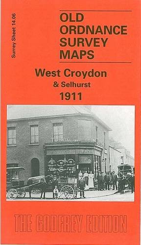
9780850549584 - West Croydon and Selhurst 1911: Surrey Sheet 14 06 Old Ordnance Survey Maps of Surrey by Oliver Harris (3 results)
Feedback
Skip to main search results
Search filters
Product Type
- All Product Types
- Books (1)
- Magazines & Periodicals (No further results match this refinement)
- Comics (No further results match this refinement)
- Sheet Music (No further results match this refinement)
- Art, Prints & Posters (No further results match this refinement)
- Photographs (No further results match this refinement)
- Maps (2)
- Manuscripts & Paper Collectibles (No further results match this refinement)
Condition
Binding
- All Bindings
- Hardcover (No further results match this refinement)
- Softcover (2)
Collectible Attributes
- First Edition (No further results match this refinement)
- Signed (No further results match this refinement)
- Dust Jacket (No further results match this refinement)
- Seller-Supplied Images (No further results match this refinement)
- Not Print on Demand (3)
Free Shipping
- Free Shipping to U.S.A. (No further results match this refinement)
Seller Rating
-
West Croydon and Selhurst 1911: Surrey Sheet 14.06 (Old Ordnance Survey Maps of Surrey)
Published by Alan Godfrey Maps, 1998
ISBN 10: 0850549582 ISBN 13: 9780850549584
Seller: WorldofBooks, Goring-By-Sea, WS, United Kingdom
Seller rating 5 out of 5 stars

Paperback. Condition: Good. The book has been read but remains in clean condition. All pages are intact and the cover is intact. Some minor wear to the spine.
-
West Croydon and Selhurst 1911: Surrey Sheet 14.06 (Old Ordnance Survey Maps of Surrey)
Published by Alan Godfrey Maps, 1998
ISBN 10: 0850549582 ISBN 13: 9780850549584
Map
Soft cover. Condition: Very Good. Shipped from UK, will dispatch next working day.
-
West Croydon and Selhurst 1911: Surrey Sheet 14.06 (Old Ordnance Survey Maps of Surrey)
Published by Alan Godfrey Maps, 1998
ISBN 10: 0850549582 ISBN 13: 9780850549584
Seller: GENERATIONS GONE BY, Manchester, United Kingdom
Seller rating 5 out of 5 stars
Map
No Binding. Condition: New. No Jacket. Here are the details of maps for Croydon (N): Surrey Sheet 14.06 West Croydon & Selhurst 1911 - published 1998; intro by Oliver Harris. ISBN.978-0-85054-958-4 This map covers north Croydon and the area known, perhaps confusingly, as West Croydon, taking its name from the railway station. It covers an area stretching from Handcroft Road and Sumner Road eastward to Dartnell Road and Jesmond Road; and from West Croydon station northward to Selhurst station and Edith Road. Features on this busy map include numerous railway junctions (Norwood Fork Junction, Selhurst Junction, Windmill Bridge Junction, Gloucester Road Junction); Croydon Common Athletic Ground, home to Croydon Common FC and, for a while, Crystal Palace; Croydon Workhouse, Queens Road Cemetery, General Hospital, Croydon Union Infirmary; Addiscombe Road station. On the reverse are street directories for St James's Road, Sydenham Road, Whitehorse Road, Whitehorse Lane. The map links up with Surrey Sheet 14.02 Thornton Heath to the north, 14.05 Mitcham Road to the west, Woodside to the east, 14.10 Central Croydon to the south.