
Order Total (1 Item Items):
Shipping Destination:

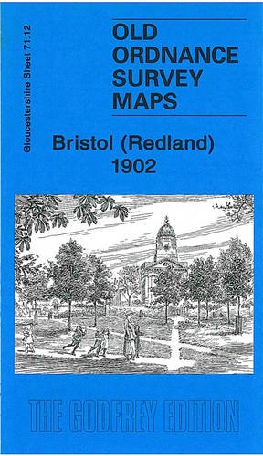
9781847843586 - Bristol Redland 1902: Gloucestershire Sheet 71 12 Old Ordnance Survey Maps of Gloucestershire by Mike Bone (2 results)
Feedback
Skip to main search results
Search filters
Product Type
- All Product Types
- Books (1)
- Magazines & Periodicals (No further results match this refinement)
- Comics (No further results match this refinement)
- Sheet Music (No further results match this refinement)
- Art, Prints & Posters (No further results match this refinement)
- Photographs (No further results match this refinement)
- Maps (1)
- Manuscripts & Paper Collectibles (No further results match this refinement)
Condition
Binding
- All Bindings
- Hardcover (No further results match this refinement)
- Softcover (1)
Collectible Attributes
- First Edition (No further results match this refinement)
- Signed (No further results match this refinement)
- Dust Jacket (No further results match this refinement)
- Seller-Supplied Images (No further results match this refinement)
- Not Print on Demand (2)
Free Shipping
- Free Shipping to U.S.A. (No further results match this refinement)
Seller Rating
-
Bristol (Redland) 1902: Gloucestershire Sheet 71.12 (Old Ordnance Survey Maps of Gloucestershire)
Published by Alan Godfrey Maps, 2010
ISBN 10: 1847843581 ISBN 13: 9781847843586
Seller: WorldofBooks, Goring-By-Sea, WS, United Kingdom
Seller rating 5 out of 5 stars

Paperback. Condition: Very Good. The book has been read, but is in excellent condition. Pages are intact and not marred by notes or highlighting. The spine remains undamaged.
-
Bristol (Redland) 1902: Gloucestershire Sheet 71.12
Published by Alan Godfrey Maps, 2010
ISBN 10: 1847843581 ISBN 13: 9781847843586
Seller: GENERATIONS GONE BY, Manchester, United Kingdom
Seller rating 5 out of 5 stars
Map
No Binding. Condition: New. No Jacket. Here are the details of maps for Redland: Gloucestershire Sheet 71.12 Bristol (Redland) 1902 - published 2010; intro by Mike Bone. ISBN.978-1-84784-358-6 This detailed map covers a busy area of NW Bristol, including much of Redland, Westbury Park, and Bishopston. Coverage stretches from Durham Down eastward to Effingham Road, and from Chandos Road northward to Bishop Road. Features include Redland area, Bishopston area, Westbury Park area, Woolcott Park area, Clifton Extension Railway with Redland station, tramways, Redland Chapel, Redland Green, St John's church, Redlandhill House, New Clifton area, Downside, St Alban's church, Colstan's School, St Katharine's church, St Bonaventure's RC church, Redland Court school, Queen Victoria Convalescent Home, etc. On the reverse we include street directoriy entries for Berkeley Road, Clarendon Road, Clyde Park/Road, Egerton Road, Elgin Park, Elliston Road, Redland Grove/Hill/Park Villa/Road/Terrace, Woodstock Road. The map links up with sheets 71.08 Westbury-on-Trym to the north, 71.11 Sneyd Park to the west, 72.09 Ashley Down to the east, 71.16 Bristol NW to the south.