
Order Total (1 Item Items):
Shipping Destination:

national geographic maps evergreen (792 results)
Skip to main search results
Product Type
- All Product Types
- Books (789)
- Magazines & Periodicals
- Comics
- Sheet Music
- Art, Prints & Posters
- Photographs
- Maps (3)
-
Manuscripts &
Paper Collectibles
Condition
Binding
- All Bindings
- Hardcover
- Softcover (31)
Collectible Attributes
- First Edition
- Signed
- Dust Jacket
- Seller-Supplied Images (282)
- Not Printed On Demand
Free Shipping
Seller Location
Seller Rating
-
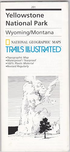
Yellowstone National Park, Wyoming/Montana (National Geographic Maps / Trails Illustrated, 201)
Published by National Geographic Maps / Trails Illustrated, Evergreen, Colorado, 1994
ISBN 10: 0925873012ISBN 13: 9780925873019
Map
Map, folding. Condition: As New. National Geographic Maps / Trails Illustrated, 1994. Map, folding. Color. Printed on both sides on waterproof/tearproof plastic. Sheet 65 x 96 cm., folded to 23 x 11 cm. Relief shown by contours and spot heights. Depths shown by contours and soundings. As New. Not from a library.
-
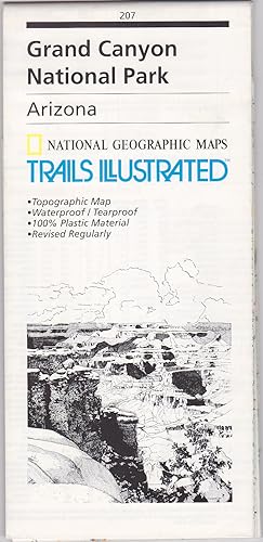
Grand Canyon National Park, Arizona (National Geographic Maps / Trails Illustrated, 207)
Published by National Geographic Maps / Trails Illustrated, Evergreen, Colorado, 1994
ISBN 10: 0925873071ISBN 13: 9780925873071
Map
Map, folding. Condition: As New. Evergreen, Colorado: National Geographic Maps / Trails Illustrated, 1994. Map, folding. Color. Printed on both sides on waterproof/tearproof plastic. Sheet 65 x 95 cm., folded to 23 x 11 cm. Relief shown by contours and spot heights. As New. Not from a library.
-
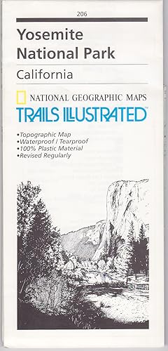
Yosemite National Park, California (National Geographic Maps / Trails Illustrated, 206)
Published by National Geographic Maps / Trails Illustrated, Evergreen, Colorado, 1996
ISBN 10: 0925873063ISBN 13: 9780925873064
Map
Map, folding. Condition: As New. Evergreen, Colorado: National Geographic Maps / Trails Illustrated, 1996. Map, folding. Color. Printed on both sides on waterproof/tearproof plastic. Sheet 65 x 94 cm., folded to 23 x 11 cm. Relief shown by contours and spot heights. As New. Not from a library.
-

Pikes Peak / Canon City
Published by National Geographic Maps, Evergreen, CO, 2023
ISBN 10: 1566953987ISBN 13: 9781566953986
Book
No Binding. Condition: New. Nat Geo Map # 137. Mint condition. Extremely detailed. Waterproof.
More buying choices from other sellers on AbeBooks
New offers from US$ 12.65
-

Mount Rogers High Country (Trails Illustrated Topographic Map)
Published by National Geographic Maps, Evergreen, CO, 2019
ISBN 10: 1566956641ISBN 13: 9781566956642
Book
No Binding. Condition: New. Map of a small but popular area in far southwestern Virginia. Map is brand new.
More buying choices from other sellers on AbeBooks
New offers from US$ 12.90
-
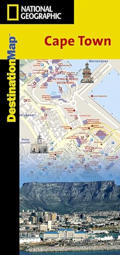
Cape Town Destination City Maps (National Geographic Destination City Map)
Published by National Geographic Maps, United States, Evergreen, 2013
ISBN 10: 1566951682ISBN 13: 9781566951685
Book
Paperback. Condition: Very Good. The newly redesigned National Geographic DestinationMaps series strikes the perfect balance between map and guidebook, and they are the ideal resource for touring culturally and geographically unique areas. All maps are double-sided with beautiful photos and detailed travel information, including comprehensive road networks, local information and natural, historical and cultural places of interest. The maps are printed on durable, waterproof, tear-resistant material that is lightweight and easily folded to fit in your pocket. The book has been read, but is in excellent condition. Pages are intact and not marred by notes or highlighting. The spine remains undamaged.
-

Road Atlas: Scenic Drives Edition (united States, Canada, Mexico) (Folded)
Published by National Geographic Maps, Evergreen, 2016
ISBN 10: 1566957060ISBN 13: 9781566957069
Book
Folded. Condition: new. Folded. National Geographic's Road Atlas: Scenic Drives Edition , is the ideal companion for the next time you hit the road for an unforgettable road trip. Includes up-to-date road maps for all 50 U.S. States, plus Canada, Mexico, and Puerto Rico. Major cities and metropolitan areas are shown in detail with inset maps that include popular attractions, infrastructure and points-of-interest. Setting this atlas apart from all others is the inclusion of selection of 20 carefully researched scenic drives to help you plan the road trip of a lifetime. A map and guide section is also included for the 20 most popular National Parks. Take the guesswork out of traveling and trip planning with a comprehensive index, mileage charts, and cross-referenced pages. The Road Atlas: Adventure Edition is printed in North America and it is a convenient letter-size format that fits comfortably into glove compartments or car side door pockets. Folded Size = 8" x 11" ISBN appears to be reused with successive editions. Shipping may be from multiple locations in the US or from the UK, depending on stock availability.
-
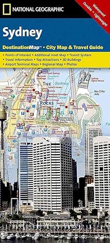
Sydney (Folded)
Published by National Geographic Maps, Evergreen, 2012
ISBN 10: 1597754021ISBN 13: 9781597754026
Book
Folded. Condition: new. Folded. In addition to the easy-to-read map on the front, the back includes: Regional map - Points of interest - Airport diagram - City Rail map - Information on transportation, tourist offices, museums, and more - Inset map of Homebush Bay Olympic Park - Multi-language legend In addition to the easy-to-read map on the front, the back includes: - Regional map - Points of interest - Airport diagram - City Rail map - Information on transportation, tourist offices, museums, and more - Inset map of Homebush Bay Olympic Park - Multi-language legend Shipping may be from multiple locations in the US or from the UK, depending on stock availability.
More buying choices from other sellers on AbeBooks
New offers from US$ 18.23
-
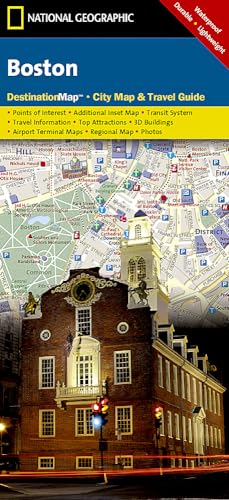
Boston (Folded)
Published by National Geographic Maps, Evergreen, 2012
ISBN 10: 1597750573ISBN 13: 9781597750578
Book
Folded. Condition: new. Folded. In addition to the easy-to-read map on the front, the back includes: Regional map - Subway map (The "T") - Airport diagram - Points of interest - Information on transportation, museums, guided tours, and more - Multi-language legend In addition to the easy-to-read map on the front, the back includes: - Regional map - Subway map (The "T") - Airport diagram - Points of interest - Information on transportation, museums, guided tours, and more - Multi-language legend Shipping may be from multiple locations in the US or from the UK, depending on stock availability.
More buying choices from other sellers on AbeBooks
New offers from US$ 18.23
-
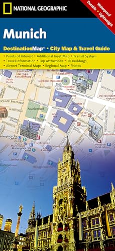
Munich (Folded)
Published by National Geographic Maps, Evergreen, 2012
ISBN 10: 1597753114ISBN 13: 9781597753111
Book
Folded. Condition: new. Folded. In addition to the easy-to-read map on the front, the back includes: Regional map - Points of interest - U-Bahn (subway) map - Airport diagram - Inset map of Schloss Nymphenburg - Map and informatioin about the Romantic Road and Bavarian Alps - Multi-language legend Shipping may be from multiple locations in the US or from the UK, depending on stock availability.
More buying choices from other sellers on AbeBooks
New offers from US$ 18.24
-
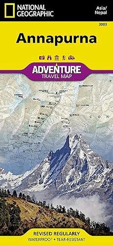
Annapurna, Nepal (Folded)
Published by National Geographic Maps, Evergreen, 2012
ISBN 10: 1566955211ISBN 13: 9781566955218
Book
Folded. Condition: new. Folded. National Geographic's Annapurna, Nepal Adventure Map is designed to meet the unique needs of adventure travelers with its durability and accurate information. This folded map provides global travelers with the perfect combination of detail and perspective, highlighting hundreds of points of interest and the diverse and unique destinations within the country. The map includes the locations of cities and towns with a user-friendly index, plus a clearly marked road network complete with distances and designations for major highways, main roads, and tracks and trails for those seeking to explore more remote regions. This detailed trekking map includes routes from Pokhara along the Marsyandi River, Thorung Pass, and the Kali Gandaki River in the Annapurna Conservation Area. Every Adventure Map is printed on durable synthetic paper, making them waterproof, tear-resistant and tough capable of withstanding the rigors of international travel. Each is two-sided and can be folded to a packable size of 235 x 108 mm; unfolded size is 965 x 660 mm. Detailed trekking map for routes from Pokhara along the Marsyandi River, Thorung Pass, and the Kali Gandaki River in the Annapurna Conservation Area. Shipping may be from multiple locations in the US or from the UK, depending on stock availability.
More buying choices from other sellers on AbeBooks
New offers from US$ 21.64
-
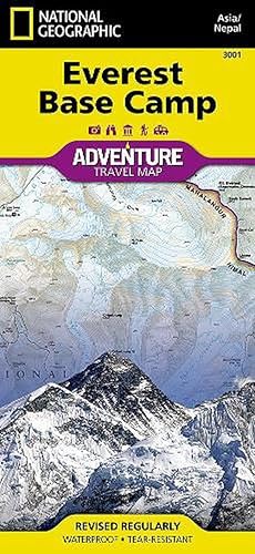
Everest Base Camp, Nepal (Paperback)
Published by National Geographic Maps, Evergreen, 2012
ISBN 10: 156695519XISBN 13: 9781566955195
Book
Paperback. Condition: new. Paperback. AdventureMaps provide global travellers with the perfect combination of detail and perspective, highlighting hundreds of points of interest and the diverse and unique destinations within the country. Each map is printed on durable synthetic paper, making them waterproof and tear-resistant. This Everest Base Camp map features a Trails Illustrated folded topographic map with trekking routes from Lukla to Everest Base Camp, Sagarmatha National Park. A full map of Nepal and detail map of Kathmandu is on the reverse side. The very name evokes majesty, mystery and magnificence! Earth's highest peaks soar above, beckoning adventurers to one of the world's most dramatic regions.Includes trail routes, villages, cultivated areas, park boundaries, and points of interest. Printed on waterproof, tear-resistant material that stands up to the rigors of travel. Shipping may be from multiple locations in the US or from the UK, depending on stock availability.
More buying choices from other sellers on AbeBooks
New offers from US$ 21.65
-
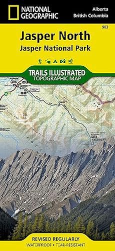
Jasper North (Folded)
Published by National Geographic Maps, Evergreen, 2012
ISBN 10: 1566956617ISBN 13: 9781566956611
Book
Folded. Condition: new. Folded. The front side of Jasper North map details the east side of the national park, from Rock Lake Solomon Creek Wildland Park to the north, to Whistler's Summit to the south. The reverse side of the map details the west side of the park, extending from Mt. Terry Fox Provincial Park to the south, to Willmore Wilderness Park to the North. Insets show survival tips, safe travel in Bear Country, and what to do while visiting. A necessity for exploring in the outdoors, this map is printed on waterproof, tear-resistant material. National Geographic's Trails Illustrated Maps are the most detailed and up-to-date topographic recreation maps available for US National Parks, National Forests and other popular outdoor recreation areas. A necessity for exploring the outdoors, each map is printed on waterproof, tear-resistant material. They also contain key safety and contact information, GPS and compass coordinates, Leave No Trace ethical guidelines and hundreds of points-of-interest, including scenic viewpoints, campgrounds, boat launches, swimming areas, marine sanctuaries and wildlife refuges. Scale : 1:100,000 Flat Size : 965 x 660 mm. Shipping may be from multiple locations in the US or from the UK, depending on stock availability.
More buying choices from other sellers on AbeBooks
New offers from US$ 21.70
-
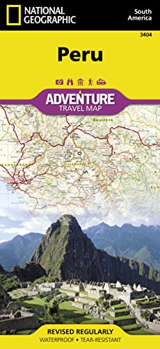
Peru (Folded)
Published by National Geographic Maps, Evergreen, 2011
ISBN 10: 1566955483ISBN 13: 9781566955485
Book
Folded. Condition: new. Folded. National Geographic's Peru Adventure Map is designed to meet the unique needs of adventure travelers with its durability and accurate information. This folded map provides global travelers with the perfect combination of detail and perspective, highlighting hundreds of points of interest and the diverse and unique destinations within the country. The map includes the locations of cities and towns with a user-friendly index, plus a clearly marked road network complete with distances and designations for major highways, main roads, and tracks and trails for those seeking to explore more remote regions. The front side of the map shows the northern half of Peru including the regions of Loreto, Tumbes, Piura, Amazonas, Lambayeque, Cajamarca, La Libertad, Ancash, Huanuco, and Ucayali. This section of the map spans from Peru's borders with Ecuador and Colombia on the north and Brazil on the east, down to the coastal city of Chimbote. The regions of Tacna, Puno, Pasco, Moquegua, Madre de Dios, Lima, Junin, Ica, Huancavelica, Cusco, Ayacucho, Arequipa, and Apurimac are included on the reverse side. Every Adventure Map is printed on durable synthetic paper, making them waterproof, tear-resistant and tough capable of withstanding the rigors of international travel. Each is two-sided and can be folded to a packable size of 235 x 108 mm; unfolded size is 965 x 660 mm. AdventureMaps provide global travellers with the perfect combination of detail and perspective, highlighting hundreds of points of interest and the diverse and unique destinations within the country. Each map is printed on durable synthetic paper, making them waterproof and tear-resistant. They also include the locations of cities and towns with a user-friendly index, plus a clearly marked road network complete with distances and designations for major highways, main roads and tracks and trails for those seeking to explore more remote regions. Shipping may be from multiple locations in the US or from the UK, depending on stock availability.
More buying choices from other sellers on AbeBooks
New offers from US$ 21.70
-

Philippines (Folded)
Published by National Geographic Maps, Evergreen, 2012
ISBN 10: 1566956153ISBN 13: 9781566956154
Book
Folded. Condition: new. Folded. National Geographic's Philippines Adventure Map is designed to meet the unique needs of adventure travelers with its durability and accurate information. This folded map provides global travelers with the perfect combination of detail and perspective, highlighting hundreds of points of interest and the diverse and unique destinations within the country. The map includes the locations of cities and towns with a user-friendly index, plus a clearly marked road network complete with distances and designations for major highways, main roads, and tracks and trails for those seeking to explore more remote regions. Every Adventure Map is printed on durable synthetic paper, making them waterproof, tear-resistant and tough capable of withstanding the rigors of international travel. Each is two-sided and can be folded to a packable size of 235 x 108 mm; unfolded size is 965 x 660 mm. AdventureMaps provide global travellers with the perfect combination of detail and perspective, highlighting hundreds of points of interest and the diverse and unique destinations within the country. Each map is printed on durable synthetic paper, making them waterproof and tear-resistant. They also include the locations of cities and towns with a user-friendly index, plus a clearly marked road network complete with distances and designations for major highways, main roads and tracks and trails for those seeking to explore more remote regions. Scale : 1:1,300,000 Flat Size : 0 x 0 mm. Shipping may be from multiple locations in the US or from the UK, depending on stock availability.
More buying choices from other sellers on AbeBooks
New offers from US$ 21.70
-
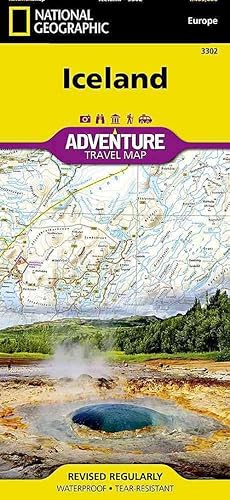
Iceland (Folded)
Published by National Geographic Maps, Evergreen, 2011
ISBN 10: 1566955343ISBN 13: 9781566955348
Book
Folded. Condition: new. Folded. National Geographic's Iceland Adventure Map is designed to meet the unique needs of adventure travelers with its durability and accurate information. This folded map provides global travelers with the perfect combination of detail and perspective, highlighting hundreds of points of interest and the diverse and unique destinations within the country. The map includes the locations of cities and towns with a user-friendly index, plus a clearly marked road network complete with distances and designations for major highways, main roads, and tracks and trails for those seeking to explore more remote regions. Iceland's western half is shown on the front side of the map including the cities of Reykjavik, Hafnarfjoerdur, Kopavogur, Gardabaer, Mossfellsbaer, Keflavik, Borgarnes, Stykkisholmur, and Siglufjoerdur. The reverse side of the map covers the eastern portion of the country showing the cities of Akureyri, Egilsstadir, Eskifjoerdur, Neskaupstadur, Husavik, and Hoefn. Every Adventure Map is printed on durable synthetic paper, making them waterproof, tear-resistant and tough capable of withstanding the rigors of international travel. Each is two-sided and can be folded to a packable size of 235 x 108 mm; unfolded size is 965 x 660 mm. Shipping may be from multiple locations in the US or from the UK, depending on stock availability.
More buying choices from other sellers on AbeBooks
New offers from US$ 21.70
-
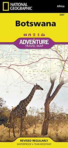
Botswana (Folded)
Published by National Geographic Maps, Evergreen, 2012
ISBN 10: 156695620XISBN 13: 9781566956208
Book
Folded. Condition: new. Folded. National Geographic's Botswana Adventure Map is designed to meet the unique needs of adventure travelers with its durability and detailed, accurate information. The map includes the locations of thousands of cities and towns with a user-friendly index, plus a clearly marked road network complete with distances and designations for major highways, main roads, plus tracks and trails for those seeking to explore more remote regions. This map differs from a traditional road map because it includes hundreds of points of interest that highlight the diverse and unique recreational, ecological, cultural and historic destinations within the country. Our adventure maps are the perfect companion to a guidebook, yet far easier to pack! The Botswana Adventure Map is printed in the United States on a durable synthetic paper, making it waterproof, tear-resistant and tough capable of withstanding the rigors of international travel. The map is two-sided and can be folded to a packable size of 235 x 108; unfolded size is 965 x 660 mm. Net proceeds from the sale of this map go to support the nonprofit mission of the National Geographic Society. The front side of the map contains the Caprivi Strip Game Park, Chobe National Park, Victoria Falls, Zambezi National Park, Nxai-Pan National Park, Moremi Game Reserve, Okavango Delta, and the Central Kalahari Game Reserve. The reverse contains the Central Kalahari Game Reserve, Gaborone, Khama Rhino Sanctuary, Khutse Game Reserve, and Gemsbok National Park.Detailed topography with clearly labeled natural features including the location of protected sites, parks and nature reserves, protected lands, archeological sites, wildlife parks and more- Thousands of place names with a detailed index- Important travel aids including airports, lighthouses, ferry routes and rail lines- Latitude/Longitude and UTM grids along with a compass rose and scale bars for accurate navigation with compass or GPSCopyright 2012Map Scale 1:1,100,000NG Map #: 3207 AdventureMaps provide global travellers with the perfect combination of detail and perspective, highlighting hundreds of points of interest and the diverse and unique destinations within the country. Each map is printed on durable synthetic paper, making them waterproof and tear-resistant. They also include the locations of cities and towns with a user-friendly index, plus a clearly marked road network complete with distances and designations for major highways, main roads and tracks and trails for those seeking to explore more remote regions. Scale : 1:1,100,000 Flat Size : 0 x 0 mm. Shipping may be from multiple locations in the US or from the UK, depending on stock availability.
More buying choices from other sellers on AbeBooks
New offers from US$ 21.71
-
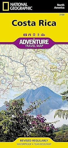
Costa Rica (Folded)
Published by National Geographic Maps, Evergreen, 2012
ISBN 10: 1566953146ISBN 13: 9781566953146
Book
Folded. Condition: new. Folded. National Geographic's Costa Rica Adventure Map is designed to meet the unique needs of adventure travelers with its durability and accurate information. This folded map provides global travelers with the perfect combination of detail and perspective, highlighting hundreds of points of interest and the diverse and unique destinations within the country. The map includes the locations of cities and towns with a user-friendly index, plus a clearly marked road network complete with distances and designations for major highways, main roads, and tracks and trails for those seeking to explore more remote regions. Every Adventure Map is printed on durable synthetic paper, making them waterproof, tear-resistant and tough capable of withstanding the rigors of international travel. Each is two-sided and can be folded to a packable size of 235 x 108 mm; unfolded size is 965 x 660 mm. AdventureMaps provide global travellers with the perfect combination of detail and perspective, highlighting hundreds of points of interest and the diverse and unique destinations within the country. Each map is printed on durable synthetic paper, making them waterproof and tear-resistant. They also include the locations of cities and towns with a user-friendly index, plus a clearly marked road network complete with distances and designations for major highways, main roads and tracks and trails for those seeking to explore more remote regions. Scale : 1:350,000 Flat Size : 965 x 660 mm. Shipping may be from multiple locations in the US or from the UK, depending on stock availability.
More buying choices from other sellers on AbeBooks
New offers from US$ 21.72
-
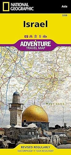
Israel (Folded)
Published by National Geographic Maps, Evergreen, 2012
ISBN 10: 156695617XISBN 13: 9781566956178
Book
Folded. Condition: new. Folded. National Geographic's Israel Adventure Map is designed to meet the unique needs of adventure travelers with its durability and accurate information. This folded map provides global travelers with the perfect combination of detail and perspective, highlighting hundreds of points of interest and the diverse and unique destinations within the country. The map includes the locations of cities and towns with a user-friendly index, plus a clearly marked road network complete with distances and designations for major highways, main roads, and tracks and trails for those seeking to explore more remote regions. The front side of the Israel map details the northern region of the country, from its border with Lebanon to the north, to Syria and Jordan to the east and the Mediterranean Sea to the west. The reverse side of the map details Israel's southern region; bordering Jordan to the east, Egypt and the Mediterranean Sea to the west, and the Gulf of Aqaba to the southernmost point. Every Adventure Map is printed on durable synthetic paper, making them waterproof, tear-resistant and tough capable of withstanding the rigors of international travel. Each is two-sided and can be folded to a packable size of 235 x 108 mm; unfolded size is 965 x 660 mm. AdventureMaps provide global travellers with the perfect combination of detail and perspective, highlighting hundreds of points of interest and the diverse and unique destinations within the country. Each map is printed on durable synthetic paper, making them waterproof and tear-resistant. They also include the locations of cities and towns with a user-friendly index, plus a clearly marked road network complete with distances and designations for major highways, main roads and tracks and trails for those seeking to explore more remote regions. Scale : 1:275,000 Flat Size : 0 x 0 mm. Shipping may be from multiple locations in the US or from the UK, depending on stock availability.
More buying choices from other sellers on AbeBooks
New offers from US$ 21.72
-

South Africa (Folded)
Published by National Geographic Maps, Evergreen, 2011
ISBN 10: 1566955319ISBN 13: 9781566955317
Book
Folded. Condition: new. Folded. National Geographic's South Africa Adventure Map is designed to meet the unique needs of adventure travelers with its durability and accurate information. This folded map provides global travelers with the perfect combination of detail and perspective, highlighting hundreds of points of interest and the diverse and unique destinations within the country. The map includes the locations of cities and towns with a user-friendly index, plus a clearly marked road network complete with distances and designations for major highways, main roads, and tracks and trails for those seeking to explore more remote regions. The west side of the South Africa map includes the Northern Cape, Western Cape, Eastern Cape, and portions of the North West and Free State provinces. Johannesburg and neighboring city Pretoria (administrative capital) are included on the east side of the map along with Bloemfontein (judicial capital) and the coastal city of Durban. Every Adventure Map is printed on durable synthetic paper, making them waterproof, tear-resistant and tough capable of withstanding the rigors of international travel. Each is two-sided and can be folded to a packable size of 235 x 108 mm; unfolded size is 965 x 660 mm. Shipping may be from multiple locations in the US or from the UK, depending on stock availability.
More buying choices from other sellers on AbeBooks
New offers from US$ 21.72
Used offers from US$ 32.00
Also find Softcover
-
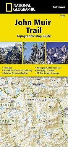
John Muir Trail (topographic Map Guide) (Folded)
Published by National Geographic Maps, Evergreen, 2014
ISBN 10: 1566956897ISBN 13: 9781566956895
Book
Folded. Condition: new. Folded. National Geographic's Map Guide of the John Muir Trail is an indispensable tool for navigating one of the most famous trails in the United States. The maps start at the northern terminus in Yosemite Valley and progress along the ridge of the Sierra Nevada, past Devils Postpile, and end at the highest point in the lower 48 on the top of Mount Whitney. Along the way you will pass through; Yosemite National Park, Ansel Adams Wilderness, Devils Postpile National Monument, John Muir Wilderness, Kings Canyon National Park, and finally, Sequoia National Park & Mt Whitney. Shipping may be from multiple locations in the US or from the UK, depending on stock availability.
More buying choices from other sellers on AbeBooks
New offers from US$ 21.72
-
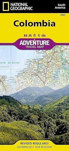
Colombia (Folded)
Published by National Geographic Maps, Evergreen, 2012
ISBN 10: 1566956242ISBN 13: 9781566956246
Book
Folded. Condition: new. Folded. National Geographic's Colombia Adventure Map is designed to meet the unique needs of adventure travelers with its durability and accurate information. This folded map provides global travelers with the perfect combination of detail and perspective, highlighting hundreds of points of interest and the diverse and unique destinations within the country. The map includes the locations of cities and towns with a user-friendly index, plus a clearly marked road network complete with distances and designations for major highways, main roads, and tracks and trails for those seeking to explore more remote regions. Every Adventure Map is printed on durable synthetic paper, making them waterproof, tear-resistant and tough capable of withstanding the rigors of international travel. Each is two-sided and can be folded to a packable size of 235 x 108 mm; unfolded size is 965 x 660 mm. AdventureMaps provide global travellers with the perfect combination of detail and perspective, highlighting hundreds of points of interest and the diverse and unique destinations within the country. Each map is printed on durable synthetic paper, making them waterproof and tear-resistant. They also include the locations of cities and towns with a user-friendly index, plus a clearly marked road network complete with distances and designations for major highways, main roads and tracks and trails for those seeking to explore more remote regions. Scale : 1:1,525,000 Flat Size : 0 x 0 mm. Shipping may be from multiple locations in the US or from the UK, depending on stock availability.
More buying choices from other sellers on AbeBooks
New offers from US$ 21.73
Used offers from US$ 25.04
Also find Softcover
-
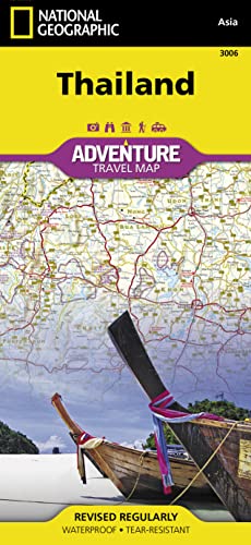
Thailand (Folded)
Published by National Geographic Maps, Evergreen, 2011
ISBN 10: 1566955262ISBN 13: 9781566955263
Book
Folded. Condition: new. Folded. National Geographic's Thailand Adventure Map is designed to meet the unique needs of adventure travelers with its durability and accurate information. This folded map provides global travelers with the perfect combination of detail and perspective, highlighting hundreds of points of interest and the diverse and unique destinations within the country. The map includes the locations of cities and towns with a user-friendly index, plus a clearly marked road network complete with distances and designations for major highways, main roads, and tracks and trails for those seeking to explore more remote regions. The front side of the Thailand map shows the northern half of the country and extends south to the capital city of Bangkok. Border crossings are noted, as are many sites of interest in the neighboring countries of Laos, Myanmar (Burma), and Cambodia. The reverse side features the southern provinces located on the Malay Peninsula. Every Adventure Map is printed on durable synthetic paper, making them waterproof, tear-resistant and tough capable of withstanding the rigors of international travel. Each is two-sided and can be folded to a packable size of 235 x 108 mm; unfolded size is 965 x 660 mm. AdventureMaps provide global travellers with the perfect combination of detail and perspective, highlighting hundreds of points of interest and the diverse and unique destinations within the country. Each map is printed on durable synthetic paper, making them waterproof and tear-resistant. They also include the locations of cities and towns with a user-friendly index, plus a clearly marked road network complete with distances and designations for major highways, main roads and tracks and trails for those seeking to explore more remote regions. Shipping may be from multiple locations in the US or from the UK, depending on stock availability.
More buying choices from other sellers on AbeBooks
New offers from US$ 21.73
Used offers from US$ 29.51
Also find Softcover
-
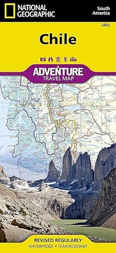
Chile (Folded)
Published by National Geographic Maps, Evergreen, 2011
ISBN 10: 1566955467ISBN 13: 9781566955461
Book
Folded. Condition: new. Folded. AdventureMaps provide global travellers with the perfect combination of detail and perspective. The Chile map details from the northern Peruvian border south to Concepcion, including Santiago, La Serena, Atacama, Arica, and Chanaral, on to Cape Horn at the southern most tip, rich with National Parks. Notable places included are Punta Arenas, Concepcion, Puerto Montt, Tierra del Fuego, and Coihaique. Additional inset maps provide detail for Easter Island, Archipelago Juan Fernandez, and the islands of San Felix and San Ambrosio. Shipping may be from multiple locations in the US or from the UK, depending on stock availability.
More buying choices from other sellers on AbeBooks
New offers from US$ 21.73
-

Hawaii, Tubed (Map)
Published by National Geographic Maps, Evergreen, 2012
ISBN 10: 0792249666ISBN 13: 9780792249665
Book
Map. Condition: new. Map. National Geographic Wall Maps offer a special glimpse into current and historical events, and they inform about the world and environment. Offered in a variety of styles and formats, these maps are excellent reference tools and a perfect addition to any home, business or school. There are a variety of map options to choose from, including the world, continents, countries and regions, the United States, history, nature and space. Scale : 1:773,000 Flat Size : 889 x 584 mm. Shipping may be from multiple locations in the US or from the UK, depending on stock availability.
More buying choices from other sellers on AbeBooks
New offers from US$ 22.03
-
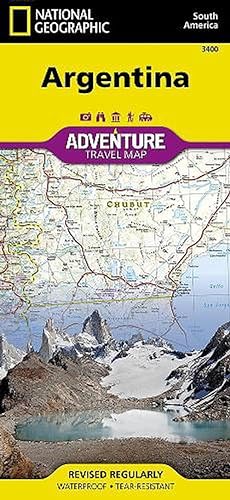
Argentina (Folded)
Published by National Geographic Maps, Evergreen, 2011
ISBN 10: 1566955440ISBN 13: 9781566955447
Book
Folded. Condition: new. Folded. National Geographic's Argentina Adventure Map is designed to meet the unique needs of adventure travelers with its durability and accurate information. This folded map provides global travelers with the perfect combination of detail and perspective, highlighting hundreds of points of interest and the diverse and unique destinations within the country. The map includes the locations of cities and towns with a user-friendly index, plus a clearly marked road network complete with distances and designations for major highways, main roads, and tracks and trails for those seeking to explore more remote regions. The north side of the Argentina map details the most highly populated areas of the country including the provinces of Buenos Aires, Cordoba, and Santa Fe as well as the impressive landscape of the Cordillera de los Andes bordering Chile on the northwest. Vineyards in Mendoza, Argentina's world-renowned wine producing province are included, as are ski areas in this popular tourist region. An inset map shows the small province of Misiones that juts into the neighboring countries of Brazil and Paraguay. The south side of the map details Argentina's extensive coastline from Mar Del Plata to Tierra Del Fuego highlighting beaches, preserves, and areas noted for fishing and surfing. Every Adventure Map is printed on durable synthetic paper, making them waterproof, tear-resistant and tough capable of withstanding the rigors of international travel. Each is two-sided and can be folded to a packable size of 235 x 108 mm; unfolded size is 965 x 660 mm. Scale : 1:2,300,000 Flat Size : 965 x 660 mm. Shipping may be from multiple locations in the US or from the UK, depending on stock availability.
More buying choices from other sellers on AbeBooks
New offers from US$ 22.17
-
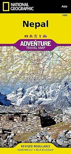
Nepal (Folded)
Published by National Geographic Maps, Evergreen, 2013
ISBN 10: 1566956536ISBN 13: 9781566956536
Book
Folded. Condition: new. Folded. National Geographic's Nepal Adventure Map is the most authoritative map for touring the country. Each waterproof and tear-resistant map provides travelers with the perfect combination of detail and perspective, highlighting points of interest for those venturing outside city centers. This durable, folded map includes the locations of cities and towns with a user-friendly index, plus a clearly marked road network complete with distances and designations for major highways, main roads, and tracks and trails for those seeking to explore more remote regions. The front side offers a detailed topographic and trekking map of central and eastern Nepal, including border regions with China and India. Mountaineers will stay on course with marked trails through the Himalayan Range, including Everest (the tallest mountain in the world), and the surrounding national parks and wildlife reserves. An inset of the Himalayas has been annotated to show elevation. The backside includes the western portion of Nepal, from the city of Mahendranagar in the west, to the Shey-Phoksundo National Park and Dhorpatan Hunting Reserve in the east. A detailed inset of Kathmandu and Patan City provide valuable locations of goods and services for casual tourists and seasoned trekkers alike, including archaeological sites, monasteries, kayaking opportunities, mountain bike paths, and campsites. Every Adventure Map is printed on synthetic paper, making them waterproof, tear-resistant and tough capable of withstanding the rigors of international travel. Each is two-sided and can be folded to a packable size of 235 x 108 mm; unfolded size is 965 x 660 mm. AdventureMaps provide global travellers with the perfect combination of detail and perspective, highlighting hundreds of points of interest and the diverse and unique destinations within the country. Each map is printed on durable synthetic paper, making them waterproof and tear-resistant. They also include the locations of cities and towns with a user-friendly index, plus a clearly marked road network complete with distances and designations for major highways, main roads and tracks and trails for those seeking to explore more remote regions. Shipping may be from multiple locations in the US or from the UK, depending on stock availability.
More buying choices from other sellers on AbeBooks
New offers from US$ 22.17
-

Canada East (Folded)
Published by National Geographic Maps, Evergreen, 2013
ISBN 10: 1566956374ISBN 13: 9781566956376
Book
Folded. Condition: new. Folded. National Geographic's Canada East Adventure Map is designed to meet the needs of adventure travelers with its durability and detailed, accurate information. The map includes the locations of cities and towns with a user-friendly index, a clearly marked road network complete with distances and designations for roads/highways, plus secondary routes for those seeking to explore the stark wilderness of Newfoundland, the fertile farms of Prince Edward Island, or Nova Scotia's hidden coves and beaches. Adventure Maps differ from a traditional road map because of the specialty content they include. Each map contains hundreds of diverse and unique recreational, ecological, cultural, and historic destinations outside of the major tourist hubs. Whether you seek the quaint harbor gem of Halifax, the majestic city life of Toronto, or the old world charm of Montreal and Quebec City, National Geographic Adventure Maps are the perfect companion to a guidebook, yet far easier to pack!On the front side you'll find routes leading to the stunning Niagara Falls, Canada's largest city of Toronto, Algonquin Provincial Park (Canada's largest national park), and the northern regions of Ontario and the Labrador Peninsula. The far eastern provinces on the backside are playgrounds for active exploring and scenic beauty, including Quebec, New Brunswick, Prince Edward Island, Nova Scotia, Newfoundland, and the mighty St. Lawrence River. The Canada East Adventure Map is printed in the United States on a durable synthetic paper, making it waterproof, tear-resistant, and capable of withstanding the rigors of international travel. The map is two-sided and is folded to a packable size of 235 x 108 mm; unfolded size is 965 x 660 mm. Travel Tip! Due to the synthetic sheet that Adventure Maps are printed on, you can easily fold the map to a discreet size, showing just the area you're interested in. Key Features: Waterproof and tear-resistant Designed and printed in the U. S. A. Detailed topography with clearly labeled natural features Major road networks Hundreds of points of interest, including the location of provincial parks, UNESCO World Heritage Sites, and ski areas. Thousands of place names with a detailed index Important travel aids including airports, rail lines, and other infrastructure Latitude/Longitude and UTM grids along with a compass rose and scale bars for accurate navigation with compass or GPSNet proceeds from the sale of this map go to support the nonprofit mission of the National Geographic Society. Shipping may be from multiple locations in the US or from the UK, depending on stock availability.
More buying choices from other sellers on AbeBooks
New offers from US$ 22.17
-
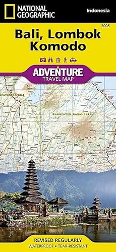
Bali, Lombok, And Komodo (Folded)
Published by National Geographic Maps, Evergreen, 2012
ISBN 10: 1566955254ISBN 13: 9781566955256
Book
Folded. Condition: new. Folded. National Geographic's Bali, Lombok, and Komodo Adventure Map is designed to meet the unique needs of adventure travelers with its durability and accurate information. This folded map provides global travelers with the perfect combination of detail and perspective, highlighting hundreds of points of interest and the diverse and unique destinations within the country. The map includes the locations of cities and towns with a user-friendly index, plus a clearly marked road network complete with distances and designations for major highways, main roads, and tracks and trails for those seeking to explore more remote regions. Every AdventureMap is printed on durable synthetic paper, making them waterproof, tear-resistant and tough capable of withstanding the rigors of international travel. Each is two-sided and can be folded to a packable size of (4.25" x 9.25"); unfolded size is (26" x 38"). AdventureMaps provide global travellers with the perfect combination of detail and perspective, highlighting hundreds of points of interest and the diverse and unique destinations within the country. Each map is printed on durable synthetic paper, making them waterproof and tear-resistant. They also include the locations of cities and towns with a user-friendly index, plus a clearly marked road network complete with distances and designations for major highways, main roads and tracks and trails for those seeking to explore more remote regions. Scale : 1:150,000 Flat Size : 965 x 660 mm. Shipping may be from multiple locations in the US or from the UK, depending on stock availability.
More buying choices from other sellers on AbeBooks
New offers from US$ 22.17
-

Vietnam South (Folded)
Published by National Geographic Maps, Evergreen, 2012
ISBN 10: 1566956021ISBN 13: 9781566956024
Book
Folded. Condition: new. Folded. AdventureMaps provide global travellers with the perfect combination of detail and perspective, highlighting hundreds of points of interest and the diverse and unique destinations within the country. Each map is printed on durable synthetic paper, making them waterproof and tear-resistant. They also include the locations of cities and towns with a user-friendly index, plus a clearly marked road network complete with distances and designations for major highways, main roads and tracks and trails for those seeking to explore more remote regions. Shipping may be from multiple locations in the US or from the UK, depending on stock availability.
More buying choices from other sellers on AbeBooks
New offers from US$ 22.17