
Order Total (1 Item Items):
Shipping Destination:

trailblazer publications hindhead surrey (159 results)
Skip to main search results
Product Type
- All Product Types
- Books (159)
- Magazines & Periodicals
- Comics
- Sheet Music
- Art, Prints & Posters
- Photographs
- Maps
- Manuscripts & Paper Collectibles
Condition
Binding
Collectible Attributes
- First Edition (4)
- Signed
- Dust Jacket
- Seller-Supplied Images (103)
- Not Print on Demand (159)
Free Shipping
Seller Location
Seller Rating
-
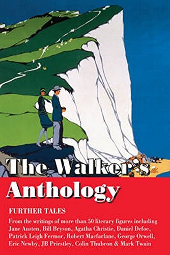
The Walker's Anthology - Further Tales (Trailblazer Travel Anthology)
Published by Trailblazer Publications, United Kingdom, Hindhead, Surrey, 2016
ISBN 10: 1905864825ISBN 13: 9781905864829
Book
Paperback. Condition: Very Good. Following the success of The Walker's Anthology , The Railway Anthology, and The Cyclist's Anthology we're continuing this series with further short excerpts from the writings of famous literary figures on the subject of hiking, trekking and climbing around the world. In this fascinating anthology, Bryn Thomas has drawn on writings of more than 50 literary figures - Bill Bryson, Agatha Christie, Arthur Conan Doyle, William Dalrymple, Daniel Defoe, EM Forster, Amitav Ghosh, Graham Greene, Ernest Hemingway, Rudyard Kipling, Eric Newby, JB Priestley, Bayard Taylor, Paul Theroux, Henry David Thoreau, Colin Thubron, Mark Twain and H.G. Wells among many others. This entertaining hardback anthology will appeal to hikers and armchair travelers alike and make the perfect gift. The book has been read, but is in excellent condition. Pages are intact and not marred by notes or highlighting. The spine remains undamaged.
More buying choices from other sellers on AbeBooks
New offers from US$ 21.48
Used offers from US$ 1.00
-

Moroccan Atlas - The Trekking Guide
Published by Trailblazer Publications, United Kingdom, Hindhead, Surrey, 2010
ISBN 10: 1873756771ISBN 13: 9781873756775
Book
Paperback. Condition: Very Good. A comprehensive and practical guidebook to trekking in the Moroccan Atlas mountains ideal for both experienced and novice trekkers. The guide contains: 50 detailed trekking maps showing route times, places to stay and points of interest; the best treks in Toubkal, Sirwa, Sahro, M'goun; practical information - planning your trip and getting to Morocco; historical and cultural background; Marrakech, Imlil, Taliouine, Ouarzazate, N'Kob, Boumalne du Dades, Azilal and Tabant - detailed street plans, where to stay, where to eat, what to see and getting to the start of your trek; green hiking and safety; language sections in Arabic, Berber and French; Moroccan flora and fauna - four page colour guide to the flowers of the High Atlas, plus an illustrated bird identification section. The book has been read, but is in excellent condition. Pages are intact and not marred by notes or highlighting. The spine remains undamaged.
-
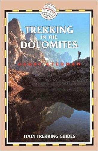
Trekking in the Dolomites
Published by Trailblazer Publications, United Kingdom, Hindhead, Surrey, 2001
ISBN 10: 1873756348ISBN 13: 9781873756348
Book
Paperback. Condition: Very Good. The book has been read, but is in excellent condition. Pages are intact and not marred by notes or highlighting. The spine remains undamaged.
-
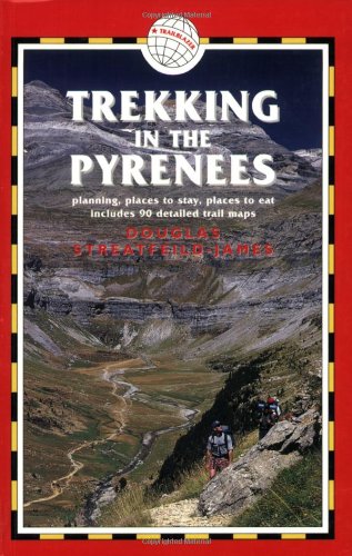
Trekking in the Pyrenees
Published by Trailblazer Publications, United Kingdom, Hindhead, Surrey, 2005
ISBN 10: 1873756828ISBN 13: 9781873756829
Book
Paperback. Condition: Very Good. The book has been read, but is in excellent condition. Pages are intact and not marred by notes or highlighting. The spine remains undamaged.
-
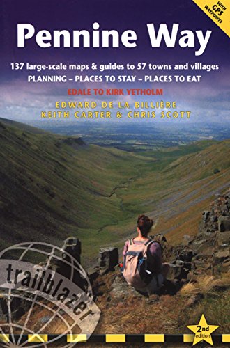
Pennine Way
Published by Trailblazer Publications, United Kingdom, Hindhead, Surrey, 2008
ISBN 10: 1905864027ISBN 13: 9781905864027
Book
Paperback. Condition: Very Good. Hiking route guide to the 256 mile Pennine Way, Britain's best known National Trail. The book has been read, but is in excellent condition. Pages are intact and not marred by notes or highlighting. The spine remains undamaged.
-
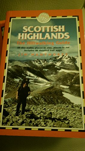
Scottish Highlands - The Hillwalking Guide: 60 Day-Walks with Accommodation Guide (British Walking Guides): Practical Walking Guide to 60 Day-Walks with Accommodation Guide
Published by Trailblazer Publications, United Kingdom, Hindhead, Surrey, 2009
ISBN 10: 1905864213ISBN 13: 9781905864218
Book
Paperback. Condition: Very Good. Practical walking guide to over 80 hills in the Scottish Highlands and Islands. This Scottish hill-walking book covers Scottish hill walks, monros, corbetts and tracks including Ben Nevis walking guide and Cairngorm walks. Includes 86 detailed walking maps: walking times, directions, tricky junctions, places to stay, places to eat, points of interest written onto the map. These are not general-purpose maps but fully edited maps drawn by walkers for walkers. 60 day-walks for all abilities, graded for difficulty, 2-day and 3-day treks. Profile maps to show climbs and descents. Detailed accommodation: B&Bs, campsites, bunkhouses, bothies, hostels, hotels, pubs. Places to eat: cafes, pubs, teashops, restaurants. What to see. Guides to 62 gateway towns and villages. Detailed public transport information. The book has been read, but is in excellent condition. Pages are intact and not marred by notes or highlighting. The spine remains undamaged.
-
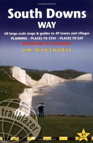
South Downs Way: Winchester to Eastbourne (Trailblazer British Walking Guides)
Published by Trailblazer Publications, United Kingdom, Hindhead, Surrey, 2009
ISBN 10: 1905864183ISBN 13: 9781905864188
Book
Paperback. Condition: Very Good. The complete walking guide to the 100-mile footpath from Winchester to Eastbourne. Includes 60 large-scale walking maps plus GPS waypoints and 11 town plans, itineraries for all walkers, practical information for all budgets and public transport information for day walks. The book has been read, but is in excellent condition. Pages are intact and not marred by notes or highlighting. The spine remains undamaged.
-
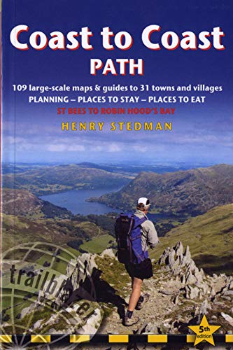
Coast to Coast Path: St Bees to Robin Hood's Bay planning, places to stay, places to eat (Trailblazer British Walking Guide)
Published by Trailblazer Publications, United Kingdom, Hindhead, Surrey, 2012
ISBN 10: 1905864477ISBN 13: 9781905864478
Book
Paperback. Condition: Very Good. Fully revised 5th edition of this classic 191-mile walk across northern England from the Irish Sea to the North Sea, inspired by Alfred Wainwright. Crossing three fabulous national parks - the Lake District, the Yorkshire Dales, and the North York Moors - it samples the very best of the English countryside - rugged mountains and lakes, gentle dales and stone-built villages; wild moorland; sea cliffs and fishing villages. The book has been read, but is in excellent condition. Pages are intact and not marred by notes or highlighting. The spine remains undamaged.
-

Japan by Rail
Published by Trailblazer Publications, United Kingdom, Hindhead, Surrey, 2007
ISBN 10: 1873756976ISBN 13: 9781873756973
Book
Paperback. Condition: Very Good. Fully revised second edition, includes full historical background, cultural tips, getting to Japan, where to stay and eat, and timetables. The book has been read, but is in excellent condition. Pages are intact and not marred by notes or highlighting. The spine remains undamaged.
-
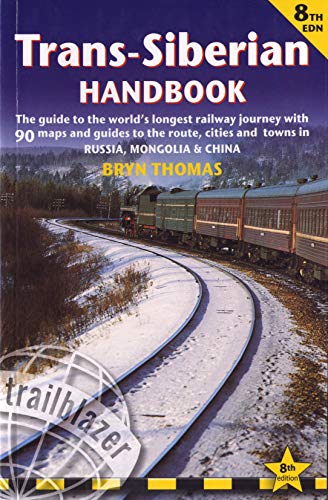
Trans-Siberian Handbook: Trans-Siberian, Trans-Mongolian, Trans-Manchurian and Siberian Bam Routes (Includes Guides to 25 Cities) (Trailblazer Guide) . Journey (Now Includes Siberian Bab Railway)
Published by Trailblazer Publications, United Kingdom, Hindhead, Surrey, 2011
ISBN 10: 1905864361ISBN 13: 9781905864362
Book
Paperback. Condition: Very Good. The eighth edition of the definitive guide to the world's longest railway journey is a major revision, entirely re-researched and updated by Anna Kaminski, a Russian-UK dual-national educated in both countries. All routes were retravelled and there is additional information on Siberia, including the Lake Baikal area. The book includes kilometre by kilometre route guides to the Trans-Siberian (Moscow-Vladivostok), Trans-Mongolian (Moscow-Beijing via Ulaan Baatar) and Trans-Manchurian (Moscow-Beijing) journeys with strip maps in Russian, English and Chinese plus a new section on the Siberian BAM route; city guides and maps to 25 stopovers including Moscow, St Petersburg, Sergiev Posad, Rostov-Yaroslavski, Yaroslavl, Vladimir, Suzdal, Nizhny Novgorod, Vyatka (Kirov), Perm, Yekaterinburg, Tyumen, Tobolsk, Omsk, Novosibirsk, Tomsk, Krasnoyarsk, Irkutsk, Lake Baikal, Listvyanka, Bolshie Koty, Bratsk, Severobaikalsk, Nizhneangarsk, Ulan Ude, Chita, Birobidzhan, Khabarovsk, Vladivostok, Ulaan Baatar, Harbin, Beijing where to stay and eat, information about Siberia and the railway, and 76 maps plus timetables, rail fares, Russian & Chinese phrases. The book has been read, but is in excellent condition. Pages are intact and not marred by notes or highlighting. The spine remains undamaged.
-

Japan by Rail: Includes Rail Route Guide and 26 Town and City Guides (Trailblazer): Includes Rail Route Guide and 30 City Guides
Published by Trailblazer Publications, United Kingdom, Hindhead, Surrey, 2016
ISBN 10: 1905864752ISBN 13: 9781905864751
Book
Paperback. Condition: Very Good. Japan is steeped inlegend and myth, perhaps the greatest of which is the popular misconceptionthat the country is simply too expensive to visit. The truth is that flights to Japan are cheaper than they've ever been, accommodation can be great value, while the warm hospitality which awaits every visitor costs nothing at all. The real secret to travelling around the country on a budget, however, is the Japan RailPass. Use this comprehensive guide in conjunction with a rail pass to get the most out of a trip to Japan. Practical information - planning your trip; when to go; suggested itineraries; what to take; festivals and events City guides and maps - where to stay, where to eat, what to see in 30 towns and cities; historical and cultural background Kilometre-by-kilometre route guides - covering train journeys from the coast into the mountains, from temple retreat to sprawling metropolis; 33 route maps Railway timetables and frequency charts - Bullet trains and main routes Customs, etiquette, Japanese words and phrases -with kanji This new edition also now includes: kanji/hiragana/katakana for all place names mentioned in the book so readers can point to the text when asking Japanese speakers for directions. The extension of the shinkansen route from Nagano toKanazawa. This is now called the Hokuriku shinkansen. Additional side trips from Tokyo including to Kawaguchi-ko for magnificent views of Mt Fuji, and to Mito for Kairakuen, the only one of the three great landscape gardens in Japan not currently mentioned in the book. Expanded coverage of Nikko, Nagasaki, the side trip to Asosan, Beppu, and many places in the Kansai region. The book has been read, but is in excellent condition. Pages are intact and not marred by notes or highlighting. The spine remains undamaged.
-
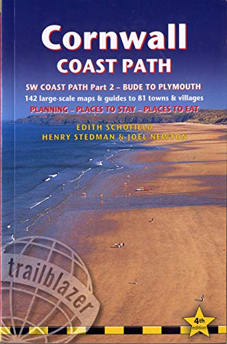
Cornwall Coast Path - Bude to Plymouth Planning, Places to Stay, Places to See (Trailblazer British Walking Guide): Practical Walking Guide with 145 . Walking Guide to South West Coast Path)
Published by Trailblazer Publications, United Kingdom, Hindhead, Surrey, 2012
ISBN 10: 1905864442ISBN 13: 9781905864447
Book
Paperback. Condition: Very Good. Practical guide to walking the entire Cornwall coast path. It covers the 2nd section of the South West Coast Path, from Bude to Plymouth, following the national trail for 288 miles. This detailed Cornwall guide includes: Cornwall maps, 142 large scale walking maps and 15 town plans. Detailed accommodation with lists of places to stay, hotels, B&Bs,pubs, campsites, hostels. Places to eat, pubs, cafes, restaurants. Detailed public transport information. Itineraries for all walkers, it can also be used for Cornwall walks for one day or short breaks. Everything you need to know to enjoy Cornwall coastal walks. The book has been read, but is in excellent condition. Pages are intact and not marred by notes or highlighting. The spine remains undamaged.
-
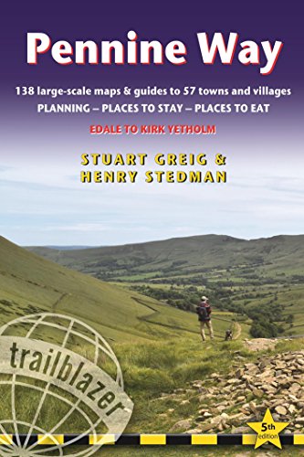
Pennine Way: Trailblazer British Walking Guide from Edale to Kirk Yetholm with 138 Large-Scale Maps & Guides to 57 Towns and Villages (British Walking . Guide with Planning, Places to Stay, Places
Published by Trailblazer Publications, United Kingdom, Hindhead, Surrey, 2014
ISBN 10: 1905864612ISBN 13: 9781905864614
Book
Paperback. Condition: Good. Britain's best-known National Trail winds for 256 miles through three National Parks - the Peak District, Yorkshire Dales and Northumberland. This superb footpath showcases Britain's finest upland scenery, while touching the literary landscape of the Bronte family and Roman history along Hadrian's Wall. *138 large-scale walking maps - at just under 1:20,000 - showing route times, gradients, where to stay, interesting features.*Guides to 57 towns and villages - along the way*Itineraries for all walkers - whether walking the route in its entirety or sampling the highlights on day walks and short breaks.*Practical information for all budgets - Edale to Kirk Yetholm: where to stay (B&Bs, hostels, campsites, pubs and hotels), where to eat, what to see, plus detailed town plans*Public transport information - all access points on the path.*GPS waypoints. These are also downloadable from the Trailblazer website.*Now includes extra color sections: 16pp color introduction and 16pp of color mapping for stage sections (one stage per page) with trail profiles. The book has been read but remains in clean condition. All pages are intact and the cover is intact. Some minor wear to the spine.
-
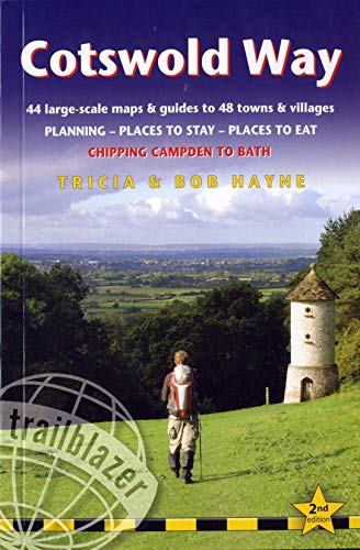
Cotswold Way, Chipping Campden to Bath, Planning, Places to Stay, Places to Eat (Trailblazer) (British Walking Guide)
Published by Trailblazer Publications, United Kingdom, Hindhead, Surrey, 2012
ISBN 10: 1905864485ISBN 13: 9781905864485
Book
Paperback. Condition: Very Good. Practical guide to walking the whole Cotswold Way. This Cotswold guide book covers the 102 miles (163km) of the Cotswold Way National Trail that runs from Chipping Campden to Bath. Includes Overview Cotswold Way map, 44 large scale walking maps (1:20,000) and 9 town and village maps. Detailed accommodation guide: B&Bs, hotels, hostels, pubs, campsites with reviews. Places to eat: cafes, pubs and restaurants. Detailed public transport information. Itineraries for all walkers including day Cotswold walks. Downloadable GPS waypoints. 32 pages of full colour pictures including 4 page colour flower and butterfly guide and colour overview map. The book has been read, but is in excellent condition. Pages are intact and not marred by notes or highlighting. The spine remains undamaged.
-
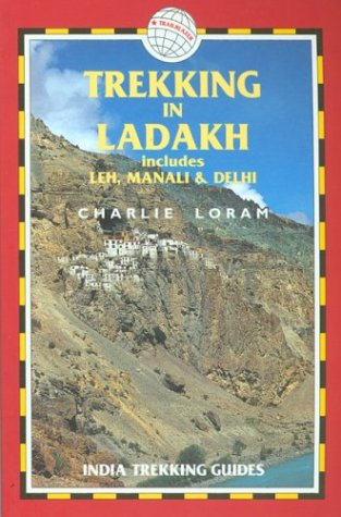
Trekking in Ladakh: includes Leh, Manali and Delhi (India Trekking Guide S.)
Published by Trailblazer Publications, United Kingdom, Hindhead, Surrey, 1999
ISBN 10: 1873756305ISBN 13: 9781873756300
Book
Paperback. Condition: Very Good. Fully revised and extended 2nd edition of Charlie Loram's guide originally published as LEH AND TREKKING IN LADAKH. Includes 70 detailed walking maps plus information on getting to Ladakh. The book has been read, but is in excellent condition. Pages are intact and not marred by notes or highlighting. The spine remains undamaged.
-

Adventure Motorcycling Handbook: A Route & Planning Guide
Published by Trailblazer Publications, United Kingdom, Hindhead, Surrey, 2012
ISBN 10: 1905864469ISBN 13: 9781905864461
Book
Paperback. Condition: Very Good. With all you need to know in one book and now in its 3rd decade, the 6th edition of AMH is the best yet Every red-blooded motorcyclist dreams of making the Big Trip - this comprehensive manual will make that dream a reality. Timbuktu to Kathmandu or Patagonia to Mongolia, whether you're planning your own Big Trip or just enjoy reading about other people's adventures, this book is guaranteed to illuminate, entertain and, above all, inspire. * Fully-revised 6th edition * Practical information - Essential documentation, ten overland machines rated, preparation and gear for riding in or across the countries of the developing world (the 'AM Zone') as well as dealing with culture shock, borders, robbery, medical emergencies, accidents, shipping, navigation, wild camping, highway and off-road riding, fault diagnosis plus filming and also overlanding on quads. * Trans-continental route outlines - Across Africa, Asia and Latin America. Improved mapping shows overland routes. * Tales from the Saddle - Spoke-bending moto adventures from the earliest two-wheel pioneers to contemporary first-hand accounts from India, Morocco, South America, Pakistan and Siberia. The book has been read, but is in excellent condition. Pages are intact and not marred by notes or highlighting. The spine remains undamaged.
-
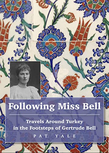
Following Miss Bell (Paperback)
Published by Trailblazer Publications, Hindhead, Surrey, 2023
ISBN 10: 1912716356ISBN 13: 9781912716357
Book
Paperback. Condition: new. Paperback. Travel around Turkey in the footsteps of the great British archaelogist Gertrude Bell.In 1889 Gertrude Bell, the great British archaeologist, writer and explorer, arrived in Constantinople (Istanbul) on the first of many visits to what is now Turkey. Over the next twenty-five years, she would travel the length and breadth of the country, climbing mountains Hasan and Cudi, crossing the Dicle (Tigris) on a raft of inflated goatskins and taking the earliest photographs of remote corners of the country.Veteran guidebook writer Pat Yale set out to retrace Bells Turkish adventures as one British traveller following another. Her journey took her to the site on the Syrian border where she met Lawrence of Arabia, to forgotten monasteries with solitary occupants and to villages where the conversation of trilingual inhabitants recalled a more multicultural past. Along the way, she rubbed shoulders with adherents of faiths that barely survive in modern Turkey, with young men manning barricades in the troubled southeast and refugees struggling to make new lives, with settled nomads making a living from modern tourism and a myriad taxi drivers whose stories exemplify the Turkish dream. Interwoven with each other, the tales of these two womens travels evoke a Turkey of then and now that is so much more complex than its modern tourist image suggests. The author of the Lonely Planet guide to Turkey interweaves her travels in modern Turkey with those of explorer Gertrude Bell 100 years ago, in an entertaining travelogue. Shipping may be from multiple locations in the US or from the UK, depending on stock availability.
-
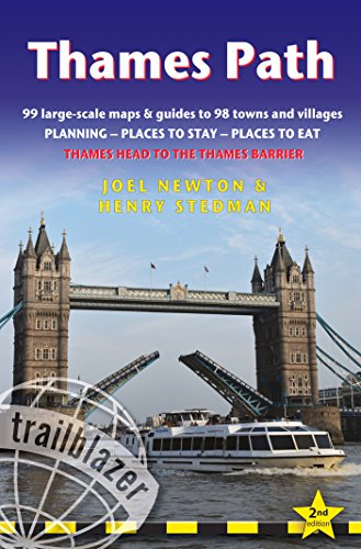
Thames Path: (Trailblazer British Walking Guide) Thames Head to the Thames Barrier (London), 99 Large-Scale Maps & Guides to 98 Towns & Villages, . . Stay, Places to Eat (British Walking Guides)
Published by Trailblazer Publications, United Kingdom, Hindhead, Surrey, 2018
ISBN 10: 1905864973ISBN 13: 9781905864973
Book
Paperback. Condition: Good. Practical, all-in-one guide to walking the Thames Path National Trail from the Costwolds to the Thames Barrier in London, including large-scale trail maps, places to stay, places to eat and public transport information. The Thames Path's National Trail runs for 184 miles (294km) from the river's source at Thames Head near Kemble in the Cotswolds to the Thames Barrier in London. The scenery is magnificently varied ranging from wild and lonely sections of the upper reaches of the river to equally impressive urban vistas. Passing so many ancient sites - Oxford, Lechlade, Abingdon, Henley, Runnymede, Windsor and London - this is as much a walk through history as an easy ramble along a river bank. *Includes 99 walking maps - the largest-scale maps available. At a scale of just under 1:20,000 (8cm or 3-1/8 inches to one mile) these are bigger than the most detailed walking maps currently available. *Unique mapping features - walking times, directions, tricky junctions, places to stay and eat, points of interest. These are not general-purpose maps but fully-edited maps drawn by walkers for walkers. *Itineraries for all walkers - whether hiking the 184-mile route in its entirety or sampling the highlights on day walks or short breaks. *Includes detailed public transport information for all access points. *Practical information for all budgets - what to see, where to stay with reviews, where to eat with reviews: pubs, hotels, B&B, camping, bunkhouses, hostels. *GPS waypoints. These are also downloadable from the Trailblazer website. * Stage maps in full colour show gradients. * Overview maps - 14 in full colour. * Colour flower guide - 4pp. The book has been read but remains in clean condition. All pages are intact and the cover is intact. Some minor wear to the spine.
-
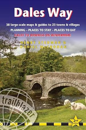
Dales Way Trailblazer Walking Guide (Paperback)
Published by Trailblazer Publications, Hindhead, Surrey, 2022
ISBN 10: 1912716305ISBN 13: 9781912716302
Book
Paperback. Condition: new. Paperback. All the information you need to enjoy your hiking adventure along the Dales Way in this fully revised and updated 2nd edition. Enjoy the Dales Way with this all-in-one guide to walking the long distance footpath from Ilkley, West Yorkshire, through the Yorkshire Dales National Park, for 84 miles (135km) to end in the Lake District, in Bowness-on-Windermere.New edition re-researched and rewritten, with maps redrawn in new two-colour styleIncludes 38 detailed walking maps, the largest-scale maps available - At just under 1:20,000 (8cm or 3 1/8 inches to 1 mile) these are bigger than even the most detailed walking maps currently available in the shopsUnique mapping features - walking times, directions, tricky junctions, places to stay, places to eat, points of interest. These are not general-purpose maps but fully edited maps drawn by walkers for walkersItineraries for all walkers - whether hiking the entire route or sampling highlights on day walks or short breaksDetailed public transport information - for all access pointsPractical information for all budgets. What to see, where to eat (cafes, pubs and restaurants); where to stay (B&Bs, hotels, bunkhouses, hostels & campsites) All-in-one guide to walking the Dales Way long distance footpath from Ilkley, West Yorkshire, through the Yorkshire Dales National Park, for 84 miles (135km) to end in the Lake District, in Bowness-on-Windermere. Shipping may be from multiple locations in the US or from the UK, depending on stock availability.
-

West Highland Way (Paperback)
Published by Trailblazer Publications, Hindhead, Surrey, 2022
ISBN 10: 1912716291ISBN 13: 9781912716296
Book
Paperback. Condition: new. Paperback. All the information you need to enjoy your hiking adventure along the West Highland Way in this fully revised 8th edition.The West Highland Way passes through some of the most spectacular scenery in all of Britain. From the outskirts of Glasgow it winds for 96 miles (154.5km) along the wooded banks of Loch Lomond, across the wilderness of Rannoch Moor, over the mountains above Glencoe to a dramatic finish passing Ben Nevis - Britain's highest mountain - into the centre of Fort William.4 large-scale town plans, 8 overview maps and 53 large-scale walking maps - at just under 1:20,000 - showing route times, places to stay, places to eat, points of interest and much more. These are not general-purpose maps but fully-edited maps drawn by walkers for walkers.Itineraries for all walkers - whether walking the route in its entirety over a week to 10 days or sampling the highlights on day walks and short break.Practical information for all budgets - camping, bunkhouses, hostels, B&Bs, pubs and hotels; Glasgow through to Fort William - where to stay, where to eat, what to see, plus detailed street plans.Comprehensive public transport information - for all access points on the West Highland Way.Climb Ben Nevis - route descriptions to the top of Britain's highest mountain and other peaks.Flora and fauna - four page full colour flower guide, plus an illustrated section on local wildlife.Green hiking - understanding the local environment and minimizing our impact on it.Includes GPS waypoints. - also downloadable from the Trailblazer website.Plus extra colour sections: 16pp colour introduction and 10pp of colour mapping for stage sections (one stage per page) with trail profiles. All the information you need to enjoy your hiking adventure along the West Highland Way in this fully revised 8th edition. Shipping may be from multiple locations in the US or from the UK, depending on stock availability.
-
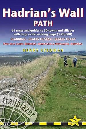
Hadrian's Wall Path Trailblazer walking guide (Paperback)
Published by Trailblazer Publications, Hindhead, Surrey, 2023
ISBN 10: 1912716372ISBN 13: 9781912716371
Book
Paperback. Condition: new. Paperback. All the information you need to enjoy your hiking adventure along Hadrian's Wall Path in this fully revised 7th edition.Hadrian's Wall Path, 84 miles from end to end, follows the course of northern Europe's largest surviving Roman monument, a 2nd-century fortification built - in the border country between England and Scotland - on the orders of the Emperor Hadrian in AD122. Opened in 2003, the path crosses the beautiful border country between England and Scotland. It is the first National Trail to follow the course of a UNESCO World Heritage Site. This week-long walk is regarded as one of the least challenging National Trails.This 7th edition has been re-walked and fully updated.8 town plans and 59 large-scale walking maps - at just under 1:20,000 - showing route times, places to stay, points of interest and much morePlus 8 stage maps and 2 overview mapsItineraries for all walkers - whether walking the route in its entirety over seven to eight days or sampling the highlights on day walks and short breaksPractical information for all budgetsWhere to stay with reviews - camping, bunkhouses, hostels, B&Bs, pubs and hotelsWhere to eat with reviews - cafes, pubs, tea-shops, restaurants, takeaways and shops/supermarketsWhat to see - historical, cultural, geographical informationDetailed street plansComprehensive public transport information - for all access points on the Hadrian's Wall PathFlora and fauna - four page full colour flower guide, plus an illustrated section on local wildlifeGreen hiking - understanding the local environment and minimizing our impact on itNewcastle city guideGPS waypoints. These are also downloadable from the Trailblazer websiteIncludes extra colour sections: 16pp colour introduction and 16pp of colour mapping for stage sections (one stage per page) with trail profiles. All the information you need to enjoy your hiking adventure along Hadrian's Wall Path in this fully revised 7th edition. Shipping may be from multiple locations in the US or from the UK, depending on stock availability.
-

South Downs Way Trailblazer Walking Guide 8e (Paperback)
Published by Trailblazer Publications, Hindhead, Surrey, 2024
ISBN 10: 191271647XISBN 13: 9781912716470
Book
Paperback. Condition: new. Paperback. All the information you need to walk the South Downs Way. Trailblazer's guide to South Downs Way shows the route in both directions from Winchester to Eastbourne and from Eastbourne to Winchester. This handy, pocket size South Downs Way guide includes: 82 Maps in two-colour style - 60 large-scale walking maps - 1:20,000 (3-1/8 inches to 1 mile), 11 town plans, 10 stage maps with trail profiles showing hills and descents, and 2 overview mapsDetailed accommodation with reviews - B&Bs, campsites, pubs, hotels, bunkhousesWhere to eat with reviews - cafes, teashops, pubs, takeaways and restaurantsComprehensive public transport information - with frequency of services for all access points on the PathDownloadable GPS waypointsItineraries for all walkers - whether hiking the entire route or sampling highlights on day walks, weekends or short breaksUnique mapping features - walking times, directions, tricky junctions, places to stay, places to eat, points of interest written onto the mapsFlora and fauna - four page full colour flower guide, plus an illustrated section on local wildlifeGreen hiking - understanding the local environment and minimizing our impact on it Practical, complete guide to walking the South Downs Way, a 100-mile National Trail footpath which follows the line of chalk hills stretching from Winchester to Eastbourne in southern England. Shipping may be from multiple locations in the US or from the UK, depending on stock availability.
-

Cleveland Way (Trailblazer British Walking Guides) (Paperback)
Published by Trailblazer Publications, Hindhead, Surrey, 2018
ISBN 10: 1905864914ISBN 13: 9781905864911
Book
Paperback. Condition: new. Paperback. All-in-one, practical guide to walking Cleveland Way National Trail, in the beautiful, wild countryside of the North York Moors National Park in northern England. The 110-mile route runs from Helmsley near Thirsk around the western edge of the park to reach the coast at Saltburn-by-the-Sea. It then continues along the eastern edge of the park south down the coast through Whitby, Robin Hood's Bay and Scarborough to finish in Filey. Combining moorland and coast there's wonderful scenic variety to this walk, with crumbling castles and idyllic fishing villages to explore. The guide includes: * 48 large-scale walking maps - at just under 1:20,000 - showing route times, places to stay, places to eat, points of interest, and 8 town plans. * 10 colour stage maps to help plan your walk, including hills and descents, and two colour overview maps. * Places to stay with reviews - campsites, bunkhouses, hostels, B&Bs, pubs and hotels. * Places to eat with reviews - cafes, teashops, pubs, takeaways, restaurants. * What to see from the path - history, culture, natural history. * Comprehensive public transport information - for all access points on the Cleveland Way. * Flora and fauna - four page full colour flower guide, plus an illustrated section on local wildlife. * Itineraries for all walkers - whether walking the route in its entirety over two weeks or sampling the highlights on day walks and short breaks. * Green hiking - understanding the local environment and minimizing our impact on it. * GPS waypoints - also downloadable from the Trailblazer website page. All-in-one, practical guide to walking Cleveland Way National Trail, in the beautiful, wild countryside of the North York Moors National Park. Shipping may be from multiple locations in the US or from the UK, depending on stock availability.
-

North Downs Way (Trailblazer British Walking Guides) (Paperback)
Published by Trailblazer Publications, Hindhead, Surrey, 2018
ISBN 10: 1905864906ISBN 13: 9781905864904
Book
Paperback. Condition: new. Paperback. Practical guide to walking the North Downs Way National Trail that runs from Farnham in Surrey to Dover in Kent, partly following the old Pilgrims Way to the shrine of St Thomas a Becket at Canterbury. It winds its way through the protected landscape of the Surrey Hills and the Kent Downs, passing medieval churches, castles, Neolithic burial sites, vineyards and numerous WWII defences. There are literary associations with Swift, Cobbett, Dickens and Jane Austen. The guide includes: * 80 large-scale walking maps - at just under 1:20,000 - showing route times, places to stay, points of interest and much more, and 15 town plans. * 14 stage maps showing hills and descents, and 2 overview maps. * Itineraries for all walkers - whether walking the route in its entirety or sampling highlights on day walks and short breaks. * 15 town plans. * Places to stay with reviews - campsites, bunkhouses, hostels, B&Bs, pubs and hotels. * Places to eat with reviews - cafes, teashops, pubs, takeaways, restaurants. * What to see - historical, cultural, geographical background information. * Comprehensive public transport information - for all access points on the Path.* Flora and fauna - four page full colour flower guide, plus an illustrated section on local wildlife. * Green hiking - understanding the local environment and minimizing our impact on it. * GPS waypoints - also downloadable from the Trailblazer website. All-in-one, practical guide to walking the North Downs Way National Trail that runs from Farnham in Surrey to Dover in Kent, via Canterbury. Shipping may be from multiple locations in the US or from the UK, depending on stock availability.
-

Pembrokeshire Coast Path (Trailblazer British Walking Guides) (Paperback)
Published by Trailblazer Publications, Hindhead, Surrey, 2021
ISBN 10: 1912716135ISBN 13: 9781912716135
Book
Paperback. Condition: new. Paperback. The Pembrokeshire Coast Path follows a National Trail for 186 miles (299km) around the magnificent coastline of the Pembrokeshire Coast National Park in south-west Wales. Renowned for its unspoilt sandy beaches, secluded coves, tiny fishing villages and off-shore islands rich in bird and marine life, this National Trail provides some of the best coastal walking in Britain.This practical, comprehensive guide to walking the Pembrokeshire Coast Path provides 96 trail maps and 15 town plans, including planning, places to stay, places to eat, what to see.* 96 large-scale trail maps and 15 town plans, 14 stage maps and 2 overview maps* Detailed accommodation with reviews: B&Bs, campsites, pubs, hotels, bunkhouses* Where to eat with reviews: cafes, teashops, takeaways, pubs and restaurants* Detailed public transport information with frequency of services* Unique mapping features - In many walking guides the reader has to read a route description then try to relate it to the map. Our guides are easier to use because walking directions, tricky junctions, places to stay and eat, points of interest and walking times are all written onto the maps themselves in the places to which they apply. With their uncluttered clarity, these are not general-purpose maps but fully- edited maps drawn by walkers for walkers. Downloadable GPS waypoints also included.Includes EXTRA COLOUR OVERVIEW MAPPING* The largest scale walking maps available - At just under 1:20,000 (8cm or 31/8 inches to 1 mile) our maps are bigger than even the most detailed walking maps currently available in the shops.* An all-in-one guide - Trailblazer guides include practical information not usually found in walking guides to the UK: reviews of places to stay, places to eat, attractions along the way and detailed public transport information showing all access points on the path, for weekend and day walkers.* Itineraries for all walkers, whether hiking the entire route or sampling highlights on day walks, weekends or short breaks* Flora and fauna - four page full colour flower guide, plus an illustrated section on local wildlife* Green hiking - understanding the local environment and minimizing our impact on it Practical guidebook to walking the Pembrokeshire Coast Path with 96 large-scale trail maps and 15 town plans, Planning, Places to Stay, Places to Eat, What to See. Shipping may be from multiple locations in the US or from the UK, depending on stock availability.
-
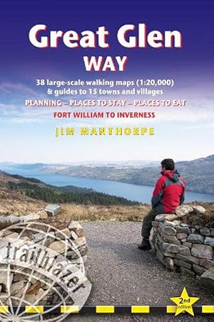
Great Glen Way (Trailblazer British Walking Guides) (Paperback)
Published by Trailblazer Publications, Hindhead, Surrey, 2021
ISBN 10: 1912716100ISBN 13: 9781912716104
Book
Paperback. Condition: new. Paperback. All-in-one, practical guide to walking the Great Glen Way long-distance footpath. The trail begins where the West Highland Way ends - at Fort William - and follows the Great Glen faultline to finish at Inverness after 79 miles (127km). The trail passes Loch Lochy, Loch Oich and Loch Ness and also follows the towpath of the Caledonian Canal. It's a relatively easy week-long walk amongst beautiful Highland scenery but there's a high level option between Fort Augustus and Drumnadrochit that gives even better mountain views. This 2nd edition has been re-walked and fully updated. * Includes 38 detailed walking maps: the largest-scale maps available - at just under 1:20,000 (8cm or 31/8 inches to 1 mile) these are bigger than even the most detailed walking maps currently available in the shops * Unique mapping features - walking times, directions, tricky junctions, places to stay, places to eat, points of interest.These are not general-purpose maps but fully edited maps drawn by walkers for walkers**With accommodation, pubs and restaurants in detailed guides to 15 towns and villages including Fort William and Inverness * Itineraries for all walkers - whether hiking the entire route or sampling highlights on day walks or short breaks * Detailed public transport information - Buses and trains for all access points * Practical information for all budgets * What to see; where to eat with reviews (cafes, teashops, pubs, restaurants, takeaways); where to stay with reviews (hostels, campsites, bunkhouses, B&Bs, hotels) * Downloadable GPS waypoints also included. * Written by Scottish hillwalker Jim Manthorpe. Practical walking guide for Great Glen Way in Scotland that runs from Fort William at the northern end of the West Highland Way for 73 miles to Inverness. Includes 40 large-scale walking maps & guides to 18 towns and villages along the way plus planning, places to stay, places to eat, public transport information; downloadable GPS waypoints. Shipping may be from multiple locations in the US or from the UK, depending on stock availability.
-
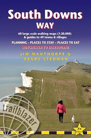
South Downs Way (Trailblazer British Walking Guides) (Paperback)
Published by Trailblazer Publications, Hindhead, Surrey, 2022
ISBN 10: 1912716232ISBN 13: 9781912716234
Book
Paperback. Condition: new. Paperback. Practical, complete guide to walking the South Downs Way, a 100-mile National Trail footpath which follows the line of chalk hills stretching from Winchester to Eastbourne in southern England. Includes * 82 Maps: 60 large-scale walking maps - 1:20,000 (3-1/8 inches to 1 mile), 11 town plans, 10 stage maps with trail profiles showing hills and descents, and 2 overview maps. * Detailed accommodation with reviews: B&Bs, campsites, pubs, hotels, bunkhouses. * Where to eat with reviews: cafes, teashops, pubs, takeaways and restaurants. * Comprehensive public transport information with frequency of services for all access points on the Path. * Downloadable GPS waypoints. * Itineraries for all walkers, whether hiking the entire route or sampling highlights on day walks, weekends or short breaks. * Unique mapping features - walking times, directions, tricky junctions, places to stay, places to eat, points of interest written onto the maps. * Flora and fauna - four page full colour flower guide, plus an illustrated section on local wildlife * Green hiking - understanding the local environment and minimizing our impact on it. Practical, all-in-one guidebook to walking the South Downs Way National Trail with 60 large-scale walking maps (1:20,000), places to stay, places to eat, what to see and public transport information. Shipping may be from multiple locations in the US or from the UK, depending on stock availability.
-
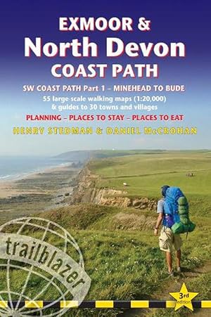
Exmoor & North Devon Coast Path, South-West-Coast Path Part 1: Minehead to Bude (Trailblazer British Walking Guides) (Paperback)
Published by Trailblazer Publications, Hindhead, Surrey, 2022
ISBN 10: 1912716240ISBN 13: 9781912716241
Book
Paperback. Condition: new. Paperback. Practical, complete guide to walking Exmoor & North Devon Coast Path, the first section of the South West Coast Path, from Minehead to Bude (124.5 miles). This spectacular route passes through the Exmoor National Park following the highest coastline in England (over 800ft), through numerous idyllic villages such as Lynton and Clovelly, around Barnstaple Bay and Hartland Point to the seaside resort of Bude just over the border with Cornwall.Includes: * 55 large-scale walking maps, 13 town plans, 8 stage maps and 2 overview maps * Places to stay with reviews - bunkhouses, campsites, B&Bs, hostels, pubs, hotels * Places to eat with reviews - cafes, teashops, pubs, restaurants, takeaways * GPS Waypoints - downloadable from Trailblazer website * New edition includes extra colour mapping for each stage of the walk. * Also includes 60 colour photos. * Itineraries for all walkers - whether walking the route in its entirety over a week to 10 days or sampling the highlights on day walks and short breaks; * What to see - attractions, history, culture * Comprehensive public transport information - for all access points on the coast * Flora and fauna - four page full colour flower guide, plus an illustrated section on local wildlife * Full information on the Exmoor National Park * Green hiking - understanding the local environment and minimising our impact on it. All-in-one practical hiking route guide, maps and accommodation for the first 124.5 miles (Minehead to Bude) of the 630-mile South-West Coast Path. Includes 55 large-scale maps (1:20,000 = 3 1/8 inches to 1 mile); 13 town plans and 8 overview maps. Accommodation, restaurants and pubs; plus full public transport information. Includes day-walks. Shipping may be from multiple locations in the US or from the UK, depending on stock availability.
-

Thames Path (Trailblazer British Walking Guides) (Paperback)
Published by Trailblazer Publications, Hindhead, Surrey, 2022
ISBN 10: 1912716275ISBN 13: 9781912716272
Book
Paperback. Condition: new. Paperback. Barrier in London. Officially 184 miles (294km) in length (although the actual distance you walk will depend on a number of decisions you make en route), the path meanders, accompanied by its watery muse, through pristine and tranquil countryside, past historic sites and buildings, via pub, lock, weir, and the occasional scattering of waterfowl, to a city, once the fulcrum of an empire, and now the heart of modern day England. The river, responsible for the metropolis' very being, tells tales, inspires artists, accommodates swans, geese, and water voles, reflects the silhouettes of red kites and kingfishers, provides employment, entices adventure, and allows time for carefree pilgrims to procrastinate and think. Following its banks is a grand way to go for a ramble. The path begins, as the river does, in a meadow in the Cotswolds; its upper reaches lonely and wild, the meadows and banks the domain of waterfowl and willows; a collage of wild flowers, otters, fishermen and farmers. As the waters deepen and spread the settlements along its banks gradually begin to grow in both size and grandeur, and reaching Oxford, the solitude of the river slowly subsides and the trail becomes as much about historic towns, churches, abbeys and castles as it does the river. Lechlade, Abingdon, Wallingford, Henley . they all owe their location to the Thames, and different eras, when the river was a life source, a place of conflict, a boundary, a mode of transport and the provider of leisure, which, thankfully--for us, at least--it remains to this day. Squeezing through the ancient Goring Gap, loomed over by the Chiltern Hills, you pass Runnymede--the site of the signing of Magna Carta--and Windsor Castle; where the aeroplanes overhead hint at the ominous size of the city to come. Walking in London is not as blighted by sound, fury and concrete as many may imagine, as the river--and especially the route along the south bank in London--remains relatively countrified, at least as far as Putney, from which the approaching sights of Westminster and Tower Bridge offer comparably fine vistas to anywhere along the Thames' green and scenic upper reaches. Leaving central London, the regenerated dockland areas of East London (ideas of what constitutes 'wild' in the modern world are of course open to debate) lure you to your journey's end and the conclusion of a most enjoyable and magnificently-varied riparian ramble, quite like no other in Britain. Yet the Thames Path is more than just a trek, more than a long walk, more than just a national trail; the river acts as a postgraduate course in the history of a nation, a counselor to the modern world, a reminder of the importance of protecting the natural habitats which gave us what we have. But most importantly--at least, for those wishing to spend some time in the river's company, and indeed planning on doing so with the help of this book--the Thames Path is a fluvial escapade of the finest kind. -Includes 90 walking maps--the largest-scale maps available. At a scale of just under 1:20,000 (8cm or 3-1/8 inches to one mile) these are bigger than the most detailed walking maps currently available in the shops. -Unique mapping features--walking times, directions, tricky junctions, places to stay and eat, points of interest. These are not general-purpose maps but fully-edited maps drawn by walkers for walkers. -Itineraries for all walkers--whether hiking the 184-mile route in its entirety or sampling the highlights on day walks or short breaks. -Includes detailed public transport information for all access points. -Practical information for all budgets--what to see, where to stay, where to eat: pubs, hotels, B&B, camping, bunkhouses, hostels. -GPS waypoints. These are also downloadable from the Trailblazer website. -Plus--extra color sections: 16pp color introduction and 16pp of color mapping for stag Shipping may be from multiple locations in the US or from the UK, depending on stock availability.
-

Norfolk Coast Path and Peddars Way (Paperback)
Published by Trailblazer Publications, Hindhead, Surrey, 2023
ISBN 10: 1912716399ISBN 13: 9781912716395
Book
Paperback. Condition: new. Paperback. All the information you need to enjoy your hiking adventure along the Norfolk Coast Path and Peddars Way.The Norfolk Coast Path & Peddars Way cover 130-miles of walking trails. The Peddars Way runs through East Anglia from Knettishall Heath on the Norfolk/Suffolk border and follows a Roman road to Holme-next-the-Sea. From here it becomes the Norfolk Coast Path, hugging the beautiful Norfolk coastline through Holkham, Wells, Blakeney and Cley to Cromer before it rounds the shoulder of the county and continues along the superb beaches and crumbling cliffs to Mundesley, Sea Palling and Great Yarmouth, finishing just before the Suffolk border.Includes:77 large-scale walking maps - at just under 1: 20,000 (8cm or 3 and one eighth inches to 1 mile) our maps are bigger than even the most detailed walking maps currently available, with walking directions, tricky junctions, places to stay and eat, points of interest and walking times written onto the mapsText and maps in clear TWO-COLOUR styleAll standards of accommodation with reviews: campsites, B&Bs, hostels, hotels, bunkhousesWhere to eat with reviews: cafes, teashops, pubs, takeaways and restaurantsDetailed public transport information for all villages and towns along the pathsItineraries for all walkers including one day Peddars Way and Norfolk Coast Path walks, car parks near the trail for weekend and day walkersIncludes 40 mile extension of the National Trail from Cromer to Hopton-on-SeaDownloadable GPS waypoints with what3words refsColour pictures including a 6 page colour bird and flower guideHistorical, cultural and geographical background information All-in-one hiking route guide, route maps and accommodation for this 130-mile route in Norfolk. Includes 77 large-scale maps (1:20,000); 8 town plans, 10 stage maps with profiles and 2 overview maps. Full details of all accommodation and campsites, restaurants and pubs; plus full public transport information. Includes day-walks. Shipping may be from multiple locations in the US or from the UK, depending on stock availability.