
Order Total (1 Item Items):
Shipping Destination:

Historical Atlas Pacific Northwest by Hayes Derek (68 results)
Skip to main search results
Product Type
- All Product Types
- Books (68)
- Magazines & Periodicals
- Comics
- Sheet Music
- Art, Prints & Posters
- Photographs
- Maps
-
Manuscripts &
Paper Collectibles
Condition
Binding
- All Bindings
- Hardcover (67)
- Softcover
Collectible Attributes
- First Edition (11)
- Signed (3)
- Dust Jacket (23)
- Seller-Supplied Images (9)
- Not Printed On Demand
Free Shipping
Seller Location
Seller Rating
-
Condition: Good. Book is in good condition and may contain underlining or highlighting and minimal wear. The book can also include library labels. May not contain miscellaneous items (toys, dvds, etc). We offer 100% money back guarantee and fast customer support.
More buying choices from other sellers on AbeBooks
New offers from US$ 51.78
Used offers from US$ 7.88
Also find Hardcover First Edition
-

Hardcover. Condition: Good. No Jacket. Pages can have notes/highlighting. Spine may show signs of wear. ~ ThriftBooks: Read More, Spend Less 3.15.
More buying choices from other sellers on AbeBooks
New offers from US$ 20.46
Used offers from US$ 9.16
Also find Hardcover First Edition Signed
-
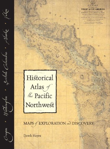
Historical Atlas of the Pacific Northwest, Maps of Exploration and Discovery 1500-2000
Published by Sasquatch, Seattle, 1999
ISBN 10: 1570612153ISBN 13: 9781570612152
Book First Edition
HARDCOVER. Condition: Fine. Dust Jacket Condition: Very Good. 1st edition. 208pp, color and b/w facsimile, quarto. boards clean and sharp, tight binding, interior clean throughout, Fine. dj covers clean, no tears, slight fading to spine and rear dj hinge, Very Good.
-
Historical Atlas of the Pacific Northwest: Maps of Exploration and Discovery: British Columbia, Washington, Oregon, Alaska, Yukon
Published by Sasquatch Books, 1999
ISBN 10: 1570612153ISBN 13: 9781570612152
Book First Edition
Hardcover. Condition: Very Good. Dust Jacket Condition: Good. First Edition. Sasquatch Books, 1999. First Edition as indicated in number line. Hardbound book. Dust jacket is in Good condition, overall shelfwear, short closed tears to head and tail of spine, sunning to top and bottom edges of front wraps. Book is in Very Good condition, boards are clean, corners remain sharp, light colored scuffs next to head of spine, binding is tight. Text block and pages are clean, crisp, and free of markings.
-
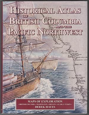
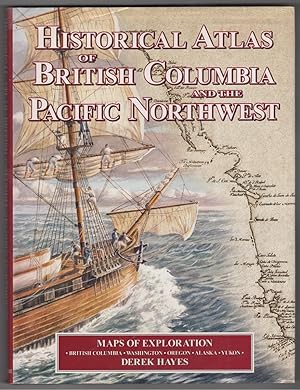
Historical Atlas of British Columbia and the Pacific Northwest
Published by Cavendish Books, Delta, BC, 1999
ISBN 10: 1552899004ISBN 13: 9781552899007
Book First Edition
Hardcover. Condition: Near Fine. Dust Jacket Condition: Very Good. First Edition. DJ has short tear top of spine area, light creasing, light shelf wear. ; A bright, solid book. Dust jacket in Mylar jacket protector. B&W and colour maps and illustrations throughout, typical of Derek Hayes' publications. ; 6.11 X 1.11 X 11.11 inches; 208 pages; "Here is history from a geographical viewpoint! For the first time, many of the old maps of British Columbia and the Pacific Northwest have been gathered together in a single book, creating an atlas of antique maps that tell a continuing story of the expanding frontier of knowledge about the region. The Historical Atlas of British Columbia and the Pacific Northwest is a unique collection of over 320 original maps of explorers and navigators from four centuries of voyages and overland treks of exploration and discovery to the northwest coast, plus native maps, and a host of others selected for their interest or historical significance.There are imaginary and speculative maps, old political boundary maps, boundary dispute maps, military and spy maps, bird s eye maps, gold rush maps, railway maps and Hudson s Bay Company maps. All are reproductions of hand-drawn or contemporary engraved originals. The maps are combined with context-setting history, explanations of how the maps came to be drawn, and the history behind them.Here are the maps of Spanish, British, Russian, American, French and other explorers who literally put the Pacific Northwest on the map - Francis Drake, Vitus Bering and Alexei Chirikov, James Cook, Juan Francisco Bodega y Quadra, Alejandro Malaspina, Dionisio Galiano, George Vancouver, Alexander Mackenzie, Meriwether Lewis and William Clark, David Thompson, Charles Wilkes, John Charles Fremont, and many others. In drawing their maps, these explorers and mapmakers helped fill in geographical knowledge of one of the last remaining gaps in the map of the world. A unique and stunning new perspective on the history of British Columbia and the Pacific Northwest. The Historical Atlas of British Columbia and the Pacific Northwest contains high quality reproductions of 335 original maps, with over 235 covering the territory which is now British Columbia. Of the 335 old maps, 180 are in colour and 155 in (usually original) black and white; there are 60 other illustrations, including modern colour photographs and black and white historical photographs and engravings; 27 are in colour, 33 in black and white.".
-

Historical Atlas of British Columbia and the Pacific Northwest : Maps of Exploration-British Columbia, Washington, Oregon, Alaska and Yukon
Published by Cavendish Books Inc., Delta, BC, 2001
ISBN 10: 1552899004ISBN 13: 9781552899007
Book Signed
Hardcover. Condition: Fine. Dust Jacket Condition: Fine. First Printing of the First Edition. Fine copy in a fine jacket. Signed by Hayes on the title page. Signed by Author(s).
-

Historical Atlas of British Columbia and the Pacific Northwest; Maps of Exploration: British Columbia, Washington, Oregon, Alaska, Yukon
Published by Cavendish Books, Vancouver
Seller: Burton Lysecki Books, ABAC/ILAB, Winnipeg, MB, Canada
Seller Rating:

First Edition
[1999], 1st printing. (Folio hardcover) Fine in fine dust jacket. 208pp. Map endpapers, notes, bibliography, index. Contains 335 reproductions of old maps, of which 180 are in colour and 155 in (usually original) black and white; plus 60 other illustrations, including modern colour photographs and black and white historical photographs and engravings.Printed on acid-free Japanese matt art paper. Locale: ; Alaska; British Columbia; Oregon; Washington; Western Canada; Yukon. (Western Canada, Atlases, Exploration).
-
Historical Atlas of British Columbia and the Pacific Northwest
Published by Cavendish Books, Vancouver, BC, 1999
ISBN 10: 1552899004ISBN 13: 9781552899007
Book First Edition Signed
Hardcover. Condition: Near Fine. Dust Jacket Condition: Very Good. First Edition. Signed by Author; DJ shows light shelf wear with short tear top of spine, light creasing. ; Signed by the author on the title page. A bright, solid book, boards are in near-fine condition. ; 13.0 X 10.0 X 1.3 inches; 208 pages; "Here is history from a geographical viewpoint! For the first time, many of the old maps of British Columbia and the Pacific Northwest have been gathered together in a single book, creating an atlas of antique maps that tell a continuing story of the expanding frontier of knowledge about the region.The Historical Atlas of British Columbia and the Pacific Northwest is a unique collection of over 320 original maps of explorers and navigators from four centuries of voyages and overland treks of exploration and discovery to the northwest coast, plus native maps, and a host of others selected for their interest or historical significance.There are imaginary and speculative maps, old political boundary maps, boundary dispute maps, military and spy maps, bird s eye maps, gold rush maps, railway maps and Hudson s Bay Company maps. All are reproductions of hand-drawn or contemporary engraved originals. The maps are combined with context-setting history, explanations of how the maps came to be drawn, and the history behind them.Here are the maps of Spanish, British, Russian, American, French and other explorers who literally put the Pacific Northwest on the map - Francis Drake, Vitus Bering and Alexei Chirikov, James Cook, Juan Francisco Bodega y Quadra, Alejandro Malaspina, Dionisio Galiano, George Vancouver, Alexander Mackenzie, Meriwether Lewis and William Clark, David Thompson, Charles Wilkes, John Charles Fremont, and many others. In drawing their maps, these explorers and mapmakers helped fill in geographical knowledge of one of the last remaining gaps in the map of the world.A unique and stunning new perspective on the history of British Columbia and the Pacific Northwest.The Historical Atlas of British Columbia and the Pacific Northwest contains high quality reproductions of 335 original maps, with over 235 covering the territory which is now British Columbia. Of the 335 old maps, 180 are in colour and 155 in (usually original) black and white; there are 60 other illustrations, including modern colour photographs and black and white historical photographs and engravings; 27 are in colour, 33 in black and white.".
-
HISTORICAL ATLAS OF BRITISH COLUMBIA AND THE PACIFIC NORTHWEST Maps of Exploration, British COlumbia - Washington - Oregon - Alaska - Yukon
Published by Cavendish Books, Vancouver, 1999
First Edition
Hardcover. Condition: Near Fine. Dust Jacket Condition: Very Good. 1st Edition. 208 pages in near fine condition. Pages are clean and unmarked with black and white and colour illustrations throughout. Bound in burgundy hardcovers with gilt titles on the spine. Lightly worn around the edges. Illustrated dustjacket in very good condition with white and red titles. Worn around the edges. Lightly scuffed and scratched on the back of the jacket. 1ST EDITION. NF/VG Size: 10 x 13.
-
Historical Atlas of British Columbia and the Pacific Northwest
Published by Cavendish Books Inc., Delta, BC, Canada, 1999
Seller: Alexandre Antique Prints, Maps & Books, Toronto, ON, Canada
Seller Rating:

Hardcover with dust jacket, Maps of Exploration: British Columbia, Washington, Oregon, Alaska, Yukon, 320 maps, illustrated throughout, 208 pp.
-
Historical Atlas Of British Columbia And The Pacific Northwest Maps of Exploration British Columbia Washington Oregon Alaska Yukon.
Published by Vancouver: Cavendish Books, [2000]., 2000
Seller: D & E LAKE LTD. (ABAC/ILAB), Toronto, ON, Canada
Seller Rating:
4to. pp. 208, [1]. Over 320 illus. (many colour). biblio. Index. cloth (corners bumped). dw. First published in 1999 and reprinted, with revisions in 2000.
-
Historical Atlas of the Pacific Northwest.
Published by Sasquatch Books, Seattle, 1999
Seller: Alexandre Antique Prints, Maps & Books, Toronto, ON, Canada
Seller Rating:
Size : small folio, 322 maps, 208 pp.
