
Order Total (1 Item Items):
Shipping Destination:

Illustrated History Commonwealth Pennsylvania (58 results)
Skip to main search results
Product Type
- All Product Types
- Books (58)
- Magazines & Periodicals
- Comics
- Sheet Music
- Art, Prints & Posters
- Photographs
- Maps
-
Manuscripts &
Paper Collectibles
Condition
Binding
Collectible Attributes
Free Shipping
Seller Location
Seller Rating
-

Spiral/Comb. Condition: New. No Jacket. Limited Edition Reprint. The history of Greene County, PA, is recalled through a mixture of colorful tales and factual data in this NEW 18 Page Booklet, reprinted primarily from three hard-to-find vintage books. The spiral-bound booklet is printed one-sided, with the print size adjusted to fit 8 1/2 x 11 paper. A vinyl sheet protects the front cover. Source books include: An Illustrated History of the Commonwealth of Pennsylvania (1876) by William Egle, M.D.; Pennsylvania, a Guide to the Keystone State compiled by WPA writers; and My Pennsylvania, a 1946 project of the Bureau of Publications, Commonwealth of Pennsylvania. (Some Information may be repeated in various excerpts, but often with a different slant or with additional details.) The communities mentioned include: Waynesburg, Carmichaels (New Lisbon, Carmichaelstown), Greensburg, New Geneva, Newtown, Mapletown, Clarksville, Jefferson, Mount Morris, Morrisville, Clinton. Among the many and diverse subjects in the booklet are: Early Settlers and Their Hardships; Sheep Raising; Minerals: Coal, Iron and Salt; Physical Features; Rev. John Corbly's narrative of the massacre and mutilation of his family; Story of a Trio of Dunkards; the story of Experience Bozarth and her axe; Narrow-Guage RR; Waynesburg College; and other interesting bits of history and trivia. The recently added excerpt from the third book includes a 1940s map of the county, several photos and a concise update of the county's progress as it looked shortly after World War II. ILLUSTRATIONS include the Central part of Waynesburg and Greene County Court House in Waynesburg.
-
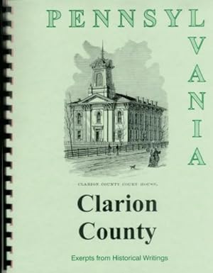
Spiral/Comb. Condition: New. No Jacket. Limited Edition Reprint. The history of Clarion County, PA, is recalled through a mixture of colorful tales and factual data in this NEW 20 Page Booklet, reprinted primarily from three hard-to-find books: An Illustrated History of the Commonwealth of Pennsylvania by William Egle, M.D., and Pennsylvania, a Guide to the Keystone State, a WPA project published in 1940. The spiral-bound booklet is printed one-sided, with the print enlarged for easier reading. A clear vinyl sheet has been added to protect the front cover. Source books include: An Illustrated History of the Commonwealth of Pennsylvania (1876) by William Egle, M.D.; Pennsylvania, a Guide to the Keystone State compiled by WPA writers; and My Pennsylvania, a 1946 project of the Bureau of Publications, Commonwealth of Pennsylvania. (Some Information may be repeated in various excerpts, but often with a different slant or with additional details.) The communities mentioned include: Clarion, Strattenville, Shippensville, Carlesville, Greenville, Callensburg, St. Petersburg, East Brady, Sligo, New Bethlehem (Gumtown), Tylersburg, Freyburg, Edinburgh, Turkey City, Salem City, Foxburg, Perryville, West Freedom, Monterey, Phillipsburg, Lawsonham, Millville, Shannondale, Rimmersburg, Currlsville, Fairmount City, Lucinda, Reidsburg, Brady's Bend, Kaylor, and Leeper. The Egle history covers the early development of this area, while excerpts from the WPA book, give a nostalgic glimpse from a 1940 vantage point, including interesting historical notes, especially as they relate to sightseeing possibilities. Among the many and diverse subjects in the booklet are: Early Settlers and their hardships; squeeze play at Brady's Bend; The building of a county seat; Oil boom; Callensburg Institute, Carrier Seminary, Clarion Collegiate Institute, Reid Institute, Clarion Academy, and other schools; Pine tar an early export; The Water Works; The legend of Capt Sam Brady at "the Narrows"; a thrifty deer hunter; Why Clarion's called Clarion, Sligo's called Sligo, and Rimmersburg's not called Pinksville; and other interesting bits of history and trivia. The recently added third book includes a 1940s map of the county, several photos and a concise update of the county's progress as it looked shortly after World War II. ILLUSTRATIONS include Public Square in Clarion, Clarion County Courthouse, Clarion County Prison.
-
Spiral/Comb. Condition: New. No Jacket. Limited Edition Reprint. The history of Elk County in Pennsylvania, is recalled through a mixture of colorful tales and factual data in this NEW 21 page Booklet, reprinted primarily from four hard-to-find vintage books. The spiral-bound booklet has the print size adjusted for 8 1/2 x 11 paper. A vinyl sheet protects the front cover. Source books include: Historical Collections of the State of Pennsylvania (1843) by Sherman Day; An Illustrated History of the Commonwealth of Pennsylvania (1876) by William Egle, M.D.; Pennsylvania, a Guide to the Keystone State compiled by WPA writers; and My Pennsylvania, a 1946 project of the Bureau of Publications, Commonwealth of Pennsylvania. (Some Information may be repeated in various excerpts, but often with a different slant or with additional details.) The communities mentioned include: Ridgway, St. Mary's, Caledonia, Earley, Kersey, Wilcox, Williamson, Wilmarth, Eddystone, Arroyo, Benezette, Hellen, Raught's Mills, Weedville, Johnsonville, Daguscahonda. The Day and Egle histories cover the early development of this area, while excerpts from the WPA book, give a nostalgic glimpse from a 1940 vantage point, including interesting historical notes, especially as they relate to sightseeing possibilities. There is occasionally some duplication of material, but often with a different slant or with additional details. Among the many and diverse subjects in the booklet are: Early settlers, including Jacob Ridgway, John Kyler, Elijah Meredith, Jacob Wilson, Libni Taylor, Capt. Potter, Leonard Morey, James Gillis, Reuben Winslow, and many others; industries, including coal, lumber, salt and paper; German Union Bond Society; Plan of Fourier, regarding labor and capital; Proposal in 1824 for the "construction of a turnpike"; Progress of colony under Co. Matthias Benzinger and Ignatius Garner; Large Catholic population; and other interesting bits of history and trivia. The recently added fourth book includes a 1940s map of the county, several photos and a concise update of the county's progress as it looked shortly after World War II. ILLUSTRATIONS include the Borough of Ridgeway, View of Wilcox.
-
History of Indiana County Pennsylvania; from An Illustrated History of the Commonwealth of Pennsylvania
Publication Date: 1876
Book
Spiral/Comb. Condition: New. No Jacket. Limited Edition Reprint. The history of Indiana County, PA, is recalled through a mixture of colorful tales and factual data in this NEW 24 Page Booklet, reprinted primarily from three hard-to-find books. The spiral-bound booklet is printed one-sided with the print enlarged for easier reading. A clear vinyl sheet has been added to protect the front cover. Source books include: An Illustrated History of the Commonwealth of Pennsylvania (1876) by William Egle, M.D.; Pennsylvania, a Guide to the Keystone State compiled by WPA writers; and My Pennsylvania, a 1946 project of the Bureau of Publications, Commonwealth of Pennsylvania. (Some Information may be repeated in various excerpts, but often with a different slant or with additional details.) The communities mentioned include: Indiana, Homer City, Blairsville, Saltsburg, Armagh, Mechanicsburg, Marion, Shelocta, Cherry Tree, Graceton, Coral, Josephine and Black Lick. The Egle history covers the early development of this area, while excerpts from the WPA book, give a nostalgic glimpse from a 1940 vantage point, including interesting historical notes, especially as they relate to sightseeing possibilities. Among the many and diverse subjects in the booklet are: Early Settlers, where they came from; Hardships - Lack of food, surplus of Wolves and Indians; Discovery of Salt and Development of Salt Wells; Early Ministers and Churches; George Clymer, signer of the Declaration of Independance and benefactor of Indiana; James Campbell, Andrew Brown, Capt. John Blair and other prominent citizens; Indiana State Teacher's College and other Educational Institutions; Canal, Railroads and Turnpike in Indiana County; Remarkable Courthouse Clock; Coke and Beehive Ovens; Moorhead Fort; an "unpardonable blunder" to save a "pittance"; and other interesting bits of history and trivia. The excerpt from the third book includes a 1940s map of the county, a map showing all 67 Pennsylvania counties, several photos and a concise update of the county's progress to the end of World War II. ILLUSTRATIONS include the Central part of the town of Indiana, Blairsville, the Indiana County Court House, and others.
-
An Illustrated History of the Commonwealth of Pennsylvania; History of Lebanon County Pennsylvania
Publication Date: 1876
Book
Spiral/Comb. Condition: New. No Jacket. Limited Edition Reprint. The history of Lebanon County, Pennsylvania, is recalled through a mixture of colorful tales and factual data in this NEW 25 Page Booklet, reprinted primarily from three hard-to-find books. The spiral-bound booklet is printed one-sided, with the print enlarged for easier reading. A vinyl sheet has been added to protect the front cover. Source books include: An Illustrated History of the Commonwealth of Pennsylvania (1876) by William Egle, M.D.; Pennsylvania, a Guide to the Keystone State compiled by WPA writers; and My Pennsylvania, a 1946 project of the Bureau of Publications, Commonwealth of Pennsylvania. (Some Information may be repeated in various excerpts, but often with a different slant or with additional details.) Communities mentioned include: Fredericksburg, Myerstown, Lebanon, Annville, Palmyra, Miner?s Village, Millerstown, Shaefferstown, Jonestown (formerly Williamstown) and Campbellstown. Since the source books are concerned with the same subject, there is some duplication of material, but the time elasped often changes the perspective and emphasis. Among the many and diverse subjects in the booklet are: Early Settlers; Physical Features of the Land; Requirement of English Language in Schools, whereas German was the "home" tongue; The Union Canal, an intrastate public improvement, proposed over a century before it was built; Religious Sects, such as the Moravians and Mennonists; German Jews in Shaefferstown; Baron Steigel?s Castle; Cornwell Ore Banks with extensive iron deposits; Indian Attack in 1757; Fort Henry and Fort Smith; Ingenuity of Peter Heydrich; Col. Greenawalt and Major Philip Marsteller; Consolidation of Lebanon and North Lebanon; Old Moravian Church used as a hospital after Battle of Trenton; Swatara Collegiate Institute; Townships; and Educational Institutions, such as Lebanon Valley College, Palatinale College, Swatara Collegiate Institution and Schuylkill Seminary, and other interesting bits of history and trivia. ILLUSTRATIONS include: Southwest View of Lebanon; View of the Borough of Lebanon (full page); Lebanon County Court House; Cornwall Mines, Middle Hill, Through Cut; and "Berg-Kirche" -- Hill Church.
-
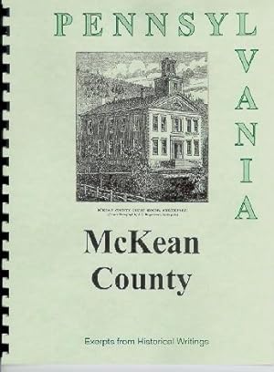
An Illustrated History of the Commonwealth of Pennsylvania; History of McKean County Pennsylvania
Publication Date: 1876
Book
Spiral/Comb. Condition: New. No Jacket. Limited Edition Reprint. The history of McKean County, PA, is recalled through a mixture of colorful tales and factual data in this NEW 25-Page Booklet, reprinted primarily from three hard-to-find books. The spiral-bound booklet is printed one-sided with the print enlarged for easier reading. A vinyl sheet has been added to protect the front cover. Source books include: An Illustrated History of the Commonwealth of Pennsylvania (1876) by William Egle, M.D.; Pennsylvania, a Guide to the Keystone State compiled by WPA writers; and My Pennsylvania, a 1946 project of the Bureau of Publications, Commonwealth of Pennsylvania. (Some Information may be repeated in various excerpts, but often with a different slant or with additional details.) Communities mentioned include: Smethport, Port Allegany, Farmer?s Valley, Mt. Jewett, Kane, Ludlow, Foster Brook, Bradford, Custer City, Eldred, Sergeant, Wetmore, Port Kennedy, Ceres (formerly King?s Settlement), Norwich Settlement, Instanter (Bunker Hill), Teutonia, and Ginalsburg. Since the source books are concerned with the same subject, there is some duplication of material, but the time elasped often changes the perspective and emphasis. Among the many and diverse subjects in the booklet are: First Settlers, first county court, first printing press, etc.; Physical Features of the County; "The Society of Industry," an unusual combination of socialism and capitalism; the Importance of Canoes in Transportation; Francis King and his ?Friends?; a Hunting Tragedy at Port Allegany; Hindrances to Development of the the Area; "The Land Office" of Messrs. Keating & Co., "The Boston Land Co." and "Ceres Land Company"; Futile Attempts to "Mine Oil"; the Lobo Wolf Pens, Kane Manor Inn, "Oil, Oil Everywhere." in Bradford; a Bull and Bear Fight that ?Ran Amuck,? and and and other interesting bits of history and trivia. The recently added third book includes a 1940s map of the county, several photos and a concise update of the county's progress as it looked shortly after World War II. ILLUSTRATIONS include: the county prision at Smethport and the county courthouse at Smethport.
-
Spiral/Comb. Condition: New. No Jacket. Limited Edition Reprint. The history of Butler County, PA, is recalled through a mixture of colorful tales and factual data in this NEW 26 Page Booklet, reprinted primarily from four hard-to-find vintage books. The spiral-bound booklet is printed one-sided, with the print size adjusted to fit 8 1/2 x 11 paper. A clear vinyl sheet protects the front cover. Source books include: Historical Collections of the State of Pennsylvania (1843) by Sherman Day; An Illustrated History of the Commonwealth of Pennsylvania (1876) by William Egle, M.D.; Pennsylvania, a Guide to the Keystone State compiled by WPA writers; and My Pennsylvania, a 1946 project of the Bureau of Publications, Commonwealth of Pennsylvania. (Some Information may be repeated in various excerpts, but often with a different slant or with additional details.) Communities mentioned include: Butler, Harmony, Zelienople, Centreville, Harrisville, Murrinsville, Portersville, Prospect, Sunbury, North Washington, Farview, Millerstown, Saxenburg, Coylesville, Hannahstown, Brownsdale, Evansburg, Petersville, Mount Chestnut, Unionville, Eau Clarie, Buena Vista, Martinsburg, Conoquenessing (Connoquenessing), Evans City, Slippery Rock, Glade Mills, Middle Lancaster, and the oil boom towns of Petrolia, Karns City, Greece City, Angelica, Argyle, Modoc, Troutman Farm, St. Joe, and Great Belt City. The Day and Egle histories cover the early development of this area, while excerpts from the WPA book, give a nostalgic glimpse from a 1940 vantage point, including interesting historical notes, especially as they relate to sightseeing possibilities. Since the source books are concerned with the same subject, there is some duplication of material, but the time elasped often changes the perspective and emphasis. Among the many and diverse subjects in the booklet are: Murdering Town of Kaskaskunk; Early settlers; Adventure of Captain Brady at Slippery Rock; Recollections of H. M. Breckenridge; Hillarious proceedings at first court case; Adventure of Massie Herbeson and her daring escape from Indians; Oil boom; Early Railroads; A Close Call for George Washington; George Rapp and the socialistic Harmony Society; "Chicken Dinner Capitol"; and other bits of history and trivia. The recently added fourth book includes a 1940s map of the county, several photos and a concise update of the county's progress as it looked shortly after World War II. ILLUSTRATIONS include: Town of Butler, Butler County Court House, The Burrow of Butler, Public school building in Butler.
-
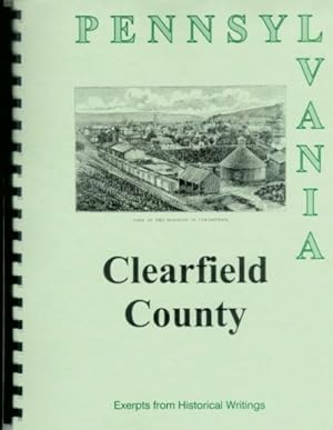
Spiral/Comb. Condition: New. No Jacket. Limited Edition Reprint. The history of Clearfield County, PA, is recalled through a mixture of colorful tales and factual data in this NEW 27 Page Booklet, reprinted primarily from three hard-to-find vintage books. The spiral-bound booklet is printed one-sided, with the print size adjusted to fit 8 1/2 x 11 paper. A clear vinyl sheet protects the front cover. Source books include: An Illustrated History of the Commonwealth of Pennsylvania (1876) by William Egle, M.D.; Pennsylvania, a Guide to the Keystone State compiled by WPA writers; and My Pennsylvania, a 1946 project of the Bureau of Publications, Commonwealth of Pennsylvania. (Some Information may be repeated in various excerpts, but often with a different slant or with additional details.) The communities mentioned include: Clearfield, Curwensville, Karthauss, Caledonia, Luthersburg, Mountpleasant, Osceola, Houtzdale, New Washington, Lumber City, Wallaceton, Burnside, Frenchville, Glen Hope, Grahamton, Grampion Hills, Kylertown, Pennfield, Rumberger, Woodland, DuBois, McGees Mills, Philipsburg, West Decatur. The Egle history covers the early development of this area, while excerpts from the WPA book, give a nostalgic glimpse from a 1940 vantage point, including interesting historical notes, especially as they relate to sightseeing possibilities. Among the many and diverse subjects in the booklet are: When Clearfield was Chinklacamoose's old-town; Early settlers and their hardships; tales of "little" Johnny Bell; How Clearfield got its name; Failure of a Philadelphia Merchant Leads to French settlement in Clearfield County; Pine trees, coal, iron ore, and fire clay; Generousity of Judge James T. Leonard; Fire in Osceola in 1875; and other interesting bits of history and trivia. The recently added fourth book includes a 1940s map of the county, several photos and a concise update of the county's progress as it looked shortly after World War II. ILLUSTRATIONS include View of Clearfield (2 pictures), Emigh's Gap, on the Tyrone and Clearfield Railroad (full page).
-
Spiral/Comb. Condition: New. No Jacket. Limited Edition Reprint. Early days in Columbia County, PA, encompassing the past and present communities of Almeda, Aristes, Beaver Valley, Benton, Berwick, Bloomsburg, Briar Creek, Buck Glen, Buckhorn, Catawissa, Central, Centralia, Cole's Creek, Danville, Divide, Elk Grove, Espy, Espytown, Eyers Grove, Forks, Fruitstown, Glen City, Iola, Jerseytown, Light Street, Limeridge, Mainville, Mifflinburg, Mifflinville, Millgrove, Milville, Newlin, Numidia, Orangeville, Pine Summit, Rohrsburg, Rupert, Sereno, Slabtown, Stillwater, Washington, Whitehall, and Williamsburg are recalled through a mixture of colorful tales and factual data in this NEW 28 Page Booklet, reprinted from four hard-to-find books. (All towns may not be mentioned in the booklet.) These include: Historical Collections of the State of Pennsylvania by Sherman Day; An Illustrated History of the Commonwealth of Pennsylvania by William Egle, M.D.; Pennsylvania, a Guide to the Keystone State compiled by WPA writers; and My Pennsylvania, a 1946 project of the Bureau of Publications, Commonwealth of Pennsylvania. There is occasionally some duplication of material, but often with a different slant or with additional details. The spiral-bound booklet is printed one-sided with the print enlarged for easier reading. A clear vinyl sheet has been added to protect the front cover. Among the many and diverse subjects in the booklet are: James McClure, Ludwig Eyer, John Mears, William Hughes, James Watson, John Hauch and other early Settlers; Two versions of a story about an Indian in a canoe; an Incomplete and Unused Railroad; the Rise and Fall of the Quaker population; the detailed adventures of two brothers, Moses and Jacobus Van Campen -- battling Indians and the British in the Revolution; the North Branch Canal, five forts in the area; the State Normal School at Bloomsburg, Minerals, Industry, a Molly Maguire murder, and other interesting bits of history and trivia. The recently added excerpt from the fourth book includes a 1940s map of the county, several photos and a concise update of the county's progress as it looked shortly after World War II. ILLUSTRATIONS include Danville, the Ancient Friends Meeting House at Catawissa, Columbia County Court House, Berwick and others. Also included is a map of the county from the 1946 book.
-
Spiral/Comb. Condition: New. No Jacket. Limited Edition Reprint. Early Days in Armstrong County, PA, are recalled through a mixture of colorful tales and factual data in this NEW 29 Page Booklet, reprinted from four hard-to-find vintage books. The spiral-bound booklet is printed one-sided, with the print size adjusted to fit 8 1/2 x 11 paper. A clear vinyl sheet protects the front cover. Source books include: Historical Collections of the State of Pennsylvania (1843) by Sherman Day; An Illustrated History of the Commonwealth of Pennsylvania (1876) by William Egle, M.D.; Pennsylvania, a Guide to the Keystone State compiled by WPA writers; and My Pennsylvania, a 1946 project of the Bureau of Publications, Commonwealth of Pennsylvania. (Some Information may be repeated in various excerpts, but often with a different slant or with additional details.) Communities mentioned include: Kittanning, Freeport, Warren, Leechburg (Leechburgh), Lawrenceburg, Manorville, Parker City, Apollo, Dayton, Elderton, Rural Village, Middlesex, Oakland, Putneyville, Slate Lick, Worthington, North Vandergrift, Ford City The Day and Egle histories cover the early development of this area, while excerpts from the WPA book, give a nostalgic glimpse from a 1940 vantage point, including interesting historical notes, especially as they relate to sightseeing possibilities. Since the source books are concerned with the same subject, there is some duplication of material, but the time elasped often changes the perspective and emphasis. Among the many and diverse subjects in the booklet are: Unusual ferry at Kittanning, Destruction of the Old Indian Town by Col. Armstrong, Early Settlers, The Great Western Iron Works; Biography of Robert Orr, Soldier and Judge; Captain Samuel Brady's exploits against the Indians, Origin of the Independent Treasury, Salt Wells, Canal on Buffalo Creek, Oil Excitement of 1864, Pittsburgh Plate Glass Company, Early Railroad History, The Blanket Hill Summit, and other interesting bits of history and trivia. The recently added fourth book includes a 1940s map of the county, several photos and a concise update of the county's progress as it looked shortly after World War II. ILLUSTRATIONS include: City of Kittanning, Distant view of Freeport, and Armstrong County Public Buildings.
-
An Illustrated History of the Commonwealth of Pennsylvania; History of Lehigh County Pennsylvania
Publication Date: 1876
Book
Spiral/Comb. Condition: New. No Jacket. Limited Edition Reprint. The history of Lehigh County, Pennsylvania, is recalled through a mixture of colorful tales and factual data in this NEW 33 Page Booklet, reprinted primarily from three hard-to-find vintage books. The spiral-bound booklet is printed one-sided, with the print size adjusted for 8 1/2 x 11 paper. A vinyl sheet protects the front cover. Source books include: An Illustrated History of the Commonwealth of Pennsylvania (1876) by William Egle, M.D.; Pennsylvania, a Guide to the Keystone State compiled by WPA writers; and My Pennsylvania, a 1946 project of the Bureau of Publications, Commonwealth of Pennsylvania. (Some Information may be repeated in various excerpts, but often with a different slant or with additional details.) The communities mentioned include: Allentown (formerly Northampton), Emmaus (Emaus); Millerstown, Segarsville, New Tripoli, Linnville, Foglesville, Trexlerstown, Freyburg, Friedensville (formerly Cranesville), Slatington, Macungie (formerly Millerstown), Coplay or Schreibers, Hokendauqua, and Whitehall. The Egle history covers the early development of this area, while excerpts from the WPA book, give a nostalgic glimpse from a 1940 vantage point, including interesting historical notes, especially as they relate to sightseeing possibilities. Among the many and diverse subjects in the booklet are: Early Settlers; Physical Features; Trial of John Fries for Treason over ?The House Tax?; Homeopathic Medical School; William Allen, founder of Allentown, and his family; Two snakes at a Communion Service; German and Pennsylvania German; Zinc Mines at Friedensville; Murders by Indian in 1756; Massacre by Indians in 1763 in Whitehall Township; County Involvement in the Revolution and the War of 1812; the ?Allen Infantry? and other Civil War soldiers; Pennsylvania Dutch with Fast Clocks and Hex Signs; Eastern State Penitentiary; Hiding Place for the Liberty Bell; 1940 Points of Interest and map of Allentown; and other interesting bits of history and trivia. ILLUSTRATIONS include Eastern View of Allentown, Lehigh County Court House, Deshler?s Fort, Site of Shikellimy?s Town, near Lewisburg.
-
Spiral/Comb. Condition: New. No Jacket. Limited Edition Reprint. The history of Jefferson and Forest Counties, PA, is recalled through a mixture of colorful tales and factual data in this NEW 33 Page Booklet, reprinted primarily from three hard-to-find vintage books. The spiral-bound booklet is printed one-sided, with the print size adjusted to fit 8 1/2 x 11 paper. A clear vinyl sheet protects the front cover. Source books include: An Illustrated History of the Commonwealth of Pennsylvania (1876) by William Egle, M.D.; Pennsylvania, a Guide to the Keystone State compiled by WPA writers; and My Pennsylvania, a 1946 project of the Bureau of Publications, Commonwealth of Pennsylvania. (Some Information may be repeated in various excerpts, but often with a different slant or with additional details.) The communities mentioned include: Port Barrett, Reynoldsville, Brookville, Brockport, Summerville, Brockway, Sykesville, Cramer, Big Run, Punxsutawney, Corsica, Marienville, East Hickory, Tionesta, Hickorytown, Newtown, Nebraska (Lacytown), Neillsville, Clarington, Kingsley, Harmon, and Green. The Egle history covers the early development of this area, while excerpts from the WPA book, give a nostalgic glimpse from a 1940 vantage point, including interesting historical notes, especially as they relate to sightseeing possibilities. Among the many and diverse subjects in the booklet are: Early Settlers and their hardships (many names included); Physical Features of the county; Joseph Barnett, patriarch of Jefferson Co.; Gnats and the Legend of Punxsutawney; the Senecas of Corplanter's Tribe; Lumber Spectulation; the Olean Road; John Wilson, an enterprising fellow; Indian sugar; Formation and naming of townships; Big Fire in Corsica; Blood's Settlement; the Monseys, a Wild Bunch of Indians; Oil and it's uses by the Indians; a Wedding gift too large to wrap; Grave-Robbing for educational purposes; Pennsylvania Game Commission Training School; and the Handley Ceramics Co.; and other interesting bits of history and trivia. The third book includes a 1940s map of the county, several photos and a concise update of the county's progress as it looked shortly after World War II. ILLUSTRATIONS include Brookville, the Jefferson County Court House, View of the Borough of Punxsutawney, View of the Borough of Tionesta, and Zeisberger Preaching to the Indians (full page).
-
Spiral/Comb. Condition: New. No Jacket. Limited Edition Reprint. The history of Centre County in Pennsylvania, is recalled through a mixture of colorful tales and factual data in this NEW 38 Page Booklet, reprinted primarily from from four hard-to-find vintage books. The spiral-bound booklet has the print size adjusted to fit 8 1/2 x 11 paper. A clear vinyl sheet protects the front cover. Source books include: "Historical Collections of the State of Pennsylvania" (1843) by Sherman Day; "An Illustrated History of the Commonwealth of Pennsylvania" (1876) by William Egle, M.D.; "Pennsylvania, a Guide to the Keystone State" compiled by WPA writers; and "My Pennsylvania," a 1946 project of the Bureau of Publications, Commonwealth of Pennsylvania. (Some Information may be repeated in various excerpts, but often with a different slant or with additional details.) The communities mentioned include: Woodward, Millheim, Spring Mills, Centre Hall, Lemont, Pine Grove Mills, Bellefonte, Phillipsburg, Milesburg, Potter's Bank, Boalsburg, Aaronsburg, Earleysburg, Pattonsville, Walkersville, Potters Mills, Martha's Furnace, Port Matilda. The Day and Egle histories cover the early development of this area, while excerpts from the WPA book, give a nostalgic glimpse from a 1940 vantage point, including interesting historical notes, especially as they relate to sightseeing possibilities. There is occasionally some duplication of material, but often with a different slant or with additional details. Among the many and diverse subjects in the booklet are: Early Iron and Coal production; Two opposites: Jonas and Daniel Davis; Logan, the celebrated Mingo Chief; Snowshoe Camp; Potter's Fort; Spring Creek; Early Settlers; Biography of Statesman Andrew Gregg; Gen. Phillip Benner's role in developing mineral industry; Author Martha Walker Cook; Col John Patton, Maj Gen James Potter, Samuel Porter and other Revolutionary War Soldiers of the County; Indian Encounters; Bald Eagle, An Indian Chief; Early Court Proceedings at Bellefonte; A Bungled Hanging; A Gang of Highwaymen; Pennsylvania State College (originally Farmer's High School); Organization of Townships; Names of Officials from 1790-1839; and other interesting bits of history and trivia. The recently added fourth book includes a 1940s map of the county, several photos and a concise update of the county's progress as it looked shortly after World War II. ILLUSTRATIONS include Bellefonte, Pennsylvania State College, View of Bellefonte, Bald Eagle's Nest on Spring Creek, Penn's Valley from Nittany Mountain, and Gap North of Bellefonte. We have tried to provide an accurate description of the booklet. We are unable to answer questions regarding content, since the booklet has no index. We are, however, happy to respond to other queries.
-
History of Huntington County Pennsylvania/ An Illustrated History of the Commonwealth of Pennsylvania
Publication Date: 1876
Book
Spiral/Comb. Condition: New. No Jacket. Limited Edition Reprint. The history of Huntingdon County, PA, is recalled through a mixture of colorful tales and factual data in this NEW 39 Page Booklet, reprinted primarily from three hard-to-find vintage books. The spiral-bound booklet has the print size adjusted to fit 8 1/2 x 11 paper. A vinyl sheet protects the front cover. Source books include: An Illustrated History of the Commonwealth of Pennsylvania (1876) by William Egle, M.D.; Pennsylvania, a Guide to the Keystone State compiled by WPA writers; and My Pennsylvania, a 1946 project of the Bureau of Publications, Commonwealth of Pennsylvania. (Some Information may be repeated in various excerpts, but often with a different slant or with additional details.) The communities mentioned include: Alexandria, Barnet, Birmingham, Broad Top City, Cassville, Coalmont, Coffee Run, Dudley, Eagle Foundry, Ennisville, Fairfield, Franklinville, Gaysport, Grafton, Graysville, Hollidaysburg, Huntingdon (Standing Stone), McAlevy's Fort, McConnellstown, Manor Hill, Mapleton, Marklesburg, Mill Creek, Mount Union, Newburg, Newry, Nossville, Orbisonia, Petersburg, Robertsdale, Saltillo, Saulsburg, Shade Gap, Shaffersville, Shirleysburg, Spruce Creek, Three Springs, Warrior's Mark, and Water Street. The Egle history covers the early development of this area, while excerpts from the WPA book, give a nostalgic glimpse from a 1940 vantage point, including interesting historical notes, especially as they relate to sightseeing possibilities. Among the many and diverse subjects in the booklet are: Early Settlers (with lots of names), Mountainous Terrain; Mineral Deposits; List of 1837 Iron Works; Juaniata Iron; PA Canal; Portage RR, Pennsylvania RR; How changing transportation effected economy; Burnt Cabins area at Aughwick; Fort Shirley; Indian Troubles on the Frontiers; Attempts at Mining Lead for Revolutionary War; Natural Formations; the Sinking Valley; Payment in "Long Dollars and "Orders"; Selina, Countess of Huntingdon; Story of the Standing Stone; a tale of Careless Tories; the Standing Stone Guards and county officers in the Civil War; Juniata College, founded by the Dunkers; the Lincoln Caverns, the Pennsylvania Industrial School; a Multiple Murder near Shirleysburg in 1840; Futile Search for Buried Silver; and other interesting bits of history and trivia. The recently added excerpt from the third book includes a 1940s map of the county, several photos and a concise update of the county's progress as it looked shortly after World War II. ILLUSTRATIONS include Huntingdon, from the Hill below the Town, Hollidaysburg, Distant View of Huntingdon, Seal of the Burough of Huntingdon, Jack's Narrows on the Pennsylvania Railroad (full page), Spruce Creek Tunnel on the Pennsylvania Railroad (full page).
-

Spiral/Comb. Condition: New. No Jacket. Limited Edition Reprint. The history of Carbon County in Pennsylvania, is recalled through a mixture of colorful tales and factual data in this NEW 39 Page Booklet, reprinted primarily from four hard-to-find vintage books. The spiral-bound booklet has the print size adjusted to fit 8 1/2 x 11 paper. A clear vinyl sheet protects the front cover. Source books include: Historical Collections of the State of Pennsylvania (1843) by Sherman Day; An Illustrated History of the Commonwealth of Pennsylvania (1876) by William Egle, M.D.; Pennsylvania, a Guide to the Keystone State compiled by WPA writers; and My Pennsylvania, a 1946 project of the Bureau of Publications, Commonwealth of Pennsylvania. (Some Information may be repeated in various excerpts, but often with a different slant or with additional details.) The communities mentioned include: Mauch Chunk, Beaver Meadow, Hazelton, Lausanne, Lowry Town, Taylor?s Retreat, Penn Haven, Cliffton, Lehighton, Weissport, Parryville, East Mauch Chunk, Packerton, Summit Hill, Nesquehoning, Weatherly, Rock-Port, Lansford, Jeansville, Yorktown, Buck Mountain, Mill-Port, Hudsondale, Bowmanstown, Palmertown, and Lehigh Water Gap. The Day and Egle histories cover the early development of this area, while excerpts from the WPA book, give a nostalgic glimpse from a 1940 vantage point, including interesting historical notes, especially as they relate to sightseeing possibilities. There is occasionally some duplication of material, but often with a different slant or with additional details. Among the many and diverse subjects in the booklet are: Moravian Missionaries and Indian Christians at Gnadenhotten and New Gadenhotten; Attack on the Mission House; Monument to those who died; How Dr. Franklin encouraged prayer attendance; Indian Encounters; Fort Allen; Moravian Marriage Arrangements; Suspicions of Irish Freebooters toward the Indian converts; Captivity of the Gilbert family; Running the gauntlet; ?adoption? of Indian captives; Discovery of coal in area; Lehigh Coal Mine Co., and early mining techniques; Second Railroad in USA; a Tragic flood in 1786 at Weissport; the Importance of a forgotten jacket; Mt. Pisgah and the ?far-famed switch-back railroad?, Beautiful cascades and water falls; and other interesting bits of history and trivia. The recently added fourth book includes a 1940s map of the county, several photos and a concise update of the county's progress as it looked shortly after World War II. ILLUSTRATIONS include Mauch Chunk, Part of Summit Coal Mine, Curious Artificial Hills, Carbon County Court House, Mt. Pisgah Inclined Plane; The Cascade at Glen Onoko, Onoko Falls at Glen Onoko, Amber Cascade at Glen Thomas, Cloud Point, and Nesquehoning Bridge.
-
Spiral/Comb. Condition: New. No Jacket. Limited Edition Reprint. The history of Beaver County, PA, is recalled through a mixture of colorful tales and factual data in this NEW 40 Page Booklet, reprinted primarily from four hard-to-find vintage books. The spiral-bound booklet has the print size adjusted to fit 8 1/2 x 11 paper. A clear vinyl sheet protects the front cover. Source books include: "Historical Collections of the State of Pennsylvania" (1843) by Sherman Day; "An Illustrated History of the Commonwealth of Pennsylvania" (1876) by William Egle, M.D.; Pennsylvania, a Guide to the Keystone State compiled by WPA writers; and "My Pennsylvania," a 1946 project of the Bureau of Publications, Commonwealth of Pennsylvania. (Some Information may be repeated in various excerpts, but often with a different slant or with additional details. The communities mentioned include: Aliquippa, Ambridge (site of Economy), Beaver Falls (formerly Brighton), Beaver, Bridgewater, Conway, Darlington, Ellwood, Fallston, Frankfort, Freedom, Glasgow, Hookstown, Industry, Koppel, Midland, Monaca, New Brighton, Phillipsburg, Rochester (Bolesville), and Sharon. The Day and Egle histories cover the early development of this area, while excerpts from the WPA book, give a nostalgic glimpse from a 1940 vantage point, including interesting historical notes, especially as they relate to sightseeing possibilities. There is occasionally some duplication of material, but often with a different slant or emphasis. Among the many and diverse subjects in the booklet are: County terrain and geological traits; Early Settlers; Extraordinary Assets ? Canals for Ready Transportation, Waterfall for Power, Fine Bottom Lands and Rich Coal Mines; Morovian Brethren, Converting Indians Despite Jealous Medicine Men; Washington?s Visits to Area; Tanacharison, Mingo Chief; An Adventure of Capt. Brady, Noted Indian Fighter; School of Speculation; Failure of the U.S. Bank; Improvements on the Beaver River; the Town of Freedom ? Built in a Week!; the Harmony Society, a search for Religious Freedom, settlement at Economy led by Frederick Rapp; Society Duped by County de Leon; Ban on Marriage, Decreasing Membership; Desolution of the Society and Preservation of Buildings; State Soldiers? Orphan School; Rochester ? Site of Logan?s Town; Jones and Laughlin Steel Corp. and Other Early Industries; and other interesting bits of history and trivia. The excerpts from the recently added fourth book include a 1940s map of the county, several photos and a concise update of the county's progress as it looked shortly after World War II. ILLUSTRATIONS include: Towns About the Mouth of Beaver River (small map); Beaver; New Brighton and Part of Fallston; Economy; Beaver College; View of New Brighton; View of Beaver Falls; Assembly Hall at Economy; Church of the Harmonists.
-
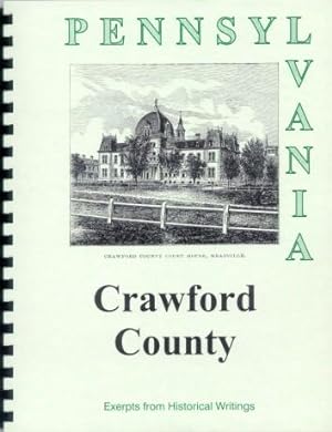
Spiral/Comb. Condition: New. No Jacket. Limited Edition Reprint. The history of Crawford County in Pennsylvania, is recalled through a mixture of colorful tales and factual data in this NEW 42 Page Booklet, reprinted primarily from four hard-to-find vintage books. The spiral-bound booklet has the print size adjusted to fit 8 1/2 x 11 paper. A clear vinyl sheet protects the front cover. Source books include: Historical Collections of the State of Pennsylvania (1843) by Sherman Day; An Illustrated History of the Commonwealth of Pennsylvania (1876) by William Egle, M.D.; Pennsylvania, a Guide to the Keystone State compiled by WPA writers; and My Pennsylvania, a 1946 project of the Bureau of Publications, Commonwealth of Pennsylvania. (Some Information may be repeated in various excerpts, but often with a different slant or with additional details.) The communities mentioned include: Meadville, Titusville, Cambridge Springs, Centreville, Vernon, Conneatville, Rockville, Sagerstown, Evansburg, Hartztown, Adamsville, Espyville, Harmonsburg, Rockdale, Bloomfield, Oil Creek, Jamestown, Cochranton, Conneaut Lake, Springboro, and others. The Day and Egle histories cover the early development of this area, while excerpts from the WPA book, give a nostalgic glimpse from a 1940 vantage point, including interesting historical notes, especially as they relate to sightseeing possibilities. There is occasionally some duplication of material, but often with a different slant or with additional details. Among the many and diverse subjects in the booklet are: Early Settlers, including bios of David Mead and Robert Randolf; Adventures of Cornelius Van Horn who escaped his Indian captors; A Remarkable early case of dual-personality; H. J. Huidekoper and the Holland Land Company; Col. Magaw, inventor of straw paper; Allegheney College and the Rev. Timothy Alden; When Allegheny College "beat" Harvard; Unusual stories in the Crawford Messenger, first area paper; Depreciation Lands and Donation Lands, rules and controversies; Meadville Theological School; Beaver and Erie Canals shoved aside by railroads; Civil War Soldiers including "Bucktales" Lincoln's Bodyguard; Carnation Milk Company; "Drakes Follie" first well in America drilled exclusively for oil; interesting history of the slide fastener (erroneously called the zipper); and other interesting bits of history and trivia. The recently added fourth book includes a 1940s map of the county, several photos and a concise update of the county's progress as it looked shortly after World War II. ILLUSTRATIONS include Public Square in Meadville, Allegheny College, Crawford County Courthouse, and Meadville looking Northwest.
-
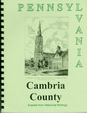
Spiral/Comb. Condition: New. No Jacket. Limited Edition Reprint. The history of Cambria County, PA, is recalled through a mixture of colorful tales and factual data in this 42 Page Booklet, reprinted primarily from four hard-to-find vintage books. The spiral-bound booklet has the print size adjusted to fit 8 1/2 x 11 paper. A clear vinyl sheet protects the front cover. Source books include: Historical Collections of the State of Pennsylvania (1843) by Sherman Day; An Illustrated History of the Commonwealth of Pennsylvania (1876) by William Egle, M.D.; Pennsylvania, a Guide to the Keystone State compiled by WPA writers; and My Pennsylvania, a 1946 project of the Bureau of Publications, Commonwealth of Pennsylvania. (Some Information may be repeated in various excerpts, but often with a different slant or with additional details.) The communities mentioned include: Johnstown, Ebensburg, Loretto, Munster, Beulah (Beula), Cresson, Cresson Springs, Carrolltown, Conemaugh, East Conemaugh, Millville, Franklin, Summitville, The Summit, Woodvale, Coopersdale, Prospect, Chest Springs, Adamsburg, Belseno, Revloc, Barnesboro, Spangler, Dividing Ridge, Windber, Ferndale, St. Lawrence, St. Bonifacius, St. Augustine, Gallitzin, Fairview, Munster, Plattville, Hemlock, Portage, Lloydsville and Nanty-Glo. The Day and Egle histories cover the early development of this area, while excerpts from the WPA book, give a nostalgic glimpse from a 1940 vantage point, including interesting historical notes, especially as they relate to sightseeing possibilities. There is occasionally some duplication of material, but often with a different slant or additional details. Among the many and diverse subjects in the booklet are: Early settlers and their hardships: hard weather, wild animals and savage Indians; a "concert" during court; Rev. Demetrius Gallitzin, a princely cleric; a most atrocious murder; Floods in Johnstown (site of Indian town of Kickenapawling); Allegheny Portage Railroad, designed by Sylvester Welch; Journey of "The Hit or Miss"; Coal Mining; The Cambria Iron Works and Bessemer Steel; John Hart and the Kittanning Path; Resorts for summer visitors; "Unknown Plot" in Grandview Cemetery; two famous sons: Charles M. Schwab and Robert E. Peary; the Ghost town of Beulah; the "shook" business and other interesting bits of history and trivia. The recently added fourth book includes a 1940s map of the county, several photos and a concise update of the county's progress as it looked shortly after World War II. ILLUSTRATIONS include the Village of Ebensburg; Johnstown and the Cambria Iron Works; Cresson, on the Allegheny Mountains; View on the Old Portage Road; Catholic Church at Carrolltown; and St. Aloysius College in Loretto.
-
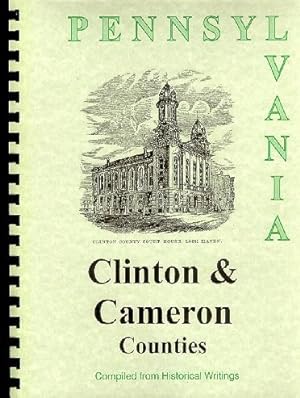
Spiral/Comb. Condition: New. No Jacket. Limited Edition Reprint. The history of Clinton and Cameron Counties in Pennsylvania, is recalled through a mixture of colorful tales and factual data in this NEW 45 Page Booklet, reprinted primarily from four hard-to-find vintage books. The spiral-bound booklet has the print size adjusted to fit 8 1/2 x 11 paper. A clear vinyl sheet protects the front cover. Source books include: Historical Collections of the State of Pennsylvania (1843) by Sherman Day; An Illustrated History of the Commonwealth of Pennsylvania (1876) by William Egle, M.D.; Pennsylvania, a Guide to the Keystone State compiled by WPA writers; and My Pennsylvania, a 1946 project of the Bureau of Publications, Commonwealth of Pennsylvania. (Some Information may be repeated in various excerpts, but often with a different slant or with additional details.) The Clinton communities mentioned include: Lock Haven, Lockport, Dunnstown, Mill Hall, Farrandsville, Salona, New Liberty, North Point (formerly Young Woman's Town), Clintondale, Tylersville, Renovo, Beech Creek, Logansville, Hyner, West Port and Lamar. The Cameron communities mentioned include: Emporium, Driftwood, Sterling Run and Sinnemahoning, and townships include Lumber, Shippon, Portage, Gibson and Grove. The Day and Egle histories cover the early development of this area, while excerpts from the WPA book, give a nostalgic glimpse from a 1940 vantage point, including interesting historical notes, especially as they relate to sightseeing possibilities. There is occasionally some duplication of material, but often with a different slant or emphasis. Among the many and diverse subjects in the booklet are: Jeremiah (Jerry) Church, William Dunn and other early settlers; Major Moses Van Campen's refusal to "change coats" in the Revolutionary War -- even to save himself from a horrible death; Picturesque Lock Haven; Riot between Irish and German workers; Rise and Fall of Farrandsville; Formation and naming of Clinton County; West Branch Canal; the Philadelphia and Erie Railroad; Lumber and Minerals: wealth of the counties; an Act of Cowardice, "The Big Runaway" and "a Crock of Silver"; pioneer life in Cameron County; When whiskey was more valuable than cows; Battle of Peter Grove with the Indians who massacred his father; Strange Indian burial site uncovered; Floods on Sinnemahoning Creek; Chimney or Altar Rocks and other Post-Revolutionary settlers; Civil War involvement; Spanish Hill controversy; an Act of Cowardice, "The Big Runaway" and "a Crock of Silver"; and other interesting bits of history and trivia. The recently added fourth book includes a 1940s map of the county, several photos and a concise update of the county's progress as it looked shortly after World War II. ILLUSTRATIONS include the View of the Borough of Emporium, Lock Haven, Clinton Court House, Pulpit Rocks near Round Island (full page) and a View of the Philadelphia and Erie Railroad Station in Renovo (full page).
-
Spiral/Comb. Condition: New. No Jacket. Limited Edition Reprint. The history of Fayette County in Pennsylvania, is recalled through a mixture of colorful tales and factual data in this NEW 45 Page Booklet, reprinted primarily from four hard-to-find vintage books. The spiral-bound booklet has the print size adjusted to fit 8 1/2 x 11 paper. A vinyl sheet protects the front cover. Source books include: Historical Collections of the State of Pennsylvania (1843) by Sherman Day; An Illustrated History of the Commonwealth of Pennsylvania (1876) by William Egle, M.D.; Pennsylvania, a Guide to the Keystone State compiled by WPA writers; and My Pennsylvania, a 1946 project of the Bureau of Publications, Commonwealth of Pennsylvania. (Some Information may be repeated in various excerpts, but often with a different slant or with additional details.) The communities mentioned include: Uniontown, Brownsville (Redstone), Bridgeport, Connellsville, Perryopolis, Bellevernon, New Geneva, Woodbridge, Haydentown, Smithfield, Monroe, Germantown, McClellandstown, New Salem, Merritstown, Middletown, Fayette City (Cookstown), New Haven, Masontown, Falls City, Dawson, Everson, Point Marion, Somerfield, Hopwood, and Broad Ford. The Day and Egle histories cover the early development of this area, while excerpts from the WPA book, give a nostalgic glimpse from a 1940 vantage point, including interesting historical notes, especially as they relate to sightseeing possibilities. There is occasionally some duplication of material, but often with a different slant or with additional details. Among the many and diverse subjects in the booklet are: Early Settlers, and their Life and Hardships; Geographic Features including Delayney's Cave; Christopher Gist (the Daniel Boone of Fayette County); George Washington's account of his activities near Uniontown; Fort Necessityand other forts; expedition of General Braddock; Braddock shot by one of his own men; "Tomahawk Rights" and "Laced Jackets"; Madison College; the Beeson Family; Bridge Disaster; James Bowman's Sketch of Brownsville; Captain Michael Cresap; a scrub Congress, a scrub Quaker and the Whiskey Rebellion; Col William Crawford; Glass Works at New Geneva; Albert Gallatin, Secretary of the Treasury under Jefferson; The National Road from Cumberland to Wheeling; the Fayette County Railroad; A. Overholt and Co. Distillery; and other interesting bits of history and trivia. The recently added fourth book includes a 1940s map of the county, several photos and a concise update of the county's progress as it looked shortly after World War II. ILLUSTRATIONS include Braddock's Grave, Uniontown from the East, Brownsville and Bridgport from the National Road, View of Brownsville, Residence of Gallatin.
-
Spiral/Comb. Condition: New. No Jacket. Limited Edition Reprint. The history of Franklin County in Pennsylvania, is recalled through a mixture of colorful tales and factual data in this NEW 46 Page Booklet, reprinted primarily from four hard-to-find vintage books. The spiral-bound booklet has the print size adjusted to fit 8 1/2 x 11 paper. A vinyl sheet protects the front cover. Source books include: Historical Collections of the State of Pennsylvania (1843) by Sherman Day; An Illustrated History of the Commonwealth of Pennsylvania (1876) by William Egle, M.D.; Pennsylvania, a Guide to the Keystone State compiled by WPA writers; and My Pennsylvania, a 1946 project of the Bureau of Publications, Commonwealth of Pennsylvania. (Some Information may be repeated in various excerpts, but often with a different slant or with additional details.) The communities mentioned include: Chambersburg, St. Thomas, Mercersburg, Fort Loudon (Loudon), Greencastle, Waynesboro, Fannetsburg, Snowhill (Snow Hill, Schneeburg), Marion, Upper Strasburg, Scotland, Fayetteville, Mont Alto, Funksburg, Upton, Bridgeport, Orrstown, Dry Run, Concord, Roxbury, and Green Village. The Day and Egle histories cover the early development of this area, while excerpts from the WPA book, give a nostalgic glimpse from a 1940 vantage point, including interesting historical notes, especially as they relate to sightseeing possibilities. There is occasionally some duplication of material, but often with a different slant or with additional details. Among the many and diverse subjects in the booklet are: Early Settlers and their Origins; Creeks, Mountains and Valleys, Minerals, Institutions, Industries, Roads and Railroads; Thieves, Counterfeiters and Other Outlaws in the Frontier Days; the Chambers family; Indian Encounters; the formidable Stone Dwelling/Fort at Falling Spring; Devastation at Great Cove; Massacre at a Schoolhouse; Revolutionary War period; a Scotch trader and his son who became President; Dr. King and the Presbyterian Church; Origins of Marshall College in Mercersburg, later Mercersville Academy; Distruction of a Pack Train by Phony Indians; The Dunkers or Seventh Day Baptists and their Music; the Court House; Stuart's Raid in 1862; Lee's Invasion in 1864 en route to Gettysburg; the Confederate General Jenkins at Green Castle and Chambersburg; Detailed account of the Burning of Chambersburg by Johnston and McCausland in 1864; John Brown's Headquarters; and other interesting bits of history and trivia. The recently added fourth book includes a 1940s map of the county, several photos and a concise update of the county's progress as it looked shortly after World War II. ILLUSTRATIONS include Public Square in Chambersburg (full page), Cemetery at Chambersburg, Marshall College, Chambersburg Before the Fire (1864), and Chambersburg After the Burning.
-
Pennsylvania Birthplace of a Nation: An Illustrated History of the Commonwealth
Published by Random House, 1964
First Edition
Hardcover. Condition: Near Fine. Dust Jacket Condition: Good. First Edition. Hardcover in jacket with chipping to jacket.
-
Spiral/Comb. Condition: New. No Jacket. Limited Edition Reprint. The history of Berks County, PA, is recalled through a mixture of colorful tales and factual data in this NEW 54 Page Booklet, reprinted primarily from four hard-to-find vintage books. The spiral-bound booklet has the print size adjusted to fit 8 1/2 x 11 paper. A clear vinyl sheet protects the front cover. Source books include: Historical Collections of the State of Pennsylvania (1843) by Sherman Day; An Illustrated History of the Commonwealth of Pennsylvania (1876) by William Egle, M.D.; Pennsylvania, a Guide to the Keystone State compiled by WPA writers; and My Pennsylvania, a 1946 project of the Bureau of Publications, Commonwealth of Pennsylvania. (Some Information may be repeated in various excerpts, but often with a different slant or with additional details.) Communities mentioned include: Reading, Womelsdorf, Kutztown, Hamburg, Bethel, Birdsboro, Boyertown, Heidelberg, Longswamp, Fleetwood, Bernville, Topton, Leesport, Morgantown, Virginsville, Cumru Township, Rehrersburg, Mertztown, Pricetown, Unionville, Warrenburg, Weaverstown, Exetertown, Millersburg, Wohleberstown, Lenhartsville, Shartlesville, Maxatawney, Maiden Creek, Temple, Shillington, Gouglersville, Hereford, Bally, Douglassville, Amityville, Baumstown, Mt. Penn, West Reading, Wyomissing, Sinking Spring, Port Clinton, Wernersville, and Robesonia. The Day and Egle histories cover the early development of this area, while excerpts from the WPA book, give a nostalgic glimpse from a 1940 vantage point, including interesting historical notes, especially as they relate to sightseeing possibilities. Since the source books are concerned with the same subject, there is some duplication of material, but the time elasped often changes the perspective and emphasis. Among the many and diverse subjects in the booklet are: Indian Alarms, "Justice" as practiced in 1752, The Hessian Camp, the High Cost of Matrimony, Early Churches, Forge Hammer House, Early Manufacturing, Resort away from Revolution and Politics of Philadelphia, Indian Perception of a Church meeting, Crystal Cave, the Reading Court House Clock, County Fair at Hamburg, Pennsylvania Dutch Meals, Move to Oust Washington as Army Chief, Discord in Amityville, Albright College, Opera House Disaster, Hopewell Village, Daniel Boone Birthplace, Lincoln's Ancestral Home, Socialism, Conrad Weiser, a friend of the Indians, Wyomissing Industries and Glen-Gery Brick Co, and other interesting bits of history and trivia. The recently added fourth book includes a 1940s map of the county, several photos and a concise update of the county's progress as it looked shortly after World War II. ILLUSTRATIONS include: Reading, the Berks County Court House, the Old Hain's Church, near Wernersville, the Provincial Court House at Reading (1762-1841), Trinity Lutheran Church, the Cemetery Gate at Reading, a 1940 view of the Public Square in Reading, and Horse Shoe Curve on the Pennsylvania Railroad. There's also a map of Reading with Points of Interest.
-

Spiral/Comb. Condition: New. No Jacket. Limited Edition Reprint. The history of Cumberland County in Pennsylvania, is recalled through a mixture of colorful tales and factual data in this NEW 54 Page Booklet, reprinted primarily from four hard-to-find vintage books. The spiral-bound booklet has the print size adjusted to fit 8 1/2 x 11 paper. A vinyl sheet protects the front cover. Source books include: Historical Collections of the State of Pennsylvania (1843) by Sherman Day; An Illustrated History of the Commonwealth of Pennsylvania (1876) by William Egle, M.D.; Pennsylvania, a Guide to the Keystone State compiled by WPA writers; and My Pennsylvania, a 1946 project of the Bureau of Publications, Commonwealth of Pennsylvania. (Some Information may be repeated in various excerpts, but often with a different slant or with additional details.) The communities mentioned include: Carlisle, Shippensburg, Newville, Middlesex, Mechanicsburg, New Cumberland, Wormleyburg, Fairview, Kingstown, Stroughstown, Springfield, Lemoyne, Camp Hill, Roxbury, Spring Run, Shade Gap, Biglerville, Millown, Oyster's Point, Whilehill, West Fairview, Bridge Port, Shiremanstown, Shepherdstown, Hogestown, Worleytown, Churchtown, Lisburn, New Kingston, Newbury, and Papertown (or Mt. Holly Springs). The Day and Egle histories cover the early development of this area, while excerpts from the WPA book, give a nostalgic glimpse from a 1940 vantage point, including interesting historical notes, especially as they relate to sightseeing possibilities. There is occasionally some duplication of material, but often with a different slant or with additional details. Among the many and diverse subjects in the booklet are: Early Settlers, and their Early Disputes; Court procedings, including the public whipping of a woman "on her bare back"; Description of Carlisle in 1753 and of "Fort Louther," a stockade built that year; Capt. Jack, "a terror to the Indians"; Murder of a friendly Indian and his family; British prisoners -- Major Andre and Lieut. Despard -- held in Carlisle; Early Churches; Early history of Capt. Samuel Brady; William Denning and his "wrought iron cannon"; Resolutions adopted in support of Boston in 1774; Revolutionary War soldiers; George Washington in Carlisle; Points of Interest in Carlisle w/ map; Irving Female College and Cumberland Valley Institute in Mechanicsburg, and Dickinson College in Carlisle; Pennsylvania Turnpike and Turnpike Tunnels in 1940; and other interesting bits of history and trivia. The recently added fourth book includes a 1940s map of the county, several photos and a concise update of the county's progress as it looked shortly after World War II. ILLUSTRATIONS include Public Square in Carlisle (full page), Dickinson College (2 vuews); Irving Female College,Soldiers' Monument in Carlisle, Cumberland County Court House, and Carlisle Springs.
-
Spiral/Comb. Condition: New. No Jacket. Limited Edition Reprint. The history of Dauphin County, Pennsylvania, is recalled through a mixture of colorful tales and factual data in this NEW 59 Page Booklet, reprinted primarily from four hard-to-find vintage books. The spiral-bound booklet has the print size adjusted to fit 8 1/2 x 11 paper. A clear vinyl sheet protects the front cover. Source books include: Historical Collections of the State of Pennsylvania (1843) by Sherman Day; An Illustrated History of the Commonwealth of Pennsylvania (1876) by William Egle, M.D.; Pennsylvania, a Guide to the Keystone State compiled by WPA writers; and My Pennsylvania, a 1946 project of the Bureau of Publications, Commonwealth of Pennsylvania. (Some Information may be repeated in various excerpts, but often with a different slant or with additional details.) The communities mentioned include: Harrisburg, Hershey, Chester, Middletown, Hummelstown, Halifax, Millersburg, Duncan's Island, Berrysburg, Baldwin, Lykens, Wiconisco, Gratz, Williamstown, Highspire, Linglestown, Union Deposit, Rockville, Fisherville, Dauphin, Clark's Ferry, Elizabethville, Hershey, Steelton, Paxtang, and Paxton. The Day and Egle histories cover the early development of this area, while excerpts from the WPA book, give a nostalgic glimpse from a 1940 vantage point, including interesting historical notes, especially as they relate to sightseeing possibilities. There may occasionally be some duplication of material, but usually with a different slant or emphasis. Among the many and diverse subjects in the booklet are: Early Settlers; Indian Attacks; Missionary David Brainerd's Observations on Indian Customs; Unjustifiable Outrage by Paxton Men against Conestoga Indians; Bio of John Harris family; George Frey, early example of "the American Dream"; Early Churches; Harrisburg Academy and Emmaus Institute; Early Railroads; Pennsylvania Canal; Cave of a Hermit; Map of Harrisburg with Points of Interest; Saving a Girl from a Forced Marriage; the Ice Flood, the Pumpkin Flood and other interesting bits of history and trivia. The recently added fourth book includes a 1940s map of the county, several photos and a concise update of the county's progress as it looked shortly after World War II. ILLUSTRATIONS include State Capitol Building, John Harris Grave and Railroad Bridge at Harrisburg, Distant View of Harrisburg (2) (full page), Central Park of Middletown, Harris Mansion, Old Derry Church, Old Derry Church Interior, Old Paxtang Church, Old Hanover Church, First English Church, First German Church, and "Fort Hunter.".
-
Spiral/Comb. Condition: New. No Jacket. Limited Edition Reprint. The history of Bucks County, PA, is recalled through a mixture of colorful tales and factual data in this NEW 60 Page Booklet, reprinted primarily from four hard-to-find vintage books. The spiral-bound booklet has the print size adjusted to fit 8 1/2 x 11 paper. A clear vinyl sheet protects the front cover. Source books include: Historical Collections of the State of Pennsylvania (1843) by Sherman Day; An Illustrated History of the Commonwealth of Pennsylvania (1876) by William Egle, M.D.; Pennsylvania, a Guide to the Keystone State compiled by WPA writers; and My Pennsylvania, a 1946 project of the Bureau of Publications, Commonwealth of Pennsylvania. (Some Information may be repeated in various excerpts, but often with a different slant or with additional details.) The communities mentioned include: Doylestown, Hartsville, Bristol, New Hope (Coryell's Ferry), Morrisville, Newtown, Sellersville, Applebachville, Hagersville, Hulmeville, Attleborough, Wrightstown, Centreville, Greenville, Fallsington, Line-Lexington, Strawhntown, Houghville, Quakertown, Andalusia, Aquetong, Lahaska, Holicong, Buckingham, Chalfont, Bryn Athyn, Tully Town, Pennsbury, Eddington, Riegelsville, Durham, Kintnersville, Neshaminy, Souderton, Washington Crossing and Yardley. The Day and Egle histories cover the early development of this area, while excerpts from the WPA book, give a nostalgic glimpse from a 1940 vantage point, including interesting historical notes, especially as they relate to sightseeing possibilities. There may occasionally be some duplication of material, but usually with a different slant or emphasis. Among the many and diverse subjects in the booklet are: Phineas Pemberton, John Chapman and other early settlers, including some Quakers who apparently preceded William Penn; Pioneer Life, including clothing, health problems, and relations with Indian neighbors; Durham Cave, the Delaware River and other natural features; Mansions along the Delaware; Certificates of "acceptable character"; "The Indian Walk" to determine boundaries, and a second, wherein a "tortoise" beat a "hare"; an early account of Washington's Crossing the Delaware and Attack on Trenton; the Crimes of the Notorious Doane Family; Encampment of the American Army in 1778; Early churches and educational institutions, including the Log College (which preceded Princeton University); Possible Burial site of Chief Tamenend (source of Tammany Hall's name); Mulberry Tree sales and "the silk rush?"; the Flood of 1841 and George Fell's remarkable "raft" ride; the "Hot Water Rebellion;" the Underground Railroad at Quakertown; when Morristown was two votes shy; when Washington rode a "horse of a different color" and other interesting bits of history and trivia. The recently added third book includes a 1940s map of the county, several photos and a concise update of the county's progress as it looked shortly after World War II. ILLUSTRATIONS include the Country Seat of Nicholas Biddle, Penn's old Brewhouse, Public Buildings at Doylestown, Eastern View of Bristol (full page), New Hope, Trenton Bridge, Newtown, Bucks County Court House in Doylestown, Friends' Meeting-House in Solesbury, Soldiers' Monument at Doylestown, and Friends' Meeting-House in Buckingham.
-
Spiral/Comb. Condition: New. No Jacket. Limited Edition Reprint. The history of Bradford County, PA, is recalled through a mixture of colorful tales and factual data in this NEW 63 Page Booklet, reprinted primarily from four hard-to-find vintage books. The spiral-bound booklet has the print size adjusted to fit 8 1/2 x 11 paper. A clear vinyl sheet protects the front cover. Source books include: Historical Collections of the State of Pennsylvania (1843) by Sherman Day; An Illustrated History of the Commonwealth of Pennsylvania (1876) by William Egle, M.D.; Pennsylvania, a Guide to the Keystone State compiled by WPA writers; and My Pennsylvania, a 1946 project of the Bureau of Publications, Commonwealth of Pennsylvania. (Some Information may be repeated in various excerpts, but often with a different slant or with additional details.) The communities mentioned include: Towanda (formerly Meansville), Athens, New Sheshequin, Burlington, Troy, Monroe, Canton, Ulster, Frenchtown, Albany, Armenia, Asylum, East Troy, LeRoy, Litchfield, Monroeton, Greenwood, Orwell Hill, Potterville, Overton, LeRaysville, Stevensville, Ridgebury, Middletown, East Smithfield, Springfield, Leona, Mill City, State Line, Gillett, Standing Stone, Rummerfield, Homet's Ferry, Wyalusing and Wycox. The Day and Egle histories cover the early development of this area, while excerpts from the WPA book, give a nostalgic glimpse from a 1940 vantage point, including interesting historical notes, especially as they relate to sightseeing possibilities. There is occasionally some duplication of material, but often with a different slant or emphasis. Among the many and diverse subjects in the booklet are: Early settlers, beginning with Moravian Missionaries at Friedenshuetten; Indian history in the county; the sale of Pennsylvania; Bitterness between Pennsylvanian and Connecticut settlers over land; Catharine Montour, known as "Queen Easter," a half-breed who had a controlling influence among the Indians; Council with the Six Nations at Tioga Point; the Adoption of Thomas Morris by the Seneca Tribe with near tragic consequences; Indian "recipe" for cooking hogs; French Settlers at Asylum with names and occupations of early settlers; Missionary David Ziesberger; Monument at the site of Friedenshuetten; Actions against Tories and other Revolutionary War incidents; Capture and escape of 4 Indian prisoners; Half-Share men and other Post-Revolutionary settlers; Civil War involvement; Spanish Hill controversy; and other interesting bits of history and trivia. The recently added fourth book includes a 1940s map of the county, several photos and a concise update of the county's progress as it looked shortly after World War II. ILLUSTRATIONS include the Village of Athens, Tioga Point, S/E View of Towanda (full page), another View of Towanda, and the Moravian Monument.
-
Spiral/Comb. Condition: New. No Jacket. Limited Edition Reprint. The history of Chester County in Pennsylvania, is recalled through a mixture of colorful tales and factual data in this NEW 72 Page Booklet, reprinted primarily from four hard-to-find vintage books. The spiral-bound booklet has the print size adjusted to fit 8 1/2 x 11 paper. A clear vinyl sheet protects the front cover. Source books include: Historical Collections of the State of Pennsylvania (1843) by Sherman Day; An Illustrated History of the Commonwealth of Pennsylvania (1876) by William Egle, M.D.; Pennsylvania, a Guide to the Keystone State compiled by WPA writers; and My Pennsylvania, a 1946 project of the Bureau of Publications, Commonwealth of Pennsylvania. (Some Information may be repeated in various excerpts, but often with a different slant or with additional details.) The communities mentioned include: West Chester (Westchester), Downingtown, Coatesville, The Yellow Springs, Kimberton, Phoenixville (Phenixville), Atglen, Waynesburg, London, Kennet (Kennett) Square, Cochranville, Unionville, Sadsbury, Hopewell, Spring City, Parksburg (Parkesburg), Red Loin, Pughtown, Shugarttown, Nottingham, Oxford, Avondale, Paoli, Christiana, Marshallton, Honey Brook, Elverson, Intercourse, Bird-in-Hand, Smoketown, Bridgeport, and King of Prussia. The Day and Egle histories cover the early development of this area, while excerpts from the WPA book, give a nostalgic glimpse from a 1940 vantage point, including interesting historical notes, especially as they relate to sightseeing possibilities. There is occasionally some duplication of material, but often with a different slant or with additional details. Among the many and diverse subjects in the booklet are: Early settlers and where they came from; Delaware Indians; Old Indian Hannah, the last of her tribe; Price the Indians put on the land; Soul-drivers and Redemptioners (indentured servants); a turn-about tale; Col. Anthony Wayne and other Revolutionary War soldiers; Detailed account of the Battle of Brandywine; Valley Forge; Names of old taverns; "Battle" over location of county seat; Jim Fitzpatrick (Fitz), a deserter who became a Robinhood-like outlaw; a Close Call for General Washington; a Wound for Lafayette; Lord Percy?s Premonition; a Description of various Revolutionary War officers; Massacre at the Paoli, where Gen. Gray "gave no quarter" to the Americans; the Paoli Monument; Minerals of the area -- Iron, Lead, Copper; Phoenix Iron Company; Eastern Experimental Farm; Railroads; Sample of early court proceedings; Whipping post, stocks, etc.; Whiskey Insurrection; War of 1812; Sunnyside Mousery at Elverson; Valley Forge State Park; Longwood Gardens; Trial under Fugitive Slave Law at Christiana; Educational institutions, including Lincoln University for "young men of color"; and other interesting bits of history and trivia. The recently added fourth book includes a 1940s map of the county, several photos and a concise update of the county's progress as it looked shortly after World War II. ILLUSTRATIONS include Distant view of Brandywine Battleground; Paoli Monument; Gen. Wayne?s Residence, Central Part of Westchester; Mr. Bolmar?s Seminary; Downingtown; Railroad Bridge near Phenixville; Phenixville; Chester County Court House; View of the Great or Chester Valley (full view); Fratricide of Wyoming (full view); Old Birmingham Meeting House.
-
Spiral/Comb. Condition: New. No Jacket. Limited Edition Reprint. The history of Erie County in PA, is recalled through a mixture of colorful tales and factual data in this NEW 76 Page Booklet, reprinted primarily from four hard-to-find vintage books. The spiral-bound booklet has the print size adjusted to fit 8 1/2 x 11 paper. A vinyl sheet protects the front cover. Source books include: Historical Collections of the State of Pennsylvania (1843) by Sherman Day; An Illustrated History of the Commonwealth of Pennsylvania (1876) by William Egle, M.D.; Pennsylvania, a Guide to the Keystone State compiled by WPA writers; and My Pennsylvania, a 1946 project of the Bureau of Publications, Commonwealth of Pennsylvania. (Some Information may be repeated in various excerpts, but often with a different slant or with additional details.) The communities mentioned include: Erie, Edinboro, Wellsburg, Albion, West Springfield, East Springfield, Corry, Union City, North East, Moorheadville, Harbor Creek (Harborcreek), Wesleyville, Fairville, Girard, Hammett, Lowville, Wattsburg, Waterford, Platea, Cranesville, and Belle Valley. The Day and Egle histories cover the early development of this area, while excerpts from the WPA book, give a nostalgic glimpse from a 1940 vantage point, including interesting historical notes, especially as they relate to sightseeing possibilities. There is occasionally some duplication of material, but often with a different slant or with additional details. Among the many and diverse subjects in the booklet are: Rapid Growth Follows Transportation Improvements; Building and Equiping of Perry's Fleet; List of Ships and Officers in Battle of Lake Erie; Diagram and Detailed accounts of the battle, including list of ships on each side; Diagram and Detailed Account of the engagement; Perry's young brother on board; Controversy: Did Perry act Rashly or Did Capt. Elliott act Cowardly; Washington Monument at Waterford; Villa Maria College and Academy at Erie; "Mad" Anthony Wayne Memorial; First Civil War Memorial is in Girard' Pennsylvania State Park, resting place for "The Niagara," one of Perry's ships; a 7-page section on Points of Interest in Erie, with a small city map; "The City of Stumps," "The Grape Belt," a Curious Case of Partial Insanity, "too many big guns" for Indians; a Scalped Man who lived 115 years; and other interesting bits of history and trivia. The recently added fourth book includes a 1940s map of the county, several photos and a concise update of the county's progress as it looked shortly after World War II. ILLUSTRATIONS: Public Square in Erie (full page); Erie from the Lake (full page); Old Blockhouse at Erie; Remains of Commodore Perry's Flag Ship; and Soldiers & Sailors Monument in Erie.
-

Spiral/Comb. Condition: New. No Jacket. Limited Edition Reprint. The history of Adams County, PA, which includes Gettysburg, site of the bloodiest battle of the Civil War, is recalled through a mixture of colorful tales and factual data in this NEW 85 Page Booklet, reprinted from five hard-to-find vintage books. The spiral-bound booklet has the print size adjusted to fit the 8 1/2 x 11" paper and enhance readability. A clear vinyl sheet protects the front cover. Source books include: Historical Collections of the State of Pennsylvania (1843) by Sherman Day; An Illustrated History of the Commonwealth of Pennsylvania (1876) by William Egle, M.D.; Pennsylvania, a Guide to the Keystone State compiled by WPA writers; and My Pennsylvania, a 1946 project of the Bureau of Publications, Commonwealth of Pennsylvania; and Women of the War (1866) by Frank Moore. (Some Information may be repeated in various excerpts, but often with a different slant or with additional details.) Besides Gettysburg, the past and present Adams County communities include: Abbotstown, Arendtsville, Beechersville, Berlin, Caledonia, Cashtown, East Berlin, Fairfield, Hampton, Hanover (Rogue's Rest), Heidlersburg, Hilltown, Hunterstown, Littlestown, McSherrystown, Mechanicsville, Middletown, Millerstown, Mummasburg, New Chester, New Oxford, New Salem, Petersburg, Seven Stars, Waynesboro and York Springs. The Day and Egle histories cover the early development of this area, while excerpts from the WPA book, give a nostalgic glimpse from a 1940 vantage point, including interesting historical notes, especially as they relate to sightseeing possibilities. Among the many and diverse subjects taken from these books are: Physical features and geological traits; Early Settlers and population origins, largely Scotch-Irish Presbyterian and German; "The Tape-Worm," an unbuilt $700,000 railroad and political fiasco in 1842; Red/Blue Cockade vs. Black Cockade - a sign of political unrest; Early Churches; the Lutheran Theological Seminary; Pennsylvania College (Gettysburg College); an Expensive Pair of Shoes; a Wild Hot Air Balloon Ride; York Sulphur Springs; Captured by Indians; a Day by Day Account of the Battle of Gettysburg; a Tour of the Battlefield; the Soldier's National Cemetery; the Battle at Hanover; the Adams County Agricultural Society; the 1938 Blue and Gray Reunion and other interesting bits of history and trivia. The newly added excerpt from Moore's book, a chapter titled "What We Did at Gettysburg," is a vivid first-hand account of the care of the 21,000 wounded of both armies after the battle, including the reaction of the local residents. Another new addition to the booklet is from My Pennsylvania and includes a 1940s map of the county, several photos and a concise update of the county's progress as it looked shortly after World War II. The booklet has no index, but I went through and picked out the following names: Rev. Alexander Dobbin, James Cunningham, Jonathan Hoge, James Johnston, Garret Vanosdol, James Gettys, Rev. Paxton, Rev. Watson, Rev. John Black, Rev. David McConaughy, McPherson, Warrell, William McClellan (McLellen), Capt. David Wilson, Capt. Nicolas Bittinger, Rev. S.S. Schmucker, Rev. Benjamin Kurtz, Rev. E. L. Hazelius, Charles P. Krauth, Henry I. Smith, Rev. D. Jacobs, Rev. H.L. Baugher, Rev. W. M. Reynolds, Rev. Henry I. Smith, D. Gilbert, M.L. Stoever, Gottlob Bessler, John Wise (balloonist), John McClellan, Peter Fleck, Isaac Sadler, Jacob Garner, Jacob Fickes, McCosh, Richard Bard, Hannah McBride, Samuel Hunter, Daniel McManimy, William White, Lt. Thomas Potter, David Moore, Joseph Farris, Hugh McKean, Matthew Black, Robert McPherson, William Black, James Agnew, John Alexander, Moses Jenkins, Richard Hall, Richard Fosset, Adam Hall, James Wilson, John Steel, John Johnson, John Hamilton, Hugh Vogan, John McWharter, Hugh Sweeny, Titus Darley, Thomas Hosack, Allison, Campbell, Horrison, Edie, Rev. James A. Brown, Rev. Charles A. Hay, Rev. J.G. Morris, Rev. S.
