
Order Total (1 Item Items):
Shipping Destination:

Lake Placid High Peaks by National Geographic (25 results)
Feedback
Skip to main search results
Search filters
Product Type
- All Product Types
- Books (23)
- Magazines & Periodicals (No further results match this refinement)
- Comics (No further results match this refinement)
- Sheet Music (No further results match this refinement)
- Art, Prints & Posters (No further results match this refinement)
- Photographs (No further results match this refinement)
- Maps (2)
- Manuscripts & Paper Collectibles (No further results match this refinement)
Condition
Binding
- All Bindings
- Hardcover (No further results match this refinement)
- Softcover (5)
Collectible Attributes
- First Edition (No further results match this refinement)
- Signed (No further results match this refinement)
- Dust Jacket (No further results match this refinement)
- Seller-Supplied Images (8)
- Not Print on Demand (25)
Free Shipping
Seller Rating
-
Lake Placid/high Peaks, Adirondack Park (Folded)
Published by National Geographic Maps, Evergreen, 2012
ISBN 10: 156695357X ISBN 13: 9781566953573
Folded. Condition: new. Folded. National Geographic's Trails Illustrated Maps are the most detailed and up-to-date topographic recreation maps available for US National Parks, National Forests and other popular outdoor recreation areas. A necessity for exploring the outdoors, each map is printed on waterproof, tear-resistant material. They also contain key safety and contact information, GPS and compass coordinates, Leave No Trace ethical guidelines and hundreds of points-of-interest, including scenic viewpoints, campgrounds, boat launches, swimming areas, marine sanctuaries and wildlife refuges. Shipping may be from multiple locations in the US or from the UK, depending on stock availability.
-
Adirondack Park: Lake Placid/High Peaks, New York, USA Outdoor Recreation Map (Sheet Map, Folded)
Published by National Geographic Maps 1/1/2012, 2012
ISBN 10: 156695357X ISBN 13: 9781566953573
Sheet Map, Folded. Condition: New. Adirondack Park: Lake Placid/High Peaks, New York, USA Outdoor Recreation Map 0.4. Book.
-
Lake Placid, High Peaks: Adirondack Park (National Geographic Trails Illustrated Map (742))
Published by National Geographic Maps, 2023
ISBN 10: 156695357X ISBN 13: 9781566953573
Condition: New. Brand New! Not Overstocks or Low Quality Book Club Editions! Direct From the Publisher! We're not a giant, faceless warehouse organization! We're a small town bookstore that loves books and loves it's customers! Buy from Lakeside Books!.
-
Lake Placid, High Peaks: Adirondack Park Map
Published by National Geographic Maps, 2023
ISBN 10: 156695357X ISBN 13: 9781566953573
map. Condition: New. Brand New!.
-
Lake Placid, High Peaks: Adirondack Park Map (National Geographic Trails Illustrated Map, 742)
Published by Natl Geographic Society Maps, 2023
ISBN 10: 156695357X ISBN 13: 9781566953573
Condition: New.
-
Lake Placid, High Peaks: Adirondack Park Map (National Geographic Trails Illustrated Map, 742)
Published by Natl Geographic Society Maps, 2023
ISBN 10: 156695357X ISBN 13: 9781566953573
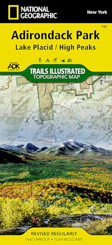
No binding. Condition: New. 2023. Waterproof Tear-Resistant Topographic MapThe largest park in the contiguous United States, Adirondack Park is a diverse mountain landscape of protected boreal forests and pristine waterways interspersed with over one hundred towns and villages. National Geographic's Trails Illustrated map of Adirondack Park combines unmatched detail with helpful information to offer an invaluable tool for making the most of your visit to this extraordinary region. Created in partnership with local land management agencies, this expertly researched map features key areas of interest including High Peaks Wilderness, Lake Placid, Sentinel Range Wilderness, Saranac Lakes Wild Forest, Lake Champlain, Giant Mountain Wilderness, Hurricane Mountain Wilderness, Split Rock Mountain Wild Forest, and Long Lake.An extensive High Peaks Trail Chart will help you choose a trail that's right for your activity level and recreation use whether you're hiking, horseback riding, biking, snowshoeing, cross country skiing, or snowmobiling. Trails are clearly marked and include mileages between intersections. The map base includes contour lines and elevations for summits, passes and major lakes. Some of the many recreation features include: campgrounds, trailheads, fishing access, boat launch sites, and interpretive trails.Every Trails Illustrated map is printed on "Backcountry Tough" waterproof, tear-resistant paper. A full UTM grid is printed on the map to aid with GPS navigation.Other features found on this map include: Adirondack Mountains, Algonquin Peak, Ampersand Mountain, Ausable River, Basin Mountain, Boundary Peak, Dix Mountain, Gothics, Gray Peak, Iroquois Peak, Little Marcy, MacIntyre Mountains, Mount Haystack, Mount Marcy, Mount Skylight, Otter Creek, Owls Head Mountain, Sentinel Range, Split Rock Mountain, Street Mountain, Tupper Lake, Upper Saranac Lake, Vanderwhacker Mountain. Map Scale = 1:75,000 Sheet Size = 37.75" x 25.5" Folded Size = 4.25" x 9.25"
-
Lake Placid, High Peaks: Adirondack Park Map (National Geographic Trails Illustrated Map, 742)
Published by Natl Geographic Society Maps, 2023
ISBN 10: 156695357X ISBN 13: 9781566953573
Condition: Good. SHIPS FROM USA. Used books have different signs of use and do not include supplemental materials such as CDs, Dvds, Access Codes, charts or any other extra material. All used books might have various degrees of writing, highliting and wear and tear and possibly be an ex-library with the usual stickers and stamps. Dust Jackets are not guaranteed and when still present, they will have various degrees of tear and damage. All images are Stock Photos, not of the actual item. book.
-
![Seller image for Lake Placid, High Peaks: Adirondack Park (National Geographic Trails Illustrated Map) by National Geographic Maps - Trails Illustrated [Map ] for sale by booksXpress](https://pictures.abebooks.com/inventory/md/md31972471333.jpg)
Lake Placid, High Peaks: Adirondack Park (National Geographic Trails Illustrated Map) by National Geographic Maps - Trails Illustrated [Map ]
Published by National Geographic Maps, 2012
ISBN 10: 156695357X ISBN 13: 9781566953573
No Binding. Condition: new.
-
Lake Placid, High Peaks: Adirondack Park Map
Published by National Geographic Maps, 2023
ISBN 10: 156695357X ISBN 13: 9781566953573
Seller: PBShop.store UK, Fairford, GLOS, United Kingdom
Seller rating 5 out of 5 stars

UNK. Condition: Used - Very Good. Used - Like New Book. Shipped from UK. Established seller since 2000.
-
Lake Placid, High Peaks: Adirondack Park Map
Published by National Geographic Maps, 2023
ISBN 10: 156695357X ISBN 13: 9781566953573
Seller: PBShop.store UK, Fairford, GLOS, United Kingdom
Seller rating 5 out of 5 stars
UNK. Condition: New. New Book. Shipped from UK. Established seller since 2000.
-
Lake Placid, High Peaks: Adirondack Park Map (National Geographic Trails Illustrated Map, 742)
Published by Natl Geographic Society Maps, 2023
ISBN 10: 156695357X ISBN 13: 9781566953573
Condition: New. Book is in NEW condition. 0.2.
-
Lake Placid, High Peaks: Adirondack Park Map (National Geographic Trails Illustrated Map, 742)
Published by Natl Geographic Society Maps, 2023
ISBN 10: 156695357X ISBN 13: 9781566953573
Condition: Good. Buy with confidence! Book is in good condition with minor wear to the pages, binding, and minor marks within 0.2.
-
Lake Placid, High Peaks: Adirondack Park (National Geographic Trails Illustrated Map (742))
Published by National Geographic Maps, 2019
ISBN 10: 156695357X ISBN 13: 9781566953573
Map. Condition: New. 2019th Edition. Special order direct from the distributor.
-
Lake Placid, High Peaks: Adirondack Park Map (National Geographic Trails Illustrated Map, 742)
Published by Natl Geographic Society Maps, 2023
ISBN 10: 156695357X ISBN 13: 9781566953573
No binding. Condition: Good. 2023. Waterproof Tear-Resistant Topographic MapThe largest park in the contiguous United States, Adirondack Park is a diverse mountain landscape of protected boreal forests and pristine waterways interspersed with over one hundred towns and villages. National Geographic's Trails Illustrated map of Adirondack Park combines unmatched detail with helpful information to offer an invaluable tool for making the most of your visit to this extraordinary region. Created in partnership with local land management agencies, this expertly researched map features key areas of interest including High Peaks Wilderness, Lake Placid, Sentinel Range Wilderness, Saranac Lakes Wild Forest, Lake Champlain, Giant Mountain Wilderness, Hurricane Mountain Wilderness, Split Rock Mountain Wild Forest, and Long Lake.An extensive High Peaks Trail Chart will help you choose a trail that's right for your activity level and recreation use whether you're hiking, horseback riding, biking, snowshoeing, cross country skiing, or snowmobiling. Trails are clearly marked and include mileages between intersections. The map base includes contour lines and elevations for summits, passes and major lakes. Some of the many recreation features include: campgrounds, trailheads, fishing access, boat launch sites, and interpretive trails.Every Trails Illustrated map is printed on "Backcountry Tough" waterproof, tear-resistant paper. A full UTM grid is printed on the map to aid with GPS navigation.Other features found on this map include: Adirondack Mountains, Algonquin Peak, Ampersand Mountain, Ausable River, Basin Mountain, Boundary Peak, Dix Mountain, Gothics, Gray Peak, Iroquois Peak, Little Marcy, MacIntyre Mountains, Mount Haystack, Mount Marcy, Mount Skylight, Otter Creek, Owls Head Mountain, Sentinel Range, Split Rock Mountain, Street Mountain, Tupper Lake, Upper Saranac Lake, Vanderwhacker Mountain. Map Scale = 1:75,000 Sheet Size = 37.75" x 25.5" Folded Size = 4.25" x 9.25"
-
Lake Placid, High Peaks: Adirondack Park Map (National Geographic Trails Illustrated Map, 742)
Published by Natl Geographic Society Maps, 2023
ISBN 10: 156695357X ISBN 13: 9781566953573
Condition: very good.
-
Lake Placid, High Peaks: Adirondack Park Map (National Geographic Trails Illustrated Map, 742)
Published by Natl Geographic Society Maps, 2023
ISBN 10: 156695357X ISBN 13: 9781566953573
Condition: new.
-
Lake Placid, High Peaks: Adirondack Park Map (National Geographic Trails Illustrated Map, 742)
Published by Natl Geographic Society Maps, 2023
ISBN 10: 156695357X ISBN 13: 9781566953573
Paperback. Condition: new. Brand New Copy.
-
Lake Placid, High Peaks: Adirondack Park Map (National Geographic Trails Illustrated Map, 742)
Published by Natl Geographic Society Maps, 2023
ISBN 10: 156695357X ISBN 13: 9781566953573
Paperback. Condition: new. New Copy. Customer Service Guaranteed.
-

Lake Placid, High Peaks: Adirondack Park Map
Published by Map Link Jan 2023, 2023
ISBN 10: 156695357X ISBN 13: 9781566953573
Map
Karte. Condition: Neu. Neuware.
-
![Seller image for Lake Placid/high Peaks, Adirondack Park: Trails Illustrated Other Rec. Areas (National Geographic Trails Illustrated Map) [Idioma Ingl?s] for sale by Pieuler Store](https://pictures.abebooks.com/inventory/md/md31372781171.jpg)
Lake Placid/high Peaks, Adirondack Park: Trails Illustrated Other Rec. Areas (National Geographic Trails Illustrated Map) [Idioma Ingl?s]
Published by National Geographic Maps, 2023
ISBN 10: 156695357X ISBN 13: 9781566953573
Condition: new. Book is in NEW condition. Satisfaction Guaranteed! Fast Customer Service!!.
-
![Seller image for Lake Placid/high Peaks, Adirondack Park: Trails Illustrated Other Rec. Areas (National Geographic Trails Illustrated Map) [Idioma Ingl?s] for sale by Pieuler Store](https://pictures.abebooks.com/inventory/md/md31372810500.jpg)
Lake Placid/high Peaks, Adirondack Park: Trails Illustrated Other Rec. Areas (National Geographic Trails Illustrated Map) [Idioma Ingl?s]
Published by National Geographic Maps, 2023
ISBN 10: 156695357X ISBN 13: 9781566953573
Condition: good. 100% Customer Satisfaction Guaranteed ! The book shows some signs of wear from use but is a good readable copy. Cover in excellent condition. Binding tight. Pages in great shape, no tears. Not contain access codes, cd, DVD.
-
Lake Placid/high Peaks, Adirondack Park (Folded)
Published by National Geographic Maps, Evergreen, 2012
ISBN 10: 156695357X ISBN 13: 9781566953573
Folded. Condition: new. Folded. National Geographic's Trails Illustrated Maps are the most detailed and up-to-date topographic recreation maps available for US National Parks, National Forests and other popular outdoor recreation areas. A necessity for exploring the outdoors, each map is printed on waterproof, tear-resistant material. They also contain key safety and contact information, GPS and compass coordinates, Leave No Trace ethical guidelines and hundreds of points-of-interest, including scenic viewpoints, campgrounds, boat launches, swimming areas, marine sanctuaries and wildlife refuges. Shipping may be from our Sydney, NSW warehouse or from our UK or US warehouse, depending on stock availability.
-

Lake Placid/high Peaks, Adirondack Park (Folded)
Published by National Geographic Maps, Evergreen, 2012
ISBN 10: 156695357X ISBN 13: 9781566953573
Folded. Condition: new. Folded. National Geographic's Trails Illustrated Maps are the most detailed and up-to-date topographic recreation maps available for US National Parks, National Forests and other popular outdoor recreation areas. A necessity for exploring the outdoors, each map is printed on waterproof, tear-resistant material. They also contain key safety and contact information, GPS and compass coordinates, Leave No Trace ethical guidelines and hundreds of points-of-interest, including scenic viewpoints, campgrounds, boat launches, swimming areas, marine sanctuaries and wildlife refuges. Shipping may be from our UK warehouse or from our Australian or US warehouses, depending on stock availability.
-
Lake Placid, High Peaks: Adirondack Park
Published by National Geographic Maps, 2021
ISBN 10: 156695357X ISBN 13: 9781566953573
Condition: New. KlappentextCoverage includes Mt Marcy, High Peaks, Dix Mountain, Jay Mountain and Sentinel Range Wilderness Areas Adirondack Mountain Reserve Hurricane Mountain Primitive Area Vanderwhacker Mountain Wild Forest and the Northville-Lak.
-
Lake Placid, High Peaks: Adirondack Park Map (National Geographic Trails Illustrated Map, 742)
Published by Natl Geographic Society Maps, 2023
ISBN 10: 156695357X ISBN 13: 9781566953573
Map
map. Condition: New. In shrink wrap. Looks like an interesting title!.