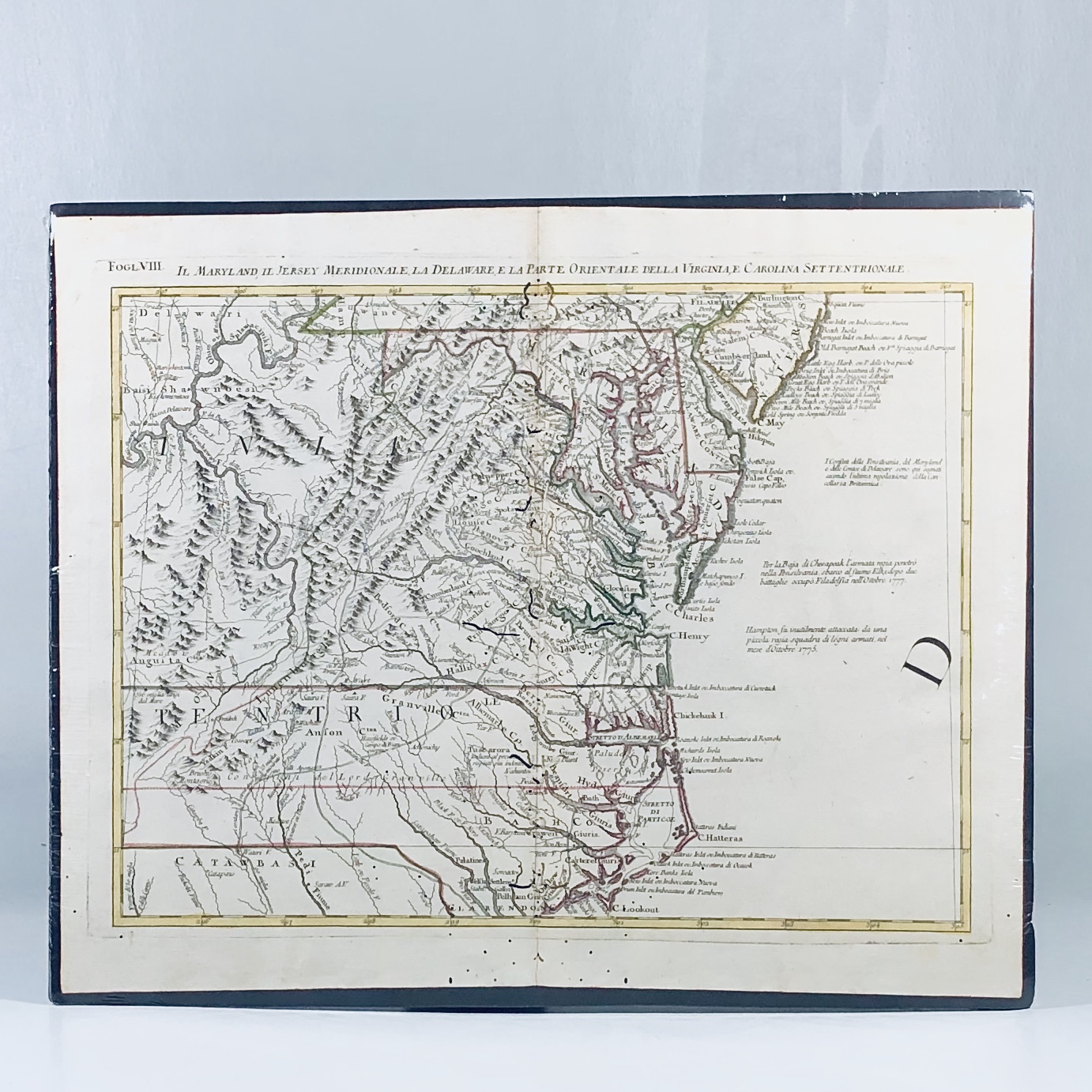
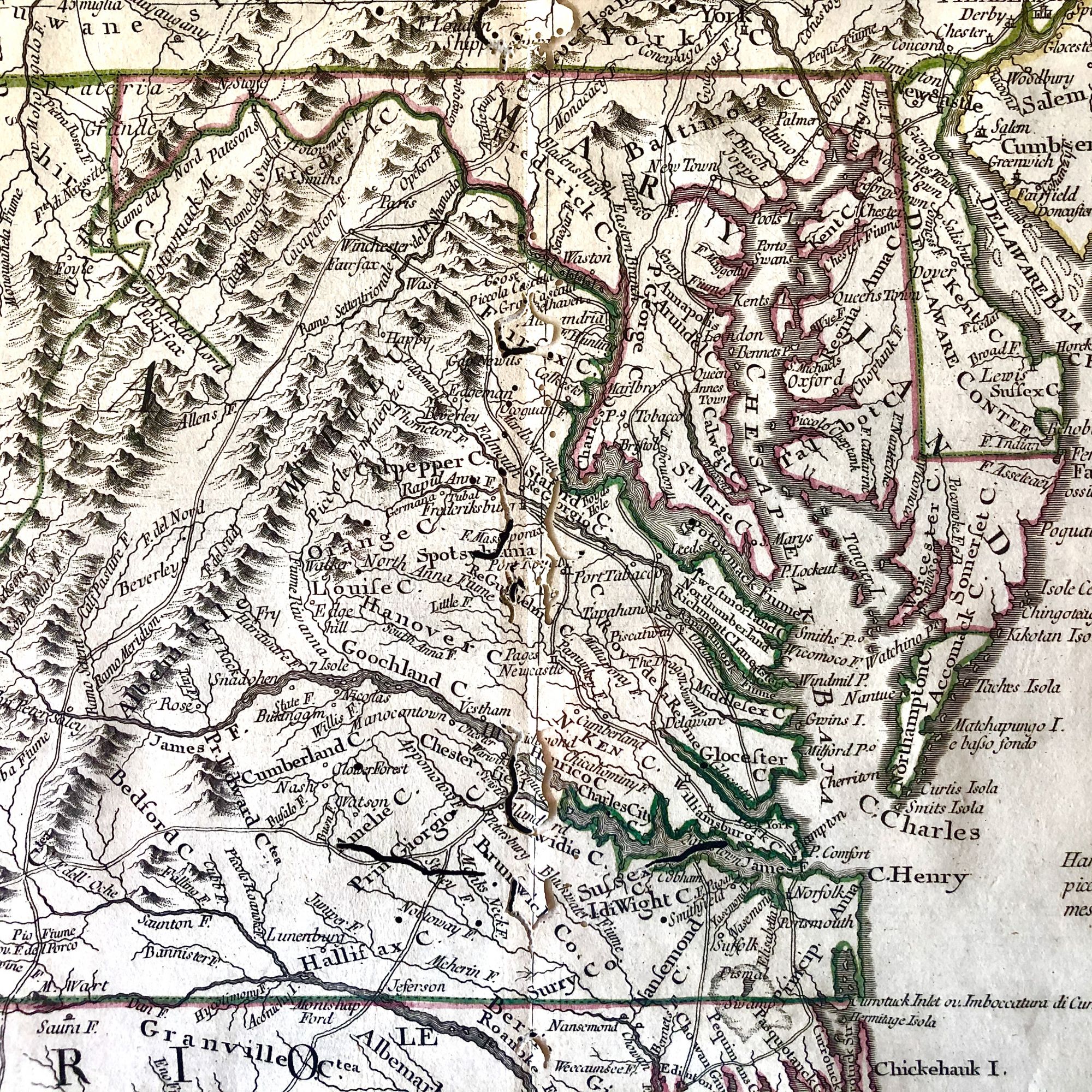
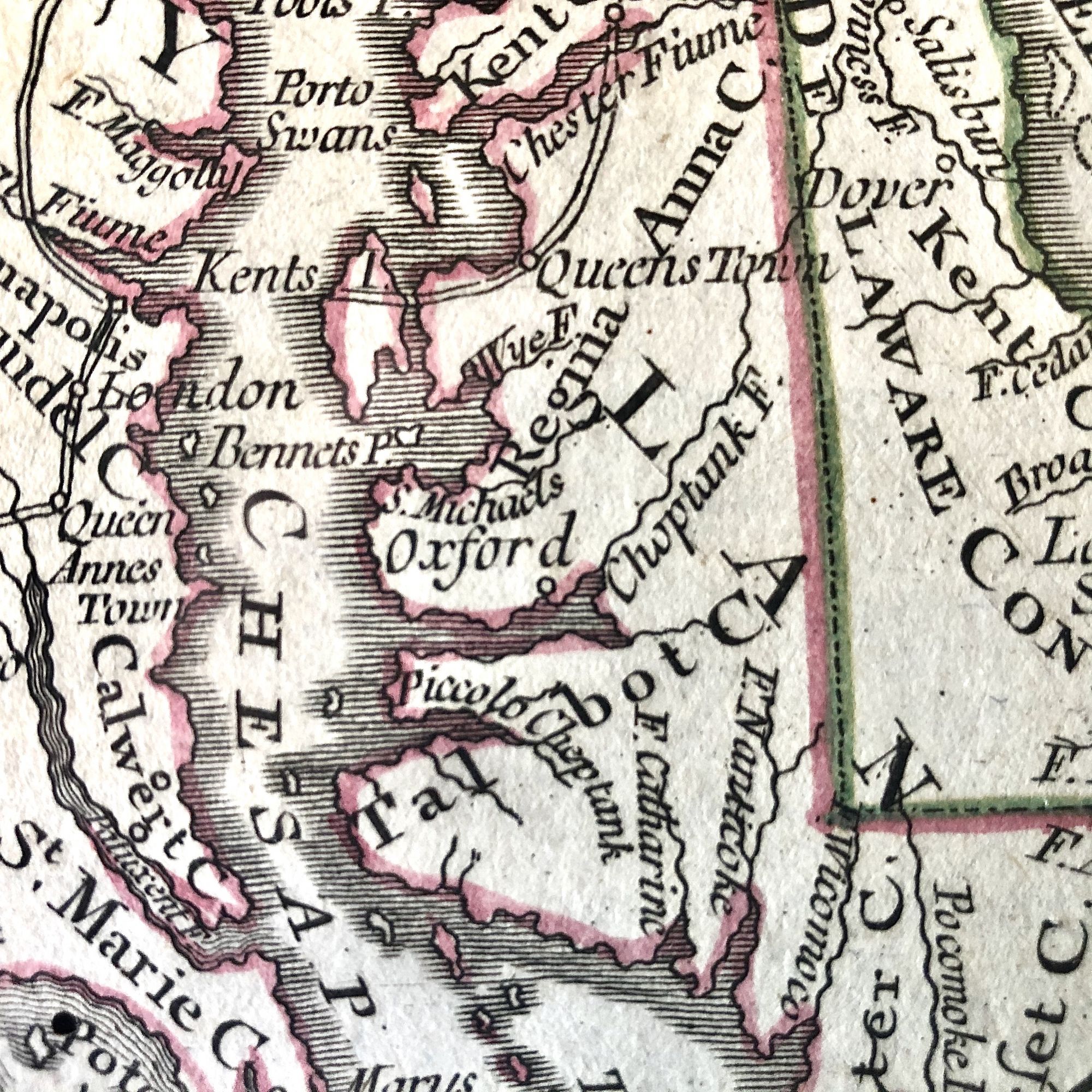
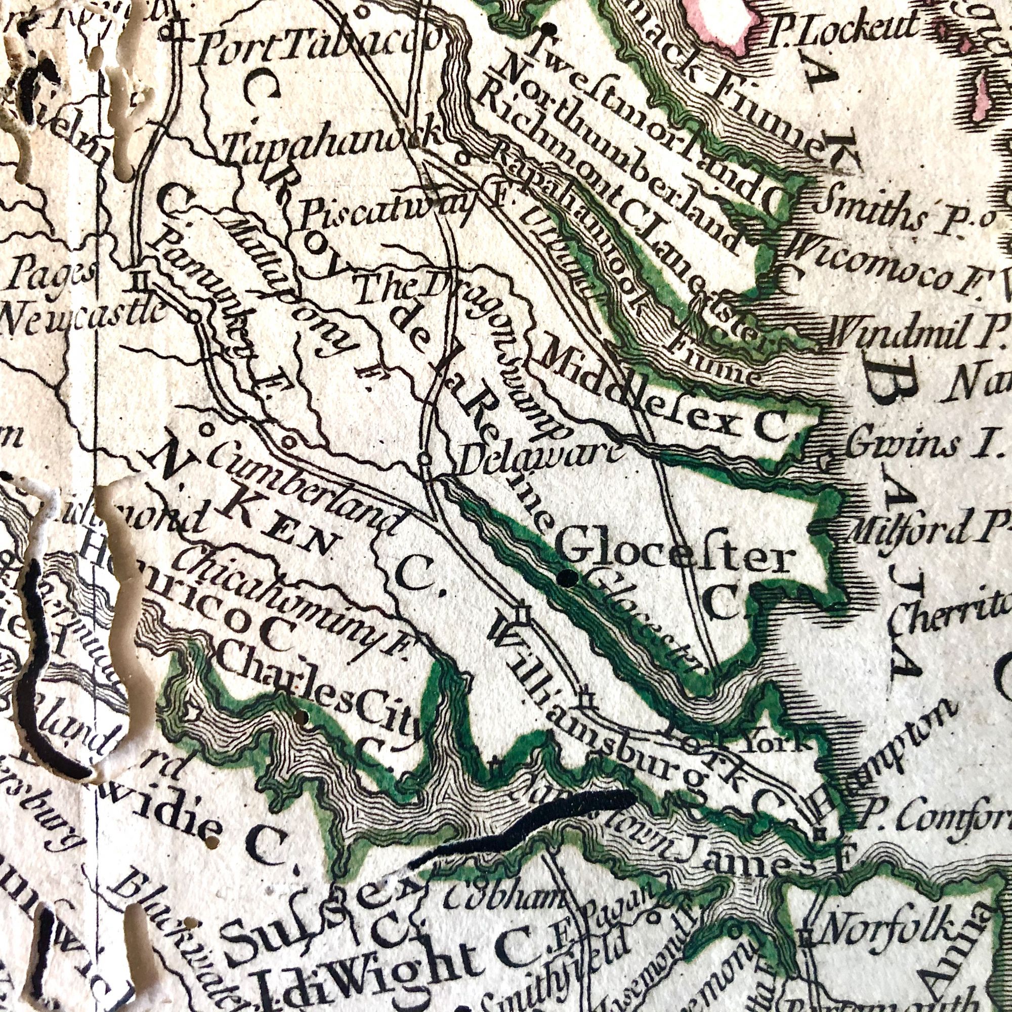
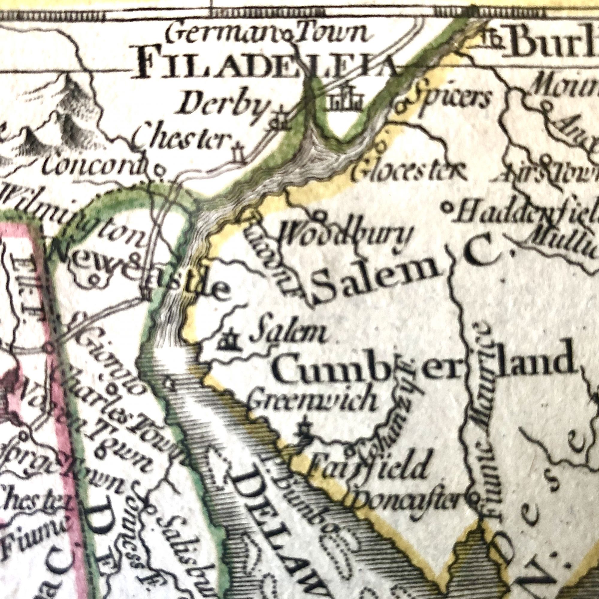
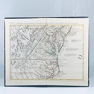
1779 Revolutionary War Map of Maryland, Virginia & Delaware
Antonio Zatta
From Vintage Books and Fine Art, Oxford, MD, U.S.A.
AbeBooks Seller Since March 26, 2021
Quantity: 1From Vintage Books and Fine Art, Oxford, MD, U.S.A.
AbeBooks Seller Since March 26, 2021
Quantity: 1About this Item
Beautiful hand-colored map published during the midst of the Revolutionary War, extending from Philadelphia and Delaware Bay in the Northeast, to Cape Lookout, Beaufort and the Welsh Settlement in South Carolina in the Southeast and extending West to show all of the Allegheny Mountains and a large portion of the Ohio River, based upon the seminal work of John Mitchell.Zatta's Map, while issued separately as part of his Atlante Novissimo, is actually one of 12 sections comprising the Italian edition of Mitchell's map of North America, one of the single-most important maps of North America during the 18th-century. very Good with occasional pinholes and worm holes along centerfold and edges. This map measures 18 5/8" X 15" and is perfect for framing and display, the ideal centerpiece to any fine Revolutionary War or Colonial Map collection. Seller Inventory # 12124
Bibliographic Details
Title: 1779 Revolutionary War Map of Maryland, ...
Publisher: Atante Novissimo, Venice, Italy
Publication Date: 1779
Condition: Very Good
Store Description
We guarantee the condition of every book as it's described
on the Abebooks web sites. If you're dissatisfied with your
purchase (Incorrect Book/Not as Described/Damaged) or if the
order hasn't arrived, you're eligible for a refund within 30
days of the estimated delivery date. If you've changed your
mind about a book that you've ordered, please use the Ask
bookseller a question link to contact us and we'll respond
within 2 business days.
Vintage Books and Fine Art
P.O. Box 372
Oxford, Md 21654
T...
Shipping costs are based on books weighing 2.2 LB, or 1 KG. If your book order is heavy or oversized, we may contact you to let you know extra shipping is required.
Payment Methods
accepted by seller