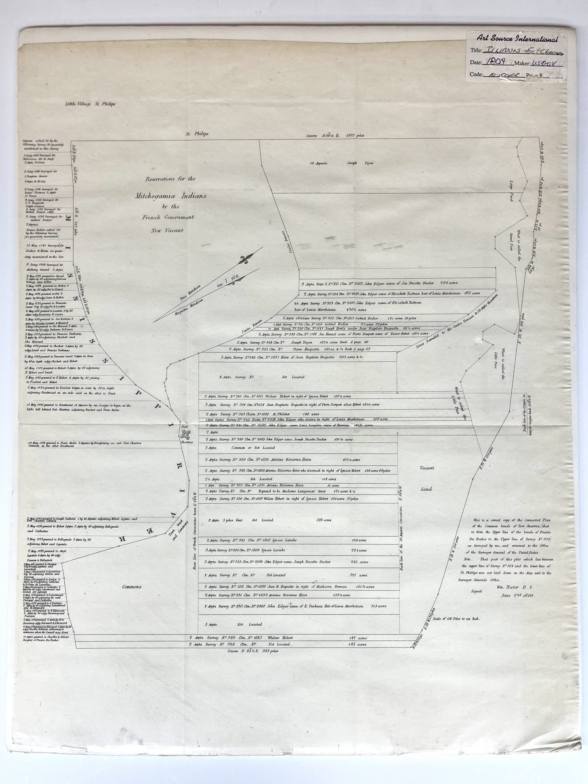
1809 Map of Fort Chartres, Illinois
U.S. Government
Publication Date: 1809
Used
From
Art Source International Inc., Boulder, CO, U.S.A.
Seller rating 2 out of 5 stars
![]()
AbeBooks Seller since July 13, 2001
This book is no longer available. AbeBooks has millions of books. Please enter search terms below to find similar copies.
About this Item
Description:
Fort de Chartres was a French fortification, first built in 1720 on the east bank of Mississippi River in present-day Illinois. The Fort de Chartres name was also applied to the two successive fortifications built nearby during the 18th century in the era of French colonial control over Louisiana and the Illinois Country. Detailed description of land grants, including names, are shown throughout. Includes area labeled, "Reservations for the Mitchegamia Indians by the French Government Now Vacant." This extremely difficult to obtain map, referred to as a "Land Ownership" map is a rare commodity. It is entitled a "Land Ownership" map because it indicates the original land owner plot number and many times their names. Created by the U.S. Government. This map measures 16.5 inches by 21.25 inches. Seller Inventory # 122296
Bibliographic Details
Title: 1809 Map of Fort Chartres, Illinois
Publication Date: 1809
AbeBooks offers millions of new, used, rare and out-of-print books, as well as cheap textbooks from thousands of booksellers around the world. Shopping on AbeBooks is easy, safe and 100% secure - search for your book, purchase a copy via our secure checkout and the bookseller ships it straight to you.
Search thousands of booksellers selling millions of new & used books
New & Used Books

New and used copies of new releases, best sellers and award winners. Save money with our huge selection.
Rare & Out of Print Books

From scarce first editions to sought-after signatures, find an array of rare, valuable and highly collectible books.
