Items related to 2014 Collins Map of Britain (Collins Road Map)
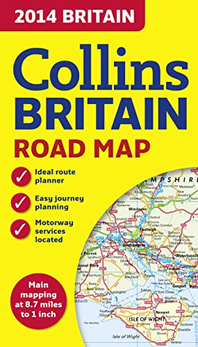

This full color double-sided map of Great Britain at 9 miles to 1 inch (1:550,000 approximately) has clear, detailed road network and administrative areas shown in color. With its political coloring of counties and unitary authorities it is ideal for business users but also perfect for tourists as a route planning map.
"synopsis" may belong to another edition of this title.
About the Author:
Collins UK is a leading information-led publisher of illustrated and narrative nonfiction.
"About this title" may belong to another edition of this title.
- PublisherHarperCollins UK
- Publication date2013
- ISBN 10 0007497113
- ISBN 13 9780007497119
- BindingMap
- Number of pages1
- Rating
Top Search Results from the AbeBooks Marketplace

Stock Image
2014 Collins Map of Britain (Collins Road Map)
Published by
HarperCollins UK
(2013)
ISBN 10: 0007497113
ISBN 13: 9780007497119
Used
Paperback
Quantity: 1
Seller:
Rating
Book Description Paperback. Condition: Good. The book has been read but remains in clean condition. All pages are intact and the cover is intact. Some minor wear to the spine. Seller Inventory # GOR006808659
Buy Used
US$ 4.29
Convert currency
Stock Image
2014 Collins Map of Britain (Collins Road Map)
Seller:
Rating
Book Description map. Condition: Very Good. All orders are dispatched the following working day from our UK warehouse. Established in 2004, we have over 500,000 books in stock. No quibble refund if not completely satisfied. Seller Inventory # mon0006732481
Buy Used
US$ 4.45
Convert currency
Stock Image
2014 Collins Map of Britain (Collins Road Map)
Published by
HarperCollins Publishers, United Kingdom, London
(2013)
ISBN 10: 0007497113
ISBN 13: 9780007497119
Used
Paperback
Quantity: 2
Seller:
Rating
Book Description Paperback. Condition: Very Good. Full colour double-sided map of Great Britain at 8.7 miles to 1 inch (1:550,000), with clear, detailed road network and administrative areas shown in colour. With its political colouring of counties and unitary authorities it is ideal for business users but it is also perfect for tourists as a route planning map. MAIN FEATURES Fully updated for 2014. Counties and local council areas shown in colour. Clear, detailed road network. Town and city names, rivers, railway lines and canals are clearly shown. 16 city/town centre street plans. Index to place names. Mileage chart. Car ferry routes. Key in English, French and German. AREA OF COVERAGE Double-sided road map covering the whole of Britain. Northern England, Scotland and the Isle of Man are on one side with Southern England and Wales on the other. The book has been read, but is in excellent condition. Pages are intact and not marred by notes or highlighting. The spine remains undamaged. Seller Inventory # GOR005382997
Buy Used
US$ 8.58
Convert currency