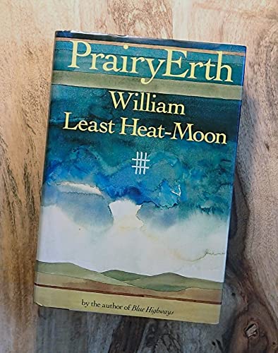
Items related to PrairyErth
Synopsis
Chronicles the author's eight-year research into the people, geology, legends, and history of a tiny cross-section of the Great Plains--Chase County, Kansas--to unearth some of the mysteries of nature
"synopsis" may belong to another edition of this title.
Reviews
Whereas Blue Highways dealt with Heat-Moon's auto trip across America, PrairyErth (an old term for heartland soils) records a journey mostly on foot across the tallgrass prairies and grasslands of Chase County, Kans. In a great cornucopia of a book, a majestic, healing hymn to America's potential, Heat-Moon attempts to penetrate the spirit of the land, a land which explorer Zebulon Pike and later white settlers stole from the Kansa (Kaw) Indians. There are now only six full-blood Kaw survivors, most of whom live on a reservation in Oklahoma. Heat-Moon writes of a feminist rancher who hires women primarily, of a farm couple swept aloft by a tornado, of abolitionists who wanted slaves free but not equal. He pauses to ponder fence posts, arrowheads and the nesting habits of pack rats. He talks to conservationists and coyote hunters, excerpts pioneer diaries and recreates the 1931 airplane crash that killed football hero Knute Rockne. Each chapter is prefaced by a map and by pages of quotations ranging from Thoreau to Frank Lloyd Wright. First serial to the Atlantic; BOMC selection.
Copyright 1991 Reed Business Information, Inc.
The long-awaited return of Heat-Moon, whose bestselling Blue Highways (1983) ranged far and wide on the byways of America, offers a memorable view of the American heartland--in the form of a splendid survey/view of a single Kansas county, the location of the last remaining expanse of tall-grass prairie. Through hundreds of vignettes and thumbnail sketches, constituting a meticulous examination of the hills and households of rural Chase County, Heat-Moon lays down a fascinating grid of interlocking experiences gathered over a five-year period. Each section of the book starts with materials from the author's ``commonplace book,'' in which relevant passages taken from 19th- and 20th-century ruminations on the American West and Kansas prepare the thematic ground for the material to follow. Facts, observations, chance encounters, and personal detail intermingle superbly in a unique travelogue, as both the ``countians'' and the many facets of their world are revealed and transformed by gentle metaphysical speculations. Feminist caf�-owners and retired limestone cutters give of themselves in their own words, while discussions of prairie soil and Osage oranges, recent native history, and distant geologic events enrich the human connections. One samples these offerings as easily as one might ramble through the stacks of a well-stocked, highly personalized library, effortlessly acquiring in the process more information than seems possible about the American experience. Rewarding and restless, evocative in its parts and deeply resonant as a whole, this is a strong successor to Blue Highways, establishing Heat-Moon as a master chronicler in the grand tradition. (Maps and drawings.) -- Copyright �1991, Kirkus Associates, LP. All rights reserved.
This new work from the author of Blue Highways ( LJ 11/1/82) is an immersion into the past, present, and future of Chase County in south central Kansas. Located in the heart of the Flint Hills, the sparsely populated area contains one of the best remaining tracts of tallgrass prairie that once covered much of the Midwest. ("PrairyErth" is an old geologic term for prairie soils). Having spent six years engaging in "participatory history," Heat-Moon creates a feel for the land and a rural way of life that seems to be dead or dying across America. Dividing his book into quadrangles, he presents a verbal map that examines the county's geological, natural, and human history. This is a fascinating book that could be improved only with the addition of an index. Highly recommended, especially for local, natural, and Western history collections. Previewed in Prepub Alert, LJ 6/1/91; BOMC selection.
- Tim Markus, Evergreen State Coll. Lib., Olympia, Wash.
Copyright 1991 Reed Business Information, Inc.
Excerpt. � Reprinted by permission. All rights reserved.
PrairyErth
(A Deep Map)
By William Least Heat-MoonHoughton Mifflin Harcourt Publishing Company
Copyright � 1991 William Least Heat-Moon
All rights reserved.
ISBN: 978-0-395-48602-3All rights reserved.
Contents
Title Page,
Table of Contents,
Copyright,
Dedication,
CROSSINGS,
From the Commonplace Book: Crossings,
On Roniger Hill,
SAFFORDVILLE,
From the Commonplace Book: Saffordville,
In the Quadrangle: Saffordville,
Upon the First Terrace,
Under Old Nell's Skirt,
Along the Ghost Highway,
On the Town: Cottonwood Falls,
GLADSTONE,
From the Commonplace Book: Gladstone,
In the Quadrangle: Gladstone,
Between Pommel and Cantle,
About the Red Buffalo,
Atop the Mound,
On the Town: Courthouse,
THRALL-NORTHWEST,
From the Commonplace Book: Thrall–Northwest,
In the Quadrangle: Thrall-Northwest,
Of Recharging the System,
Down in the Hollow,
By Way of Spelling Kansas,
On the Town: The Emma Chase,
FOX CREEK,
From the Commonplace Book: Fox Creek,
In the Quadrangle: Fox Creek,
After the Sixteen-Sixty-Six Beast,
Above the Crystalline Basement,
Outside the Z Bar,
On the Town: Gabriel's Inventory,
BAZAAR,
From the Commonplace Book: Bazaar,
In the Quadrangle: Bazaar,
In Ecstasy,
Beneath a Thirty-Six-Square Grid,
Within Her Pages,
On the Town: A Night at Darla's,
MATFIELD GREEN,
From the Commonplace Book: Matfield Green,
In the Quadrangle: Matfield Green,
En las Casitas,
Ex Radice,
Via the Short Line to China,
On the Town: Versus Harry B. (I),
HYMER,
From the Commonplace Book: Hymer,
In the Quadrangle: Hymer,
Underneath the Overburden,
With the Grain of the Grid,
Around Half Past,
On the Town: Versus Harry B. (II),
ELMDALE,
From the Commonplace Book: Elmdale,
In the Quadrangle: Elmdale,
Up Dead-End Dirt Roads,
In Kit Form: The Cottonwood Chapter,
Across Osage Hill,
On the Town: Versus Harry B. (III),
HOMESTEAD,
From the Commonplace Book: Homestead,
In the Quadrangle: Homestead,
Beyond the Teeth of the Dragon,
Amidst the Drummers Desirous,
Regarding Fokker Niner-Niner-Easy,
On the Town: From the Life and Opinions of Sam Wood, with Commentary (I),
ELK,
From the Commonplace Book: Elk,
In the Quadrangle: Elk,
Among the Hic Jacets,
Out of the Totem Hawk Lexicon,
At the Diamond of the Plain,
On the Town: From the Life and Opinions of Sam Wood, with Commentary (II),
CEDAR POINT,
From the Commonplace Book: Cedar Point,
In the Quadrangle: Cedar Point,
To Consult the Genius of the Place in All,
Concerning the Glitter Weaver,
According to the Leader,
On the Town: From the Life and Opinions of Sam Wood, with Commentary (III),
WONSEVU,
From the Commonplace Book: Wonsevu,
In the Quadrangle: Wonsevu,
Toward a Kaw Hornbook,
Beside Coming Morning,
Below the Turf,
Until Black Hole XTK Yields Its Light,
CIRCLINGS,
From the Commonplace Book: Circlings,
Over the Kaw Track,
In Thanks,
About the Author,
CHAPTER 1
On Roniger Hill
Sundown: I am standing on Roniger Hill, and I am trying to see myself as if atop a giant map of the United States. If you draw two lines from the metropolitan comers of America, one from New York City southwest to San Diego and another from Miami northwest to Seattle, the intersection would fall a few miles from my position. I am on a flat-topped ridge 155 miles southeast of the geographic center of the contiguous states, 130 miles from the geodetic datum (the point from which all North American mapping originates), and about three miles from the precise middle of Chase County, Kansas. Were you to fold in half a three-foot-long map of the forty-eight states north to south then east to west, the creases would cross within an inch of where I stand, and you would see that Roniger Hill is nearly at the heart of the nation; but I think that is only incidental to my reason for being here. In truth, I don't much understand why I am here, but, whatever the answer, it's strong enough to pull me five hours by interstates from home, eight hours if I follow a route of good caf� food through the Missouri hills.
For years, outsiders have considered this prairie place barren, desolate, monotonous, a land of more nothing than almost any other place you might name, but I know I'm not here to explore vacuousness at the heart of America. I'm only in search of what is here, here in the middle of the Flint Hills of Kansas. I'm in quest of the land and what informs it, and I'm here because of shadows in me, loomings about threats to America that are alive here too, but things I hope will show more clearly in the spareness of this county.
The Flint Hills: if you drive from the Atlantic Ocean to the Pacific by the most central yet least traveled national route, you set off on U.S. 50 from Ocean City, Maryland, pass before the Capitol, ride down Constitution Avenue, past the Declaration of Independence in the National Archives, past the Washington Monument and the Truman Balcony of the White House and the Zero Milestone it looks out upon, past the Lincoln Memorial, and then head into the countryside where the places are Hayfield, Virginia; Coolville, Ohio; Loogootee, Indiana; Flora, Illinois; Useful, Missouri; Dodge City, Kansas; the Royal Gorge of Colorado; Deseret, Utah; Eureka, Nevada; Placerville, California. You'll run out of route 50 only on the Embarcadero along San Francisco Bay, and behind will lie your course over four time zones, over the Alleghenies, along the northern edge of the broken Ozark Plateau, across the Rockies, over the Sierra Nevadas. At times you will have followed the routes of the Overland-Butterfield Stage, the Pony Express, the Oregon, Santa Fe, and California trails, and the Lincoln Highway; along the entire three thousand miles between Washington and San Francisco, you'll have seen only four other cities: Cincinnati, St. Louis, Kansas City, Sacramento. You will have closely paralleled the old "Main Street of America," highway 40, a road that has taken most of the cities and congestion and four-lane life, and, for half the trip, you will also have roughly paralleled route 66, the so-called Mother Road of the thirties. People write books about 40 and 66, but I know of nobody writing or singing about 50 (considering what fame can do, travelers of this transcontinental highway can be thankful Bobby Troup drove route 66). Yet, for at least the last couple of generations, the westering center of American population has followed 50, at times edging precisely along it like an aerialist on his wire. For the unhurried, this little-known highway is the best national road across the middle of the United States.
When an English woman, inspired by Isabella Bird's travels in nineteenth-century America, asked me last year how she might see the full dimension of the country, I said to drive highway 50 from ocean to ocean. If she begins in the East, I know the very mile where she will exclaim from behind her windshield that she has at last arrived in the American West. That spot is in Kansas in the Flint Hills in Chase County: if highway 50 is a belt across the midriff of America, then the Flint Hills make a buckle cinching East to West. From where I stand above what's left of the village of Bazaar, I can nearly see that stretch of road where the West begins. The traditional hundredth meridian be damned; at this latitude the West starts here, obviously, definitively. What's more, Chase County, Kansas, is the most easterly piece of the American Far West.
For twelve hundred miles, ever since driving smack through the morning shadow of the Washington Monument, my English traveler will pass from woodland to woodland — central Virginia looks much like central Missouri — but, several miles across the Kansas line, she'll begin to see fewer trees, see them thinning out and clustering in draws and valleys until she notices from the first rise of highway 50 in Chase County that, but for the wooded vales, the trees have nearly disappeared altogether. To encounter treelessness of such distance has often moved eastern travelers — and sometimes natives — more to discomfiture than rapture. Of the prairie, Willa Cather wrote in My �ntonia: Between that earth and that sky I felt erased, blotted out. The protection and sureties of the vertical woodland, walled like a home and enclosed like a refuge, are gone, and now the land, although more filled with cellulose than ever, is a world of air, space, apparent emptiness, near nothingness, where once the first travelers could walk for twelve hours and believe they had taken only a dozen steps. On a clear day of summer along this section of highway 50, the world changes in a few miles from green to blue, from shadows to nearly unbroken sunlight, from intermittent breezes to a wind blowing steadily as if out of the lungs of the universe.
The Flint Hills are the last remaining grand expanse of tallgrass prairie in America. On a geologic map, their shape something like a stone spear point, they cover most of the two-hundred-mile longitude of Kansas from Nebraska to Oklahoma, a stony upland twenty to eighty miles wide. At their western edge, the mixed-grass prairie begins and spreads a hundred or so miles to the shortgrass country of the high plains. On the eastern side, settlement and agriculture have all but obliterated the whilom tallgrass prairie so that it is hardly visible to anyone who would not seek it out on hands and knees; although the six million acres of the Flint Hills — also called the Bluestem Hills — were once a mere four percent of the American long-grass prairie, they are now nearly all of it. The grasses can grow to ten feet, high enough that red men once stood atop their horses to see twenty yards ahead; that wasn't common, but it occurred, and, even today in moist vales protected from development and cattle, I've found big bluestem and sloughgrass, the grandest of the tallgrasses, eight feet high. In season, these and their relatives make the Flint Hills an immense pasturage nutritionally richer than the Bluegrass country of Kentucky. During the warm season, a big steer will gain two pounds a day, and the 120,000 beeves in the uplands will put on twenty-two million pounds.
Although the height of the Hills here is not remarkable, never rising more than three hundred feet from base to crest, their length and breadth would make them noteworthy even in places outside the somewhat level horizon of eastern Kansas, but, were they forested, my English traveler would hardly know she was crossing them. Because they belong to the open world of grasses, they dominate if not the sky then surely the horizon with their symmetrical and flattened tops, their trapezoidal slopes, and (at dawn and sunset) their shadows that can stretch unbrokenly and most visibly for a prairie mile.
These hills are largely limestones and shales distilled from the Permian seas that covered most of middle America off and on for fifty million years in the days when — had human beings and cities been around — a man could have paddled from Pittsburgh to Denver. Those seas were of such size that their sediments buried a mountain range with an eastern front once the equivalent to the New Mexico Rockies. Beneath Chase County, the great Nemaha Ridge, sometimes called the Kansas Mountains, lies about three thousand feet down, but its presence below the Flint Hills is coincidental: these tilted uplands are largely the result of erosion and not, like the Ridge or the Rockies, of upthrust. Still, today, the ancient Nemahas, as if gods buried alive, move their stone shoulders below and rattle the county atop its three fault zones, and, in time, the Flint Hills could split open and part like a biblical sea and the Nemahas may come again into the sun to throw the grassed slopes aside like so much surf.
Let this book page, appropriate as it is in shape and proportion, be Chase County. Lay your right hand across the page from right edge to left; tuck middle finger under palm and splay your other fingers wide so that your thumb points down, your little finger nearly upward: you have a configuration of the county watercourses, a manual topography of the place. Everything here has been and continues to be shaped by those four drainages: the South Fork of the Cottonwood River (thumb), the Cottonwood (index finger), Middle Creek (ring), Diamond Creek (little finger). Many more streams and brooks are here, but these four control the country, and where they have gone and are going and what they have done and are doing mark out where and what men have gone and done.
I am standing on Roniger Hill: I am facing west, dusk creeping up my back to absorb my thirty-foot shadow, the sun now a flattened crescent so dull I can look directly into it. The month is November, and, behind me, a nearly full moon will soon rise, and I am standing on this hill. I've been to this place before. Up here in the thirties Frank and George Roniger built three stone markers to honor Indian remains they unearthed atop the ridge. The Roniger brothers were bachelors, farmers, and collectors of stone artifacts from their fields lying below, and they believed this hill sacred to the people living around it in the time when Europeans were building cathedrals and sending children off to take holy cities from desert tribes. To me, this ridge is singular and, at night, almost unearthly, and I come here, in a friend's words, as a two-bit mystic, but I believe I've found my way onto the top by some old compass in the blood.
I've already said that what's left of Bazaar, Kansas, lies below. Lights in houses are coming on, but I can't make out the Ronigers' old brick home, and that's good because it's the nearest one, and when I come here I want Anglo civilization and its disruptions of the prairie contours far enough away so they soften and simplify into mere silhouettes. When the darkness is complete — before the moon blanches the valley — house lights will appear as campfires, and the hills can again assume their ancient aspect. Only the ponderous throb and roll of the Atchison, Topeka and Santa Fe Railroad, approaching now as it does about every half hour, breaks the illusion, an illusion that helps me see things here, to imagine how things have been. I've come into the county from that dreaming, and from it, finally, all my questions proceed, and, if things run true, I believe they will return to it.
I am standing on Roniger Hill to test the shape of what I'm going to write about this prairie place. For thirty months, maybe more, I've come and gone here and have found stories to tell, but, until last week, I had not discovered the way to tell them. My searches and researches, like my days, grew more randomly than otherwise, and every form I tried contorted them, and each time I began to press things into cohesion, I edged not so much toward fiction as toward distortion, when what I wanted was accuracy; even when I got a detail down accurately, I couldn't hook it to the next without concocting theories. It was connections that deviled me. I was hunting a fact or image and not a thesis to hold my details together, and so I arrived at this question: should I just gather up items like creek pebbles into a bag and then let them tumble into their own pattern? Did I really want the reality of randomness? Answer: only if it would yield a landscape with figures, one that would unroll like a Chinese scroll painting or a bison-skin drawing where both beginnings and ends of an event are at once present in the conflated time of the American Indian. The least I hoped for was a, topographic map of words that would open inch by inch to show its long miles.
Early, I aimed to write about a most spare landscape, seemingly poor for a reporter to poke into, one appearing thin and minimal in history and texture, a stark region recent American life had mostly gone past, a still point, a fastness an ascetic seeking a penitential corner might discover. Chase County fit. Then, a week ago, at home in the second-story room where I write, I laid over the floor the twenty-five U.S. Geological Survey maps that cover Chase County to the measure of an inch and a half to the mile, maps so detailed that bams and houses and windmills appear. On the carpet, the county was about seven feet by six, and I had to walk from the north border to read the scale at the south end. As I traipsed around this paper land, a shape came to me: while thirteen of the maps contain only narrow strips of Chase, the central twelve hold almost all of it, and their outlines form a kind of grid such as an archaeologist lays over ground he will excavate. Wasn't I a kind of digger of shards? Maybe a grid was the answer: arbitrary quadrangles that have nothing inherently to do with the land, little to do with history, and not much to do with my details. After all, since the National Survey of 1785, seventy percent of America lies under such a grid, a system of coordinates that has allowed wildness to be subdued. Would coordinates lead to connections? Were they themselves the only links we can truly understand? Could they lead into the dark loomings that draw me here?
Now: I am standing on Roniger Hill to test the grid. I'm not waiting for revelation, only watching to see whether my notions will crumble like these old, eroding slopes. Standing here, thinking of grids and what's under them, their depths and their light and darkness, I'm watching, and in an hour or so I'll lie down and sleep on this hill and let it and its old shadows work on me, let the dark have at my own shadows and assail my sleep. If my configuration is still alive by morning, then I'll go down off this ridge, and, one more time, begin walking over Chase County, Kansas, grid by topographic grid, digging, sifting, sorting, assembling shards, and my arbitrary course will be that of a Japanese reading a book: up to down, right to left.
So.
Sunrise: sometime last night just before I went into my sleeping bag, the south wind — the one that so blows here the Kansa Indians may have taken their name from it, South Wind People — eased to a brief stillness almost unnatural. (I once asked a countian when this Kansas wind would stop. He said, Never.) It seemed to sit on the land, on Roniger Hill, on me, pushing me down into a burden of sleep, leaning heavily as if to impress me into the prairie earth, and then, I don't know when, it rose once more and fetched up chilled bird calls from the south valley, dumped them over me as if from a pitcher of drawn well-water, poured them down, and I got up and rolled my bag, not hurrying before the lightning and murk of clouds coming on, hurrying only a little in the sparse raindrops. Then, as often happens in the Flint Hills, the morning shifted, rearranged itself, all the while getting cooler and clearer, and I went off up-county with a tool kit not of shovels and trowels but of imaginary lines and questions and loomings and the archaeologist's perpetual unease that time is running out before the obliteration hits. And that's how I started off my fourth term in Chase County, Kansas.
Again: let the book page represent this county in east-central Kansas. Divide it horizontally into thirds and split those vertically into quarters so you see twelve sections of a grid that looks like a muntin-bar window of a dozen lights. These are their names north to south, east to west: Saffordville, Gladstone, Thrall-Northwest, Fox Creek, Bazaar, Matfield Green, Hymer, Elmdale, Homestead, Elk, Cedar Point, Wonsevu.
To them attach this old Indian story: The white man asked, Where is your nation? The red man said, My nation is the grass and rocks and the four-leggeds and the six-leggeds and the belly wrigglers and swimmers and the winds and all things that grow and don't grow. The white man asked, How big is it? The other said, My nation is where I am and my people where they are and the grandfathers and their grandfathers and all the grandmothers and all the stories told, and it is all the songs, and it is our dancing. The white man asked, But how many people are there? The red man said, That I do not know.
(Continues...)
Excerpted from PrairyErth by William Least Heat-Moon. Copyright � 1991 William Least Heat-Moon. Excerpted by permission of Houghton Mifflin Harcourt Publishing Company.
All rights reserved. No part of this excerpt may be reproduced or reprinted without permission in writing from the publisher.
Excerpts are provided by Dial-A-Book Inc. solely for the personal use of visitors to this web site.
"About this title" may belong to another edition of this title.

Search results for PrairyErth

Stock Image
Prairyerth: (A Deep Map
Seller: SecondSale, Montgomery, IL, U.S.A.
Seller rating 5 out of 5 stars
![]()
Condition: Good. Item in good condition and has highlighting/writing on text. Used texts may not contain supplemental items such as CDs, info-trac etc. Seller Inventory # 00092904813
Quantity: 1 available
Stock Image
Prairyerth: (A Deep Map
Seller: SecondSale, Montgomery, IL, U.S.A.
Seller rating 5 out of 5 stars
![]()
Condition: Acceptable. Item in acceptable condition! Textbooks may not include supplemental items i.e. CDs, access codes etc. Seller Inventory # 00085550099
Quantity: 3 available
Stock Image
Prairyerth: (A Deep Map
Seller: SecondSale, Montgomery, IL, U.S.A.
Seller rating 4 out of 5 stars
![]()
Condition: Good. Item in good condition. Textbooks may not include supplemental items i.e. CDs, access codes etc. Seller Inventory # 00084429184
Quantity: 9 available
Stock Image
PrairyErth
Seller: Your Online Bookstore, Houston, TX, U.S.A.
Seller rating 5 out of 5 stars
![]()
Hardcover. Condition: Good. Seller Inventory # 0395486025-3-17398851
Quantity: 2 available
Stock Image
PrairyErth
Seller: Orion Tech, Kingwood, TX, U.S.A.
Seller rating 5 out of 5 stars
![]()
Hardcover. Condition: Good. Seller Inventory # 0395486025-3-19768665
Quantity: 1 available
Stock Image
PrairyErth
Seller: Orion Tech, Kingwood, TX, U.S.A.
Seller rating 5 out of 5 stars
![]()
Hardcover. Condition: Fair. Seller Inventory # 0395486025-4-16335388
Quantity: 1 available
Seller Image
PrairyErth
Published by
Houghton Mifflin Harcourt, 1991
ISBN 10: 0395486025
ISBN 13: 9780395486023
Used
Hardcover
Seller: Reliant Bookstore, El Dorado, KS, U.S.A.
Seller rating 4 out of 5 stars
![]()
Condition: acceptable. This book is a well used but readable copy. Integrity of the book is still intact with no missing pages. The dust jacket is torn. May have notes or highlighting. Cover image on the book may vary from photo. Ships out quickly in a secure plastic mailer. Seller Inventory # RDV.0395486025.A
Quantity: 1 available
Seller Image
PrairyErth
Published by
Houghton Mifflin Harcourt, 1991
ISBN 10: 0395486025
ISBN 13: 9780395486023
Used
Hardcover
Seller: Greenworld Books, Arlington, TX, U.S.A.
Seller rating 5 out of 5 stars
![]()
Condition: good. Fast Free Shipping �" Good condition book with a firm cover and clean, readable pages. Shows normal use, including some light wear or limited notes highlighting, yet remains a dependable copy overall. Supplemental items like CDs or access codes may not be included. Seller Inventory # GWV.0395486025.G
Quantity: 2 available
Stock Image
PrairyErth: (Deep Map)
Seller: Half Price Books Inc., Dallas, TX, U.S.A.
Seller rating 5 out of 5 stars
![]()
Hardcover. Condition: Very Good. Connecting readers with great books since 1972! Used books may not include companion materials, and may have some shelf wear or limited writing. We ship orders daily and Customer Service is our top priority! Seller Inventory # S_437610615
Quantity: 1 available
Stock Image
PrairyErth
Seller: HPB Inc., Dallas, TX, U.S.A.
Seller rating 5 out of 5 stars
![]()
Hardcover. Condition: Very Good. Connecting readers with great books since 1972! Used books may not include companion materials, and may have some shelf wear or limited writing. We ship orders daily and Customer Service is our top priority! Seller Inventory # S_424692326
Quantity: 1 available