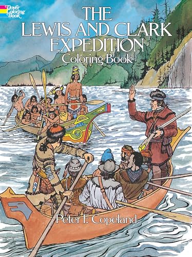
Items related to The Lewis and Clark Expedition Coloring Book (Dover...

On April 30, 1803, the Louisiana Purchase Agreement between France and the United States was formally signed. President Thomas Jefferson paid the French emperor Napoleon Bonaparte approximately 18 cents per square mile for a vast wilderness territory (more than 825,000 square miles) stretching from New Orleans to the Canadian border and west from the Mississippi River to the Rocky Mountains. The Purchase effectively doubled the size of the young United States.
On May 14, 1804, Captains Meriwether Lewis and William Clark — accompanied by an intrepid band of skilled hunters, carpenters, gunsmiths, and blacksmiths — sailed up the Missouri River with a small fleet of three vessels. For the next two years, this dauntless team navigated insect- and snake-infested waterways, crossed scorching plains, scaled frigid mountain passes, battled hostile Indians, and faced near-starvation—all the while charting a vast wilderness never before glimpsed by white men.
By the time of their return to civilization in September of 1806, Lewis and Clark had brought back a large collection of important scientific information, opened the unknown East to American exploration and settlement, and added credibility to the U.S. claim to the Oregon Territory. Distinguished artist Peter F. Copeland recaptures the high points of this mighty expedition. Forty-five historically accurate, precisely drawn illustrations for coloring retrace the nearly 8,000 miles of the perilous trek. Captions identify the action in each plate, provide background information, and link the plates in a continuous and informative narrative.
"synopsis" may belong to another edition of this title.
- PublisherDover Publications
- Publication date1984
- ISBN 10 0486245578
- ISBN 13 9780486245577
- BindingPaperback
- Number of pages48
- IllustratorPeter F. Copeland
- Rating
Buy New
Learn more about this copy
US$ 3.14
Shipping:
US$ 3.99
Within U.S.A.
Top Search Results from the AbeBooks Marketplace
Stock Image
The Lewis and Clark Expedition Coloring Book (Dover History Coloring Book)
Published by
Dover Publications
(1984)
ISBN 10: 0486245578
ISBN 13: 9780486245577
New
Softcover
Quantity: 4
Seller:
Rating
Book Description Condition: New. Peter F. Copeland (illustrator). Brand New! Not Overstocks or Low Quality Book Club Editions! Direct From the Publisher! We're not a giant, faceless warehouse organization! We're a small town bookstore that loves books and loves it's customers! Buy from Lakeside Books!. Seller Inventory # OTF-S-9780486245577
Buy New
US$ 3.14
Convert currency
Stock Image
The Lewis and Clark Expedition Coloring Book (Dover American History Coloring Books)
Published by
Dover Publications
(1984)
ISBN 10: 0486245578
ISBN 13: 9780486245577
New
Paperback
Quantity: 7
Seller:
Rating
Book Description Paperback. Condition: New. Peter F. Copeland (illustrator). Brand New!. Seller Inventory # 0486245578
Buy New
US$ 7.89
Convert currency
Seller Image
Lewis and Clark Expedition Coloring Book
Published by
Dover Publications
(1984)
ISBN 10: 0486245578
ISBN 13: 9780486245577
New
Softcover
Quantity: 4
Seller:
Rating
Book Description Condition: New. Peter F. Copeland (illustrator). Seller Inventory # 443633-n
Buy New
US$ 5.28
Convert currency
Stock Image
The Lewis and Clark Expedition Coloring Book Format: Paperback
Published by
Dover Publishers
(1984)
ISBN 10: 0486245578
ISBN 13: 9780486245577
New
Softcover
Quantity: > 20
Seller:
Rating
Book Description Condition: New. Peter F. Copeland (illustrator). Brand New. Seller Inventory # 0486245578
Buy New
US$ 4.00
Convert currency
Seller Image
The Lewis and Clark Expedition Coloring Book (Paperback)
Published by
Dover Publications Inc., New York
(2003)
ISBN 10: 0486245578
ISBN 13: 9780486245577
New
Paperback
Quantity: 1
Seller:
Rating
Book Description Paperback. Condition: new. Peter F. Copeland (illustrator). Paperback. On April 30, 1803, the Louisiana Purchase Agreement between France and the United States was formally signed. President Thomas Jefferson paid the French emperor Napoleon Bonaparte approximately 18 cents per square mile for a vast wilderness territory (more than 825,000 square miles) stretching from New Orleans to the Canadian border and west from the Mississippi River to the Rocky Mountains. The Purchase effectively doubled the size of the young United States.On May 14, 1804, Captains Meriwether Lewis and William Clark - accompanied by an intrepid band of skilled hunters, carpenters, gunsmiths, and blacksmiths - sailed up the Missouri River with a small fleet of three vessels. For the next two years, this dauntless team navigated insect- and snake-infested waterways, crossed scorching plains, scaled frigid mountain passes, battled hostile Indians, and faced near-starvation-all the while charting a vast wilderness never before glimpsed by white men.By the time of their return to civilization in September of 1806, Lewis and Clark had brought back a large collection of important scientific information, opened the unknown East to American exploration and settlement, and added credibility to the U.S. claim to the Oregon Territory. Distinguished artist Peter F. Copeland recaptures the high points of this mighty expedition. Forty-five historically accurate, precisely drawn illustrations for colouring retrace the nearly 8,000 miles of the perilous trek. Captions identify the action in each plate, provide background information, and link the plates in a continuous and informative narrative. On May 14, 1804, Captains Meriwether Lewis and William Clark set off to explore a vast wilderness of 825,000 square miles purchased from the French. 45 accurate, precisely rendered illustrations recapture highpoints of expedition. Shipping may be from multiple locations in the US or from the UK, depending on stock availability. Seller Inventory # 9780486245577
Buy New
US$ 9.37
Convert currency
Stock Image
The Lewis and Clark Expedition Coloring Book (Dover American History Coloring Books)
Published by
Dover Publications
(1984)
ISBN 10: 0486245578
ISBN 13: 9780486245577
New
Softcover
Quantity: 2
Seller:
Rating
Book Description Condition: New. Peter F. Copeland (illustrator). Seller Inventory # ABLING22Oct2018170014055
Buy New
US$ 5.46
Convert currency
Stock Image
The Lewis and Clark Expedition Coloring Book (Dover History Coloring Book)
Published by
Dover Publications January 1984
(1984)
ISBN 10: 0486245578
ISBN 13: 9780486245577
New
Trade Paperback
Quantity: 2
Seller:
Rating
Book Description Trade Paperback. Condition: New. Peter F. Copeland (illustrator). Seller Inventory # 39396
Buy New
US$ 4.99
Convert currency
Stock Image
The Lewis and Clark Expedition Coloring Book (Dover History Coloring Book) [Soft Cover ]
Published by
Dover Publications
(1984)
ISBN 10: 0486245578
ISBN 13: 9780486245577
New
Soft Cover
Quantity: 1
Seller:
Rating
Book Description Soft Cover. Condition: new. Peter F. Copeland (illustrator). Seller Inventory # 9780486245577
Buy New
US$ 10.86
Convert currency
Stock Image
The Lewis and Clark Expedition Coloring Book (Dover American History Coloring Books)
Published by
Dover Publications
(1984)
ISBN 10: 0486245578
ISBN 13: 9780486245577
New
Softcover
Quantity: 1
Seller:
Rating
Book Description Condition: New. Peter F. Copeland (illustrator). . Seller Inventory # 52GZZZ019PMN_ns
Buy New
US$ 10.92
Convert currency
Stock Image
The Lewis and Clark Expedition Coloring Book (Dover American History Coloring Books)
Published by
Dover Publications
(1984)
ISBN 10: 0486245578
ISBN 13: 9780486245577
New
Softcover
Quantity: 11
Seller:
Rating
Book Description Condition: New. Peter F. Copeland (illustrator). Seller Inventory # I-9780486245577
Buy New
US$ 11.00
Convert currency