Items related to Folded Map: Orlando Street Map

Rand McNally's folded map for Orlando is a must-have for anyone traveling in and around this part of Florida, offering unbeatable accuracy and reliability at a great price. Our trusted cartography shows all Interstate, U.S., state, and county highways, along with clearly indicated parks, points of interest, airports, county boundaries, and streets. The easy-to-use legend and detailed index make for quick and easy location of destinations. You'll see why Rand McNally folded maps have been the trusted standard for years.
Regularly updated
Full-color maps
Clearly labeled Interstate, U.S., state, and county highways
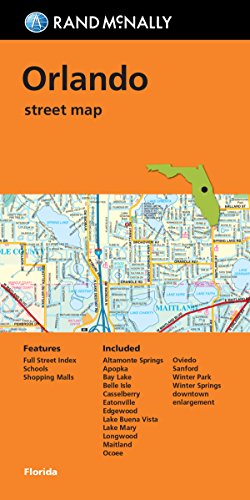
Indications of parks, points of interest, airports, county boundaries, schools, shopping malls, downtown & vicinity maps
Easy-to-use legend
Detailed & full street index
Convenient folded size
Coverage Area
Communities Included: Altamonte Spings, Apopka, Bay Lake, Belle Isle, Casselberry, Eatonville, Edgewood, Lake Buena Vista, Lake Mary, Longwood, Maitland, Ocoee, Oviedo, Sanford, Winter Park, Winter Springs
Product Details
Measures 9.5' x 4' and folds out to 40' x 28'.
Regularly updated
Full-color maps
Clearly labeled Interstate, U.S., state, and county highways
Indications of parks, points of interest, airports, county boundaries, schools, shopping malls, downtown & vicinity maps
Easy-to-use legend
Detailed & full street index
Convenient folded size
Coverage Area
Communities Included: Altamonte Spings, Apopka, Bay Lake, Belle Isle, Casselberry, Eatonville, Edgewood, Lake Buena Vista, Lake Mary, Longwood, Maitland, Ocoee, Oviedo, Sanford, Winter Park, Winter Springs
Product Details
Measures 9.5' x 4' and folds out to 40' x 28'.
"synopsis" may belong to another edition of this title.
- PublisherRand McNally
- Publication date2016
- ISBN 10 0528008811
- ISBN 13 9780528008818
- BindingMap
- Number of pages2
(No Available Copies)
Search Books: Create a WantIf you know the book but cannot find it on AbeBooks, we can automatically search for it on your behalf as new inventory is added. If it is added to AbeBooks by one of our member booksellers, we will notify you!
Create a Want